Property Record
135 N Branigin Rd, Franklin, IN 46131

NEARBY LISTINGS FOR SALE OR LEASE
-
-
View all Franklin listings for sale on LoopNet.com
Property Detail
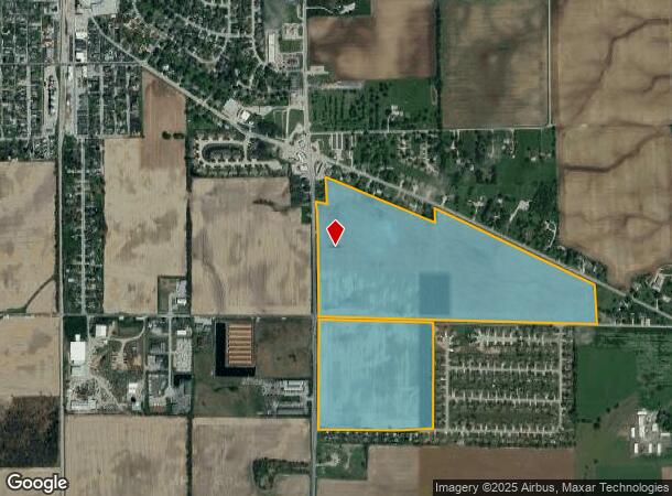
135 N Branigin Rd
41-09-01-023-001.000-035
SE NW NW SE S1 T12 R3 MP FRANKLIN COMMUNI
Agriculturalland
Johnson
X
Indiana
18109C0200E
109.42 AC
2023
Far South Johnson Cty
2024
Indianapolis
610900
Indianapolis-Carmel-Anderson, IN
DEMOGRAPHICS near 135 N Branigin Rd
1 Mile
3 Mile
5 Mile
2024 Total Population
2,043
8,784
46,324
2029 Population
2,199
9,488
49,576
Pop Growth 2024-2029
+ 7.64%
+ 8.01%
+ 7.02%
Average Age
39
38
38
2024 Total Households
800
3,164
16,513
HH Growth 2024-2029
+ 7.75%
+ 8.22%
+ 7.16%
Median Household Inc
$59,761
$93,398
$86,165
Avg Household Size
2.60
2.80
2.70
2024 Avg HH Vehicles
2.00
2.00
2.00
Median Home Value
$177,260
$293,027
$238,233
Median Year Built
1986
2001
1996
Nearby Places
- Restaurants
- Banks
- Shops
- Fitness
- Groceries
PUBLIC TRANSPORTATION
AIRPORT
Indianapolis International
DRIVE
WALK
Distance
Indianapolis International
40 min
24.2 mi
Freight Ports
Port of Toledo
DRIVE
WALK
Distance
Port of Toledo
296 min
245.2 mi
Nearby Properties
Address
Land Use
TOTAL SIZE
Lot Size
Zoning
Address
Land Use
TOTAL SIZE
Lot Size
Zoning
19,104 SF
27.27 AC
R2
Address
Land Use
TOTAL SIZE
Lot Size
Zoning
16,000 SF
4.29 AC
Address
Land Use
TOTAL SIZE
Lot Size
Zoning
9,540 SF
3.19 AC
Address
Land Use
TOTAL SIZE
Lot Size
Zoning
13,598 SF
2.50 AC
Address
Land Use
TOTAL SIZE
Lot Size
Zoning
9,497 SF
0.90 AC
Address
Land Use
TOTAL SIZE
Lot Size
Zoning
7,200 SF
3.82 AC
Address
Land Use
TOTAL SIZE
Lot Size
Zoning
5,924 SF
2.26 AC
Address
Land Use
TOTAL SIZE
Lot Size
Zoning
7,903 SF
0.93 AC
Address
Land Use
TOTAL SIZE
Lot Size
Zoning
6,834 SF
2.13 AC
Address
Land Use
TOTAL SIZE
Lot Size
Zoning
6,683 SF
1.52 AC
Address
Land Use
TOTAL SIZE
Lot Size
Zoning
6,485 SF
0.77 AC
Address
Land Use
TOTAL SIZE
Lot Size
Zoning
7,944 SF
1.01 AC
Address
Land Use
TOTAL SIZE
Lot Size
Zoning
6,240 SF
0.07 AC
Address
Land Use
TOTAL SIZE
Lot Size
Zoning
40,480 SF
11.49 AC
BUF
Address
Land Use
TOTAL SIZE
Lot Size
Zoning
8,800 SF
1.96 AC
Address
Land Use
TOTAL SIZE
Lot Size
Zoning
5,514 SF
1.27 AC
Address
Land Use
TOTAL SIZE
Lot Size
Zoning
3,600 SF
2.35 AC
Address
Land Use
TOTAL SIZE
Lot Size
Zoning
5,672 SF
0.81 AC
Address
Land Use
TOTAL SIZE
Lot Size
Zoning
9,709 SF
1.55 AC
Address
Land Use
TOTAL SIZE
Lot Size
Zoning
36,454 SF
5.79 AC
Address
Land Use
TOTAL SIZE
Lot Size
Zoning
9,682 SF
0.08 AC
Address
Land Use
TOTAL SIZE
Lot Size
Zoning
4,094 SF
0.75 AC
Address
Land Use
TOTAL SIZE
Lot Size
Zoning
5,400 SF
1.25 AC
Address
Land Use
TOTAL SIZE
Lot Size
Zoning
5,804 SF
2.15 AC
Address
Land Use
TOTAL SIZE
Lot Size
Zoning
1,918 SF
10 AC
A1
Address
Land Use
TOTAL SIZE
Lot Size
Zoning
3,920 SF
0.46 AC
Address
Land Use
TOTAL SIZE
Lot Size
Zoning
Address
Land Use
TOTAL SIZE
Lot Size
Zoning
6,002 SF
0.93 AC
Address
Land Use
TOTAL SIZE
Lot Size
Zoning
10,400 SF
6 AC
Address
Land Use
TOTAL SIZE
Lot Size
Zoning
5 AC
A1
The World's #1 Commercial Real Estate Marketplace
Connect with us
© 2025 CoStar Group
The information above has been obtained from sources believed reliable. While we do not doubt its accuracy we have not verified it and make no guarantee, warranty or representation about it. It is your responsibility to independently confirm its accuracy and completeness. Any projections, opinions, assumptions, or estimates used are for example only and do not represent the current or future performance of the property. The value of this transaction to you depends on tax and other factors which should be evaluated by your tax, financial, and legal advisors. You and your advisors should conduct a careful, independent investigation of the property to determine to your satisfaction the suitability of the property for your needs.