Property Record
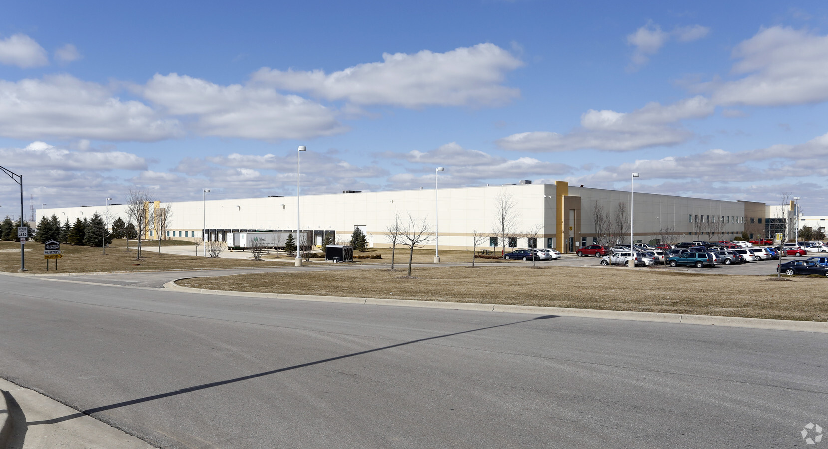
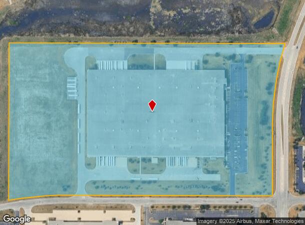
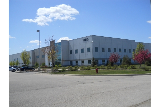
1350 Munger Rd, Bartlett, IL 60103

NEARBY LISTINGS FOR SALE OR LEASE
Property Detail
1350 Munger Rd
Chicago-Naperville-Elgin, IL-IN-WI
Brewster Creek Business Park
01-05-400-013
A P NO 1 OF LTS 9 &10 BREWSTER CREEK BUSINESS PARK UNITS 1 & 2 ALL LOT 9A
Industrialgeneral
DuPage
X
Illinois
17043C0026J
9a
2023
31.67 AC
2023
Northwest Cook
841308
Chicago
400,000 SF
DEMOGRAPHICS near 1350 Munger Rd
1 Mile
3 Mile
5 Mile
2024 Total Population
826
39,483
182,465
2029 Population
759
38,335
178,186
Pop Growth 2024-2029
(8.11%)
(2.91%)
(2.35%)
Average Age
44
41
39
2024 Total Households
298
13,666
60,607
HH Growth 2024-2029
(8.72%)
(3.20%)
(2.56%)
Median Household Inc
$91,666
$115,008
$94,637
Avg Household Size
2.80
2.80
2.90
2024 Avg HH Vehicles
3.00
2.00
2.00
Median Home Value
$442,410
$302,137
$263,021
Median Year Built
1992
1989
1982
Nearby Places
- Restaurants
- Banks
- Shops
- Fitness
- Groceries
PUBLIC TRANSPORTATION
COMMUTER RAIL
Bartlett Station (Milwaukee District West Line - Northeast Illinois Regional Commuter Railroad (Metra))
DRIVE
WALK
Distance
Bartlett Station (Milwaukee District West Line - Northeast Illinois Regional Commuter Railroad (Metra))
6 min
2.9 mi
Hanover Park Station (Milwaukee District West Line - Northeast Illinois Regional Commuter Railroad (Metra))
DRIVE
WALK
Distance
Hanover Park Station (Milwaukee District West Line - Northeast Illinois Regional Commuter Railroad (Metra))
11 min
5.9 mi
AIRPORT
Chicago O'Hare International
DRIVE
WALK
Distance
Chicago O'Hare International
38 min
27.4 mi
Chicago Midway International
DRIVE
WALK
Distance
Chicago Midway International
53 min
36.7 mi
Freight Ports
Port Milwaukee
DRIVE
WALK
Distance
Port Milwaukee
115 min
83.7 mi
Nearby Properties
Address
Land Use
TOTAL SIZE
Lot Size
Zoning
Address
Land Use
TOTAL SIZE
Lot Size
Zoning
Address
Land Use
TOTAL SIZE
Lot Size
Zoning
Address
Land Use
TOTAL SIZE
Lot Size
Zoning
Address
Land Use
TOTAL SIZE
Lot Size
Zoning
299,888 SF
16.56 AC
I
Address
Land Use
TOTAL SIZE
Lot Size
Zoning
14.23 AC
Address
Land Use
TOTAL SIZE
Lot Size
Zoning
259,840 SF
15.92 AC
I
Address
Land Use
TOTAL SIZE
Lot Size
Zoning
81,377 SF
9.43 AC
C
Address
Land Use
TOTAL SIZE
Lot Size
Zoning
401,250 SF
73.98 AC
Address
Land Use
TOTAL SIZE
Lot Size
Zoning
11.72 AC
Address
Land Use
TOTAL SIZE
Lot Size
Zoning
11.80 AC
Address
Land Use
TOTAL SIZE
Lot Size
Zoning
11.44 AC
Address
Land Use
TOTAL SIZE
Lot Size
Zoning
Address
Land Use
TOTAL SIZE
Lot Size
Zoning
6.47 AC
Address
Land Use
TOTAL SIZE
Lot Size
Zoning
167,166 SF
12.85 AC
Address
Land Use
TOTAL SIZE
Lot Size
Zoning
11.15 AC
Address
Land Use
TOTAL SIZE
Lot Size
Zoning
105,493 SF
16.26 AC
I
Address
Land Use
TOTAL SIZE
Lot Size
Zoning
7.92 AC
Address
Land Use
TOTAL SIZE
Lot Size
Zoning
86,781 SF
8.80 AC
C
Address
Land Use
TOTAL SIZE
Lot Size
Zoning
8.76 AC
Address
Land Use
TOTAL SIZE
Lot Size
Zoning
436,500 SF
Address
Land Use
TOTAL SIZE
Lot Size
Zoning
348,500 SF
23.57 AC
Address
Land Use
TOTAL SIZE
Lot Size
Zoning
9.39 AC
Address
Land Use
TOTAL SIZE
Lot Size
Zoning
115,673 SF
5.95 AC
I
Address
Land Use
TOTAL SIZE
Lot Size
Zoning
101,065 SF
9.01 AC
I
Address
Land Use
TOTAL SIZE
Lot Size
Zoning
66,640 SF
6.72 AC
C
Address
Land Use
TOTAL SIZE
Lot Size
Zoning
8.90 AC
Address
Land Use
TOTAL SIZE
Lot Size
Zoning
4.29 AC
I
Address
Land Use
TOTAL SIZE
Lot Size
Zoning
45.20 AC
Address
Land Use
TOTAL SIZE
Lot Size
Zoning
9.95 AC
The World's #1 Commercial Real Estate Marketplace
Connect with us
© 2025 CoStar Group
The information above has been obtained from sources believed reliable. While we do not doubt its accuracy we have not verified it and make no guarantee, warranty or representation about it. It is your responsibility to independently confirm its accuracy and completeness. Any projections, opinions, assumptions, or estimates used are for example only and do not represent the current or future performance of the property. The value of this transaction to you depends on tax and other factors which should be evaluated by your tax, financial, and legal advisors. You and your advisors should conduct a careful, independent investigation of the property to determine to your satisfaction the suitability of the property for your needs.