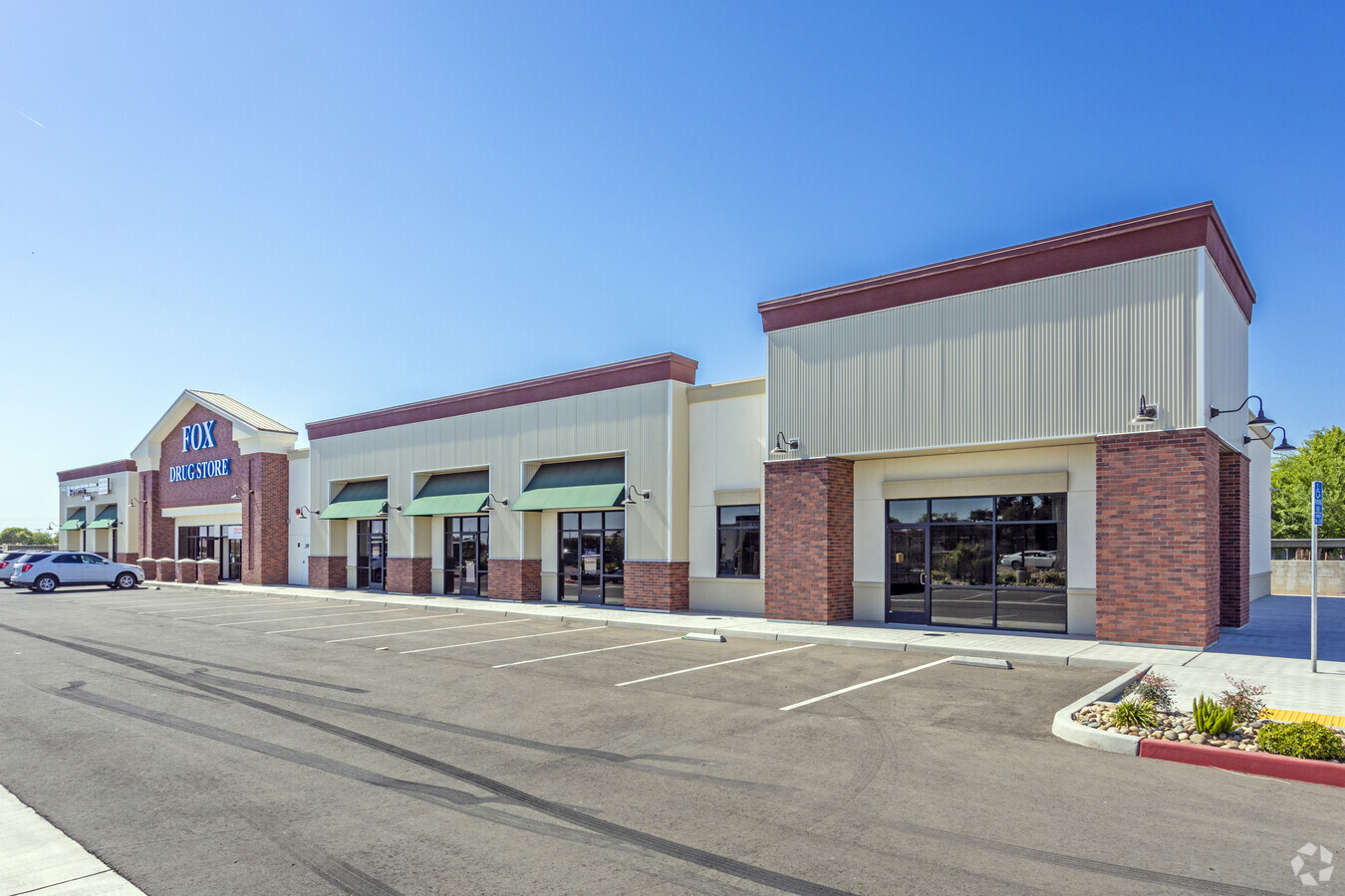
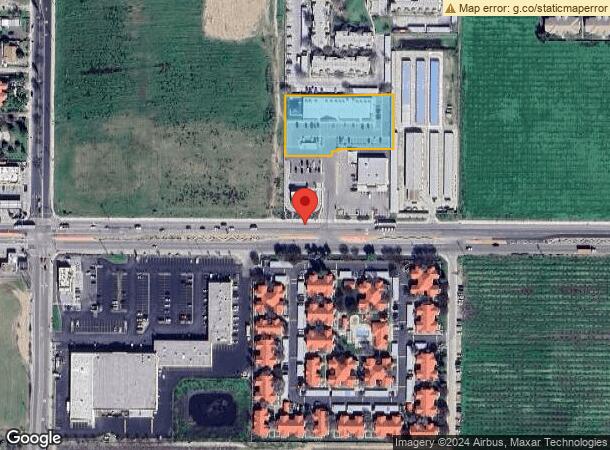
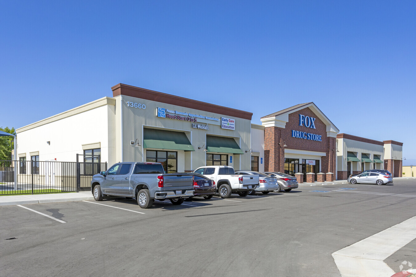
Property Record
13660 E Manning Ave, Parlier, CA 93648
NEARBY LISTINGS FOR SALE OR LEASE
-
-
View all Parlier listings for lease on LoopNet.com
Property Detail
13660 E Manning Ave
355-510-16
Parcel Map No 2009 01
Storebuilding
PAR 3 & POR PAR 4 OF P/M 09-01 BK 70 PGS 71-72
X
Fresno
06019C1595H
California
2023
1.36 AC
2023
E Outlying Fresno Cnty
008503
Fresno
14,840 SF
Fresno, CA
DEMOGRAPHICS near 13660 E Manning Ave
1 Mile
3 Mile
5 Mile
2024 Total Population
12,338
16,060
42,739
2029 Population
12,607
16,340
43,212
Pop Growth 2024-2029
+ 2.18%
+ 1.74%
+ 1.11%
Average Age
32
33
35
2024 Total Households
3,010
4,027
11,956
HH Growth 2024-2029
+ 2.16%
+ 1.66%
+ 1.01%
Median Household Inc
$47,372
$45,303
$51,218
Avg Household Size
4.10
4.00
3.50
2024 Avg HH Vehicles
2.00
2.00
2.00
Median Home Value
$199,680
$217,287
$244,062
Median Year Built
1993
1991
1982
Nearby Places
- Restaurants
- Banks
- Shops
- Fitness
- Groceries
PUBLIC TRANSPORTATION
AIRPORT
Fresno Yosemite International
DRIVE
WALK
Distance
Fresno Yosemite International
30 min
20.7 mi
Freight Ports
Port of Stockton
DRIVE
WALK
Distance
Port of Stockton
171 min
145.1 mi
SALE & LEASE HISTORY
LISTING DATE
SALE/LEASE

Nov 05, 2019
For Lease
Nearby Properties
Address
Land Use
TOTAL SIZE
Lot Size
Zoning
Address
Land Use
TOTAL SIZE
Lot Size
Zoning
88,640 SF
8.44 AC
M1
Address
Land Use
TOTAL SIZE
Lot Size
Zoning
19,994 SF
1.52 AC
C5
Address
Land Use
TOTAL SIZE
Lot Size
Zoning
162,424 SF
8.67 AC
AE20
Address
Land Use
TOTAL SIZE
Lot Size
Zoning
34,155 SF
4.70 AC
R2
Address
Land Use
TOTAL SIZE
Lot Size
Zoning
281,562 SF
14.28 AC
M1
Address
Land Use
TOTAL SIZE
Lot Size
Zoning
5.01 AC
Address
Land Use
TOTAL SIZE
Lot Size
Zoning
94,254 SF
5.76 AC
R1
Address
Land Use
TOTAL SIZE
Lot Size
Zoning
92,627 SF
12 AC
M1
Address
Land Use
TOTAL SIZE
Lot Size
Zoning
67,308 SF
3.98 AC
R2
Address
Land Use
TOTAL SIZE
Lot Size
Zoning
64,524 SF
3.38 AC
R2
Address
Land Use
TOTAL SIZE
Lot Size
Zoning
41,774 SF
3.29 AC
C4
Address
Land Use
TOTAL SIZE
Lot Size
Zoning
126,336 SF
16.60 AC
M1
Address
Land Use
TOTAL SIZE
Lot Size
Zoning
58,820 SF
7.53 AC
C5
Address
Land Use
TOTAL SIZE
Lot Size
Zoning
33,658 SF
1.09 AC
M1
Address
Land Use
TOTAL SIZE
Lot Size
Zoning
76.40 AC
AE20
Address
Land Use
TOTAL SIZE
Lot Size
Zoning
53,036 SF
2.54 AC
R3
Address
Land Use
TOTAL SIZE
Lot Size
Zoning
40,841 SF
2.95 AC
AL20
Address
Land Use
TOTAL SIZE
Lot Size
Zoning
154.35 AC
AE20
Address
Land Use
TOTAL SIZE
Lot Size
Zoning
61,486 SF
3.25 AC
R3
Address
Land Use
TOTAL SIZE
Lot Size
Zoning
4,722 SF
18.44 AC
AE20
Address
Land Use
TOTAL SIZE
Lot Size
Zoning
27,784 SF
3.13 AC
R3
Address
Land Use
TOTAL SIZE
Lot Size
Zoning
1,944 SF
316.28 AC
AE20
Address
Land Use
TOTAL SIZE
Lot Size
Zoning
25,187 SF
4.31 AC
C4
Address
Land Use
TOTAL SIZE
Lot Size
Zoning
3,132 SF
73.18 AC
AE20
Address
Land Use
TOTAL SIZE
Lot Size
Zoning
798 SF
117.44 AC
AE20
Address
Land Use
TOTAL SIZE
Lot Size
Zoning
1,200 SF
141.77 AC
AE20
Address
Land Use
TOTAL SIZE
Lot Size
Zoning
15,680 SF
40 AC
AE20
Address
Land Use
TOTAL SIZE
Lot Size
Zoning
163.39 AC
AE20
Address
Land Use
TOTAL SIZE
Lot Size
Zoning
2,140 SF
0.66 AC
CM
The World's #1 Commercial Real Estate Marketplace
Connect with us
© 2025 CoStar Group
The information above has been obtained from sources believed reliable. While we do not doubt its accuracy we have not verified it and make no guarantee, warranty or representation about it. It is your responsibility to independently confirm its accuracy and completeness. Any projections, opinions, assumptions, or estimates used are for example only and do not represent the current or future performance of the property. The value of this transaction to you depends on tax and other factors which should be evaluated by your tax, financial, and legal advisors. You and your advisors should conduct a careful, independent investigation of the property to determine to your satisfaction the suitability of the property for your needs.