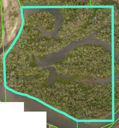
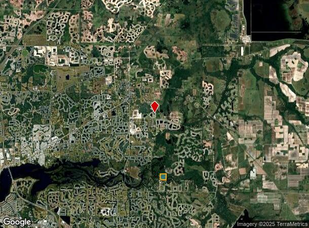
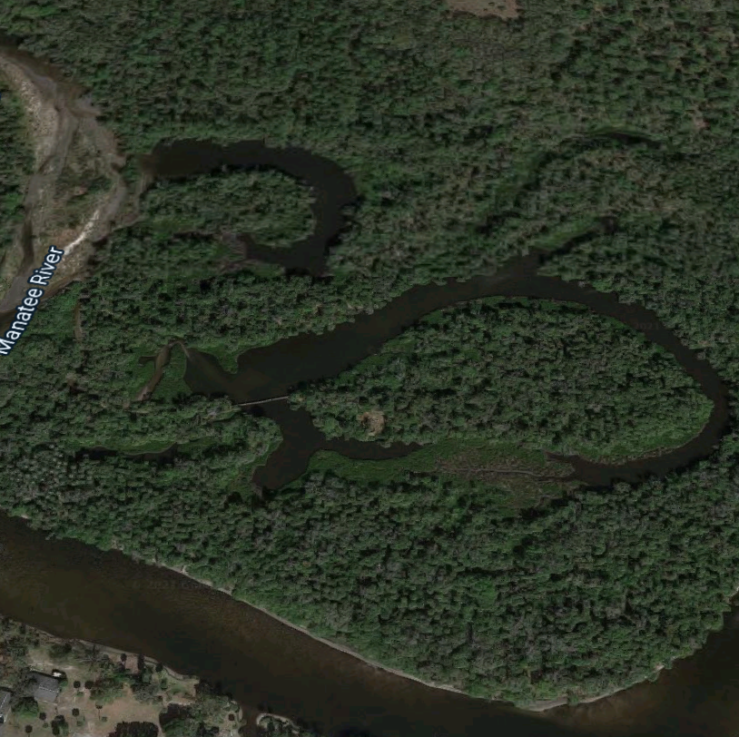
Property Record
136Th St Ne, Parrish, FL 34219
This Property Is For Sale
NEARBY LISTINGS FOR SALE OR LEASE
Property Detail
136Th St Ne
North Port-Sarasota-Bradenton, FL
SE 1/4 OF NE 1/4 P-2 SUBJ TO CONSERVATION EASMT PER OR2250/3223 ; LESS THAT PART LYING WITHIN EAST MANATEE FIRE RESCURE DISTRICT PI #5361.0005/9
5361-0005-9
Manatee
Vacantlandnec
Florida
0
37.92 AC
2023
Manatee Outlying
001913
Tampa/St Petersburg
DEMOGRAPHICS near 136Th St Ne
1 Mile
3 Mile
5 Mile
2024 Total Population
2,370
27,113
64,999
2029 Population
2,797
31,830
77,066
Pop Growth 2024-2029
+ 18.02%
+ 17.40%
+ 18.56%
Average Age
44
44
45
2024 Total Households
887
9,643
24,598
HH Growth 2024-2029
+ 17.14%
+ 16.57%
+ 17.72%
Median Household Inc
$101,986
$108,610
$105,710
Avg Household Size
2.60
2.70
2.60
2024 Avg HH Vehicles
2.00
2.00
2.00
Median Home Value
$464,870
$422,161
$394,311
Median Year Built
2010
2008
2010
Nearby Places
- Restaurants
- Banks
- Shops
- Fitness
- Groceries
PUBLIC TRANSPORTATION
AIRPORT
Sarasota/Bradenton International
DRIVE
WALK
Distance
Sarasota/Bradenton International
40 min
21.2 mi
St Pete-Clearwater International
DRIVE
WALK
Distance
St Pete-Clearwater International
64 min
43.1 mi
Tampa International
DRIVE
WALK
Distance
Tampa International
69 min
45.7 mi
Freight Ports
Port Manatee
DRIVE
WALK
Distance
Port Manatee
26 min
14.2 mi
Nearby Properties
Address
Land Use
TOTAL SIZE
Lot Size
Zoning
Address
Land Use
TOTAL SIZE
Lot Size
Zoning
293,048 SF
42.24 AC
A-1 SUBURB
Address
Land Use
TOTAL SIZE
Lot Size
Zoning
114,376 SF
19.17 AC
PD-R
Address
Land Use
TOTAL SIZE
Lot Size
Zoning
164,551 SF
31.22 AC
PD-MU
Address
Land Use
TOTAL SIZE
Lot Size
Zoning
112,078 SF
22.02 AC
PD-MU
Address
Land Use
TOTAL SIZE
Lot Size
Zoning
821.30 AC
Address
Land Use
TOTAL SIZE
Lot Size
Zoning
19,260 SF
140.65 AC
A GENERAL
Address
Land Use
TOTAL SIZE
Lot Size
Zoning
66,063 SF
9.24 AC
PD-C
Address
Land Use
TOTAL SIZE
Lot Size
Zoning
21.72 AC
PDR
Address
Land Use
TOTAL SIZE
Lot Size
Zoning
43,464 SF
14.47 AC
VIL VILLAG
Address
Land Use
TOTAL SIZE
Lot Size
Zoning
190.90 AC
PD-R
Address
Land Use
TOTAL SIZE
Lot Size
Zoning
165.96 AC
Address
Land Use
TOTAL SIZE
Lot Size
Zoning
245.52 AC
Address
Land Use
TOTAL SIZE
Lot Size
Zoning
30,101 SF
13.44 AC
PD-C
Address
Land Use
TOTAL SIZE
Lot Size
Zoning
36,700 SF
17 AC
A-1 SUBURB
Address
Land Use
TOTAL SIZE
Lot Size
Zoning
7,042 SF
55.04 AC
A-1 SUBURB
Address
Land Use
TOTAL SIZE
Lot Size
Zoning
98.57 AC
A GENERAL
Address
Land Use
TOTAL SIZE
Lot Size
Zoning
4.07 AC
Address
Land Use
TOTAL SIZE
Lot Size
Zoning
53,448 SF
3 AC
PD-C
Address
Land Use
TOTAL SIZE
Lot Size
Zoning
9,806 SF
4.04 AC
VIL VILLAG
Address
Land Use
TOTAL SIZE
Lot Size
Zoning
17,677 SF
9.52 AC
A-1 SUBURB
Address
Land Use
TOTAL SIZE
Lot Size
Zoning
34,824 SF
192.28 AC
PD-R
Address
Land Use
TOTAL SIZE
Lot Size
Zoning
1.96 AC
Address
Land Use
TOTAL SIZE
Lot Size
Zoning
50.40 AC
PD-MU
Address
Land Use
TOTAL SIZE
Lot Size
Zoning
58.47 AC
Address
Land Use
TOTAL SIZE
Lot Size
Zoning
6,554 SF
8.67 AC
VIL VILLAG
Address
Land Use
TOTAL SIZE
Lot Size
Zoning
21,657 SF
91.19 AC
A GENERAL
Address
Land Use
TOTAL SIZE
Lot Size
Zoning
10.38 AC
PD-C,PD-O,
Address
Land Use
TOTAL SIZE
Lot Size
Zoning
12,513 SF
2.49 AC
VIL VILLAG
Address
Land Use
TOTAL SIZE
Lot Size
Zoning
10,560 SF
2.37 AC
PD-C
Address
Land Use
TOTAL SIZE
Lot Size
Zoning
10,220 SF
23.74 AC
A GENERAL
The World's #1 Commercial Real Estate Marketplace
Connect with us
© 2025 CoStar Group
The information above has been obtained from sources believed reliable. While we do not doubt its accuracy we have not verified it and make no guarantee, warranty or representation about it. It is your responsibility to independently confirm its accuracy and completeness. Any projections, opinions, assumptions, or estimates used are for example only and do not represent the current or future performance of the property. The value of this transaction to you depends on tax and other factors which should be evaluated by your tax, financial, and legal advisors. You and your advisors should conduct a careful, independent investigation of the property to determine to your satisfaction the suitability of the property for your needs.