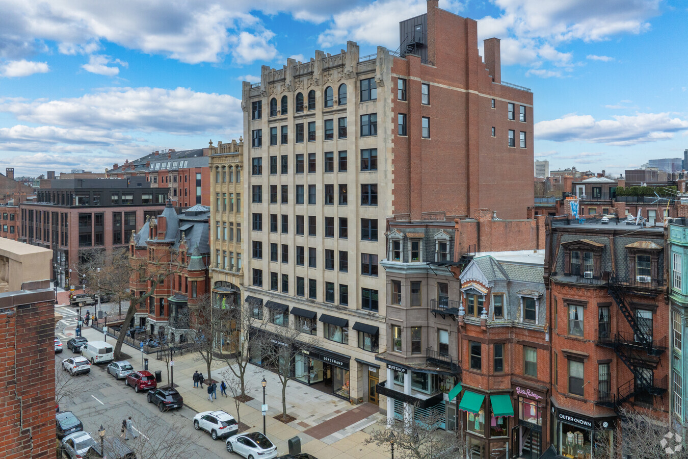
Property Record
137 Newbury St, Boston, MA 02116
Current Lease Availabilities
NEARBY LISTINGS FOR SALE OR LEASE
-
-
-
-
-
-
-
-
-
-
-
-
-
-
-
-
-
No Photo
-
-
-
-
-
-
View all Boston listings for lease on LoopNet.com
Property Detail
137 Newbury St
Officebuilding
Suffolk
X
Massachusetts
25025C0077J
0.18 AC
2024
Back Bay
2024
Boston
010702
Boston-Cambridge-Newton, MA-NH
51,150 SF
CBOS-000000-000005-001339
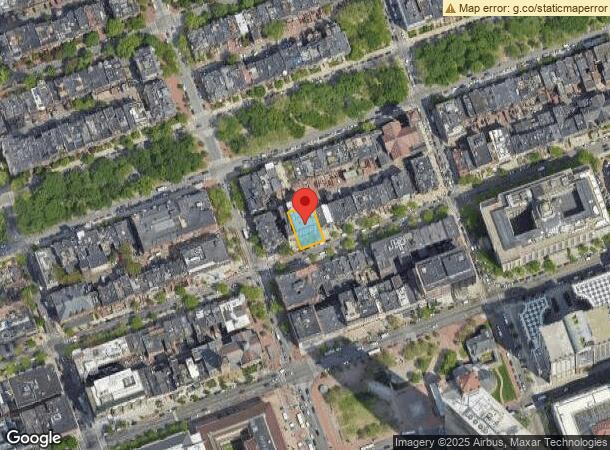
DEMOGRAPHICS near 137 Newbury St
1 Mile
3 Mile
5 Mile
2024 Total Population
106,593
519,020
942,797
2029 Population
103,703
502,021
908,145
Pop Growth 2024-2029
(2.71%)
(3.28%)
(3.68%)
Average Age
37
36
37
2024 Total Households
49,182
224,762
390,632
HH Growth 2024-2029
(3.02%)
(3.48%)
(3.85%)
Median Household Inc
$89,419
$91,344
$90,780
Avg Household Size
1.80
2.00
2.20
2024 Avg HH Vehicles
1.00
1.00
1.00
Median Home Value
$1,028,751
$862,551
$796,073
Median Year Built
1950
1951
1949
Nearby Places
- Restaurants
- Banks
- Shops
- Fitness
- Groceries
PUBLIC TRANSPORTATION
TRANSIT/SUBWAY
Copley Station (Green Line - B - Massachusetts Bay Transportation Authority Subway (The T), Green Line - C - Massachusetts Bay Transportation Authority Subway (The T), Green Line - D - Massachusetts Bay Transportation Authority Subway (The T), Green Line - E - Massachusetts Bay Transportation Authority Subway (The T))
DRIVE
WALK
Distance
Copley Station (Green Line - B - Massachusetts Bay Transportation Authority Subway (The T), Green Line - C - Massachusetts Bay Transportation Authority Subway (The T), Green Line - D - Massachusetts Bay Transportation Authority Subway (The T), Green Line - E - Massachusetts Bay Transportation Authority Subway (The T))
1 min
2 min
0.1 mi
Arlington Station (Green Line - B - Massachusetts Bay Transportation Authority Subway (The T), Green Line - C - Massachusetts Bay Transportation Authority Subway (The T), Green Line - D - Massachusetts Bay Transportation Authority Subway (The T), Green Line - E - Massachusetts Bay Transportation Authority Subway (The T))
DRIVE
WALK
Distance
Arlington Station (Green Line - B - Massachusetts Bay Transportation Authority Subway (The T), Green Line - C - Massachusetts Bay Transportation Authority Subway (The T), Green Line - D - Massachusetts Bay Transportation Authority Subway (The T), Green Line - E - Massachusetts Bay Transportation Authority Subway (The T))
2 min
7 min
0.4 mi
Prudential Station (Green Line - E - Massachusetts Bay Transportation Authority Subway (The T))
DRIVE
WALK
Distance
Prudential Station (Green Line - E - Massachusetts Bay Transportation Authority Subway (The T))
2 min
10 min
0.5 mi
Hynes Convention Center Station (Green Line - B - Massachusetts Bay Transportation Authority Subway (The T), Green Line - C - Massachusetts Bay Transportation Authority Subway (The T), Green Line - D - Massachusetts Bay Transportation Authority Subway (The T))
DRIVE
WALK
Distance
Hynes Convention Center Station (Green Line - B - Massachusetts Bay Transportation Authority Subway (The T), Green Line - C - Massachusetts Bay Transportation Authority Subway (The T), Green Line - D - Massachusetts Bay Transportation Authority Subway (The T))
2 min
11 min
0.6 mi
Boylston Street Station (Green Line - B - Massachusetts Bay Transportation Authority Subway (The T), Green Line - C - Massachusetts Bay Transportation Authority Subway (The T), Green Line - D - Massachusetts Bay Transportation Authority Subway (The T), Green Line - E - Massachusetts Bay Transportation Authority Subway (The T), Silver Line - Washington Street - Massachusetts Bay Transportation Authority Subway (The T))
DRIVE
WALK
Distance
Boylston Street Station (Green Line - B - Massachusetts Bay Transportation Authority Subway (The T), Green Line - C - Massachusetts Bay Transportation Authority Subway (The T), Green Line - D - Massachusetts Bay Transportation Authority Subway (The T), Green Line - E - Massachusetts Bay Transportation Authority Subway (The T), Silver Line - Washington Street - Massachusetts Bay Transportation Authority Subway (The T))
3 min
13 min
0.7 mi
COMMUTER RAIL
Back Bay Station (Framingham/Worcester Line - Massachusetts Bay Transportation Authority Commuter Rail (Purple Line), Franklin Line - Massachusetts Bay Transportation Authority Commuter Rail (Purple Line), Needham Line - Massachusetts Bay Transportation Authority Commuter Rail (Purple Line), Orange Line - Massachusetts Bay Transportation Authority Commuter Rail (Purple Line), Providence/Stoughton Line - Massachusetts Bay Transportation Authority Commuter Rail (Purple Line))
DRIVE
WALK
Distance
Back Bay Station (Framingham/Worcester Line - Massachusetts Bay Transportation Authority Commuter Rail (Purple Line), Franklin Line - Massachusetts Bay Transportation Authority Commuter Rail (Purple Line), Needham Line - Massachusetts Bay Transportation Authority Commuter Rail (Purple Line), Orange Line - Massachusetts Bay Transportation Authority Commuter Rail (Purple Line), Providence/Stoughton Line - Massachusetts Bay Transportation Authority Commuter Rail (Purple Line))
4 min
7 min
0.4 mi
South Station (Fairmount Line - Massachusetts Bay Transportation Authority Commuter Rail (Purple Line), Framingham/Worcester Line - Massachusetts Bay Transportation Authority Commuter Rail (Purple Line), Franklin Line - Massachusetts Bay Transportation Authority Commuter Rail (Purple Line), Greenbush Line - Massachusetts Bay Transportation Authority Commuter Rail (Purple Line), Kingston/Plymouth Line - Massachusetts Bay Transportation Authority Commuter Rail (Purple Line), Middleborough/Lakeville Line - Massachusetts Bay Transportation Authority Commuter Rail (Purple Line), Needham Line - Massachusetts Bay Transportation Authority Commuter Rail (Purple Line), Providence/Stoughton Line - Massachusetts Bay Transportation Authority Commuter Rail (Purple Line))
DRIVE
WALK
Distance
South Station (Fairmount Line - Massachusetts Bay Transportation Authority Commuter Rail (Purple Line), Framingham/Worcester Line - Massachusetts Bay Transportation Authority Commuter Rail (Purple Line), Franklin Line - Massachusetts Bay Transportation Authority Commuter Rail (Purple Line), Greenbush Line - Massachusetts Bay Transportation Authority Commuter Rail (Purple Line), Kingston/Plymouth Line - Massachusetts Bay Transportation Authority Commuter Rail (Purple Line), Middleborough/Lakeville Line - Massachusetts Bay Transportation Authority Commuter Rail (Purple Line), Needham Line - Massachusetts Bay Transportation Authority Commuter Rail (Purple Line), Providence/Stoughton Line - Massachusetts Bay Transportation Authority Commuter Rail (Purple Line))
5 min
1.5 mi
AIRPORT
General Edward Lawrence Logan International
DRIVE
WALK
Distance
General Edward Lawrence Logan International
12 min
5.1 mi
Freight Ports
Port of Boston
DRIVE
WALK
Distance
Port of Boston
10 min
3.3 mi
Nearby Properties
Address
Land Use
TOTAL SIZE
Lot Size
Zoning
Address
Land Use
TOTAL SIZE
Lot Size
Zoning
909,764 SF
25.13 AC
E
Address
Land Use
TOTAL SIZE
Lot Size
Zoning
610,560 SF
4 AC
E
Address
Land Use
TOTAL SIZE
Lot Size
Zoning
707,000 SF
1.60 AC
C
Address
Land Use
TOTAL SIZE
Lot Size
Zoning
2.79 AC
Address
Land Use
TOTAL SIZE
Lot Size
Zoning
825,000 SF
5.17 AC
E
Address
Land Use
TOTAL SIZE
Lot Size
Zoning
467,952 SF
0.86 AC
BPA
Address
Land Use
TOTAL SIZE
Lot Size
Zoning
488,832 SF
1.38 AC
BB
Address
Land Use
TOTAL SIZE
Lot Size
Zoning
469,670 SF
7.60 AC
C
Address
Land Use
TOTAL SIZE
Lot Size
Zoning
230,394 SF
0.60 AC
MXD
Address
Land Use
TOTAL SIZE
Lot Size
Zoning
448,796 SF
1.84 AC
C
Address
Land Use
TOTAL SIZE
Lot Size
Zoning
304,349 SF
1.72 AC
Address
Land Use
TOTAL SIZE
Lot Size
Zoning
342,300 SF
1.04 AC
C
Address
Land Use
TOTAL SIZE
Lot Size
Zoning
530,200 SF
62.08 AC
E
Address
Land Use
TOTAL SIZE
Lot Size
Zoning
239,377 SF
0.71 AC
MXD
Address
Land Use
TOTAL SIZE
Lot Size
Zoning
114,000 SF
1.20 AC
RC
Address
Land Use
TOTAL SIZE
Lot Size
Zoning
46,259 SF
1.04 AC
E
Address
Land Use
TOTAL SIZE
Lot Size
Zoning
379,172 SF
1.04 AC
RC
Address
Land Use
TOTAL SIZE
Lot Size
Zoning
4,355 SF
13.12 AC
E
Address
Land Use
TOTAL SIZE
Lot Size
Zoning
1.13 AC
C
Address
Land Use
TOTAL SIZE
Lot Size
Zoning
2.81 AC
O-2
Address
Land Use
TOTAL SIZE
Lot Size
Zoning
408,667 SF
3.27 AC
C
Address
Land Use
TOTAL SIZE
Lot Size
Zoning
2.25 AC
SD-12
Address
Land Use
TOTAL SIZE
Lot Size
Zoning
157,083 SF
0.41 AC
C
Address
Land Use
TOTAL SIZE
Lot Size
Zoning
227,107 SF
7.70 AC
E
Address
Land Use
TOTAL SIZE
Lot Size
Zoning
334,522 SF
1.26 AC
C
Address
Land Use
TOTAL SIZE
Lot Size
Zoning
419,722 SF
2.02 AC
RC
Address
Land Use
TOTAL SIZE
Lot Size
Zoning
341,500 SF
1.18 AC
RC
Address
Land Use
TOTAL SIZE
Lot Size
Zoning
237,928 SF
1.27 AC
C-3
Address
Land Use
TOTAL SIZE
Lot Size
Zoning
155,818 SF
5.33 AC
OS
Address
Land Use
TOTAL SIZE
Lot Size
Zoning
262,120 SF
0.62 AC
C
The World's #1 Commercial Real Estate Marketplace
Connect with us
© 2025 CoStar Group
The information above has been obtained from sources believed reliable. While we do not doubt its accuracy we have not verified it and make no guarantee, warranty or representation about it. It is your responsibility to independently confirm its accuracy and completeness. Any projections, opinions, assumptions, or estimates used are for example only and do not represent the current or future performance of the property. The value of this transaction to you depends on tax and other factors which should be evaluated by your tax, financial, and legal advisors. You and your advisors should conduct a careful, independent investigation of the property to determine to your satisfaction the suitability of the property for your needs.