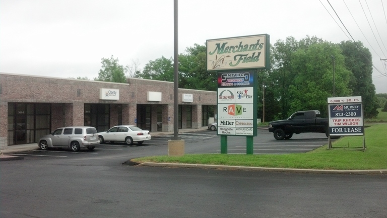
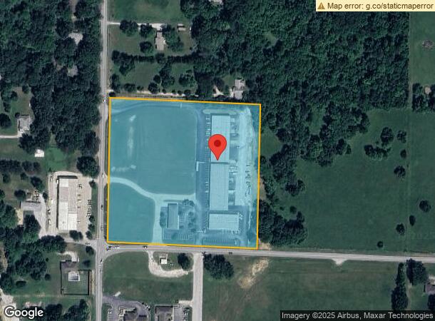
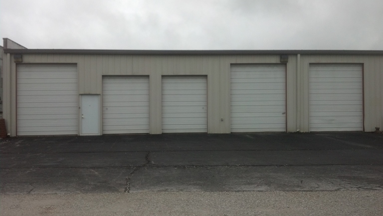
Property Record
137 E State Highway Cc, Nixa, MO 65714
NEARBY LISTINGS FOR SALE OR LEASE
Property Detail
137 E State Highway Cc
10-0.1-01-000-000-057.001
Nixa, City Of Out
Commercialnec
W2 S2 SE4 NW4
X
Christian
29043C0058D
Missouri
2023
10 AC
2023
West Christian County
020207
Springfield
15,774 SF
Springfield, MO
DEMOGRAPHICS near 137 E State Highway Cc
1 Mile
3 Mile
5 Mile
2024 Total Population
5,532
33,791
83,427
2029 Population
6,265
37,704
90,740
Pop Growth 2024-2029
+ 13.25%
+ 11.58%
+ 8.77%
Average Age
39
40
41
2024 Total Households
2,184
13,026
33,101
HH Growth 2024-2029
+ 13.32%
+ 11.67%
+ 8.63%
Median Household Inc
$70,823
$75,994
$75,548
Avg Household Size
2.50
2.60
2.50
2024 Avg HH Vehicles
2.00
2.00
2.00
Median Home Value
$211,669
$238,170
$248,433
Median Year Built
1997
1996
1996
Nearby Places
- Restaurants
- Banks
- Shops
- Fitness
- Groceries
PUBLIC TRANSPORTATION
AIRPORT
Springfield-Branson National
DRIVE
WALK
Distance
Springfield-Branson National
30 min
23.4 mi
SALE & LEASE HISTORY
LISTING DATE
SALE/LEASE

Sep 25, 2016
For Lease
Nearby Properties
Address
Land Use
TOTAL SIZE
Lot Size
Zoning
Address
Land Use
TOTAL SIZE
Lot Size
Zoning
310,792 SF
12.27 AC
Address
Land Use
TOTAL SIZE
Lot Size
Zoning
10,720 SF
9.71 AC
Address
Land Use
TOTAL SIZE
Lot Size
Zoning
30,049 SF
5.01 AC
Address
Land Use
TOTAL SIZE
Lot Size
Zoning
3,080 SF
24.20 AC
Address
Land Use
TOTAL SIZE
Lot Size
Zoning
141,200 SF
35.65 AC
Address
Land Use
TOTAL SIZE
Lot Size
Zoning
19,682 SF
7.17 AC
Address
Land Use
TOTAL SIZE
Lot Size
Zoning
13,750 SF
6.56 AC
Address
Land Use
TOTAL SIZE
Lot Size
Zoning
73,140 SF
10.80 AC
Address
Land Use
TOTAL SIZE
Lot Size
Zoning
23,660 SF
10 AC
Address
Land Use
TOTAL SIZE
Lot Size
Zoning
43,194 SF
18 AC
Address
Land Use
TOTAL SIZE
Lot Size
Zoning
13,836 SF
5.81 AC
Address
Land Use
TOTAL SIZE
Lot Size
Zoning
22,920 SF
8.51 AC
Address
Land Use
TOTAL SIZE
Lot Size
Zoning
36,110 SF
7 AC
Address
Land Use
TOTAL SIZE
Lot Size
Zoning
13,940 SF
3.43 AC
Address
Land Use
TOTAL SIZE
Lot Size
Zoning
107,194 SF
39.40 AC
Address
Land Use
TOTAL SIZE
Lot Size
Zoning
200,000 SF
10 AC
Address
Land Use
TOTAL SIZE
Lot Size
Zoning
40,726 SF
4.54 AC
Address
Land Use
TOTAL SIZE
Lot Size
Zoning
22,150 SF
7.41 AC
Address
Land Use
TOTAL SIZE
Lot Size
Zoning
39,380 SF
2.50 AC
Address
Land Use
TOTAL SIZE
Lot Size
Zoning
7,172 SF
6.30 AC
Address
Land Use
TOTAL SIZE
Lot Size
Zoning
23,170 SF
3.36 AC
Address
Land Use
TOTAL SIZE
Lot Size
Zoning
33,712 SF
2.66 AC
Address
Land Use
TOTAL SIZE
Lot Size
Zoning
1.95 AC
INC
Address
Land Use
TOTAL SIZE
Lot Size
Zoning
8,512 SF
7.39 AC
Address
Land Use
TOTAL SIZE
Lot Size
Zoning
58,989 SF
3.25 AC
INC
Address
Land Use
TOTAL SIZE
Lot Size
Zoning
24,282 SF
13.82 AC
Address
Land Use
TOTAL SIZE
Lot Size
Zoning
19,848 SF
5.48 AC
Address
Land Use
TOTAL SIZE
Lot Size
Zoning
6,800 SF
3.80 AC
Address
Land Use
TOTAL SIZE
Lot Size
Zoning
31,642 SF
6.34 AC
The World's #1 Commercial Real Estate Marketplace
Connect with us
© 2025 CoStar Group
The information above has been obtained from sources believed reliable. While we do not doubt its accuracy we have not verified it and make no guarantee, warranty or representation about it. It is your responsibility to independently confirm its accuracy and completeness. Any projections, opinions, assumptions, or estimates used are for example only and do not represent the current or future performance of the property. The value of this transaction to you depends on tax and other factors which should be evaluated by your tax, financial, and legal advisors. You and your advisors should conduct a careful, independent investigation of the property to determine to your satisfaction the suitability of the property for your needs.