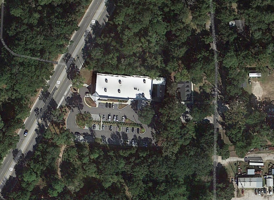
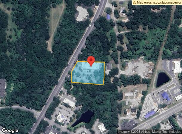
Property Record
137 Parris Island Gtwy, Beaufort, SC 29906
NEARBY LISTINGS FOR SALE OR LEASE
Property Detail
137 Parris Island Gtwy
Other Market Areas
Burton Commercial & Mixed Use
Hilton Head Island-Bluffton-Beaufort, SC
POR LOT 54 BURTON HILL *SPLIT 6/84 2/18 AC 29/54B DELETED BLDG - BURNED 12/89 3/
R120-029-000-054A-0000
Beaufort
Storebuilding
South Carolina
2024
54
2024
1.78 AC
000502
Hilton Head/Beaufort
15,274 SF
DEMOGRAPHICS near 137 Parris Island Gtwy
1 Mile
3 Mile
5 Mile
2024 Total Population
1,912
19,724
45,174
2029 Population
2,117
21,800
49,889
Pop Growth 2024-2029
+ 10.72%
+ 10.53%
+ 10.44%
Average Age
36
39
38
2024 Total Households
756
7,958
17,488
HH Growth 2024-2029
+ 10.45%
+ 10.08%
+ 10.41%
Median Household Inc
$48,749
$54,087
$58,459
Avg Household Size
2.50
2.40
2.40
2024 Avg HH Vehicles
2.00
2.00
2.00
Median Home Value
$309,740
$245,071
$274,686
Median Year Built
1997
1989
1991
Nearby Places
- Restaurants
- Banks
- Shops
- Fitness
- Groceries
PUBLIC TRANSPORTATION
AIRPORT
Hilton Head
DRIVE
WALK
Distance
Hilton Head
46 min
35.1 mi
Freight Ports
Georgia Ports - Savannah
DRIVE
WALK
Distance
Georgia Ports - Savannah
55 min
44.4 mi
Nearby Properties
Address
Land Use
TOTAL SIZE
Lot Size
Zoning
Address
Land Use
TOTAL SIZE
Lot Size
Zoning
245,864 SF
19.36 AC
6601
Address
Land Use
TOTAL SIZE
Lot Size
Zoning
4,613 AC
6601
Address
Land Use
TOTAL SIZE
Lot Size
Zoning
243,644 SF
13.23 AC
6601
Address
Land Use
TOTAL SIZE
Lot Size
Zoning
4.45 AC
6601
Address
Land Use
TOTAL SIZE
Lot Size
Zoning
22,944 SF
16.59 AC
6101
Address
Land Use
TOTAL SIZE
Lot Size
Zoning
23,136 SF
9.67 AC
6101
Address
Land Use
TOTAL SIZE
Lot Size
Zoning
101,304 SF
6.47 AC
6611
Address
Land Use
TOTAL SIZE
Lot Size
Zoning
217,792 SF
60 AC
6611
Address
Land Use
TOTAL SIZE
Lot Size
Zoning
103,282 SF
19.22 AC
Address
Land Use
TOTAL SIZE
Lot Size
Zoning
85,656 SF
22.54 AC
6611
Address
Land Use
TOTAL SIZE
Lot Size
Zoning
39,296 SF
2.05 AC
6611
Address
Land Use
TOTAL SIZE
Lot Size
Zoning
34,200 SF
4.18 AC
6601
Address
Land Use
TOTAL SIZE
Lot Size
Zoning
142,753 SF
47.79 AC
6611
Address
Land Use
TOTAL SIZE
Lot Size
Zoning
116,067 SF
27 AC
6611
Address
Land Use
TOTAL SIZE
Lot Size
Zoning
214,795 SF
24.94 AC
6611
Address
Land Use
TOTAL SIZE
Lot Size
Zoning
4,928 SF
4.76 AC
6611
Address
Land Use
TOTAL SIZE
Lot Size
Zoning
60,814 SF
3 AC
Address
Land Use
TOTAL SIZE
Lot Size
Zoning
2,760 SF
4.16 AC
6611
Address
Land Use
TOTAL SIZE
Lot Size
Zoning
92,125 SF
10.14 AC
6611
Address
Land Use
TOTAL SIZE
Lot Size
Zoning
134,446 SF
19.90 AC
6611
Address
Land Use
TOTAL SIZE
Lot Size
Zoning
53,684 SF
24.30 AC
6611
Address
Land Use
TOTAL SIZE
Lot Size
Zoning
71,309 SF
2.30 AC
6601
Address
Land Use
TOTAL SIZE
Lot Size
Zoning
44,312 SF
1.87 AC
Address
Land Use
TOTAL SIZE
Lot Size
Zoning
52,322 SF
6.86 AC
6601
Address
Land Use
TOTAL SIZE
Lot Size
Zoning
20,800 SF
12.55 AC
6611
Address
Land Use
TOTAL SIZE
Lot Size
Zoning
53,704 SF
4.76 AC
6611
Address
Land Use
TOTAL SIZE
Lot Size
Zoning
36,020 SF
3.46 AC
6611
Address
Land Use
TOTAL SIZE
Lot Size
Zoning
32,035 SF
7.39 AC
4201
Address
Land Use
TOTAL SIZE
Lot Size
Zoning
192 SF
368 AC
6111
The World's #1 Commercial Real Estate Marketplace
Connect with us
© 2025 CoStar Group
The information above has been obtained from sources believed reliable. While we do not doubt its accuracy we have not verified it and make no guarantee, warranty or representation about it. It is your responsibility to independently confirm its accuracy and completeness. Any projections, opinions, assumptions, or estimates used are for example only and do not represent the current or future performance of the property. The value of this transaction to you depends on tax and other factors which should be evaluated by your tax, financial, and legal advisors. You and your advisors should conduct a careful, independent investigation of the property to determine to your satisfaction the suitability of the property for your needs.