Property Record
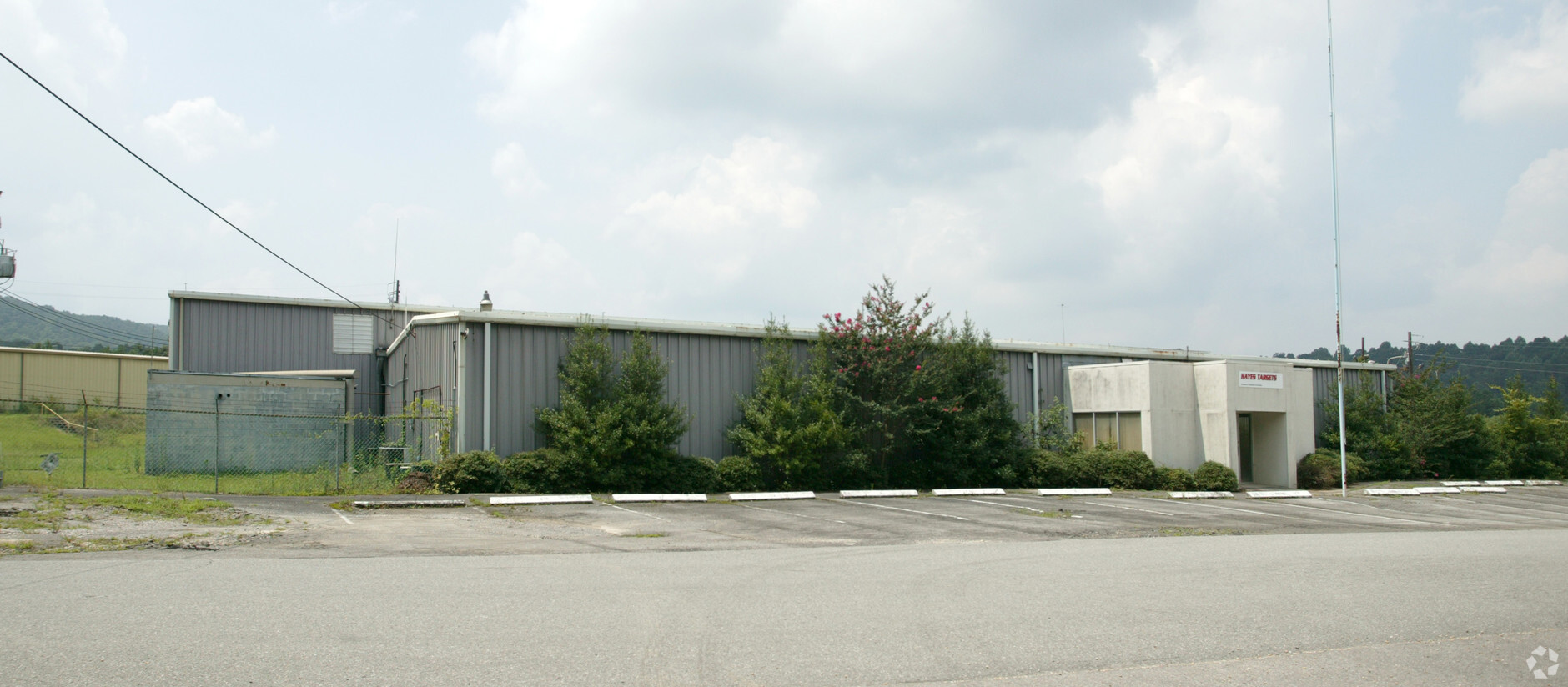
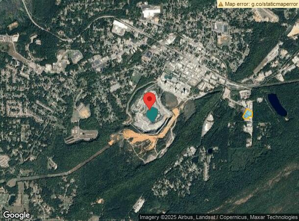
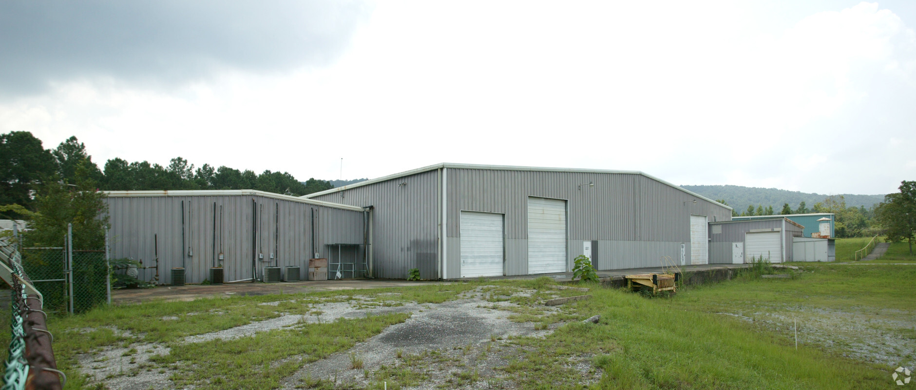
1371 Borden Ave, Leeds, AL 35094
NEARBY LISTINGS FOR SALE OR LEASE
-
-
View all Leeds listings for sale on LoopNet.com
Property Detail
1371 Borden Ave
25-00-22-3-002-025.000
BEG INTER OF W R/W OF GOLDENROD ST & S R/W OF BORDEN ST TH S 250 FT TH W 187.2 FT TH S 106.8 FT TH W 237.8 FT TH NW 132.7 FT TH NE 465 FT TH SE 330 FT TO POB SEC 22 T17S R1E
Heavyindustrial
Jefferson
X
Alabama
01115C0342H
4 AC
2023
Trussville
2024
Birmingham
011003
Birmingham-Hoover, AL
38,500 SF
DEMOGRAPHICS near 1371 Borden Ave
1 Mile
3 Mile
5 Mile
2024 Total Population
1,326
12,746
24,360
2029 Population
1,321
12,858
25,019
Pop Growth 2024-2029
(0.38%)
+ 0.88%
+ 2.71%
Average Age
40
40
40
2024 Total Households
541
5,166
9,739
HH Growth 2024-2029
(0.37%)
+ 0.81%
+ 2.63%
Median Household Inc
$68,333
$58,255
$61,154
Avg Household Size
2.40
2.40
2.50
2024 Avg HH Vehicles
2.00
2.00
2.00
Median Home Value
$186,110
$177,615
$185,554
Median Year Built
1976
1983
1992
Nearby Places
- Restaurants
- Banks
- Shops
- Fitness
- Groceries
PUBLIC TRANSPORTATION
AIRPORT
Birmingham-Shuttlesworth International
DRIVE
WALK
Distance
Birmingham-Shuttlesworth International
21 min
14.6 mi
Freight Ports
Port of Mobile
DRIVE
WALK
Distance
Port of Mobile
292 min
265.8 mi
Nearby Properties
Address
Land Use
TOTAL SIZE
Lot Size
Zoning
Address
Land Use
TOTAL SIZE
Lot Size
Zoning
356,967 SF
34.71 AC
I3S&
Address
Land Use
TOTAL SIZE
Lot Size
Zoning
146,749 SF
23.99 AC
B2
Address
Land Use
TOTAL SIZE
Lot Size
Zoning
52,828 SF
12.70 AC
B2
Address
Land Use
TOTAL SIZE
Lot Size
Zoning
28,666 SF
4.41 AC
B2
Address
Land Use
TOTAL SIZE
Lot Size
Zoning
15.90 AC
Address
Land Use
TOTAL SIZE
Lot Size
Zoning
123,425 SF
15.80 AC
Address
Land Use
TOTAL SIZE
Lot Size
Zoning
51,801 SF
7.45 AC
Address
Land Use
TOTAL SIZE
Lot Size
Zoning
57,399 SF
2.49 AC
Address
Land Use
TOTAL SIZE
Lot Size
Zoning
59,487 SF
9.20 AC
B2-R
Address
Land Use
TOTAL SIZE
Lot Size
Zoning
46,338 SF
8.30 AC
Address
Land Use
TOTAL SIZE
Lot Size
Zoning
22.57 AC
I3
Address
Land Use
TOTAL SIZE
Lot Size
Zoning
184,068 SF
62 AC
M2
Address
Land Use
TOTAL SIZE
Lot Size
Zoning
243,530 SF
29 AC
M2
Address
Land Use
TOTAL SIZE
Lot Size
Zoning
77,822 SF
6.12 AC
R-3
Address
Land Use
TOTAL SIZE
Lot Size
Zoning
139,086 SF
15 AC
M2
Address
Land Use
TOTAL SIZE
Lot Size
Zoning
6,000 SF
8.30 AC
Address
Land Use
TOTAL SIZE
Lot Size
Zoning
16,789 SF
2.03 AC
B2
Address
Land Use
TOTAL SIZE
Lot Size
Zoning
122,300 SF
5.70 AC
M2-I
Address
Land Use
TOTAL SIZE
Lot Size
Zoning
80,643 SF
4.22 AC
R3
Address
Land Use
TOTAL SIZE
Lot Size
Zoning
82,256 SF
6.60 AC
B-2
Address
Land Use
TOTAL SIZE
Lot Size
Zoning
12,960 SF
4.45 AC
B2
Address
Land Use
TOTAL SIZE
Lot Size
Zoning
113,550 SF
10 AC
M-2
Address
Land Use
TOTAL SIZE
Lot Size
Zoning
14.18 AC
B2
Address
Land Use
TOTAL SIZE
Lot Size
Zoning
141,610 SF
4.40 AC
M1-R
Address
Land Use
TOTAL SIZE
Lot Size
Zoning
6.66 AC
Address
Land Use
TOTAL SIZE
Lot Size
Zoning
35,483 SF
1.39 AC
Address
Land Use
TOTAL SIZE
Lot Size
Zoning
33,227 SF
3.50 AC
R2
The World's #1 Commercial Real Estate Marketplace
Connect with us
© 2025 CoStar Group
The information above has been obtained from sources believed reliable. While we do not doubt its accuracy we have not verified it and make no guarantee, warranty or representation about it. It is your responsibility to independently confirm its accuracy and completeness. Any projections, opinions, assumptions, or estimates used are for example only and do not represent the current or future performance of the property. The value of this transaction to you depends on tax and other factors which should be evaluated by your tax, financial, and legal advisors. You and your advisors should conduct a careful, independent investigation of the property to determine to your satisfaction the suitability of the property for your needs.