Property Record
1380 W Paces Ferry Rd Nw, Atlanta, GA 30327


NEARBY LISTINGS FOR SALE OR LEASE
Property Detail
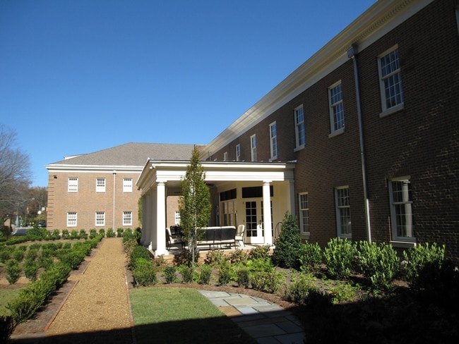
1380 W Paces Ferry Rd Nw
17-0198-LL-047-8
KA HARDIN CONSTRUCTION 98 OWNER 42148 SF NLC-BSM PAKG 2011 LAND SIZE CORRECTED PER SRVY INTER PERMITS COMPL 2/17 CLOSED OLD ONES
Officebuilding
Fulton
AE
Georgia
13121C0231F
5.03 AC
2024
Cumberland/Galleria
2025
Atlanta
009802
Atlanta-Sandy Springs-Roswell, GA
47,848 SF
DEMOGRAPHICS near 1380 W Paces Ferry Rd Nw
1 Mile
3 Mile
5 Mile
2024 Total Population
5,412
69,246
271,287
2029 Population
5,551
71,817
279,796
Pop Growth 2024-2029
+ 2.57%
+ 3.71%
+ 3.14%
Average Age
44
40
38
2024 Total Households
2,549
34,402
136,744
HH Growth 2024-2029
+ 3.06%
+ 4.03%
+ 3.30%
Median Household Inc
$155,590
$113,033
$97,081
Avg Household Size
2.00
2.00
1.90
2024 Avg HH Vehicles
2.00
2.00
2.00
Median Home Value
$965,178
$750,327
$560,007
Median Year Built
1988
1990
1995
Nearby Places
Map Layers
Map Styles
 Street
 Aerial
- Restaurants
- Banks
- Shops
- Fitness
- Groceries
PUBLIC TRANSPORTATION
COMMUTER RAIL
Atlanta (Crescent - Amtrak)
DRIVE
WALK
Distance
Atlanta (Crescent - Amtrak)
10 min
5.5 mi
AIRPORT
Hartsfield - Jackson Atlanta International
DRIVE
WALK
Distance
Hartsfield - Jackson Atlanta International
26 min
17.5 mi
Freight Ports
Georgia Ports - Savannah
DRIVE
WALK
Distance
Georgia Ports - Savannah
289 min
256.8 mi
SALE & LEASE HISTORY
LISTING DATE
SALE/LEASE

Feb 10, 2017
For Lease
Nearby Properties
Address
Land Use
TOTAL SIZE
Lot Size
Zoning
Address
Land Use
TOTAL SIZE
Lot Size
Zoning
1,572,131 SF
25.12 AC
RG3
Address
Land Use
TOTAL SIZE
Lot Size
Zoning
654,394 SF
2.27 AC
C1C
Address
Land Use
TOTAL SIZE
Lot Size
Zoning
32.79 AC
R3
Address
Land Use
TOTAL SIZE
Lot Size
Zoning
527,188 SF
2.06 AC
PDOC
Address
Land Use
TOTAL SIZE
Lot Size
Zoning
645,419 SF
1.11 AC
C3
Address
Land Use
TOTAL SIZE
Lot Size
Zoning
508,883 SF
7.60 AC
OI
Address
Land Use
TOTAL SIZE
Lot Size
Zoning
1,116,209 SF
5.05 AC
OHR
Address
Land Use
TOTAL SIZE
Lot Size
Zoning
417,453 SF
21.94 AC
RMR
Address
Land Use
TOTAL SIZE
Lot Size
Zoning
394,294 SF
21.56 AC
OHR
Address
Land Use
TOTAL SIZE
Lot Size
Zoning
475,848 SF
1.20 AC
C3
Address
Land Use
TOTAL SIZE
Lot Size
Zoning
5.36 AC
RRC
Address
Land Use
TOTAL SIZE
Lot Size
Zoning
467,671 SF
4.82 AC
C1
Address
Land Use
TOTAL SIZE
Lot Size
Zoning
296,698 SF
8.99 AC
RG2
Address
Land Use
TOTAL SIZE
Lot Size
Zoning
403,545 SF
6.33 AC
RRC
Address
Land Use
TOTAL SIZE
Lot Size
Zoning
480,544 SF
2.36 AC
RRC
Address
Land Use
TOTAL SIZE
Lot Size
Zoning
451,996 SF
1.28 AC
C3
Address
Land Use
TOTAL SIZE
Lot Size
Zoning
482,016 SF
50.92 AC
RM-8
Address
Land Use
TOTAL SIZE
Lot Size
Zoning
914,424 SF
56.61 AC
OI
Address
Land Use
TOTAL SIZE
Lot Size
Zoning
550,043 SF
26.83 AC
OI
Address
Land Use
TOTAL SIZE
Lot Size
Zoning
405,957 SF
13.73 AC
RG3
Address
Land Use
TOTAL SIZE
Lot Size
Zoning
354,766 SF
11.32 AC
RG3
Address
Land Use
TOTAL SIZE
Lot Size
Zoning
546,928 SF
2.39 AC
PDOC
Address
Land Use
TOTAL SIZE
Lot Size
Zoning
509,000 SF
4.36 AC
CRC
Address
Land Use
TOTAL SIZE
Lot Size
Zoning
452,107 SF
37.95 AC
RM-12
Address
Land Use
TOTAL SIZE
Lot Size
Zoning
695,481 SF
11.66 AC
RG3
Address
Land Use
TOTAL SIZE
Lot Size
Zoning
1,770,090 SF
23.90 AC
RG2
Address
Land Use
TOTAL SIZE
Lot Size
Zoning
857,386 SF
2.69 AC
RRC
Address
Land Use
TOTAL SIZE
Lot Size
Zoning
511,640 SF
5.56 AC
OIC
Address
Land Use
TOTAL SIZE
Lot Size
Zoning
115 AC
I2
Address
Land Use
TOTAL SIZE
Lot Size
Zoning
580,189 SF
5.49 AC
OI
The World's #1 Commercial Real Estate Marketplace
Connect with us
© 2026 CoStar Group
The information above has been obtained from sources believed reliable. While we do not doubt its accuracy we have not verified it and make no guarantee, warranty or representation about it. It is your responsibility to independently confirm its accuracy and completeness. Any projections, opinions, assumptions, or estimates used are for example only and do not represent the current or future performance of the property. The value of this transaction to you depends on tax and other factors which should be evaluated by your tax, financial, and legal advisors. You and your advisors should conduct a careful, independent investigation of the property to determine to your satisfaction the suitability of the property for your needs.