Property Record
13826 Meyers Rd, Oregon City, OR 97045
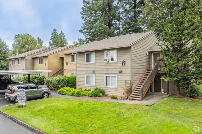


Property Detail
13826 Meyers Rd
Portland-Vancouver-Hillsboro, OR-WA
SECTION 08 TOWNSHIP 3S RANGE 2E QUARTER DA TAX LOT 06500
01448954
Clackamas
Multifamilydwelling
Oregon
R2
6500
B and X Area of moderate flood hazard, usually the area between the limits of the 100-year and 500-year floods.
20.28 AC
2025
Gaffney Lane
2025
Portland
022605
NEARBY LISTINGS FOR SALE OR LEASE
-
-
View all Oregon City listings for sale on LoopNet.com
DEMOGRAPHICS near 13826 Meyers Rd
1 mile
3 mile
5 mile
2025 Total Population
8,777
41,733
86,769
2030 Population
8,766
41,778
86,598
Pop Growth 2025-2030
(0.13%)
+ 0.11%
(0.20%)
Average Age
40
41
42
2025 Total Households
3,225
15,489
32,353
HH Growth 2025-2030
(0.16%)
+ 0.06%
(0.25%)
Median Household Inc
$93,184
$99,442
$106,888
Avg Household Size
2.60
2.60
2.60
2025 Avg HH Vehicles
2.00
2.00
2.00
Median Home Value
$633,775
$594,897
$656,491
Median Year Built
1993
1986
1984
Nearby Places
Map Layers
Map Styles
 Street
 Aerial
Layers
 Traffic
 Biking
Places
Listings with unknown addresses are not visible on the map
- Restaurants
- Banks
- Shops
- Fitness
- Groceries
PUBLIC TRANSPORTATION
COMMUTER RAIL
Oregon City Amtrak (Amtrak Cascades - Amtrak)
Drive
Walk
Distance
Oregon City Amtrak (Amtrak Cascades - Amtrak)
8 min
4.6 mi
AIRPORT
Portland International
Drive
Walk
Distance
Portland International
33 min
21.4 mi
Freight Ports
Port of Portland
Drive
Walk
Distance
Port of Portland
37 min
21.1 mi
Nearby Properties
Address
Land Use
TOTAL SIZE
Lot Size
Zoning
Address
Land Use
TOTAL SIZE
Lot Size
Zoning
58 AC
MUE
Address
Land Use
TOTAL SIZE
Lot Size
Zoning
9,233 SF
8.27 AC
MUE
Address
Land Use
TOTAL SIZE
Lot Size
Zoning
1,408 SF
7.12 AC
MUC2
Address
Land Use
TOTAL SIZE
Lot Size
Zoning
936 SF
10.25 AC
CI
Address
Land Use
TOTAL SIZE
Lot Size
Zoning
9.30 AC
C
Address
Land Use
TOTAL SIZE
Lot Size
Zoning
15.29 AC
R2
Address
Land Use
TOTAL SIZE
Lot Size
Zoning
Address
Land Use
TOTAL SIZE
Lot Size
Zoning
Address
Land Use
TOTAL SIZE
Lot Size
Zoning
4 AC
MUE
Address
Land Use
TOTAL SIZE
Lot Size
Zoning
1.67 AC
MUE
Address
Land Use
TOTAL SIZE
Lot Size
Zoning
0.94 AC
MUD
Address
Land Use
TOTAL SIZE
Lot Size
Zoning
4.12 AC
MUC2
Address
Land Use
TOTAL SIZE
Lot Size
Zoning
8 AC
R2
Address
Land Use
TOTAL SIZE
Lot Size
Zoning
17.99 AC
C
Address
Land Use
TOTAL SIZE
Lot Size
Zoning
Address
Land Use
TOTAL SIZE
Lot Size
Zoning
5.38 AC
C
Address
Land Use
TOTAL SIZE
Lot Size
Zoning
1,114 SF
3.11 AC
R2
Address
Land Use
TOTAL SIZE
Lot Size
Zoning
3 AC
MUE
Address
Land Use
TOTAL SIZE
Lot Size
Zoning
Address
Land Use
TOTAL SIZE
Lot Size
Zoning
1.92 AC
MUC1
Address
Land Use
TOTAL SIZE
Lot Size
Zoning
Address
Land Use
TOTAL SIZE
Lot Size
Zoning
5.35 AC
R2
Address
Land Use
TOTAL SIZE
Lot Size
Zoning
2,094 SF
7.10 AC
MUC2
Address
Land Use
TOTAL SIZE
Lot Size
Zoning
3 AC
MUE
Address
Land Use
TOTAL SIZE
Lot Size
Zoning
Address
Land Use
TOTAL SIZE
Lot Size
Zoning
4 AC
GI
Address
Land Use
TOTAL SIZE
Lot Size
Zoning
6.76 AC
MUE
Address
Land Use
TOTAL SIZE
Lot Size
Zoning
2 AC
GI
Address
Land Use
TOTAL SIZE
Lot Size
Zoning
644 SF
1.80 AC
C
The World's #1 Commercial Real Estate Marketplace
Connect with us
© 2026 CoStar Group
The information above has been obtained from sources believed reliable. While we do not doubt its accuracy we have not verified it and make no guarantee, warranty or representation about it. It is your responsibility to independently confirm its accuracy and completeness. Any projections, opinions, assumptions, or estimates used are for example only and do not represent the current or future performance of the property. The value of this transaction to you depends on tax and other factors which should be evaluated by your tax, financial, and legal advisors. You and your advisors should conduct a careful, independent investigation of the property to determine to your satisfaction the suitability of the property for your needs.