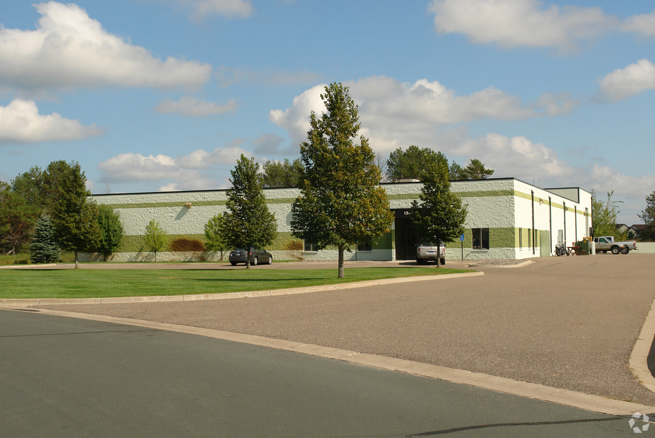
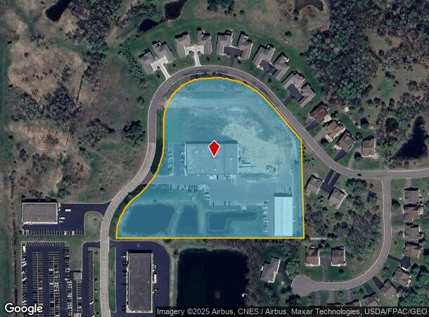
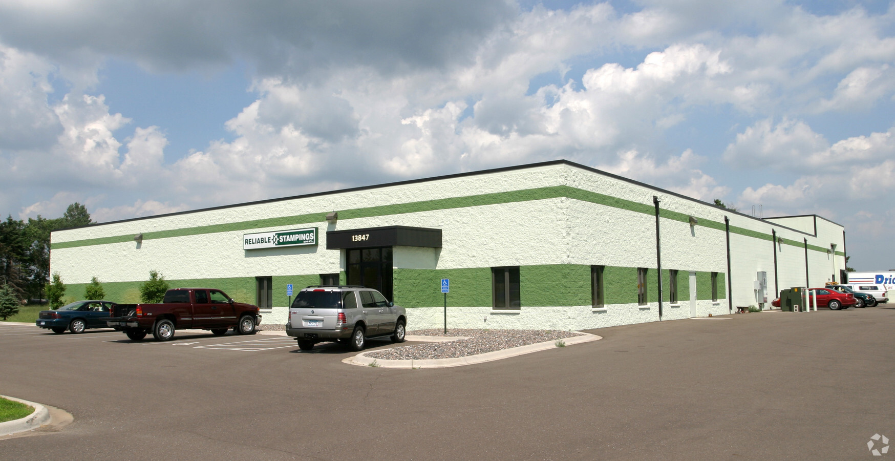
Property Record
13847 Aberdeen St Ne, Andover, MN 55304
NEARBY LISTINGS FOR SALE OR LEASE
-
-
View all Andover listings for sale on LoopNet.com
Property Detail
13847 Aberdeen St Ne
Minneapolis-St. Paul-Bloomington, MN-WI
Enterprise Plaza 2Nd Add
32-32-23-13-0026
LOT 1 BLK 2 ENTERPRISE PLAZA 2ND ADD; TOG/W LOT 1 BLK 2 LARSONS COMMERCIAL PARK
Industrialgeneral
Anoka
2024
Minnesota
2024
1
050215
North Central
24,000 SF
Minneapolis/St Paul
DEMOGRAPHICS near 13847 Aberdeen St Ne
1 Mile
3 Mile
5 Mile
2024 Total Population
3,460
42,236
116,583
2029 Population
3,568
44,081
121,427
Pop Growth 2024-2029
+ 3.12%
+ 4.37%
+ 4.15%
Average Age
43
39
39
2024 Total Households
1,234
14,604
40,631
HH Growth 2024-2029
+ 3.08%
+ 4.28%
+ 4.11%
Median Household Inc
$109,532
$112,086
$103,995
Avg Household Size
2.70
2.80
2.80
2024 Avg HH Vehicles
2.00
2.00
2.00
Median Home Value
$376,695
$355,551
$327,675
Median Year Built
1993
1997
1993
Nearby Places
- Restaurants
- Banks
- Shops
- Fitness
- Groceries
PUBLIC TRANSPORTATION
COMMUTER RAIL
Coon Rapids-Riverdale Station (Northstar Corridor - Northstar Commuter Rail)
DRIVE
WALK
Distance
Coon Rapids-Riverdale Station (Northstar Corridor - Northstar Commuter Rail)
15 min
8.0 mi
Anoka Station (Northstar Corridor - Northstar Commuter Rail)
DRIVE
WALK
Distance
Anoka Station (Northstar Corridor - Northstar Commuter Rail)
17 min
8.8 mi
AIRPORT
Minneapolis-St Paul International/Wold-Chamberlain
DRIVE
WALK
Distance
Minneapolis-St Paul International/Wold-Chamberlain
45 min
29.8 mi
Freight Ports
Port Milwaukee
DRIVE
WALK
Distance
Port Milwaukee
390 min
352.0 mi
Nearby Properties
Address
Land Use
TOTAL SIZE
Lot Size
Zoning
Address
Land Use
TOTAL SIZE
Lot Size
Zoning
1,075 SF
41.99 AC
Address
Land Use
TOTAL SIZE
Lot Size
Zoning
225,576 SF
6.07 AC
Address
Land Use
TOTAL SIZE
Lot Size
Zoning
192 SF
11.30 AC
Address
Land Use
TOTAL SIZE
Lot Size
Zoning
179,853 SF
37.73 AC
Address
Land Use
TOTAL SIZE
Lot Size
Zoning
76,383 SF
7.60 AC
Address
Land Use
TOTAL SIZE
Lot Size
Zoning
135,994 SF
3.20 AC
Address
Land Use
TOTAL SIZE
Lot Size
Zoning
162,450 SF
9.97 AC
Address
Land Use
TOTAL SIZE
Lot Size
Zoning
98,642 SF
20.01 AC
Address
Land Use
TOTAL SIZE
Lot Size
Zoning
104,477 SF
18 AC
Address
Land Use
TOTAL SIZE
Lot Size
Zoning
83,688 SF
5.75 AC
Address
Land Use
TOTAL SIZE
Lot Size
Zoning
8,410 SF
12.69 AC
Address
Land Use
TOTAL SIZE
Lot Size
Zoning
156,889 SF
18.95 AC
Address
Land Use
TOTAL SIZE
Lot Size
Zoning
76,374 SF
4.91 AC
Address
Land Use
TOTAL SIZE
Lot Size
Zoning
10,912 SF
1.97 AC
Address
Land Use
TOTAL SIZE
Lot Size
Zoning
Address
Land Use
TOTAL SIZE
Lot Size
Zoning
8,680 SF
8.12 AC
Address
Land Use
TOTAL SIZE
Lot Size
Zoning
Address
Land Use
TOTAL SIZE
Lot Size
Zoning
77,272 SF
3.09 AC
Address
Land Use
TOTAL SIZE
Lot Size
Zoning
139,229 SF
13 AC
Address
Land Use
TOTAL SIZE
Lot Size
Zoning
26,719 SF
36.48 AC
Address
Land Use
TOTAL SIZE
Lot Size
Zoning
6,080 SF
20 AC
Address
Land Use
TOTAL SIZE
Lot Size
Zoning
70,304 SF
Address
Land Use
TOTAL SIZE
Lot Size
Zoning
3,744 SF
0.92 AC
Address
Land Use
TOTAL SIZE
Lot Size
Zoning
53,715 SF
2.70 AC
Address
Land Use
TOTAL SIZE
Lot Size
Zoning
50,710 SF
3.43 AC
Address
Land Use
TOTAL SIZE
Lot Size
Zoning
74,720 SF
5.24 AC
Address
Land Use
TOTAL SIZE
Lot Size
Zoning
33,645 SF
3.49 AC
Address
Land Use
TOTAL SIZE
Lot Size
Zoning
33,205 SF
6.58 AC
Address
Land Use
TOTAL SIZE
Lot Size
Zoning
54,272 SF
4.97 AC
The World's #1 Commercial Real Estate Marketplace
Connect with us
© 2025 CoStar Group
The information above has been obtained from sources believed reliable. While we do not doubt its accuracy we have not verified it and make no guarantee, warranty or representation about it. It is your responsibility to independently confirm its accuracy and completeness. Any projections, opinions, assumptions, or estimates used are for example only and do not represent the current or future performance of the property. The value of this transaction to you depends on tax and other factors which should be evaluated by your tax, financial, and legal advisors. You and your advisors should conduct a careful, independent investigation of the property to determine to your satisfaction the suitability of the property for your needs.