Property Record
1385 Grafton Rd, Morgantown, WV 26508
NEARBY LISTINGS FOR SALE OR LEASE
-
-
View all Morgantown listings for sale on LoopNet.com
Property Detail
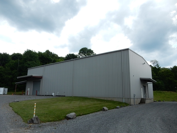
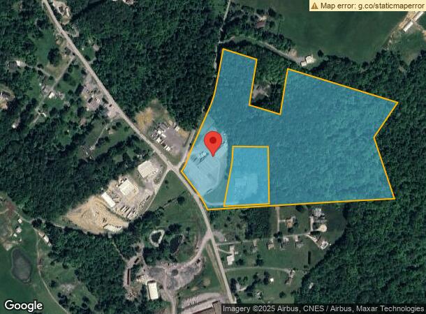
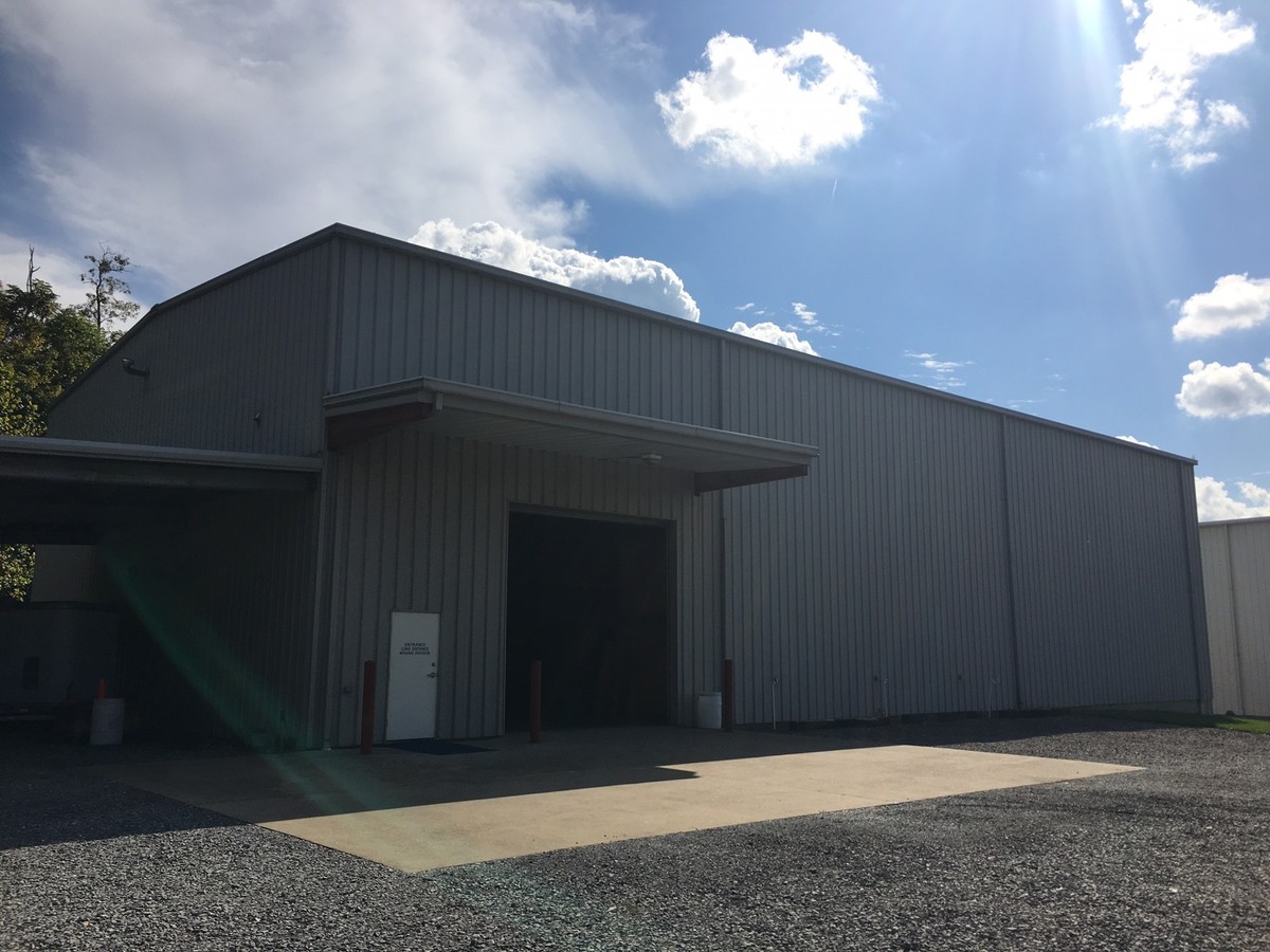
1385 Grafton Rd
05-6-00560002
32.5958 AC SUR RINGGOLD ROUTE 119 GRAFTON ROAD
Warehouse
Monongalia
X
West Virginia
54077C0125D
32.60 AC
2024
West Virginia North Area
2024
Other Market Areas
011804
Morgantown, WV
DEMOGRAPHICS near 1385 Grafton Rd
1 Mile
3 Mile
5 Mile
2024 Total Population
587
6,543
34,026
2029 Population
602
6,655
34,864
Pop Growth 2024-2029
+ 2.56%
+ 1.71%
+ 2.46%
Average Age
41
40
38
2024 Total Households
221
2,534
13,811
HH Growth 2024-2029
+ 2.26%
+ 1.50%
+ 2.55%
Median Household Inc
$110,227
$88,829
$59,322
Avg Household Size
2.60
2.50
2.20
2024 Avg HH Vehicles
3.00
2.00
2.00
Median Home Value
$278,030
$266,390
$225,010
Median Year Built
1992
1991
1977
Nearby Places
- Restaurants
- Banks
- Shops
- Fitness
- Groceries
PUBLIC TRANSPORTATION
AIRPORT
North Central West Virginia
DRIVE
WALK
Distance
North Central West Virginia
37 min
28.9 mi
Freight Ports
Port of Baltimore
DRIVE
WALK
Distance
Port of Baltimore
241 min
214.5 mi
Nearby Properties
Address
Land Use
TOTAL SIZE
Lot Size
Zoning
Address
Land Use
TOTAL SIZE
Lot Size
Zoning
154.88 AC
Address
Land Use
TOTAL SIZE
Lot Size
Zoning
2,983 SF
53.98 AC
Address
Land Use
TOTAL SIZE
Lot Size
Zoning
50.74 AC
Address
Land Use
TOTAL SIZE
Lot Size
Zoning
163.66 AC
Address
Land Use
TOTAL SIZE
Lot Size
Zoning
9.93 AC
Address
Land Use
TOTAL SIZE
Lot Size
Zoning
13.92 AC
Address
Land Use
TOTAL SIZE
Lot Size
Zoning
Address
Land Use
TOTAL SIZE
Lot Size
Zoning
6.09 AC
Address
Land Use
TOTAL SIZE
Lot Size
Zoning
6.60 AC
Address
Land Use
TOTAL SIZE
Lot Size
Zoning
8.73 AC
Address
Land Use
TOTAL SIZE
Lot Size
Zoning
2.07 AC
Address
Land Use
TOTAL SIZE
Lot Size
Zoning
209.90 AC
Address
Land Use
TOTAL SIZE
Lot Size
Zoning
Address
Land Use
TOTAL SIZE
Lot Size
Zoning
Address
Land Use
TOTAL SIZE
Lot Size
Zoning
10.17 AC
Address
Land Use
TOTAL SIZE
Lot Size
Zoning
Address
Land Use
TOTAL SIZE
Lot Size
Zoning
18.64 AC
Address
Land Use
TOTAL SIZE
Lot Size
Zoning
Address
Land Use
TOTAL SIZE
Lot Size
Zoning
5.50 AC
Address
Land Use
TOTAL SIZE
Lot Size
Zoning
6.46 AC
Address
Land Use
TOTAL SIZE
Lot Size
Zoning
2.09 AC
Address
Land Use
TOTAL SIZE
Lot Size
Zoning
Address
Land Use
TOTAL SIZE
Lot Size
Zoning
8.86 AC
Address
Land Use
TOTAL SIZE
Lot Size
Zoning
Address
Land Use
TOTAL SIZE
Lot Size
Zoning
0.68 AC
Address
Land Use
TOTAL SIZE
Lot Size
Zoning
Address
Land Use
TOTAL SIZE
Lot Size
Zoning
50.39 AC
Address
Land Use
TOTAL SIZE
Lot Size
Zoning
9.72 AC
Address
Land Use
TOTAL SIZE
Lot Size
Zoning
1.19 AC
Address
Land Use
TOTAL SIZE
Lot Size
Zoning
The World's #1 Commercial Real Estate Marketplace
Connect with us
© 2025 CoStar Group
The information above has been obtained from sources believed reliable. While we do not doubt its accuracy we have not verified it and make no guarantee, warranty or representation about it. It is your responsibility to independently confirm its accuracy and completeness. Any projections, opinions, assumptions, or estimates used are for example only and do not represent the current or future performance of the property. The value of this transaction to you depends on tax and other factors which should be evaluated by your tax, financial, and legal advisors. You and your advisors should conduct a careful, independent investigation of the property to determine to your satisfaction the suitability of the property for your needs.