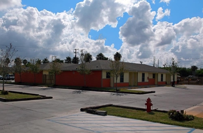
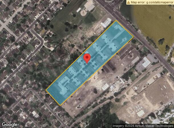
Property Record
1385 Military Rd, Brownsville, TX 78520
NEARBY LISTINGS FOR SALE OR LEASE
-
-
View all Brownsville listings for sale on LoopNet.com
Property Detail
1385 Military Rd
763740-0110-000000
Lenena Subdivision
Multifamilydwelling
ABST 2- LENENA BLK 11 7.6500ACRES
X
Cameron
48061C0560F
Texas
2023
7.65 AC
2024
Outlying Cameron County
012512
Brownsville/Harlingen
75,336 SF
Brownsville-Harlingen, TX
DEMOGRAPHICS near 1385 Military Rd
1 Mile
3 Mile
5 Mile
2024 Total Population
10,036
54,996
127,630
2029 Population
10,174
56,155
130,515
Pop Growth 2024-2029
+ 1.38%
+ 2.11%
+ 2.26%
Average Age
36
36
36
2024 Total Households
2,931
17,720
40,532
HH Growth 2024-2029
+ 1.30%
+ 2.14%
+ 2.26%
Median Household Inc
$60,885
$52,201
$50,913
Avg Household Size
3.30
3.00
3.10
2024 Avg HH Vehicles
2.00
2.00
2.00
Median Home Value
$88,422
$110,762
$117,190
Median Year Built
1996
1990
1991
Nearby Places
- Restaurants
- Banks
- Shops
- Fitness
- Groceries
PUBLIC TRANSPORTATION
AIRPORT
Brownsville/South Padre Island International
Drive
Walk
Distance
Brownsville/South Padre Island International
14 min
7.5 mi
Valley International
Drive
Walk
Distance
Valley International
36 min
25.9 mi
Freight Ports
Port of Brownsville
Drive
Walk
Distance
Port of Brownsville
15 min
9.0 mi
Nearby Properties
Address
Land Use
TOTAL SIZE
Lot Size
Zoning
Address
Land Use
TOTAL SIZE
Lot Size
Zoning
369883
80.26 AC
Address
Land Use
TOTAL SIZE
Lot Size
Zoning
452559
13.79 AC
C
Address
Land Use
TOTAL SIZE
Lot Size
Zoning
302902
6.61 AC
C
Address
Land Use
TOTAL SIZE
Lot Size
Zoning
196847
19.62 AC
Address
Land Use
TOTAL SIZE
Lot Size
Zoning
277742
31.28 AC
Address
Land Use
TOTAL SIZE
Lot Size
Zoning
56804
1.83 AC
Address
Land Use
TOTAL SIZE
Lot Size
Zoning
176990
18.31 AC
C
Address
Land Use
TOTAL SIZE
Lot Size
Zoning
73090
3.08 AC
C
Address
Land Use
TOTAL SIZE
Lot Size
Zoning
60747
2.59 AC
C
Address
Land Use
TOTAL SIZE
Lot Size
Zoning
167653
5.10 AC
Address
Land Use
TOTAL SIZE
Lot Size
Zoning
66340
3.85 AC
C
Address
Land Use
TOTAL SIZE
Lot Size
Zoning
78583
5 AC
C
Address
Land Use
TOTAL SIZE
Lot Size
Zoning
98006
20.30 AC
Address
Land Use
TOTAL SIZE
Lot Size
Zoning
62344
2.92 AC
Address
Land Use
TOTAL SIZE
Lot Size
Zoning
205001
20.13 AC
C
Address
Land Use
TOTAL SIZE
Lot Size
Zoning
102042
8.68 AC
C
Address
Land Use
TOTAL SIZE
Lot Size
Zoning
133476
8.14 AC
Address
Land Use
TOTAL SIZE
Lot Size
Zoning
363515
34.39 AC
Address
Land Use
TOTAL SIZE
Lot Size
Zoning
110431
15 AC
Address
Land Use
TOTAL SIZE
Lot Size
Zoning
52668
2.23 AC
Address
Land Use
TOTAL SIZE
Lot Size
Zoning
101569
1.95 AC
Address
Land Use
TOTAL SIZE
Lot Size
Zoning
46381
2.16 AC
Address
Land Use
TOTAL SIZE
Lot Size
Zoning
97077
16.78 AC
Address
Land Use
TOTAL SIZE
Lot Size
Zoning
80379
8.27 AC
Address
Land Use
TOTAL SIZE
Lot Size
Zoning
241619
14.68 AC
Address
Land Use
TOTAL SIZE
Lot Size
Zoning
76588
2 AC
Address
Land Use
TOTAL SIZE
Lot Size
Zoning
57845
10.52 AC
Address
Land Use
TOTAL SIZE
Lot Size
Zoning
82556
36.56 AC
Address
Land Use
TOTAL SIZE
Lot Size
Zoning
48862
1.22 AC
C
Address
Land Use
TOTAL SIZE
Lot Size
Zoning
130269
8.38 AC
Start a new search to find other properties for sale or lease
Connect with us
© 2024 CoStar Group
The information above has been obtained from sources believed reliable. While we do not doubt its accuracy we have not verified it and make no guarantee, warranty or representation about it. It is your responsibility to independently confirm its accuracy and completeness. Any projections, opinions, assumptions, or estimates used are for example only and do not represent the current or future performance of the property. The value of this transaction to you depends on tax and other factors which should be evaluated by your tax, financial, and legal advisors. You and your advisors should conduct a careful, independent investigation of the property to determine to your satisfaction the suitability of the property for your needs.