Property Record
139 Silvio O Conte Dr, Greenfield, MA 01301
NEARBY LISTINGS FOR SALE OR LEASE
-
-
View all Greenfield listings for sale on LoopNet.com
Property Detail
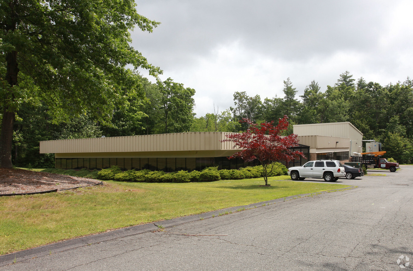
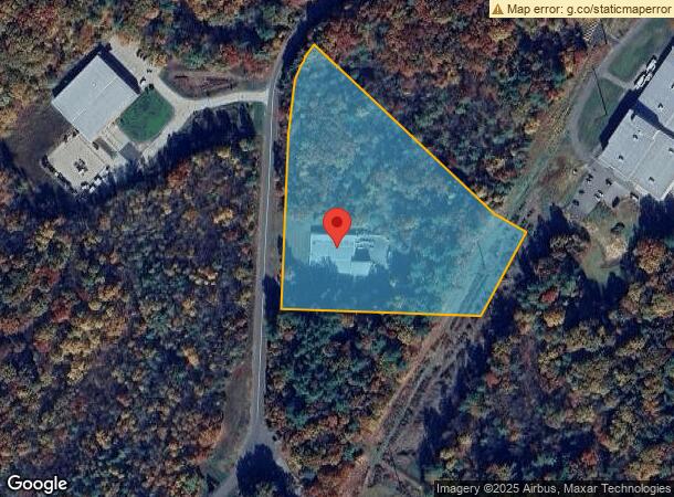
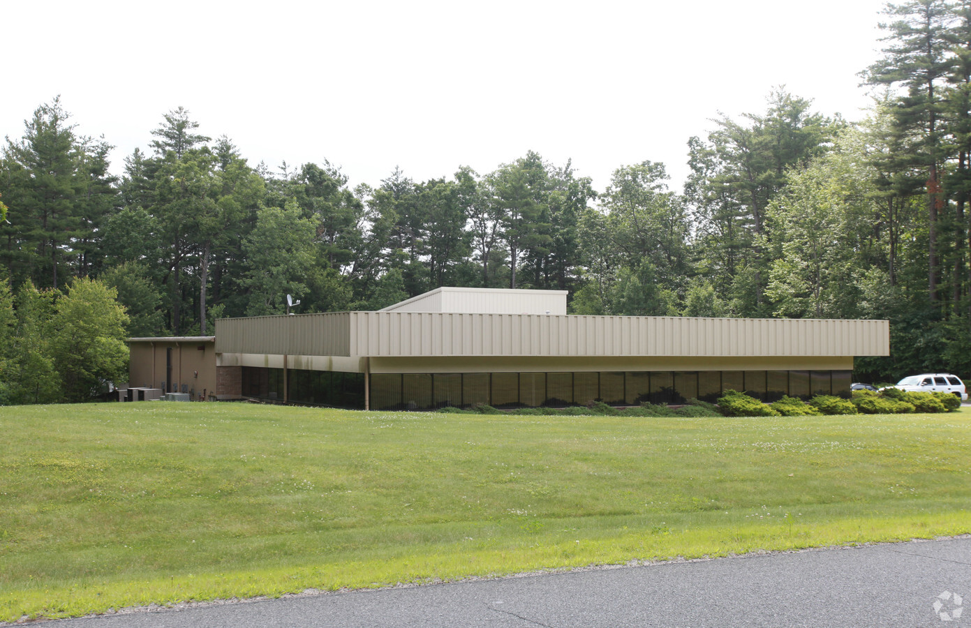
139 Silvio O Conte Dr
Greenfield Town, MA
Mwm Dev Co Inc
GREE-000005R-000024H
Franklin
Commercialbuilding
Massachusetts
2024
6.56 AC
2024
Franklin County
041100
Hartford
11,268 SF
DEMOGRAPHICS near 139 Silvio O Conte Dr
1 Mile
3 Mile
5 Mile
2024 Total Population
2,035
21,122
28,924
2029 Population
2,014
20,978
28,765
Pop Growth 2024-2029
(1.03%)
(0.68%)
(0.55%)
Average Age
43
45
45
2024 Total Households
924
9,760
13,049
HH Growth 2024-2029
(0.97%)
(0.66%)
(0.51%)
Median Household Inc
$63,924
$60,133
$62,492
Avg Household Size
2.10
2.00
2.10
2024 Avg HH Vehicles
1.00
1.00
2.00
Median Home Value
$288,622
$250,941
$253,710
Median Year Built
1949
1949
1951
Nearby Places
- Restaurants
- Banks
- Shops
- Fitness
- Groceries
PUBLIC TRANSPORTATION
COMMUTER RAIL
Greenfield Amtrak Station (Valley Flyer - Amtrak, Vermonter - Amtrak)
DRIVE
WALK
Distance
Greenfield Amtrak Station (Valley Flyer - Amtrak, Vermonter - Amtrak)
8 min
4.3 mi
Freight Ports
Albany, NY Port
DRIVE
WALK
Distance
Albany, NY Port
143 min
116.6 mi
Nearby Properties
Address
Land Use
TOTAL SIZE
Lot Size
Zoning
Address
Land Use
TOTAL SIZE
Lot Size
Zoning
160,366 SF
56.38 AC
RB
Address
Land Use
TOTAL SIZE
Lot Size
Zoning
237,722 SF
20.69 AC
RE
Address
Land Use
TOTAL SIZE
Lot Size
Zoning
159,991 SF
44 AC
RB
Address
Land Use
TOTAL SIZE
Lot Size
Zoning
213,062 SF
6.50 AC
H
Address
Land Use
TOTAL SIZE
Lot Size
Zoning
157,867 SF
48.03 AC
ID
Address
Land Use
TOTAL SIZE
Lot Size
Zoning
173,646 SF
21.77 AC
RA
Address
Land Use
TOTAL SIZE
Lot Size
Zoning
158,638 SF
37.60 AC
RA
Address
Land Use
TOTAL SIZE
Lot Size
Zoning
2 AC
R1
Address
Land Use
TOTAL SIZE
Lot Size
Zoning
117,897 SF
6.99 AC
H
Address
Land Use
TOTAL SIZE
Lot Size
Zoning
40.50 AC
ID
Address
Land Use
TOTAL SIZE
Lot Size
Zoning
42,076 SF
3.49 AC
GI
Address
Land Use
TOTAL SIZE
Lot Size
Zoning
184,872 SF
2.41 AC
ID
Address
Land Use
TOTAL SIZE
Lot Size
Zoning
29,600 SF
8.38 AC
NB
Address
Land Use
TOTAL SIZE
Lot Size
Zoning
195,199 SF
16.37 AC
RA
Address
Land Use
TOTAL SIZE
Lot Size
Zoning
94,910 SF
1.79 AC
SR
Address
Land Use
TOTAL SIZE
Lot Size
Zoning
32,911 SF
10.39 AC
RE
Address
Land Use
TOTAL SIZE
Lot Size
Zoning
8.92 AC
GB
Address
Land Use
TOTAL SIZE
Lot Size
Zoning
60,844 SF
15.31 AC
GC
Address
Land Use
TOTAL SIZE
Lot Size
Zoning
125,640 SF
4.98 AC
CC
Address
Land Use
TOTAL SIZE
Lot Size
Zoning
17,558 SF
60 AC
ID
Address
Land Use
TOTAL SIZE
Lot Size
Zoning
73,648 SF
2.10 AC
SR
Address
Land Use
TOTAL SIZE
Lot Size
Zoning
72,456 SF
5.80 AC
RA
Address
Land Use
TOTAL SIZE
Lot Size
Zoning
58,330 SF
1.53 AC
LC
Address
Land Use
TOTAL SIZE
Lot Size
Zoning
66,257 SF
4.17 AC
GI
Address
Land Use
TOTAL SIZE
Lot Size
Zoning
75,368 SF
22.23 AC
RA
Address
Land Use
TOTAL SIZE
Lot Size
Zoning
85,138 SF
19.70 AC
PI
Address
Land Use
TOTAL SIZE
Lot Size
Zoning
78,589 SF
15 AC
PI
Address
Land Use
TOTAL SIZE
Lot Size
Zoning
58,767 SF
2.42 AC
CC
Address
Land Use
TOTAL SIZE
Lot Size
Zoning
141,890 SF
24.65 AC
ID
Address
Land Use
TOTAL SIZE
Lot Size
Zoning
53,952 SF
5.51 AC
LC
The World's #1 Commercial Real Estate Marketplace
Connect with us
© 2025 CoStar Group
The information above has been obtained from sources believed reliable. While we do not doubt its accuracy we have not verified it and make no guarantee, warranty or representation about it. It is your responsibility to independently confirm its accuracy and completeness. Any projections, opinions, assumptions, or estimates used are for example only and do not represent the current or future performance of the property. The value of this transaction to you depends on tax and other factors which should be evaluated by your tax, financial, and legal advisors. You and your advisors should conduct a careful, independent investigation of the property to determine to your satisfaction the suitability of the property for your needs.