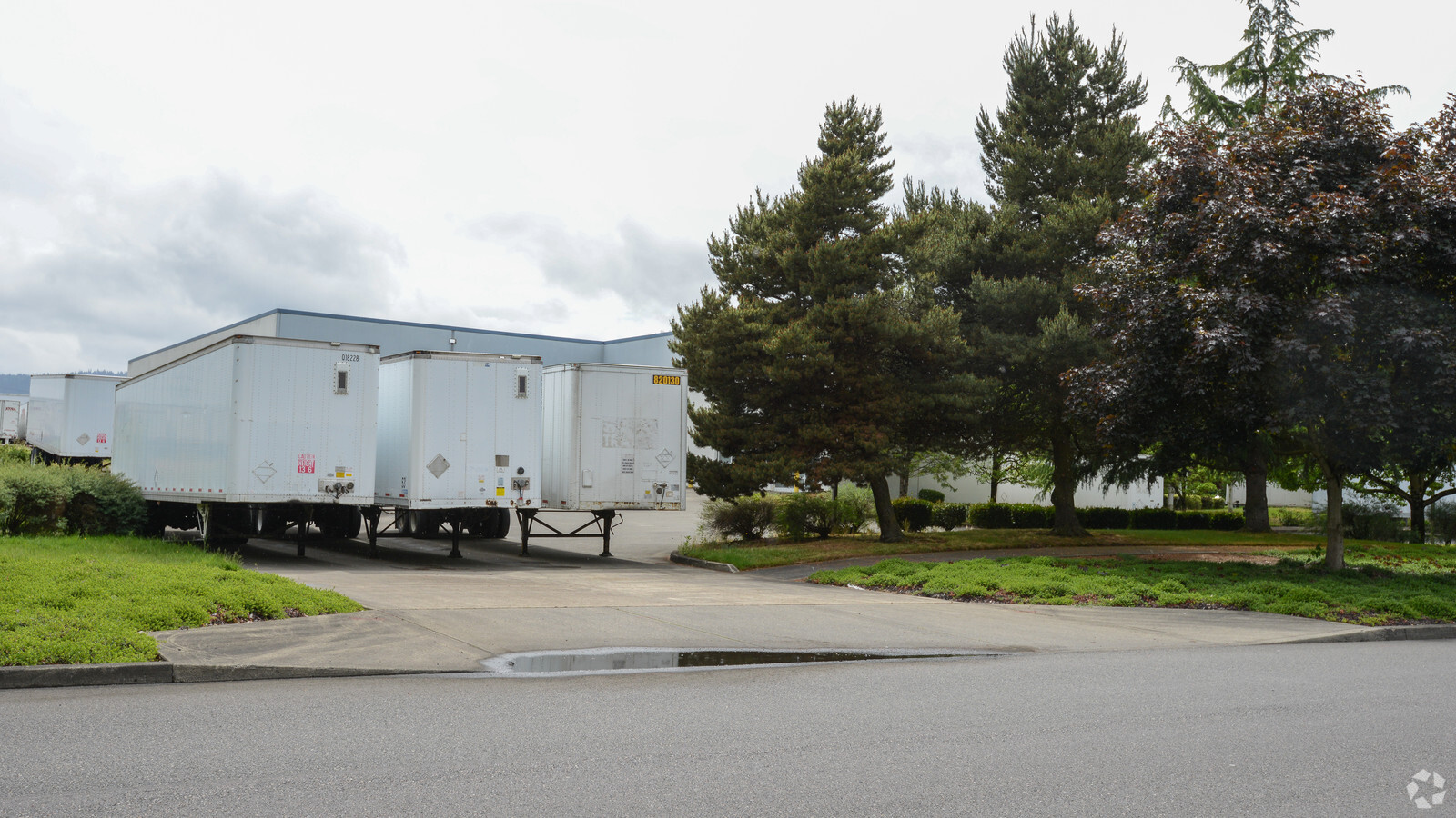
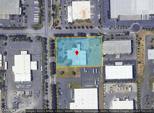
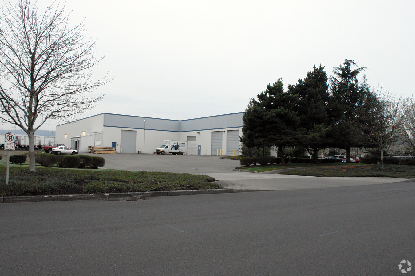
Property Record
13908 N Columbia Blvd, Portland, OR 97203
NEARBY LISTINGS FOR SALE OR LEASE
Property Detail
13908 N Columbia Blvd
R256233
Rivergate Industrial Dis
Commercialnec
RIVERGATE INDUSTRIAL DIS, BLOCK 5 TL 800
X
Multnomah
41067C0375E
Oregon
2023
3.68 AC
2023
Rivergate
007202
Portland
31,379 SF
Portland-Vancouver-Hillsboro, OR-WA
DEMOGRAPHICS near 13908 N Columbia Blvd
1 Mile
3 Mile
5 Mile
2024 Total Population
52
16,653
69,915
2029 Population
51
16,209
70,455
Pop Growth 2024-2029
(1.92%)
(2.67%)
+ 0.77%
Average Age
38
39
39
2024 Total Households
21
7,129
28,379
HH Growth 2024-2029
0.00%
(2.92%)
+ 1.32%
Median Household Inc
$104,167
$80,768
$83,071
Avg Household Size
2.00
2.20
2.30
2024 Avg HH Vehicles
2.00
2.00
2.00
Median Home Value
$450,000
$462,186
$481,435
Median Year Built
1964
1963
1972
Nearby Places
- Restaurants
- Banks
- Shops
- Fitness
- Groceries
PUBLIC TRANSPORTATION
COMMUTER RAIL
Vancouver (Amtrak Cascades - Amtrak, Coast Starlight - Amtrak, Empire Builder - Amtrak)
DRIVE
WALK
Distance
Vancouver (Amtrak Cascades - Amtrak, Coast Starlight - Amtrak, Empire Builder - Amtrak)
19 min
9.2 mi
AIRPORT
Portland International
DRIVE
WALK
Distance
Portland International
27 min
13.3 mi
Freight Ports
Port of Vancouver
DRIVE
WALK
Distance
Port of Vancouver
22 min
10.7 mi
Nearby Properties
Address
Land Use
TOTAL SIZE
Lot Size
Zoning
Address
Land Use
TOTAL SIZE
Lot Size
Zoning
546,069 SF
142 AC
IH
Address
Land Use
TOTAL SIZE
Lot Size
Zoning
332,800 SF
12.78 AC
IH
Address
Land Use
TOTAL SIZE
Lot Size
Zoning
Address
Land Use
TOTAL SIZE
Lot Size
Zoning
Address
Land Use
TOTAL SIZE
Lot Size
Zoning
48.39 AC
IH
Address
Land Use
TOTAL SIZE
Lot Size
Zoning
5,499,311 SF
40.90 AC
IH
Address
Land Use
TOTAL SIZE
Lot Size
Zoning
335.31 AC
OS
Address
Land Use
TOTAL SIZE
Lot Size
Zoning
5,045,000 SF
116.53 AC
IH
Address
Land Use
TOTAL SIZE
Lot Size
Zoning
Address
Land Use
TOTAL SIZE
Lot Size
Zoning
202,876 SF
17.10 AC
R5
Address
Land Use
TOTAL SIZE
Lot Size
Zoning
100 SF
82.93 AC
IH
Address
Land Use
TOTAL SIZE
Lot Size
Zoning
75.20 AC
IH
Address
Land Use
TOTAL SIZE
Lot Size
Zoning
313,214 SF
NULL
Address
Land Use
TOTAL SIZE
Lot Size
Zoning
37,770 SF
6.90 AC
EG2
Address
Land Use
TOTAL SIZE
Lot Size
Zoning
200 SF
50.40 AC
IH
Address
Land Use
TOTAL SIZE
Lot Size
Zoning
523,196 SF
21.97 AC
IHH
Address
Land Use
TOTAL SIZE
Lot Size
Zoning
425,395 SF
16.65 AC
IHH
Address
Land Use
TOTAL SIZE
Lot Size
Zoning
309,393 SF
14.86 AC
IH
Address
Land Use
TOTAL SIZE
Lot Size
Zoning
96.34 AC
IH
Address
Land Use
TOTAL SIZE
Lot Size
Zoning
459,662 SF
19.41 AC
IHH
Address
Land Use
TOTAL SIZE
Lot Size
Zoning
385,275 SF
25.29 AC
IH
Address
Land Use
TOTAL SIZE
Lot Size
Zoning
573,020 SF
27.30 AC
IH
Address
Land Use
TOTAL SIZE
Lot Size
Zoning
15 AC
IHH
Address
Land Use
TOTAL SIZE
Lot Size
Zoning
2,124 SF
417.17 AC
IH
Address
Land Use
TOTAL SIZE
Lot Size
Zoning
2,064,857 SF
47.40 AC
IH
Address
Land Use
TOTAL SIZE
Lot Size
Zoning
Address
Land Use
TOTAL SIZE
Lot Size
Zoning
137,784 SF
8.36 AC
RM1
Address
Land Use
TOTAL SIZE
Lot Size
Zoning
606,639 SF
27.62 AC
IH
Address
Land Use
TOTAL SIZE
Lot Size
Zoning
438,700 SF
21.30 AC
IH
Address
Land Use
TOTAL SIZE
Lot Size
Zoning
55,587 SF
6.95 AC
R5
The World's #1 Commercial Real Estate Marketplace
Connect with us
© 2025 CoStar Group
The information above has been obtained from sources believed reliable. While we do not doubt its accuracy we have not verified it and make no guarantee, warranty or representation about it. It is your responsibility to independently confirm its accuracy and completeness. Any projections, opinions, assumptions, or estimates used are for example only and do not represent the current or future performance of the property. The value of this transaction to you depends on tax and other factors which should be evaluated by your tax, financial, and legal advisors. You and your advisors should conduct a careful, independent investigation of the property to determine to your satisfaction the suitability of the property for your needs.