Property Record
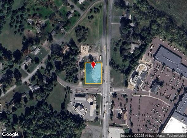
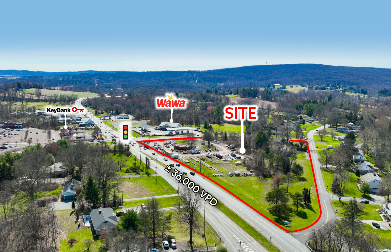
1395 S Hanover St, Pottstown, PA 19465

NEARBY LISTINGS FOR SALE OR LEASE
Property Detail
1395 S Hanover St
17-007-0057.1500
LOT 29
Commercialacreage
Chester
X
Pennsylvania
42029C0015G
29
2024
0.73 AC
2024
Exton/Whitelands
301402
Philadelphia
1,230 SF
Philadelphia-Camden-Wilmington, PA-NJ-DE-MD
DEMOGRAPHICS near 1395 S Hanover St
1 Mile
3 Mile
5 Mile
2024 Total Population
1,705
30,020
67,292
2029 Population
1,764
30,781
68,778
Pop Growth 2024-2029
+ 3.46%
+ 2.53%
+ 2.21%
Average Age
42
40
41
2024 Total Households
608
11,781
26,246
HH Growth 2024-2029
+ 3.62%
+ 2.55%
+ 2.21%
Median Household Inc
$110,532
$66,210
$75,428
Avg Household Size
2.70
2.40
2.50
2024 Avg HH Vehicles
3.00
2.00
2.00
Median Home Value
$380,555
$267,021
$243,554
Median Year Built
1973
1958
1964
Nearby Places
- Restaurants
- Banks
- Shops
- Fitness
- Groceries
Nearby Properties
Address
Land Use
TOTAL SIZE
Lot Size
Zoning
Address
Land Use
TOTAL SIZE
Lot Size
Zoning
707,965 SF
80.33 AC
RMHD
Address
Land Use
TOTAL SIZE
Lot Size
Zoning
478,148 SF
56.30 AC
RES
Address
Land Use
TOTAL SIZE
Lot Size
Zoning
240,140 SF
31.50 AC
R3
Address
Land Use
TOTAL SIZE
Lot Size
Zoning
135,368 SF
5.31 AC
DG
Address
Land Use
TOTAL SIZE
Lot Size
Zoning
216,693 SF
38 AC
I1
Address
Land Use
TOTAL SIZE
Lot Size
Zoning
589,859 SF
53.31 AC
C2
Address
Land Use
TOTAL SIZE
Lot Size
Zoning
84,953 SF
51.29 AC
R2
Address
Land Use
TOTAL SIZE
Lot Size
Zoning
94,997 SF
6 AC
R3
Address
Land Use
TOTAL SIZE
Lot Size
Zoning
681,836 SF
40.12 AC
HI
Address
Land Use
TOTAL SIZE
Lot Size
Zoning
165,168 SF
11.10 AC
C2
Address
Land Use
TOTAL SIZE
Lot Size
Zoning
175,151 SF
14.74 AC
RMHD
Address
Land Use
TOTAL SIZE
Lot Size
Zoning
166,912 SF
11.10 AC
R4
Address
Land Use
TOTAL SIZE
Lot Size
Zoning
66,270 SF
1.20 AC
R1
Address
Land Use
TOTAL SIZE
Lot Size
Zoning
79,010 SF
13.74 AC
C2
Address
Land Use
TOTAL SIZE
Lot Size
Zoning
77,944 SF
0.47 AC
D
Address
Land Use
TOTAL SIZE
Lot Size
Zoning
74,550 SF
19.60 AC
R2
Address
Land Use
TOTAL SIZE
Lot Size
Zoning
114,240 SF
18.57 AC
IN
Address
Land Use
TOTAL SIZE
Lot Size
Zoning
86,532 SF
13 AC
R3
Address
Land Use
TOTAL SIZE
Lot Size
Zoning
227,008 SF
0.79 AC
TTN
Address
Land Use
TOTAL SIZE
Lot Size
Zoning
78,770 SF
2.20 AC
RHD
Address
Land Use
TOTAL SIZE
Lot Size
Zoning
522,093 SF
23.50 AC
HM
Address
Land Use
TOTAL SIZE
Lot Size
Zoning
86,556 SF
4.50 AC
R2
Address
Land Use
TOTAL SIZE
Lot Size
Zoning
81,285 SF
0.67 AC
D
Address
Land Use
TOTAL SIZE
Lot Size
Zoning
48,456 SF
9.46 AC
C2
Address
Land Use
TOTAL SIZE
Lot Size
Zoning
65,199 SF
12.70 AC
R4
Address
Land Use
TOTAL SIZE
Lot Size
Zoning
44,820 SF
0.94 AC
R2
Address
Land Use
TOTAL SIZE
Lot Size
Zoning
33,826 SF
7.06 AC
R2
Address
Land Use
TOTAL SIZE
Lot Size
Zoning
3,600 SF
9.55 AC
C2
Address
Land Use
TOTAL SIZE
Lot Size
Zoning
27,240 SF
1.70 AC
D
Address
Land Use
TOTAL SIZE
Lot Size
Zoning
70,360 SF
10.44 AC
R3
The World's #1 Commercial Real Estate Marketplace
Connect with us
© 2025 CoStar Group
The information above has been obtained from sources believed reliable. While we do not doubt its accuracy we have not verified it and make no guarantee, warranty or representation about it. It is your responsibility to independently confirm its accuracy and completeness. Any projections, opinions, assumptions, or estimates used are for example only and do not represent the current or future performance of the property. The value of this transaction to you depends on tax and other factors which should be evaluated by your tax, financial, and legal advisors. You and your advisors should conduct a careful, independent investigation of the property to determine to your satisfaction the suitability of the property for your needs.