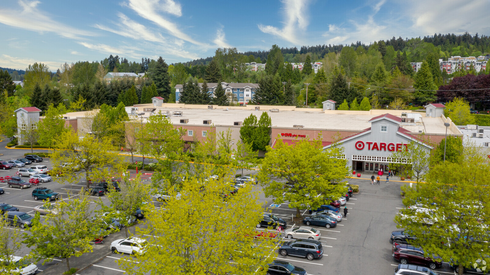
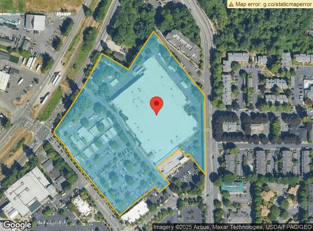
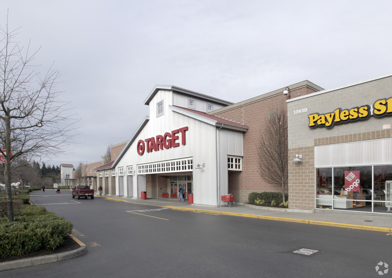
Property Record
13950 Ne 178Th Pl, Woodinville, WA 98072
NEARBY LISTINGS FOR SALE OR LEASE
Property Detail
13950 Ne 178Th Pl
Seattle-Tacoma-Bellevue, WA
Downtown Woodinville-Bsp
210600-0010
DOWNTOWN WOODINVILLE - BSP AMENDED PER AMENDMENT 1 REC #20090625001042 PLAT BLOCK: A PLAT LOT: 1
Storebuilding
King
X
Washington
53033C0069G
1
2025
9.60 AC
2024
Mill Creek/Woodinville
032319
Seattle/Puget Sound
123,674 SF
DEMOGRAPHICS near 13950 Ne 178Th Pl
1 Mile
3 Mile
5 Mile
2024 Total Population
9,886
70,884
206,656
2029 Population
10,047
71,843
210,193
Pop Growth 2024-2029
+ 1.63%
+ 1.35%
+ 1.71%
Average Age
40
40
39
2024 Total Households
4,610
27,548
78,787
HH Growth 2024-2029
+ 1.84%
+ 1.38%
+ 1.67%
Median Household Inc
$107,273
$129,189
$134,740
Avg Household Size
2.10
2.50
2.60
2024 Avg HH Vehicles
2.00
2.00
2.00
Median Home Value
$791,179
$831,275
$834,714
Median Year Built
1991
1988
1987
Nearby Places
- Restaurants
- Banks
- Shops
- Fitness
- Groceries
PUBLIC TRANSPORTATION
AIRPORT
Seattle Paine Field International
DRIVE
WALK
Distance
Seattle Paine Field International
26 min
16.1 mi
Seattle-Tacoma International
DRIVE
WALK
Distance
Seattle-Tacoma International
41 min
28.8 mi
Freight Ports
Port of Everett
DRIVE
WALK
Distance
Port of Everett
33 min
21.4 mi
Nearby Properties
Address
Land Use
TOTAL SIZE
Lot Size
Zoning
Address
Land Use
TOTAL SIZE
Lot Size
Zoning
50,400 SF
123.66 AC
C
Address
Land Use
TOTAL SIZE
Lot Size
Zoning
11.29 AC
R-AC, OP,
Address
Land Use
TOTAL SIZE
Lot Size
Zoning
2.60 AC
DN
Address
Land Use
TOTAL SIZE
Lot Size
Zoning
343,095 SF
39.09 AC
R 5,400A,
Address
Land Use
TOTAL SIZE
Lot Size
Zoning
295,920 SF
17.30 AC
R-18
Address
Land Use
TOTAL SIZE
Lot Size
Zoning
293,664 SF
38.51 AC
R 2800, OP
Address
Land Use
TOTAL SIZE
Lot Size
Zoning
270,101 SF
78.77 AC
LI
Address
Land Use
TOTAL SIZE
Lot Size
Zoning
190,512 SF
4.86 AC
CBD
Address
Land Use
TOTAL SIZE
Lot Size
Zoning
194,388 SF
1.65 AC
DC
Address
Land Use
TOTAL SIZE
Lot Size
Zoning
226,192 SF
6.34 AC
CBD
Address
Land Use
TOTAL SIZE
Lot Size
Zoning
264,253 SF
29.11 AC
R 4,000
Address
Land Use
TOTAL SIZE
Lot Size
Zoning
170,520 SF
1.92 AC
DN
Address
Land Use
TOTAL SIZE
Lot Size
Zoning
187,590 SF
17.20 AC
R 2800, OP
Address
Land Use
TOTAL SIZE
Lot Size
Zoning
158,220 SF
13.28 AC
RMA 2.4
Address
Land Use
TOTAL SIZE
Lot Size
Zoning
122,766 SF
2 AC
GDC
Address
Land Use
TOTAL SIZE
Lot Size
Zoning
130,800 SF
2.28 AC
CBD
Address
Land Use
TOTAL SIZE
Lot Size
Zoning
182,875 SF
16.47 AC
R-AC, OP,
Address
Land Use
TOTAL SIZE
Lot Size
Zoning
119,470 SF
1.56 AC
DN
Address
Land Use
TOTAL SIZE
Lot Size
Zoning
126,522 SF
2.62 AC
CBD
Address
Land Use
TOTAL SIZE
Lot Size
Zoning
114,513 SF
2.35 AC
GDC
Address
Land Use
TOTAL SIZE
Lot Size
Zoning
113,880 SF
1.56 AC
GDC
Address
Land Use
TOTAL SIZE
Lot Size
Zoning
229,632 SF
37.61 AC
P/I
Address
Land Use
TOTAL SIZE
Lot Size
Zoning
275,500 SF
16.29 AC
LI
Address
Land Use
TOTAL SIZE
Lot Size
Zoning
120,420 SF
0.94 AC
DN
Address
Land Use
TOTAL SIZE
Lot Size
Zoning
95,892 SF
1.05 AC
DT
Address
Land Use
TOTAL SIZE
Lot Size
Zoning
141,044 SF
5.46 AC
R 9600, SS
Address
Land Use
TOTAL SIZE
Lot Size
Zoning
187,806 SF
8.13 AC
R-AC, OP,
Address
Land Use
TOTAL SIZE
Lot Size
Zoning
187,790 SF
9.95 AC
T/I
Address
Land Use
TOTAL SIZE
Lot Size
Zoning
111,492 SF
9.10 AC
CBD
Address
Land Use
TOTAL SIZE
Lot Size
Zoning
159,528 SF
8.80 AC
I
The World's #1 Commercial Real Estate Marketplace
Connect with us
© 2025 CoStar Group
The information above has been obtained from sources believed reliable. While we do not doubt its accuracy we have not verified it and make no guarantee, warranty or representation about it. It is your responsibility to independently confirm its accuracy and completeness. Any projections, opinions, assumptions, or estimates used are for example only and do not represent the current or future performance of the property. The value of this transaction to you depends on tax and other factors which should be evaluated by your tax, financial, and legal advisors. You and your advisors should conduct a careful, independent investigation of the property to determine to your satisfaction the suitability of the property for your needs.