Property Record
14 Route 6A, Sandwich, MA 02563
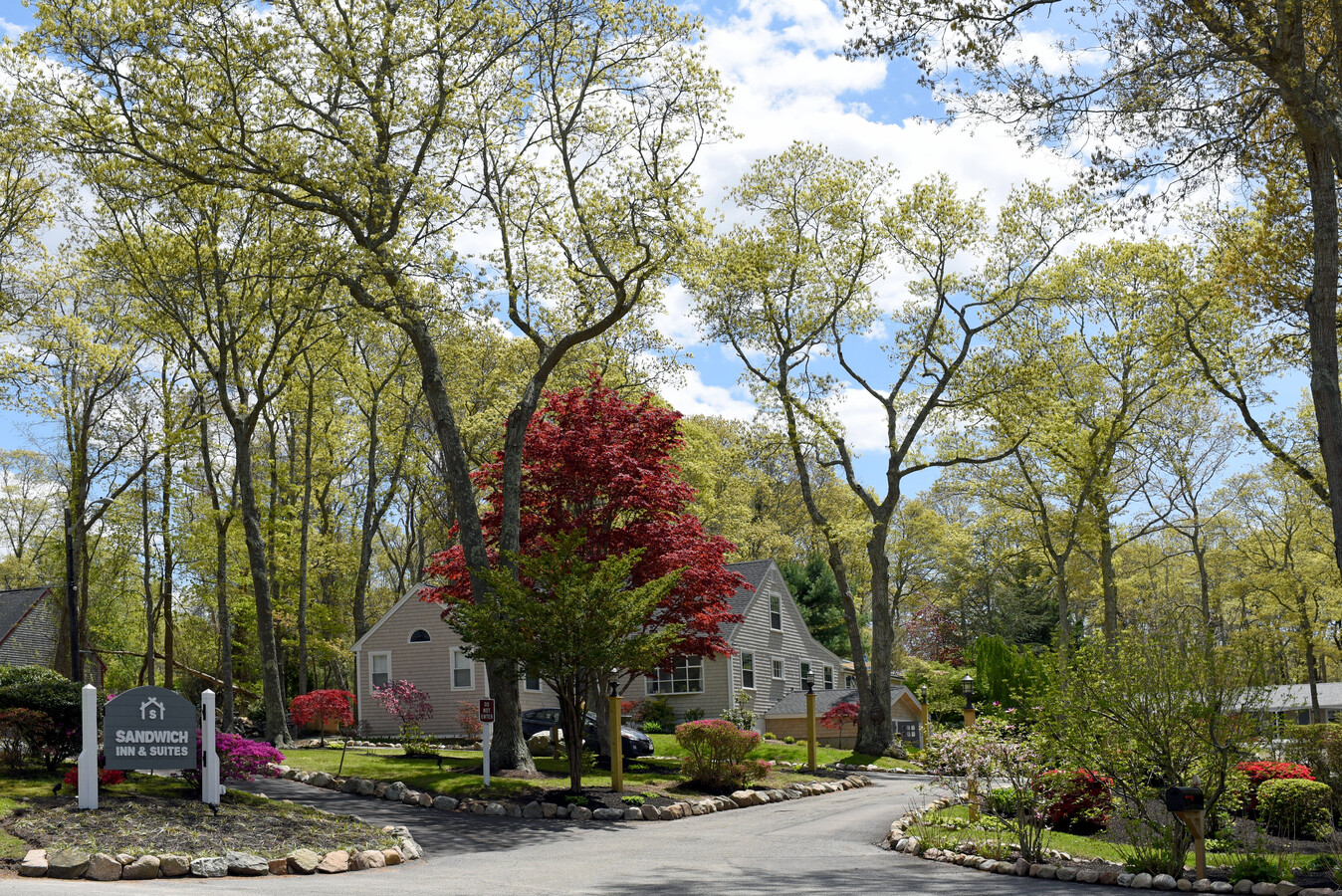
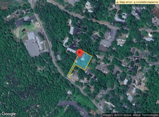
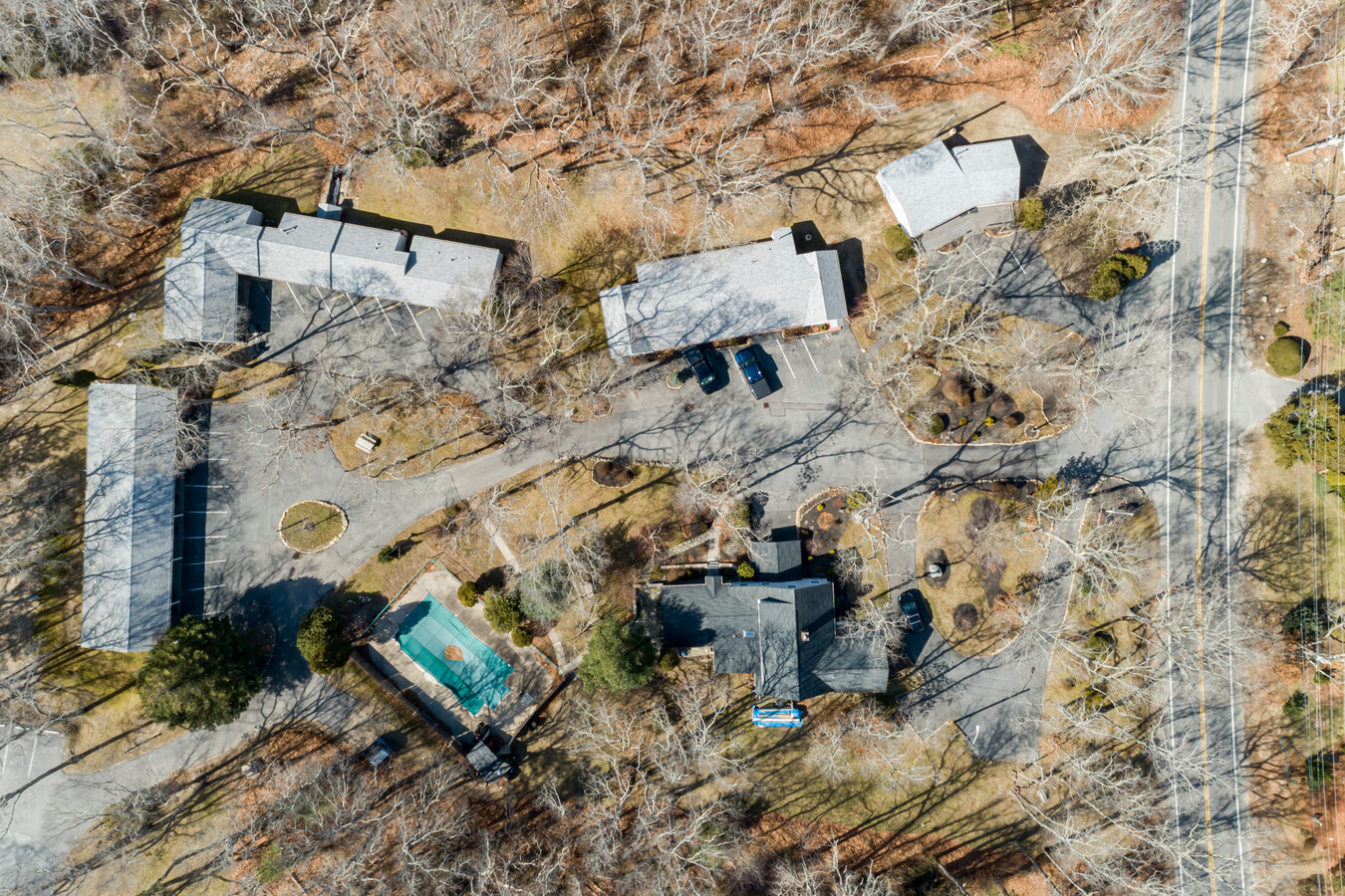
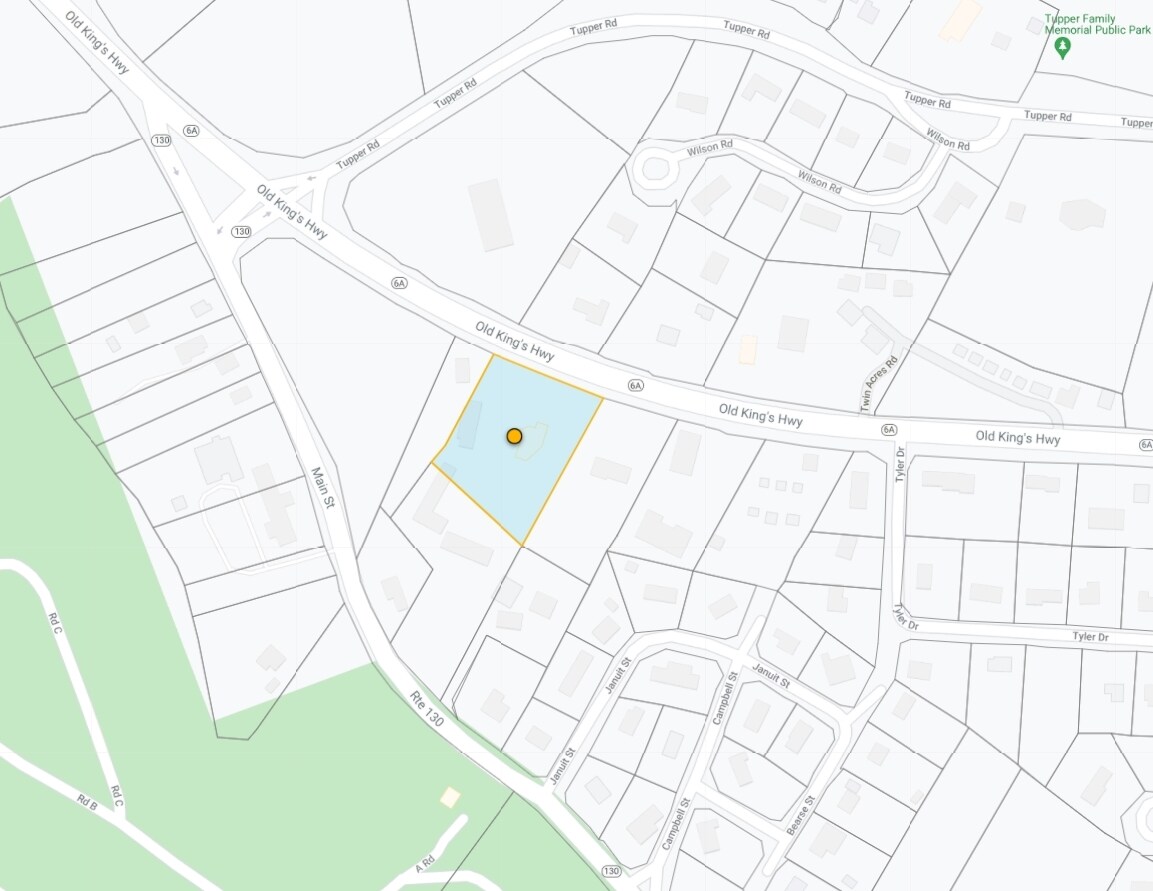
Property Detail
14 Route 6A
SAND-000086-000090
Barnstable
Commercialnec
Massachusetts
X
0.70 AC
25001C0319J
Cape Cod
2025
Other Market Areas
2025
Barnstable Town, MA
013300
DEMOGRAPHICS near 14 Route 6A
1 Mile
3 Mile
5 Mile
2024 Total Population
1,349
7,792
23,718
2029 Population
1,295
7,651
23,638
Pop Growth 2024-2029
(4.00%)
(1.81%)
(0.34%)
Average Age
51
48
45
2024 Total Households
569
3,232
9,303
HH Growth 2024-2029
(4.57%)
(2.20%)
(0.70%)
Median Household Inc
$96,195
$97,598
$99,981
Avg Household Size
2.10
2.30
2.40
2024 Avg HH Vehicles
2.00
2.00
2.00
Median Home Value
$450,709
$470,787
$448,617
Median Year Built
1975
1977
1981
Nearby Places
- Restaurants
- Banks
- Shops
- Fitness
- Groceries
PUBLIC TRANSPORTATION
COMMUTER RAIL
Bourne (CapeFLYER - Cape Cod Regional Transit Authority)
DRIVE
WALK
Distance
Bourne (CapeFLYER - Cape Cod Regional Transit Authority)
9 min
5.0 mi
Buzzards Bay (CapeFLYER - Cape Cod Regional Transit Authority)
DRIVE
WALK
Distance
Buzzards Bay (CapeFLYER - Cape Cod Regional Transit Authority)
14 min
7.6 mi
AIRPORT
Martha's Vineyard
DRIVE
WALK
Distance
Martha's Vineyard
97 min
35.7 mi
Freight Ports
Port of New Bedford Harbor
DRIVE
WALK
Distance
Port of New Bedford Harbor
45 min
32.3 mi
SALE & LEASE HISTORY
LISTING DATE
SALE/LEASE
Nearby Properties
Address
Land Use
TOTAL SIZE
Lot Size
Zoning
Address
Land Use
TOTAL SIZE
Lot Size
Zoning
654.71 AC
R40
Address
Land Use
TOTAL SIZE
Lot Size
Zoning
12.28 AC
Address
Land Use
TOTAL SIZE
Lot Size
Zoning
2,295.68 AC
R-1
Address
Land Use
TOTAL SIZE
Lot Size
Zoning
16.20 AC
BL-1
Address
Land Use
TOTAL SIZE
Lot Size
Zoning
46.68 AC
R-1
Address
Land Use
TOTAL SIZE
Lot Size
Zoning
208 SF
125.13 AC
SDD
Address
Land Use
TOTAL SIZE
Lot Size
Zoning
5,928 SF
12.90 AC
Address
Land Use
TOTAL SIZE
Lot Size
Zoning
148.70 AC
R40
Address
Land Use
TOTAL SIZE
Lot Size
Zoning
Address
Land Use
TOTAL SIZE
Lot Size
Zoning
29.83 AC
IND
Address
Land Use
TOTAL SIZE
Lot Size
Zoning
41.40 AC
IND
Address
Land Use
TOTAL SIZE
Lot Size
Zoning
4.94 AC
VILLAG
Address
Land Use
TOTAL SIZE
Lot Size
Zoning
11.97 AC
MARINE
Address
Land Use
TOTAL SIZE
Lot Size
Zoning
36,388 SF
6.70 AC
BL-1
Address
Land Use
TOTAL SIZE
Lot Size
Zoning
40,476 SF
7 AC
BL-1
Address
Land Use
TOTAL SIZE
Lot Size
Zoning
17,110 SF
1.68 AC
R-1
Address
Land Use
TOTAL SIZE
Lot Size
Zoning
39,202 SF
6.31 AC
BL-1
Address
Land Use
TOTAL SIZE
Lot Size
Zoning
4,146 SF
11.40 AC
BL-1
Address
Land Use
TOTAL SIZE
Lot Size
Zoning
8,989 SF
1.19 AC
MARINE
Address
Land Use
TOTAL SIZE
Lot Size
Zoning
16,449 SF
4.20 AC
Address
Land Use
TOTAL SIZE
Lot Size
Zoning
Address
Land Use
TOTAL SIZE
Lot Size
Zoning
10,691 SF
0.75 AC
VILLAG
Address
Land Use
TOTAL SIZE
Lot Size
Zoning
15,740 SF
4.30 AC
R-1
Address
Land Use
TOTAL SIZE
Lot Size
Zoning
12,480 SF
1 AC
BL-1
Address
Land Use
TOTAL SIZE
Lot Size
Zoning
3 AC
BUSINE
Address
Land Use
TOTAL SIZE
Lot Size
Zoning
9,378 SF
2.38 AC
R-1
Address
Land Use
TOTAL SIZE
Lot Size
Zoning
10,000 SF
13.15 AC
R40
Address
Land Use
TOTAL SIZE
Lot Size
Zoning
18.98 AC
R-2
Address
Land Use
TOTAL SIZE
Lot Size
Zoning
37,257 SF
3.54 AC
R40
Address
Land Use
TOTAL SIZE
Lot Size
Zoning
8,291 SF
4.23 AC
R-1