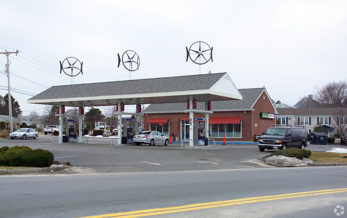
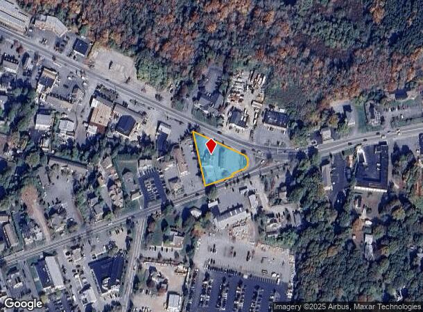
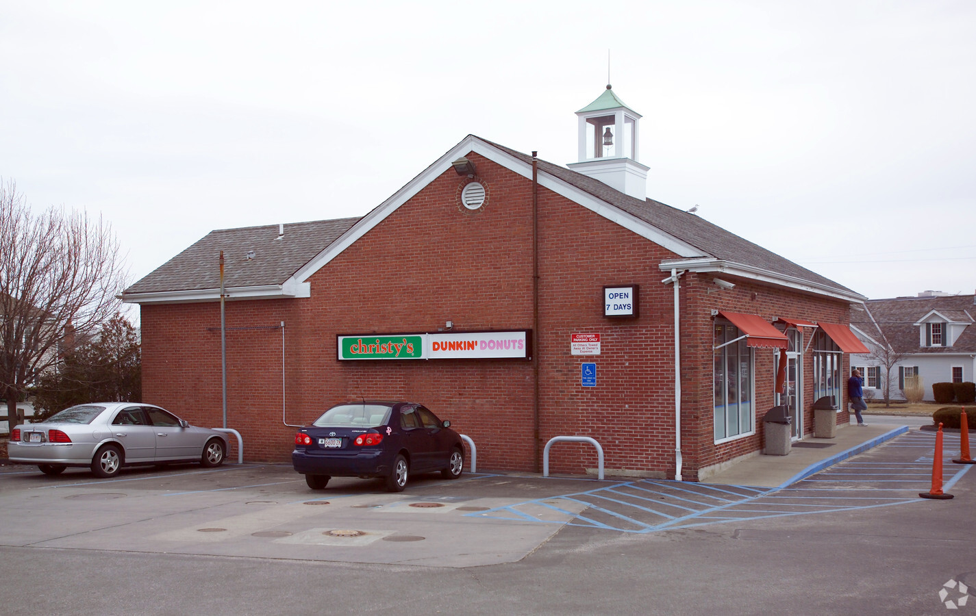
Property Record
16 Maine Ave, West Yarmouth, MA 02673
NEARBY LISTINGS FOR SALE OR LEASE
Property Detail
16 Maine Ave
Commercialnec
Barnstable
X
Massachusetts
25001C0567J
0.71 AC
2025
Cape Cod
2025
Other Market Areas
012101
Barnstable Town, MA
1,838 SF
YARM-000036-000097
DEMOGRAPHICS near 16 Maine Ave
1 Mile
3 Mile
5 Mile
2024 Total Population
5,128
29,930
52,931
2029 Population
5,237
30,876
54,488
Pop Growth 2024-2029
+ 2.13%
+ 3.16%
+ 2.94%
Average Age
45
45
47
2024 Total Households
2,256
12,822
23,079
HH Growth 2024-2029
+ 1.99%
+ 3.24%
+ 2.93%
Median Household Inc
$55,566
$63,617
$72,109
Avg Household Size
2.10
2.20
2.20
2024 Avg HH Vehicles
1.00
2.00
2.00
Median Home Value
$407,759
$419,544
$448,125
Median Year Built
1973
1973
1973
Nearby Places
- Restaurants
- Banks
- Shops
- Fitness
- Groceries
PUBLIC TRANSPORTATION
COMMUTER RAIL
Hyannis (CapeFLYER - Cape Cod Regional Transit Authority)
DRIVE
WALK
Distance
Hyannis (CapeFLYER - Cape Cod Regional Transit Authority)
1 min
9 min
0.5 mi
AIRPORT
Martha's Vineyard
DRIVE
WALK
Distance
Martha's Vineyard
107 min
39.4 mi
Freight Ports
Port of New Bedford Harbor
DRIVE
WALK
Distance
Port of New Bedford Harbor
71 min
49.3 mi
SALE & LEASE HISTORY
LISTING DATE
SALE/LEASE

Sep 23, 2016
For Sale
Nearby Properties
Address
Land Use
TOTAL SIZE
Lot Size
Zoning
Address
Land Use
TOTAL SIZE
Lot Size
Zoning
411,756 SF
68.70 AC
RB;HB
Address
Land Use
TOTAL SIZE
Lot Size
Zoning
25.88 AC
HB;B
Address
Land Use
TOTAL SIZE
Lot Size
Zoning
298,272 SF
9.34 AC
IN
Address
Land Use
TOTAL SIZE
Lot Size
Zoning
187,006 SF
17.12 AC
RB;HB
Address
Land Use
TOTAL SIZE
Lot Size
Zoning
96,929 SF
9.63 AC
Address
Land Use
TOTAL SIZE
Lot Size
Zoning
14.34 AC
B;IND
Address
Land Use
TOTAL SIZE
Lot Size
Zoning
110,415 SF
70 AC
Address
Land Use
TOTAL SIZE
Lot Size
Zoning
30,000 SF
8.48 AC
HB;RF-
Address
Land Use
TOTAL SIZE
Lot Size
Zoning
82.38 AC
RC-1;R
Address
Land Use
TOTAL SIZE
Lot Size
Zoning
253,562 SF
12.54 AC
RC-1;H
Address
Land Use
TOTAL SIZE
Lot Size
Zoning
12.82 AC
B;HB
Address
Land Use
TOTAL SIZE
Lot Size
Zoning
177,385 SF
39.53 AC
Address
Land Use
TOTAL SIZE
Lot Size
Zoning
54,172 SF
17.97 AC
IND;B;
Address
Land Use
TOTAL SIZE
Lot Size
Zoning
67,000 SF
9.15 AC
HB;B
Address
Land Use
TOTAL SIZE
Lot Size
Zoning
117,584 SF
9.68 AC
IND;B
Address
Land Use
TOTAL SIZE
Lot Size
Zoning
193,364 SF
54.54 AC
RB;DV
Address
Land Use
TOTAL SIZE
Lot Size
Zoning
32.95 AC
IN
Address
Land Use
TOTAL SIZE
Lot Size
Zoning
106,197 SF
8.13 AC
Address
Land Use
TOTAL SIZE
Lot Size
Zoning
37,169 SF
8.71 AC
RC-1;H
Address
Land Use
TOTAL SIZE
Lot Size
Zoning
167,800 SF
9.73 AC
IN
Address
Land Use
TOTAL SIZE
Lot Size
Zoning
90,837 SF
11.66 AC
IN
Address
Land Use
TOTAL SIZE
Lot Size
Zoning
125,280 SF
6.41 AC
RB;HB
Address
Land Use
TOTAL SIZE
Lot Size
Zoning
49,596 SF
22.14 AC
RB;HB
Address
Land Use
TOTAL SIZE
Lot Size
Zoning
3,738 SF
48.06 AC
R
Address
Land Use
TOTAL SIZE
Lot Size
Zoning
13.46 AC
IN
Address
Land Use
TOTAL SIZE
Lot Size
Zoning
3.86 AC
U
Address
Land Use
TOTAL SIZE
Lot Size
Zoning
118,274 SF
7.42 AC
Address
Land Use
TOTAL SIZE
Lot Size
Zoning
32,818 SF
3.17 AC
U
Address
Land Use
TOTAL SIZE
Lot Size
Zoning
99,248 SF
4.73 AC
HB;B
Address
Land Use
TOTAL SIZE
Lot Size
Zoning
54,688 SF
10.02 AC
B;RG;R
The World's #1 Commercial Real Estate Marketplace
Connect with us
© 2025 CoStar Group
The information above has been obtained from sources believed reliable. While we do not doubt its accuracy we have not verified it and make no guarantee, warranty or representation about it. It is your responsibility to independently confirm its accuracy and completeness. Any projections, opinions, assumptions, or estimates used are for example only and do not represent the current or future performance of the property. The value of this transaction to you depends on tax and other factors which should be evaluated by your tax, financial, and legal advisors. You and your advisors should conduct a careful, independent investigation of the property to determine to your satisfaction the suitability of the property for your needs.