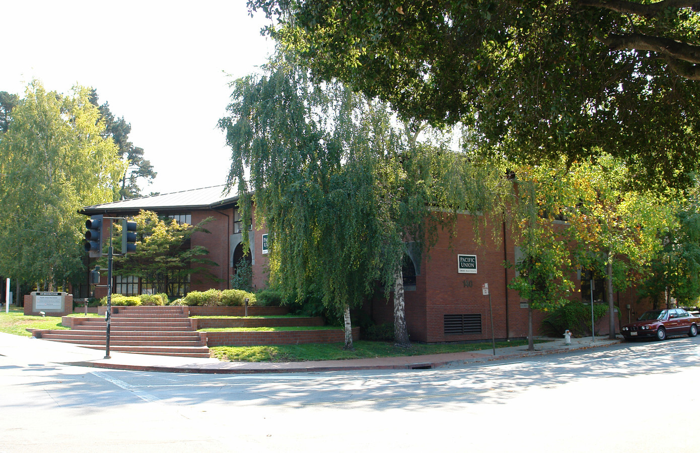
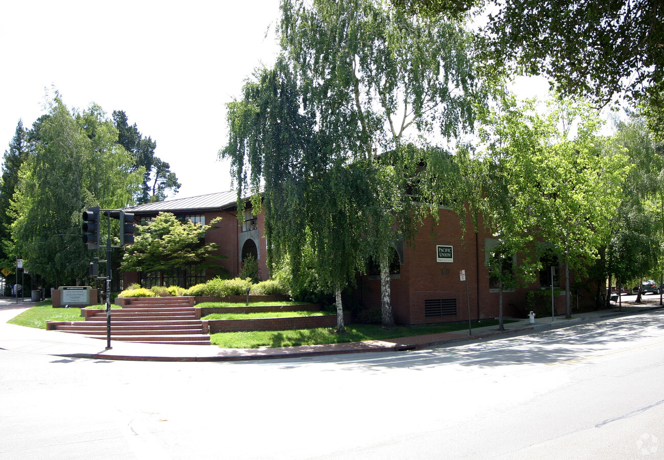
Property Record
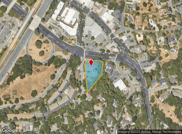
140 Brookwood Rd, Orinda, CA 94563
NEARBY LISTINGS FOR SALE OR LEASE
Property Detail
140 Brookwood Rd
Oakland-Hayward-Berkeley, CA
Colorados Rho
273-041-009-5
RO LAGUNA DE LOS PALOS COLORADOS 1.09 AC
Officebuilding
Contra Costa
AE
California
06013C0268F
38
2023
1.09 AC
2024
Lamorinda
353001
East Bay/Oakland
15,260 SF
DEMOGRAPHICS near 140 Brookwood Rd
1 Mile
3 Mile
5 Mile
2024 Total Population
5,273
32,281
171,858
2029 Population
5,274
31,935
168,121
Pop Growth 2024-2029
+ 0.02%
(1.07%)
(2.17%)
Average Age
44
44
41
2024 Total Households
1,935
12,017
64,112
HH Growth 2024-2029
(0.21%)
(1.23%)
(2.28%)
Median Household Inc
$235,038
$232,819
$158,090
Avg Household Size
2.70
2.60
2.40
2024 Avg HH Vehicles
2.00
2.00
2.00
Median Home Value
$1,142,381
$1,132,518
$1,126,787
Median Year Built
1962
1964
1957
Nearby Places
- Restaurants
- Banks
- Shops
- Fitness
- Groceries
PUBLIC TRANSPORTATION
TRANSIT/SUBWAY
Orinda Station (Pittsburg/Bay Point - San Francisco International - Bay Area Rapid Transit (BART))
DRIVE
WALK
Distance
Orinda Station (Pittsburg/Bay Point - San Francisco International - Bay Area Rapid Transit (BART))
1 min
4 min
0.2 mi
COMMUTER RAIL
Emeryville (California Zephyr - Capitol Corridor Joint Powers Authority, Capitol Corridor - Capitol Corridor Joint Powers Authority, Coast Starlight - Capitol Corridor Joint Powers Authority, San Joaquins - Capitol Corridor Joint Powers Authority)
DRIVE
WALK
Distance
Emeryville (California Zephyr - Capitol Corridor Joint Powers Authority, Capitol Corridor - Capitol Corridor Joint Powers Authority, Coast Starlight - Capitol Corridor Joint Powers Authority, San Joaquins - Capitol Corridor Joint Powers Authority)
14 min
8.1 mi
AIRPORT
Metro Oakland International
DRIVE
WALK
Distance
Metro Oakland International
24 min
16.7 mi
San Francisco International
DRIVE
WALK
Distance
San Francisco International
42 min
28.7 mi
Freight Ports
Port of Oakland
DRIVE
WALK
Distance
Port of Oakland
14 min
9.5 mi
Nearby Properties
Address
Land Use
TOTAL SIZE
Lot Size
Zoning
Address
Land Use
TOTAL SIZE
Lot Size
Zoning
963.58 AC
A80
Address
Land Use
TOTAL SIZE
Lot Size
Zoning
26,885 SF
1.92 AC
Address
Land Use
TOTAL SIZE
Lot Size
Zoning
16,632 SF
5.71 AC
Address
Land Use
TOTAL SIZE
Lot Size
Zoning
1,320 SF
27.04 AC
Address
Land Use
TOTAL SIZE
Lot Size
Zoning
7,100 SF
10.73 AC
Address
Land Use
TOTAL SIZE
Lot Size
Zoning
63,749 SF
3.86 AC
Address
Land Use
TOTAL SIZE
Lot Size
Zoning
18,015 SF
7.21 AC
Address
Land Use
TOTAL SIZE
Lot Size
Zoning
73,600 SF
1.45 AC
Address
Land Use
TOTAL SIZE
Lot Size
Zoning
82,500 SF
3.56 AC
Address
Land Use
TOTAL SIZE
Lot Size
Zoning
20,600 SF
6.88 AC
Address
Land Use
TOTAL SIZE
Lot Size
Zoning
9,798 SF
9.94 AC
Address
Land Use
TOTAL SIZE
Lot Size
Zoning
7,560 SF
1.26 AC
Address
Land Use
TOTAL SIZE
Lot Size
Zoning
49,168 SF
1.24 AC
Address
Land Use
TOTAL SIZE
Lot Size
Zoning
54,000 SF
1.95 AC
Address
Land Use
TOTAL SIZE
Lot Size
Zoning
17,206 SF
1.14 AC
Address
Land Use
TOTAL SIZE
Lot Size
Zoning
22,067 SF
1.30 AC
Address
Land Use
TOTAL SIZE
Lot Size
Zoning
22,514 SF
1.27 AC
Address
Land Use
TOTAL SIZE
Lot Size
Zoning
24,336 SF
1.10 AC
Address
Land Use
TOTAL SIZE
Lot Size
Zoning
66,176 SF
41.71 AC
Address
Land Use
TOTAL SIZE
Lot Size
Zoning
27,250 SF
0.90 AC
Address
Land Use
TOTAL SIZE
Lot Size
Zoning
9,216 SF
0.82 AC
Address
Land Use
TOTAL SIZE
Lot Size
Zoning
215.95 AC
Address
Land Use
TOTAL SIZE
Lot Size
Zoning
15,468 SF
1.21 AC
Address
Land Use
TOTAL SIZE
Lot Size
Zoning
21.79 AC
Address
Land Use
TOTAL SIZE
Lot Size
Zoning
6,744 SF
1.54 AC
Address
Land Use
TOTAL SIZE
Lot Size
Zoning
14,904 SF
1.85 AC
Address
Land Use
TOTAL SIZE
Lot Size
Zoning
8,893 SF
13.16 AC
Address
Land Use
TOTAL SIZE
Lot Size
Zoning
15,786 SF
0.97 AC
Address
Land Use
TOTAL SIZE
Lot Size
Zoning
42,689 SF
1.95 AC
Address
Land Use
TOTAL SIZE
Lot Size
Zoning
5,902 SF
24.02 AC
The World's #1 Commercial Real Estate Marketplace
Connect with us
© 2025 CoStar Group
The information above has been obtained from sources believed reliable. While we do not doubt its accuracy we have not verified it and make no guarantee, warranty or representation about it. It is your responsibility to independently confirm its accuracy and completeness. Any projections, opinions, assumptions, or estimates used are for example only and do not represent the current or future performance of the property. The value of this transaction to you depends on tax and other factors which should be evaluated by your tax, financial, and legal advisors. You and your advisors should conduct a careful, independent investigation of the property to determine to your satisfaction the suitability of the property for your needs.