No Photo
Property Record
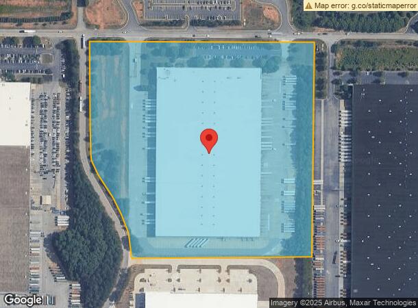
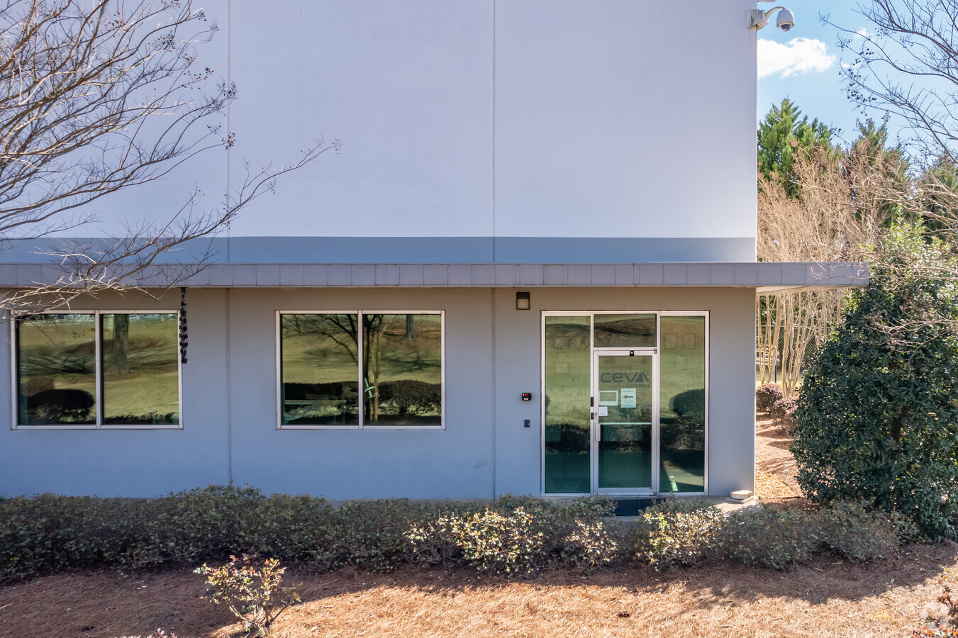
140 Greenwood Industrial Pky, Mcdonough, GA 30253


NEARBY LISTINGS FOR SALE OR LEASE
Property Detail
140 Greenwood Industrial Pky
0095-01-007-007
LAND LOT: 253 /LAND DISTRICT: 7; Total Multi Sales 79.67 AC
Distributionwarehouseregional
Henry
X
Georgia
13151C0170D
253
2024
22.34 AC
2024
S Clayton/Henry Cnty
070411
Atlanta
400,500 SF
Atlanta-Sandy Springs-Roswell, GA
DEMOGRAPHICS near 140 Greenwood Industrial Pky
1 Mile
3 Mile
5 Mile
2024 Total Population
1,973
24,256
69,371
2029 Population
2,215
26,812
76,314
Pop Growth 2024-2029
+ 12.27%
+ 10.54%
+ 10.01%
Average Age
38
36
36
2024 Total Households
697
8,484
24,536
HH Growth 2024-2029
+ 12.48%
+ 10.77%
+ 10.15%
Median Household Inc
$74,018
$74,012
$69,427
Avg Household Size
2.80
2.80
2.80
2024 Avg HH Vehicles
2.00
2.00
2.00
Median Home Value
$317,368
$238,550
$227,705
Median Year Built
2007
2006
2004
Nearby Places
- Restaurants
- Banks
- Shops
- Fitness
- Groceries
PUBLIC TRANSPORTATION
AIRPORT
Hartsfield - Jackson Atlanta International
DRIVE
WALK
Distance
Hartsfield - Jackson Atlanta International
36 min
27.2 mi
Freight Ports
Georgia Ports - Savannah
DRIVE
WALK
Distance
Georgia Ports - Savannah
246 min
220.6 mi
Nearby Properties
Address
Land Use
TOTAL SIZE
Lot Size
Zoning
Address
Land Use
TOTAL SIZE
Lot Size
Zoning
33,565 SF
44.68 AC
Address
Land Use
TOTAL SIZE
Lot Size
Zoning
1,569,644 SF
84.31 AC
M2
Address
Land Use
TOTAL SIZE
Lot Size
Zoning
15,803 SF
39.67 AC
RM
Address
Land Use
TOTAL SIZE
Lot Size
Zoning
900,556 SF
61.08 AC
M
Address
Land Use
TOTAL SIZE
Lot Size
Zoning
1,038,514 SF
141.54 AC
M1
Address
Land Use
TOTAL SIZE
Lot Size
Zoning
16,636 SF
24 AC
RM
Address
Land Use
TOTAL SIZE
Lot Size
Zoning
31,528 SF
22.04 AC
RMH
Address
Land Use
TOTAL SIZE
Lot Size
Zoning
1,245,868 SF
66.85 AC
M1
Address
Land Use
TOTAL SIZE
Lot Size
Zoning
1,010,600 SF
78.40 AC
M1
Address
Land Use
TOTAL SIZE
Lot Size
Zoning
56.89 AC
M1
Address
Land Use
TOTAL SIZE
Lot Size
Zoning
22,633 SF
31 AC
RM
Address
Land Use
TOTAL SIZE
Lot Size
Zoning
861,909 SF
44.42 AC
M
Address
Land Use
TOTAL SIZE
Lot Size
Zoning
869,506 SF
59.72 AC
M1
Address
Land Use
TOTAL SIZE
Lot Size
Zoning
728,000 SF
82.62 AC
Address
Land Use
TOTAL SIZE
Lot Size
Zoning
863,704 SF
47.66 AC
C1
Address
Land Use
TOTAL SIZE
Lot Size
Zoning
760,540 SF
44.93 AC
M2
Address
Land Use
TOTAL SIZE
Lot Size
Zoning
707,997 SF
53.72 AC
C2
Address
Land Use
TOTAL SIZE
Lot Size
Zoning
698,544 SF
44.95 AC
M1
Address
Land Use
TOTAL SIZE
Lot Size
Zoning
247,544 SF
43.30 AC
Address
Land Use
TOTAL SIZE
Lot Size
Zoning
865,642 SF
42.27 AC
M1
Address
Land Use
TOTAL SIZE
Lot Size
Zoning
417,918 SF
41.35 AC
Address
Land Use
TOTAL SIZE
Lot Size
Zoning
1,014,800 SF
85.65 AC
M1
Address
Land Use
TOTAL SIZE
Lot Size
Zoning
712,571 SF
14.22 AC
M1
Address
Land Use
TOTAL SIZE
Lot Size
Zoning
622,430 SF
46.24 AC
M1
Address
Land Use
TOTAL SIZE
Lot Size
Zoning
761,930 SF
57.04 AC
M
Address
Land Use
TOTAL SIZE
Lot Size
Zoning
675,238 SF
49.23 AC
M1
Address
Land Use
TOTAL SIZE
Lot Size
Zoning
756,220 SF
43.09 AC
M1
Address
Land Use
TOTAL SIZE
Lot Size
Zoning
676,198 SF
40.84 AC
M
Address
Land Use
TOTAL SIZE
Lot Size
Zoning
1,111,620 SF
67.79 AC
M2
The World's #1 Commercial Real Estate Marketplace
Connect with us
© 2025 CoStar Group
The information above has been obtained from sources believed reliable. While we do not doubt its accuracy we have not verified it and make no guarantee, warranty or representation about it. It is your responsibility to independently confirm its accuracy and completeness. Any projections, opinions, assumptions, or estimates used are for example only and do not represent the current or future performance of the property. The value of this transaction to you depends on tax and other factors which should be evaluated by your tax, financial, and legal advisors. You and your advisors should conduct a careful, independent investigation of the property to determine to your satisfaction the suitability of the property for your needs.