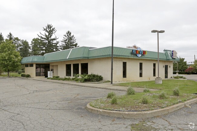
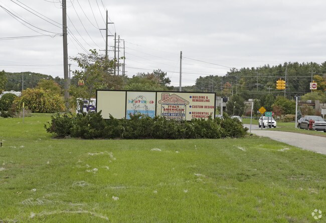
Property Record
140 W Highland Rd, Highland, MI 48357

NEARBY LISTINGS FOR SALE OR LEASE
Property Detail
140 W Highland Rd
Detroit-Warren-Dearborn, MI
Acres
11-22-301-007
T3N, R7E, SEC 22 MAE-GRACE ACRES PART OF LOT 1 BEG AT NE LOT COR, TH S 00-11-30 W 154.20 FT, TH S 89-30-20 W 100.40 FT, TH S
Officebuilding
Oakland
X
Michigan
26125C0313F
1
2024
1.20 AC
2025
St Clair & Lapeer Counties
131800
Detroit
3,485 SF
DEMOGRAPHICS near 140 W Highland Rd
1 Mile
3 Mile
5 Mile
2024 Total Population
2,660
17,308
46,909
2029 Population
2,714
17,344
46,814
Pop Growth 2024-2029
+ 2.03%
+ 0.21%
(0.20%)
Average Age
42
43
43
2024 Total Households
956
6,619
18,157
HH Growth 2024-2029
+ 1.67%
+ 0.12%
(0.26%)
Median Household Inc
$101,071
$96,100
$95,193
Avg Household Size
2.80
2.60
2.50
2024 Avg HH Vehicles
2.00
2.00
2.00
Median Home Value
$402,133
$328,441
$333,841
Median Year Built
1994
1983
1985
Nearby Places
Map Layers
Map Styles
 Street
 Aerial
- Restaurants
- Banks
- Shops
- Fitness
- Groceries
PUBLIC TRANSPORTATION
AIRPORT
Bishop International
DRIVE
WALK
Distance
Bishop International
47 min
32.4 mi
Detroit Metro Wayne County
DRIVE
WALK
Distance
Detroit Metro Wayne County
63 min
45.0 mi
SALE & LEASE HISTORY
LISTING DATE
SALE/LEASE

Sep 25, 2016
For Lease
Nearby Properties
Address
Land Use
TOTAL SIZE
Lot Size
Zoning
Address
Land Use
TOTAL SIZE
Lot Size
Zoning
6,498 SF
77.52 AC
MM
Address
Land Use
TOTAL SIZE
Lot Size
Zoning
83,159 SF
34.44 AC
Address
Land Use
TOTAL SIZE
Lot Size
Zoning
46,500 SF
5.86 AC
BI
Address
Land Use
TOTAL SIZE
Lot Size
Zoning
38,453 SF
5.05 AC
Address
Land Use
TOTAL SIZE
Lot Size
Zoning
34,854 SF
5.28 AC
AI
Address
Land Use
TOTAL SIZE
Lot Size
Zoning
603.37 AC
FC
Address
Land Use
TOTAL SIZE
Lot Size
Zoning
45,644 SF
7.74 AC
BI
Address
Land Use
TOTAL SIZE
Lot Size
Zoning
26,054 SF
7.90 AC
AV
Address
Land Use
TOTAL SIZE
Lot Size
Zoning
34,075 SF
14.06 AC
BI
Address
Land Use
TOTAL SIZE
Lot Size
Zoning
38,846 SF
6.78 AC
BI
Address
Land Use
TOTAL SIZE
Lot Size
Zoning
51,167 SF
11.08 AC
BI
Address
Land Use
TOTAL SIZE
Lot Size
Zoning
55,183 SF
Address
Land Use
TOTAL SIZE
Lot Size
Zoning
47,204 SF
10.77 AC
II
Address
Land Use
TOTAL SIZE
Lot Size
Zoning
24,370 SF
4.86 AC
BI
Address
Land Use
TOTAL SIZE
Lot Size
Zoning
67,936 SF
9.68 AC
BI
Address
Land Use
TOTAL SIZE
Lot Size
Zoning
27,756 SF
228.31 AC
Address
Land Use
TOTAL SIZE
Lot Size
Zoning
34,464 SF
7.45 AC
AI
Address
Land Use
TOTAL SIZE
Lot Size
Zoning
47,996 SF
8.99 AC
BI
Address
Land Use
TOTAL SIZE
Lot Size
Zoning
36,928 SF
5.16 AC
II
Address
Land Use
TOTAL SIZE
Lot Size
Zoning
58,721 SF
7.59 AC
BI
Address
Land Use
TOTAL SIZE
Lot Size
Zoning
68,340 SF
5.48 AC
II
Address
Land Use
TOTAL SIZE
Lot Size
Zoning
21,000 SF
3.12 AC
BI
Address
Land Use
TOTAL SIZE
Lot Size
Zoning
58,677 SF
16.70 AC
II
Address
Land Use
TOTAL SIZE
Lot Size
Zoning
25,432 SF
4.53 AC
AI
Address
Land Use
TOTAL SIZE
Lot Size
Zoning
59,200 SF
6 AC
II
Address
Land Use
TOTAL SIZE
Lot Size
Zoning
37,646 SF
7.53 AC
SI
Address
Land Use
TOTAL SIZE
Lot Size
Zoning
22,605 SF
3.79 AC
BI
Address
Land Use
TOTAL SIZE
Lot Size
Zoning
12,463 SF
4.73 AC
Address
Land Use
TOTAL SIZE
Lot Size
Zoning
50.93 AC
MM
Address
Land Use
TOTAL SIZE
Lot Size
Zoning
32,400 SF
2.67 AC
II
The World's #1 Commercial Real Estate Marketplace
Connect with us
© 2025 CoStar Group
The information above has been obtained from sources believed reliable. While we do not doubt its accuracy we have not verified it and make no guarantee, warranty or representation about it. It is your responsibility to independently confirm its accuracy and completeness. Any projections, opinions, assumptions, or estimates used are for example only and do not represent the current or future performance of the property. The value of this transaction to you depends on tax and other factors which should be evaluated by your tax, financial, and legal advisors. You and your advisors should conduct a careful, independent investigation of the property to determine to your satisfaction the suitability of the property for your needs.