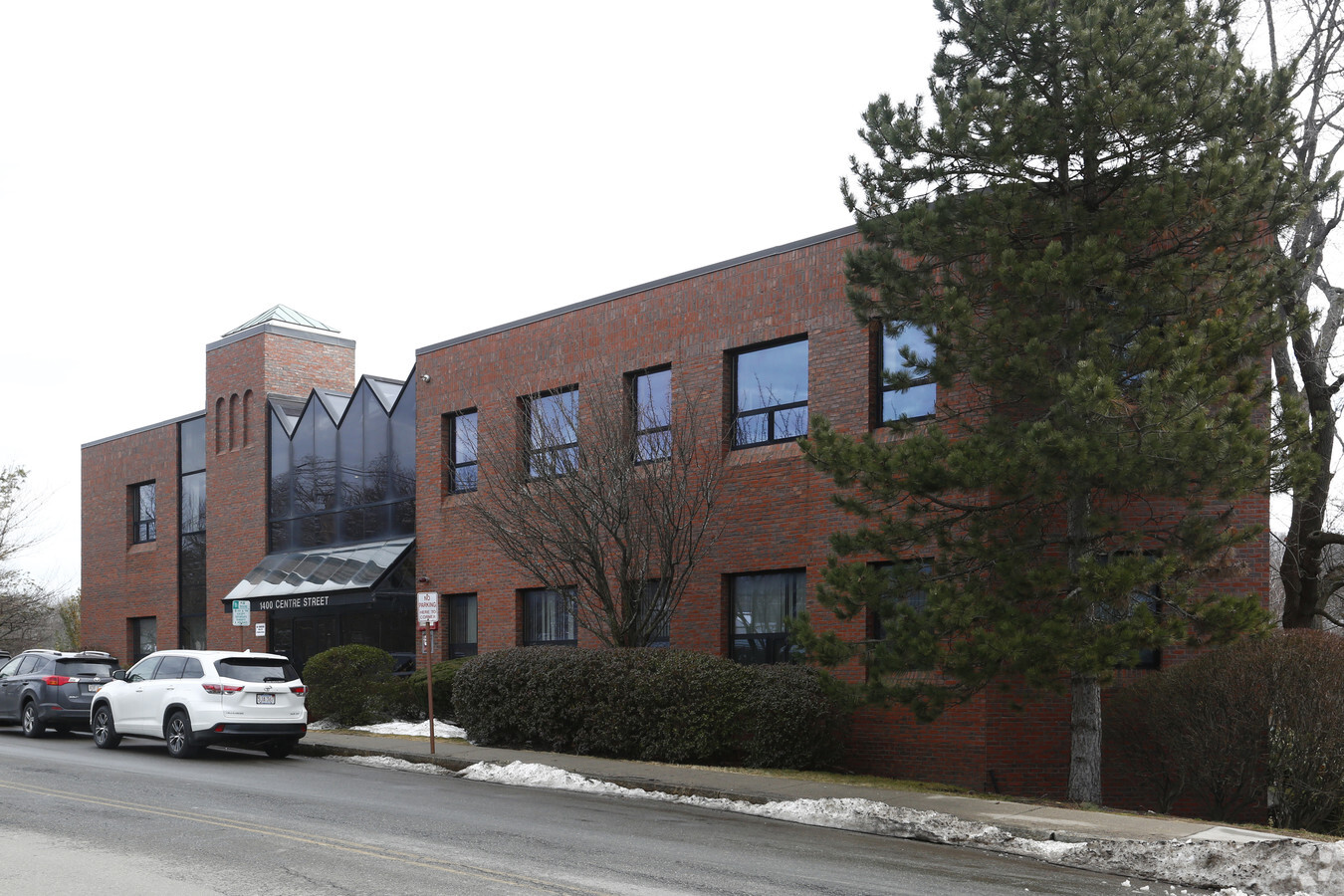
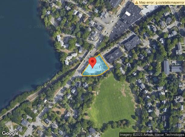
Property Record
77 Paul St, Newton Center, MA 02459
Current Lease Availabilities
NEARBY LISTINGS FOR SALE OR LEASE
Property Detail
77 Paul St
NEWT-000062-000013-000009
Middlesex
Commercialbuilding
Massachusetts
X
9
25017C0554E
0.69 AC
2025
Newton/Brookline
2025
Boston
373800
Boston-Cambridge-Newton, MA-NH
26,284 SF
DEMOGRAPHICS near 77 Paul St
1 Mile
3 Mile
5 Mile
2024 Total Population
15,883
150,713
478,887
2029 Population
15,631
147,632
467,046
Pop Growth 2024-2029
(1.59%)
(2.04%)
(2.47%)
Average Age
43
40
39
2024 Total Households
5,913
58,361
191,573
HH Growth 2024-2029
(1.67%)
(2.37%)
(2.80%)
Median Household Inc
$196,978
$135,601
$115,305
Avg Household Size
2.60
2.40
2.30
2024 Avg HH Vehicles
2.00
2.00
1.00
Median Home Value
$1,078,419
$1,015,171
$886,959
Median Year Built
1947
1949
1949
Nearby Places
- Restaurants
- Banks
- Shops
- Fitness
- Groceries
PUBLIC TRANSPORTATION
TRANSIT/SUBWAY
Newton Centre Station (Green Line - D - Massachusetts Bay Transportation Authority Subway (The T))
DRIVE
WALK
Distance
Newton Centre Station (Green Line - D - Massachusetts Bay Transportation Authority Subway (The T))
1 min
6 min
0.4 mi
Newton Highlands Station (Green Line - D - Massachusetts Bay Transportation Authority Subway (The T))
DRIVE
WALK
Distance
Newton Highlands Station (Green Line - D - Massachusetts Bay Transportation Authority Subway (The T))
1 min
12 min
0.6 mi
COMMUTER RAIL
Newtonville (Framingham/Worcester Line - Massachusetts Bay Transportation Authority Commuter Rail (Purple Line))
DRIVE
WALK
Distance
Newtonville (Framingham/Worcester Line - Massachusetts Bay Transportation Authority Commuter Rail (Purple Line))
7 min
3.6 mi
West Newton (Framingham/Worcester Line - Massachusetts Bay Transportation Authority Commuter Rail (Purple Line))
DRIVE
WALK
Distance
West Newton (Framingham/Worcester Line - Massachusetts Bay Transportation Authority Commuter Rail (Purple Line))
9 min
4.9 mi
AIRPORT
General Edward Lawrence Logan International
DRIVE
WALK
Distance
General Edward Lawrence Logan International
22 min
12.8 mi
Freight Ports
Port of Boston
DRIVE
WALK
Distance
Port of Boston
21 min
11.1 mi
Nearby Properties
Address
Land Use
TOTAL SIZE
Lot Size
Zoning
Address
Land Use
TOTAL SIZE
Lot Size
Zoning
30,845 SF
50.36 AC
SR1
Address
Land Use
TOTAL SIZE
Lot Size
Zoning
336,518 SF
6.14 AC
I-3
Address
Land Use
TOTAL SIZE
Lot Size
Zoning
387,550 SF
7.99 AC
MU1
Address
Land Use
TOTAL SIZE
Lot Size
Zoning
220,671 SF
2.52 AC
I-2
Address
Land Use
TOTAL SIZE
Lot Size
Zoning
176,625 SF
5.76 AC
I-3
Address
Land Use
TOTAL SIZE
Lot Size
Zoning
30,170 SF
19 AC
SR2
Address
Land Use
TOTAL SIZE
Lot Size
Zoning
485,370 SF
5.13 AC
NEBC
Address
Land Use
TOTAL SIZE
Lot Size
Zoning
228,483 SF
7.57 AC
BU1
Address
Land Use
TOTAL SIZE
Lot Size
Zoning
412,208 SF
7.93 AC
I
Address
Land Use
TOTAL SIZE
Lot Size
Zoning
317,049 SF
11.22 AC
M05
Address
Land Use
TOTAL SIZE
Lot Size
Zoning
1,050 SF
8.76 AC
BU4
Address
Land Use
TOTAL SIZE
Lot Size
Zoning
203,252 SF
236.88 AC
S40
Address
Land Use
TOTAL SIZE
Lot Size
Zoning
163,364 SF
3.08 AC
O10
Address
Land Use
TOTAL SIZE
Lot Size
Zoning
179,834 SF
8.57 AC
PUB
Address
Land Use
TOTAL SIZE
Lot Size
Zoning
241,737 SF
4.67 AC
BU1
Address
Land Use
TOTAL SIZE
Lot Size
Zoning
25,744 SF
35.80 AC
S40
Address
Land Use
TOTAL SIZE
Lot Size
Zoning
76,800 SF
22.65 AC
MU1
Address
Land Use
TOTAL SIZE
Lot Size
Zoning
5,119 SF
119.98 AC
S15
Address
Land Use
TOTAL SIZE
Lot Size
Zoning
225,294 SF
0.57 AC
C
Address
Land Use
TOTAL SIZE
Lot Size
Zoning
286,928 SF
2.89 AC
BU1
Address
Land Use
TOTAL SIZE
Lot Size
Zoning
4.74 AC
NEBC
Address
Land Use
TOTAL SIZE
Lot Size
Zoning
234,814 SF
4.06 AC
Address
Land Use
TOTAL SIZE
Lot Size
Zoning
151,232 SF
8.27 AC
PUB
Address
Land Use
TOTAL SIZE
Lot Size
Zoning
6.51 AC
PSCD
Address
Land Use
TOTAL SIZE
Lot Size
Zoning
108,818 SF
I-1
Address
Land Use
TOTAL SIZE
Lot Size
Zoning
200,730 SF
5.95 AC
BU4
Address
Land Use
TOTAL SIZE
Lot Size
Zoning
59.94 AC
PUB
Address
Land Use
TOTAL SIZE
Lot Size
Zoning
Address
Land Use
TOTAL SIZE
Lot Size
Zoning
7,873 SF
5.04 AC
SR1
Address
Land Use
TOTAL SIZE
Lot Size
Zoning
36,868 SF
3.41 AC
MAN
The World's #1 Commercial Real Estate Marketplace
Connect with us
© 2025 CoStar Group
The information above has been obtained from sources believed reliable. While we do not doubt its accuracy we have not verified it and make no guarantee, warranty or representation about it. It is your responsibility to independently confirm its accuracy and completeness. Any projections, opinions, assumptions, or estimates used are for example only and do not represent the current or future performance of the property. The value of this transaction to you depends on tax and other factors which should be evaluated by your tax, financial, and legal advisors. You and your advisors should conduct a careful, independent investigation of the property to determine to your satisfaction the suitability of the property for your needs.