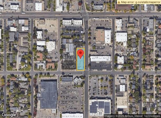
Property Record
1417 Krameria St, Denver, CO 80220

NEARBY LISTINGS FOR SALE OR LEASE
Property Detail
1417 Krameria St
Denver-Aurora-Lakewood, CO
Colfax Terrace
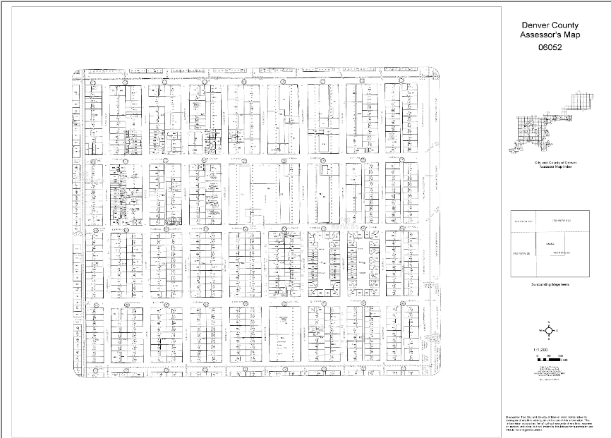
6052-04-013
EAST88 FT LOTS24-33
Commercialbuilding
Denver
X
Colorado
08005C0175K
24-33
2021
0.50 AC
2023
Central
0043044003
Denver
19,406 SF
DEMOGRAPHICS near 1417 Krameria St
1 Mile
3 Mile
5 Mile
2024 Total Population
19,305
183,767
504,230
2029 Population
19,509
185,990
512,899
Pop Growth 2024-2029
+ 1.06%
+ 1.21%
+ 1.72%
Average Age
40
39
38
2024 Total Households
8,283
82,918
233,867
HH Growth 2024-2029
+ 0.92%
+ 1.16%
+ 1.73%
Median Household Inc
$110,679
$84,080
$78,576
Avg Household Size
2.20
2.10
2.10
2024 Avg HH Vehicles
2.00
2.00
1.00
Median Home Value
$733,802
$696,145
$620,041
Median Year Built
1948
1968
1975
Nearby Places
- Restaurants
- Banks
- Shops
- Fitness
- Groceries
PUBLIC TRANSPORTATION
COMMUTER RAIL
Central Park Station Track 1 (Union Station to Denver Airport Station - Regional Transportation District)
DRIVE
WALK
Distance
Central Park Station Track 1 (Union Station to Denver Airport Station - Regional Transportation District)
9 min
4.0 mi
Central Park Station Track 2 (Union Station to Denver Airport Station - Regional Transportation District)
DRIVE
WALK
Distance
Central Park Station Track 2 (Union Station to Denver Airport Station - Regional Transportation District)
9 min
4.0 mi
AIRPORT
Denver International
DRIVE
WALK
Distance
Denver International
30 min
21.0 mi
Freight Ports
Tulsa Port Of Catoosa
DRIVE
WALK
Distance
Tulsa Port Of Catoosa
727 min
706.5 mi
SALE & LEASE HISTORY
LISTING DATE
SALE/LEASE

Apr 25, 2022
For Lease
Nearby Properties
Address
Land Use
TOTAL SIZE
Lot Size
Zoning
Address
Land Use
TOTAL SIZE
Lot Size
Zoning
859,638 SF
10.04 AC
B-3
Address
Land Use
TOTAL SIZE
Lot Size
Zoning
1,323,471 SF
10.26 AC
CMP-H
Address
Land Use
TOTAL SIZE
Lot Size
Zoning
252,992 SF
11.76 AC
B-3
Address
Land Use
TOTAL SIZE
Lot Size
Zoning
573,985 SF
21.47 AC
M-MX-5
Address
Land Use
TOTAL SIZE
Lot Size
Zoning
1,507,456 SF
10.93 AC
H-1-A
Address
Land Use
TOTAL SIZE
Lot Size
Zoning
579,102 SF
7.47 AC
H-1-A
Address
Land Use
TOTAL SIZE
Lot Size
Zoning
285,478 SF
0.56 AC
C-CCN-5
Address
Land Use
TOTAL SIZE
Lot Size
Zoning
850,232 SF
9.25 AC
H-1-A
Address
Land Use
TOTAL SIZE
Lot Size
Zoning
237,753 SF
18.94 AC
U-SU-B1
Address
Land Use
TOTAL SIZE
Lot Size
Zoning
349,226 SF
1.09 AC
C-CCN-12
Address
Land Use
TOTAL SIZE
Lot Size
Zoning
869,166 SF
5.44 AC
B-4
Address
Land Use
TOTAL SIZE
Lot Size
Zoning
185,689 SF
2.50 AC
C-CCN-8
Address
Land Use
TOTAL SIZE
Lot Size
Zoning
103,096 SF
0.42 AC
C-CCN-7
Address
Land Use
TOTAL SIZE
Lot Size
Zoning
254,509 SF
16.29 AC
E-SU-DX
Address
Land Use
TOTAL SIZE
Lot Size
Zoning
208,177 SF
0.47 AC
C-CCN-8
Address
Land Use
TOTAL SIZE
Lot Size
Zoning
346,917 SF
2.28 AC
C-CCN-8
Address
Land Use
TOTAL SIZE
Lot Size
Zoning
191,192 SF
10.16 AC
E-SU-D
Address
Land Use
TOTAL SIZE
Lot Size
Zoning
884,849 SF
7.23 AC
CMP-H
Address
Land Use
TOTAL SIZE
Lot Size
Zoning
1,054,198 SF
6.62 AC
PUD
Address
Land Use
TOTAL SIZE
Lot Size
Zoning
379,927 SF
8.06 AC
PUD
Address
Land Use
TOTAL SIZE
Lot Size
Zoning
157,800 SF
2.12 AC
C-CCN-8
Address
Land Use
TOTAL SIZE
Lot Size
Zoning
698,527 SF
79.66 AC
OS-A
Address
Land Use
TOTAL SIZE
Lot Size
Zoning
285,683 SF
2.76 AC
C-CCN-8
Address
Land Use
TOTAL SIZE
Lot Size
Zoning
302,231 SF
9.94 AC
C-MU-20
Address
Land Use
TOTAL SIZE
Lot Size
Zoning
289,759 SF
1.54 AC
C-MX-5
Address
Land Use
TOTAL SIZE
Lot Size
Zoning
194,259 SF
6.58 AC
E-SU-D
Address
Land Use
TOTAL SIZE
Lot Size
Zoning
646,975 SF
32.60 AC
M-IMX-8
Address
Land Use
TOTAL SIZE
Lot Size
Zoning
107,976 SF
0.28 AC
C-CCN-8
Address
Land Use
TOTAL SIZE
Lot Size
Zoning
192,716 SF
0.48 AC
C-MX-8
Address
Land Use
TOTAL SIZE
Lot Size
Zoning
217,834 SF
1.02 AC
C-MX-5
The World's #1 Commercial Real Estate Marketplace
Connect with us
© 2025 CoStar Group
The information above has been obtained from sources believed reliable. While we do not doubt its accuracy we have not verified it and make no guarantee, warranty or representation about it. It is your responsibility to independently confirm its accuracy and completeness. Any projections, opinions, assumptions, or estimates used are for example only and do not represent the current or future performance of the property. The value of this transaction to you depends on tax and other factors which should be evaluated by your tax, financial, and legal advisors. You and your advisors should conduct a careful, independent investigation of the property to determine to your satisfaction the suitability of the property for your needs.