Property Record
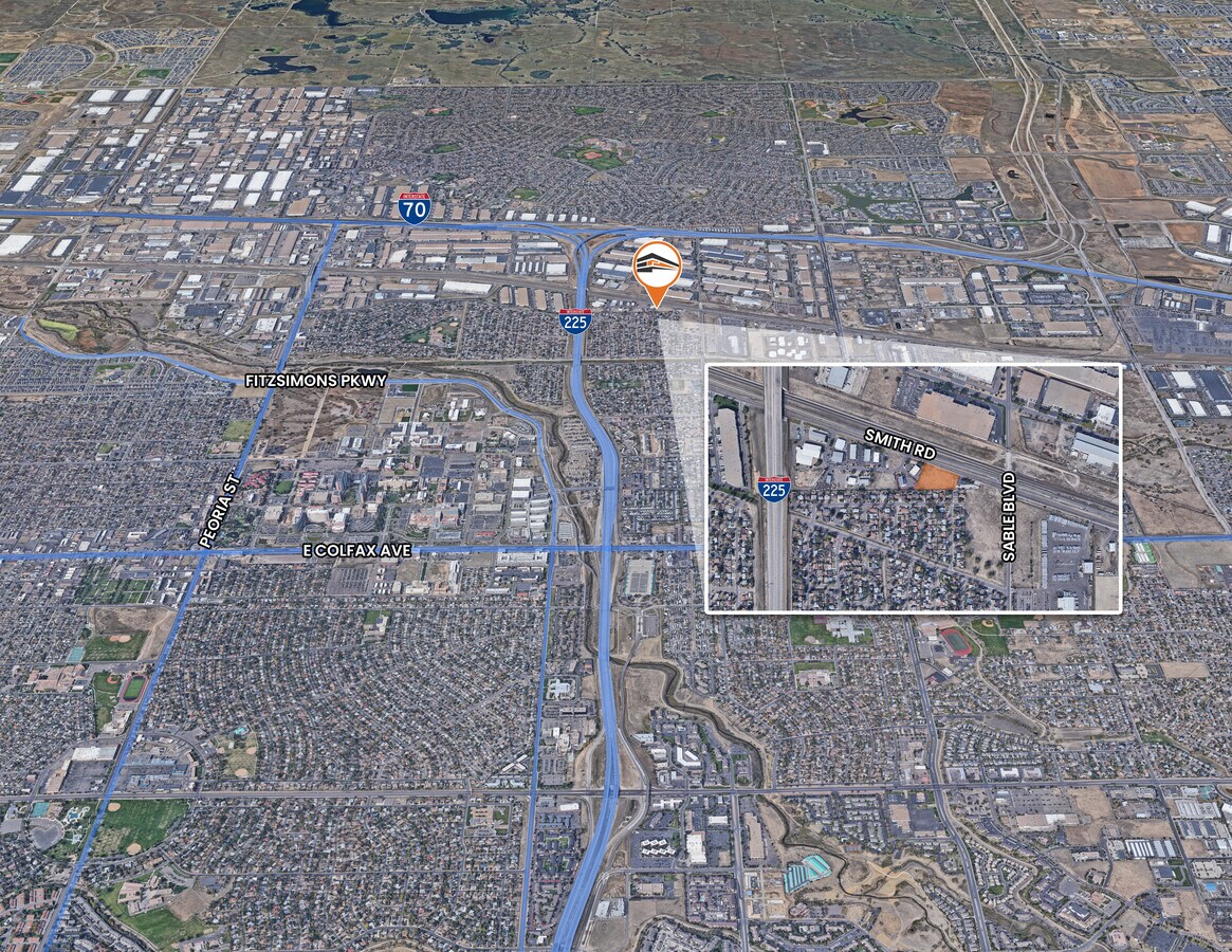
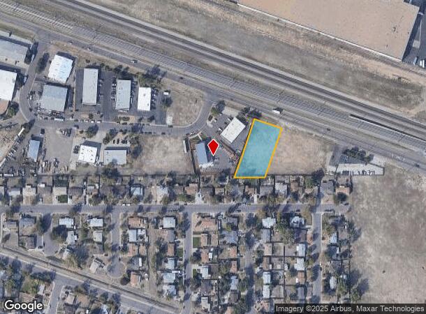
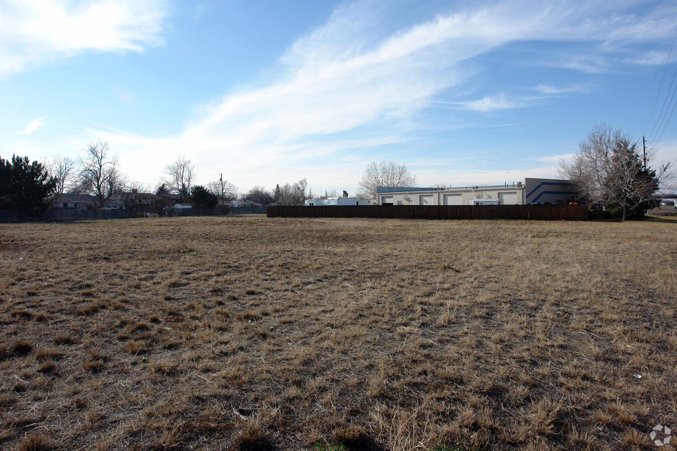
14104 E Smith Dr, Aurora, CO 80011
This Property Is For Sale
NEARBY LISTINGS FOR SALE OR LEASE
Property Detail
14104 E Smith Dr
Denver-Aurora-Lakewood, CO
Smith Road Industrial Park Filing No 2
1821-30-0-12-014
SUB:SMITH ROAD INDUSTRIAL PARK FILING NO 2 BLK:1 LOT:7
Commercialacreage
Adams
X
Colorado
08005C0039L
7
2023
0.70 AC
2024
Aurora
008200
Denver
DEMOGRAPHICS near 14104 E Smith Dr
1 Mile
3 Mile
5 Mile
2024 Total Population
9,205
121,248
300,106
2029 Population
9,497
123,223
305,165
Pop Growth 2024-2029
+ 3.17%
+ 1.63%
+ 1.69%
Average Age
36
35
35
2024 Total Households
2,570
38,529
103,829
HH Growth 2024-2029
+ 3.27%
+ 1.82%
+ 1.76%
Median Household Inc
$76,217
$63,924
$69,009
Avg Household Size
3.20
2.90
2.70
2024 Avg HH Vehicles
2.00
2.00
2.00
Median Home Value
$350,668
$354,580
$390,156
Median Year Built
1975
1982
1986
Nearby Places
- Restaurants
- Banks
- Shops
- Fitness
- Groceries
PUBLIC TRANSPORTATION
COMMUTER RAIL
Peoria Station Track 1 (Union Station to Denver Airport Station - Regional Transportation District)
DRIVE
WALK
Distance
Peoria Station Track 1 (Union Station to Denver Airport Station - Regional Transportation District)
6 min
2.5 mi
Peoria Station Track 2 (Union Station to Denver Airport Station - Regional Transportation District)
DRIVE
WALK
Distance
Peoria Station Track 2 (Union Station to Denver Airport Station - Regional Transportation District)
6 min
2.6 mi
AIRPORT
Denver International
DRIVE
WALK
Distance
Denver International
19 min
14.0 mi
Freight Ports
Tulsa Port Of Catoosa
DRIVE
WALK
Distance
Tulsa Port Of Catoosa
716 min
699.5 mi
Nearby Properties
Address
Land Use
TOTAL SIZE
Lot Size
Zoning
Address
Land Use
TOTAL SIZE
Lot Size
Zoning
353,829 SF
4.51 AC
Address
Land Use
TOTAL SIZE
Lot Size
Zoning
368,450 SF
48.59 AC
Address
Land Use
TOTAL SIZE
Lot Size
Zoning
880,442 SF
67.95 AC
I-B
Address
Land Use
TOTAL SIZE
Lot Size
Zoning
525,050 SF
105.06 AC
Address
Land Use
TOTAL SIZE
Lot Size
Zoning
868,780 SF
105.02 AC
Address
Land Use
TOTAL SIZE
Lot Size
Zoning
461,580 SF
23.56 AC
Address
Land Use
TOTAL SIZE
Lot Size
Zoning
335,757 SF
36.88 AC
CMP-EI2
Address
Land Use
TOTAL SIZE
Lot Size
Zoning
273,184 SF
1.89 AC
Address
Land Use
TOTAL SIZE
Lot Size
Zoning
390,822 SF
13.47 AC
O-1
Address
Land Use
TOTAL SIZE
Lot Size
Zoning
876,549 SF
46.65 AC
Address
Land Use
TOTAL SIZE
Lot Size
Zoning
691,200 SF
38.09 AC
Address
Land Use
TOTAL SIZE
Lot Size
Zoning
550,031 SF
37.73 AC
Address
Land Use
TOTAL SIZE
Lot Size
Zoning
200,105 SF
34.54 AC
C-MU-20
Address
Land Use
TOTAL SIZE
Lot Size
Zoning
512,720 SF
42.32 AC
Address
Land Use
TOTAL SIZE
Lot Size
Zoning
46,125 SF
87.83 AC
PUD
Address
Land Use
TOTAL SIZE
Lot Size
Zoning
287,550 SF
18.66 AC
Address
Land Use
TOTAL SIZE
Lot Size
Zoning
672,521 SF
0.61 AC
RB3
Address
Land Use
TOTAL SIZE
Lot Size
Zoning
178,235 SF
1.38 AC
RFBAD
Address
Land Use
TOTAL SIZE
Lot Size
Zoning
244,920 SF
12.87 AC
Address
Land Use
TOTAL SIZE
Lot Size
Zoning
419,630 SF
24.34 AC
Address
Land Use
TOTAL SIZE
Lot Size
Zoning
290,147 SF
22.02 AC
Address
Land Use
TOTAL SIZE
Lot Size
Zoning
466,055 SF
24.82 AC
M-IMX-5
Address
Land Use
TOTAL SIZE
Lot Size
Zoning
347,840 SF
19.95 AC
Address
Land Use
TOTAL SIZE
Lot Size
Zoning
400,000 SF
22.91 AC
I-0
Address
Land Use
TOTAL SIZE
Lot Size
Zoning
458,020 SF
18.65 AC
I-B
Address
Land Use
TOTAL SIZE
Lot Size
Zoning
269,622 SF
12.90 AC
Address
Land Use
TOTAL SIZE
Lot Size
Zoning
111,358 SF
1.21 AC
Address
Land Use
TOTAL SIZE
Lot Size
Zoning
424,700 SF
31.64 AC
PUD
Address
Land Use
TOTAL SIZE
Lot Size
Zoning
426,510 SF
32.17 AC
GTWY
Address
Land Use
TOTAL SIZE
Lot Size
Zoning
385,187 SF
26.62 AC
The World's #1 Commercial Real Estate Marketplace
Connect with us
© 2025 CoStar Group
The information above has been obtained from sources believed reliable. While we do not doubt its accuracy we have not verified it and make no guarantee, warranty or representation about it. It is your responsibility to independently confirm its accuracy and completeness. Any projections, opinions, assumptions, or estimates used are for example only and do not represent the current or future performance of the property. The value of this transaction to you depends on tax and other factors which should be evaluated by your tax, financial, and legal advisors. You and your advisors should conduct a careful, independent investigation of the property to determine to your satisfaction the suitability of the property for your needs.