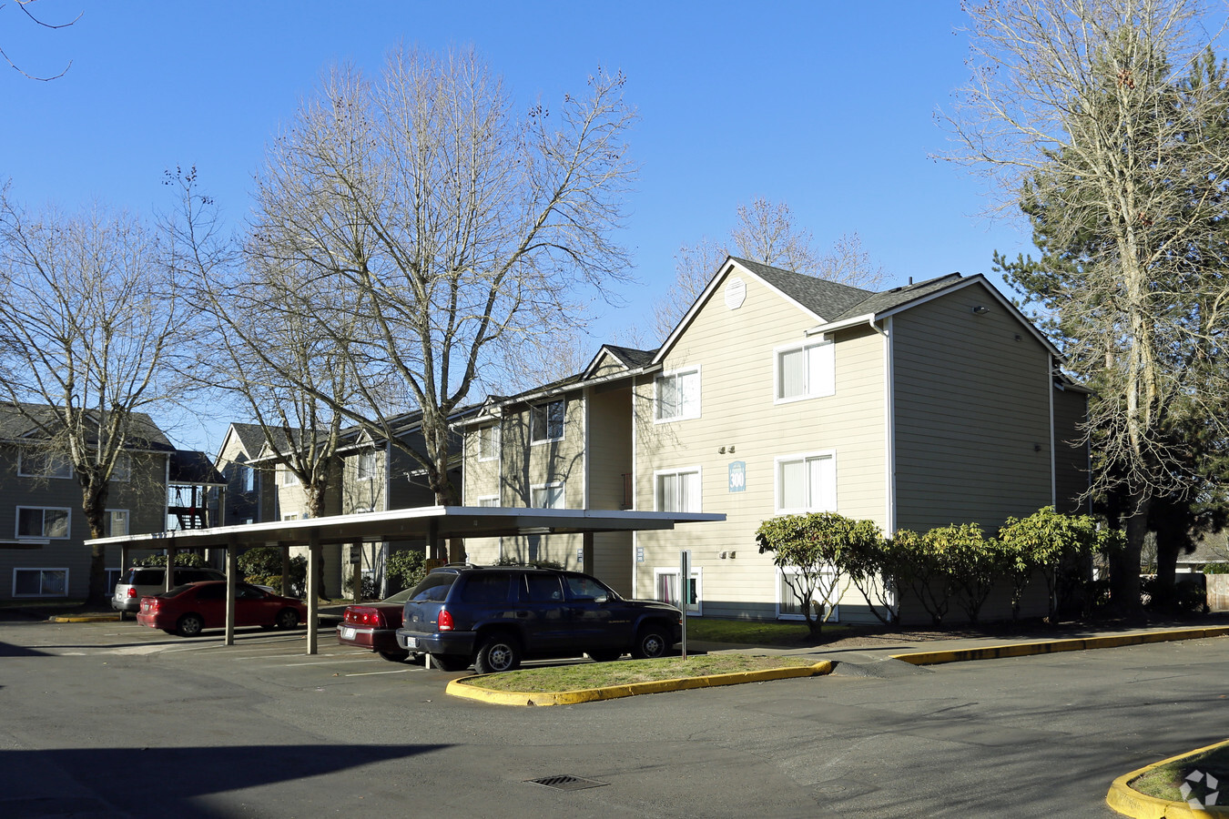
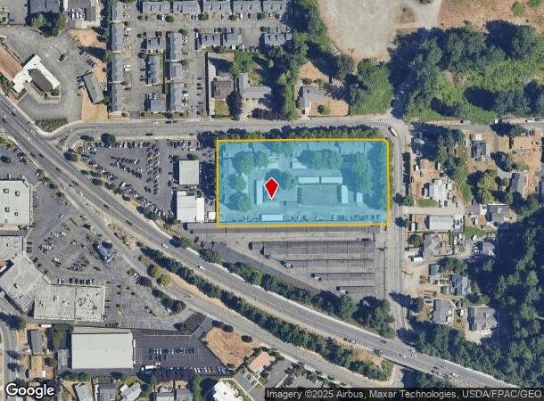
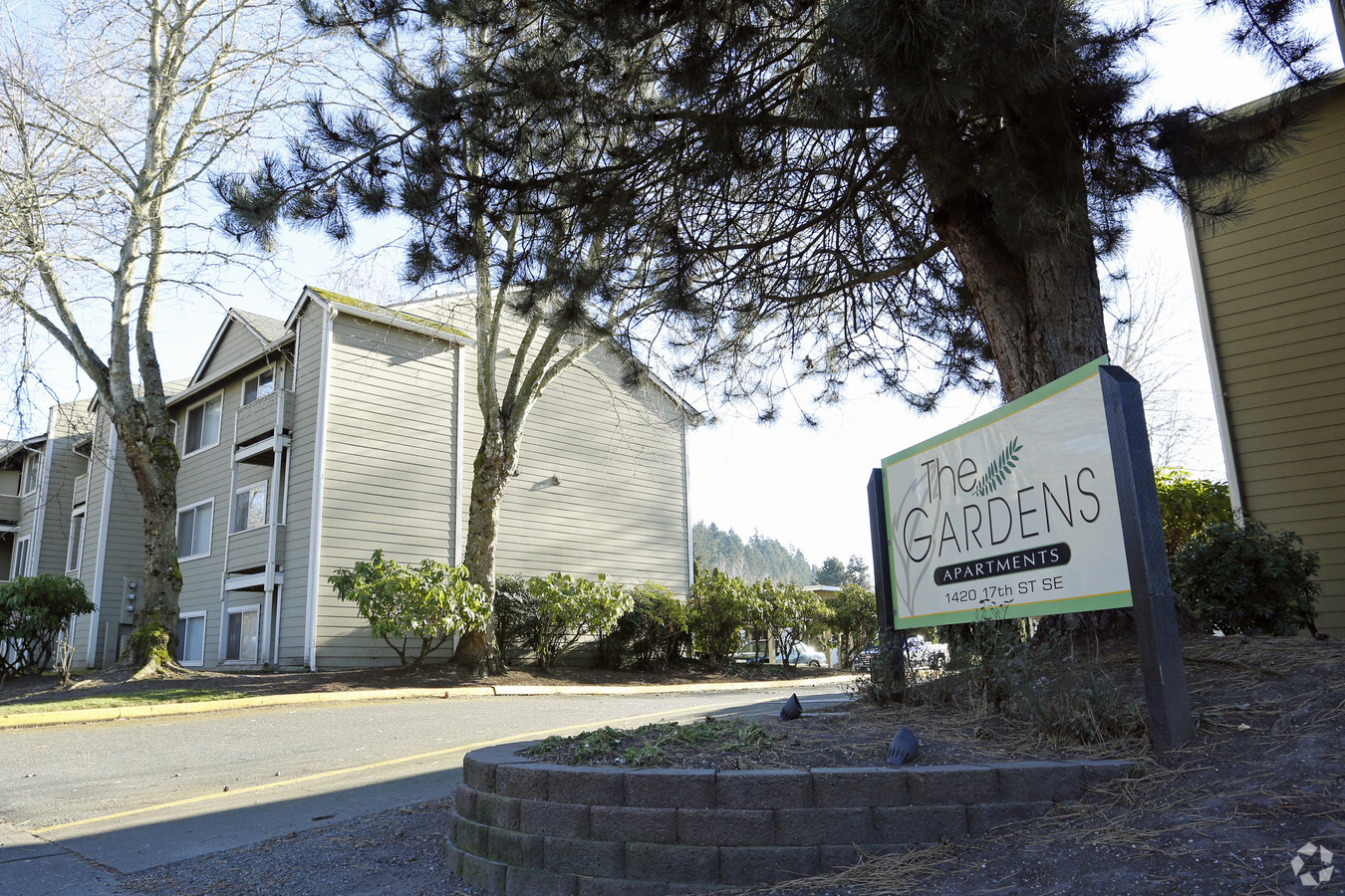
Property Record
1420 17Th St Se, Auburn, WA 98002
NEARBY LISTINGS FOR SALE OR LEASE
Property Detail
1420 17Th St Se
Seattle-Tacoma-Bellevue, WA
Lot Line Adjustment #Lla-4-87
192105-9063
POR OF NE 1/4 OF SE 1/4 LY NELY OF SR #5 DAF N 217.07 FT OF E 229.63 FT OF SD NE 1/4 OF NE 1/4 LESS CO RD RDS TGW POR LOT 2 AU SP 21-79 REC #8001150343 LY ELY OF LN DAF - BEG SE COR SD LOT 2 TH S 89-38-35 W 510 FT TO TPOB OF SD LN TH N 0-04-14 E 253.
Apartment
King
X
Washington
53033C1262G
2
2025
2.96 AC
2024
Plateau
031101
Seattle/Puget Sound
64,734 SF
DEMOGRAPHICS near 1420 17Th St Se
1 Mile
3 Mile
5 Mile
2024 Total Population
16,533
76,893
159,945
2029 Population
16,486
77,248
161,448
Pop Growth 2024-2029
(0.28%)
+ 0.46%
+ 0.94%
Average Age
37
38
39
2024 Total Households
5,850
27,033
54,843
HH Growth 2024-2029
(0.50%)
+ 0.32%
+ 0.84%
Median Household Inc
$61,443
$76,592
$88,154
Avg Household Size
2.70
2.70
2.80
2024 Avg HH Vehicles
2.00
2.00
2.00
Median Home Value
$323,731
$401,197
$465,017
Median Year Built
1971
1985
1987
Nearby Places
- Restaurants
- Banks
- Shops
- Fitness
- Groceries
PUBLIC TRANSPORTATION
COMMUTER RAIL
Auburn Station (Sounder South Line - Central Puget Sound Regional Transit Authority Rail (Link Light Rail/Sounder))
DRIVE
WALK
Distance
Auburn Station (Sounder South Line - Central Puget Sound Regional Transit Authority Rail (Link Light Rail/Sounder))
5 min
1.7 mi
Kent Station (Sounder South Line - Central Puget Sound Regional Transit Authority Rail (Link Light Rail/Sounder))
DRIVE
WALK
Distance
Kent Station (Sounder South Line - Central Puget Sound Regional Transit Authority Rail (Link Light Rail/Sounder))
15 min
8.5 mi
AIRPORT
Seattle-Tacoma International
DRIVE
WALK
Distance
Seattle-Tacoma International
29 min
15.7 mi
Freight Ports
Port of Tacoma
DRIVE
WALK
Distance
Port of Tacoma
22 min
13.7 mi
Nearby Properties
Address
Land Use
TOTAL SIZE
Lot Size
Zoning
Address
Land Use
TOTAL SIZE
Lot Size
Zoning
524,636 SF
102.28 AC
M2
Address
Land Use
TOTAL SIZE
Lot Size
Zoning
369,280 SF
31.30 AC
M1
Address
Land Use
TOTAL SIZE
Lot Size
Zoning
662,963 SF
29.75 AC
M2
Address
Land Use
TOTAL SIZE
Lot Size
Zoning
749,967 SF
39.82 AC
M2
Address
Land Use
TOTAL SIZE
Lot Size
Zoning
63,950 SF
127.86 AC
C3
Address
Land Use
TOTAL SIZE
Lot Size
Zoning
217,000 SF
19.99 AC
R20
Address
Land Use
TOTAL SIZE
Lot Size
Zoning
326,634 SF
14.40 AC
C1
Address
Land Use
TOTAL SIZE
Lot Size
Zoning
9,765 SF
87.33 AC
I
Address
Land Use
TOTAL SIZE
Lot Size
Zoning
923,143 SF
90.42 AC
C3
Address
Land Use
TOTAL SIZE
Lot Size
Zoning
245,393 SF
2.48 AC
DUC
Address
Land Use
TOTAL SIZE
Lot Size
Zoning
288,600 SF
21.93 AC
M2
Address
Land Use
TOTAL SIZE
Lot Size
Zoning
287,945 SF
11.12 AC
M-1
Address
Land Use
TOTAL SIZE
Lot Size
Zoning
286,350 SF
13.84 AC
M1
Address
Land Use
TOTAL SIZE
Lot Size
Zoning
278,038 SF
12.91 AC
M-1
Address
Land Use
TOTAL SIZE
Lot Size
Zoning
270,739 SF
12.20 AC
M-1
Address
Land Use
TOTAL SIZE
Lot Size
Zoning
160,432 SF
4.70 AC
C1
Address
Land Use
TOTAL SIZE
Lot Size
Zoning
204,727 SF
18.63 AC
TV
Address
Land Use
TOTAL SIZE
Lot Size
Zoning
258,308 SF
10.55 AC
M2
Address
Land Use
TOTAL SIZE
Lot Size
Zoning
68,040 SF
14.68 AC
M1
Address
Land Use
TOTAL SIZE
Lot Size
Zoning
205,443 SF
11.41 AC
M2
Address
Land Use
TOTAL SIZE
Lot Size
Zoning
125,664 SF
5.28 AC
R20
Address
Land Use
TOTAL SIZE
Lot Size
Zoning
158,650 SF
9.24 AC
R20
Address
Land Use
TOTAL SIZE
Lot Size
Zoning
218,316 SF
8.69 AC
M-1
Address
Land Use
TOTAL SIZE
Lot Size
Zoning
186,749 SF
6.14 AC
P1
Address
Land Use
TOTAL SIZE
Lot Size
Zoning
144,780 SF
9.54 AC
R20
Address
Land Use
TOTAL SIZE
Lot Size
Zoning
206,001 SF
10.69 AC
M-1
Address
Land Use
TOTAL SIZE
Lot Size
Zoning
144,157 SF
5.99 AC
C3
Address
Land Use
TOTAL SIZE
Lot Size
Zoning
109,403 SF
17.68 AC
P1
The World's #1 Commercial Real Estate Marketplace
Connect with us
© 2025 CoStar Group
The information above has been obtained from sources believed reliable. While we do not doubt its accuracy we have not verified it and make no guarantee, warranty or representation about it. It is your responsibility to independently confirm its accuracy and completeness. Any projections, opinions, assumptions, or estimates used are for example only and do not represent the current or future performance of the property. The value of this transaction to you depends on tax and other factors which should be evaluated by your tax, financial, and legal advisors. You and your advisors should conduct a careful, independent investigation of the property to determine to your satisfaction the suitability of the property for your needs.