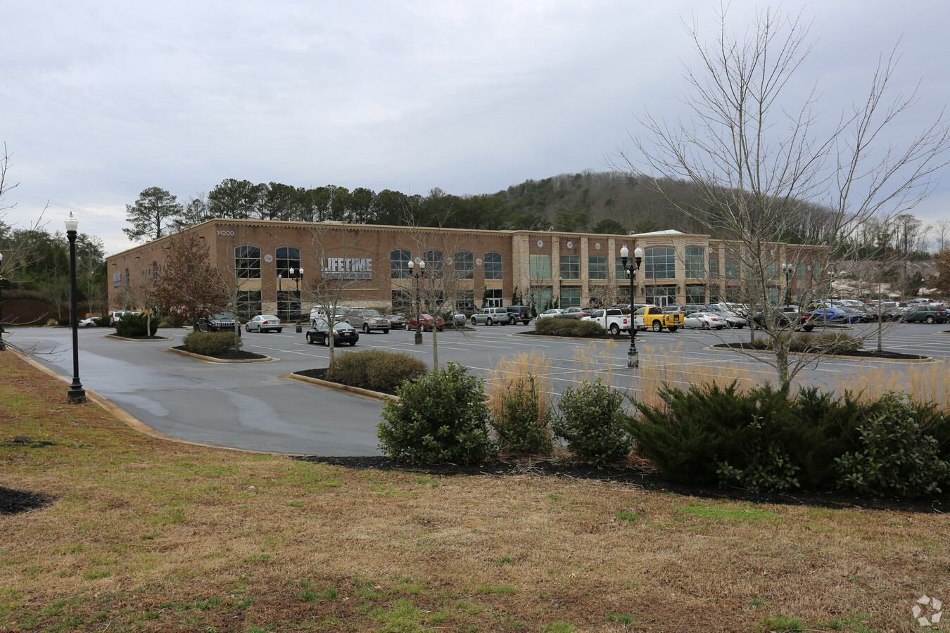
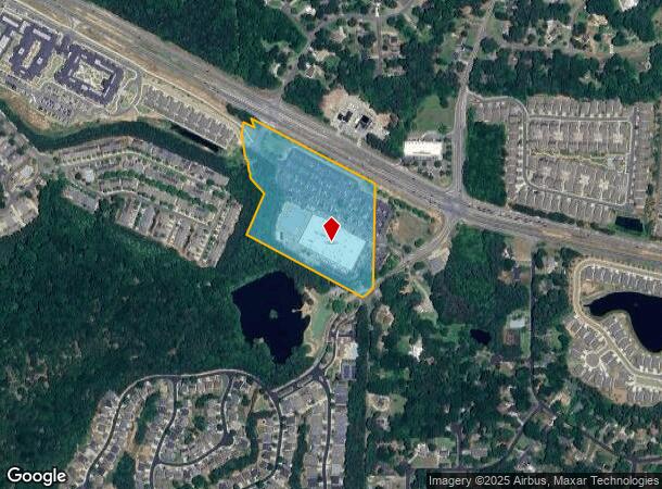
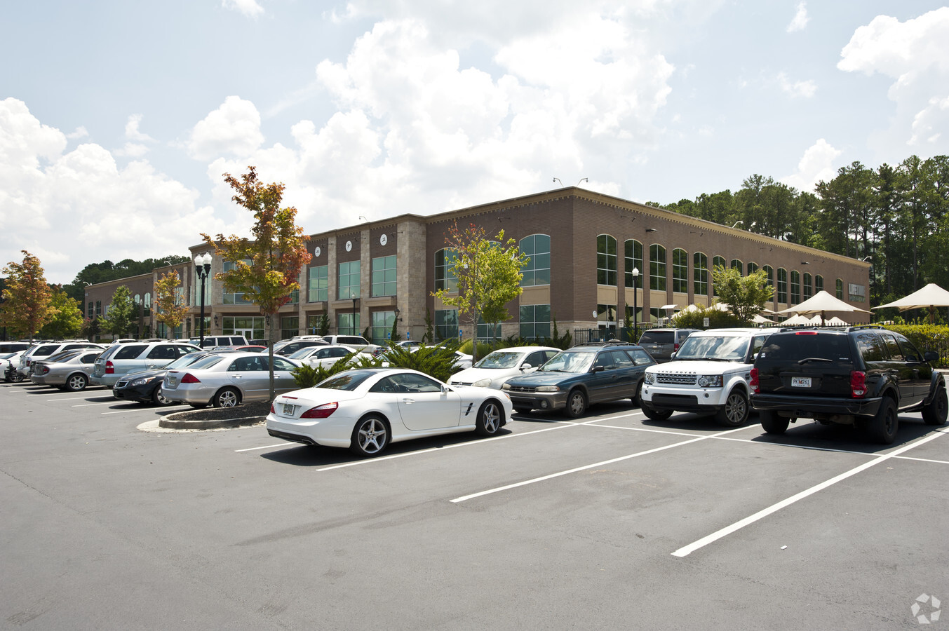
Property Record
14200 Highway 92, Woodstock, GA 30188
NEARBY LISTINGS FOR SALE OR LEASE
Property Detail
14200 Highway 92
015N24-00000-211-00B-0000
LL 1197, 1251; 15TH D TRACT 4
Gymhealthspa
Cherokee
X
Georgia
13057C0354E
11.17 AC
2024
Cherokee/Woodstock
2024
Atlanta
090906
Atlanta-Sandy Springs-Roswell, GA
114,080 SF
DEMOGRAPHICS near 14200 Highway 92
1 Mile
3 Mile
5 Mile
2024 Total Population
8,243
61,224
149,042
2029 Population
9,465
66,244
159,427
Pop Growth 2024-2029
+ 14.82%
+ 8.20%
+ 6.97%
Average Age
42
41
41
2024 Total Households
3,253
21,908
53,710
HH Growth 2024-2029
+ 15.12%
+ 8.72%
+ 7.39%
Median Household Inc
$106,878
$120,305
$118,512
Avg Household Size
2.50
2.70
2.70
2024 Avg HH Vehicles
2.00
2.00
2.00
Median Home Value
$347,227
$391,754
$405,172
Median Year Built
2003
1991
1990
Nearby Places
- Restaurants
- Banks
- Shops
- Fitness
- Groceries
Nearby Properties
Address
Land Use
TOTAL SIZE
Lot Size
Zoning
Address
Land Use
TOTAL SIZE
Lot Size
Zoning
288,158 SF
25.03 AC
R-40
Address
Land Use
TOTAL SIZE
Lot Size
Zoning
367,731 SF
20.40 AC
GC
Address
Land Use
TOTAL SIZE
Lot Size
Zoning
328,203 SF
71 AC
R-40
Address
Land Use
TOTAL SIZE
Lot Size
Zoning
22,960 SF
34.63 AC
R-40
Address
Land Use
TOTAL SIZE
Lot Size
Zoning
139,694 SF
16.35 AC
GC/WS
Address
Land Use
TOTAL SIZE
Lot Size
Zoning
134,017 SF
31.50 AC
R-40
Address
Land Use
TOTAL SIZE
Lot Size
Zoning
186,090 SF
30.08 AC
GC
Address
Land Use
TOTAL SIZE
Lot Size
Zoning
133,856 SF
5.77 AC
R-80
Address
Land Use
TOTAL SIZE
Lot Size
Zoning
121,240 SF
21.04 AC
R1C
Address
Land Use
TOTAL SIZE
Lot Size
Zoning
105,600 SF
2.13 AC
GC
Address
Land Use
TOTAL SIZE
Lot Size
Zoning
107,572 SF
1.83 AC
GC
Address
Land Use
TOTAL SIZE
Lot Size
Zoning
54,336 SF
10.21 AC
GC
Address
Land Use
TOTAL SIZE
Lot Size
Zoning
86,806 SF
4.09 AC
OI
Address
Land Use
TOTAL SIZE
Lot Size
Zoning
56,868 SF
6.41 AC
CRC
Address
Land Use
TOTAL SIZE
Lot Size
Zoning
1,800 SF
3.01 AC
GC
Address
Land Use
TOTAL SIZE
Lot Size
Zoning
35,603 SF
12.25 AC
GC
Address
Land Use
TOTAL SIZE
Lot Size
Zoning
105,216 SF
10.42 AC
GC
Address
Land Use
TOTAL SIZE
Lot Size
Zoning
69,407 SF
5.42 AC
PUD
Address
Land Use
TOTAL SIZE
Lot Size
Zoning
79,905 SF
3.39 AC
NRC
Address
Land Use
TOTAL SIZE
Lot Size
Zoning
33,410 SF
4.54 AC
GC/WS
Address
Land Use
TOTAL SIZE
Lot Size
Zoning
59,690 SF
9.30 AC
GC
Address
Land Use
TOTAL SIZE
Lot Size
Zoning
45,334 SF
7.49 AC
GC
Address
Land Use
TOTAL SIZE
Lot Size
Zoning
25,858 SF
35.79 AC
R-40
Address
Land Use
TOTAL SIZE
Lot Size
Zoning
1,750 SF
28.15 AC
R-40
Address
Land Use
TOTAL SIZE
Lot Size
Zoning
56,899 SF
13.85 AC
NRC/R-15
Address
Land Use
TOTAL SIZE
Lot Size
Zoning
24,840 SF
10.47 AC
GC
Address
Land Use
TOTAL SIZE
Lot Size
Zoning
50,009 SF
13.43 AC
NC
Address
Land Use
TOTAL SIZE
Lot Size
Zoning
78,906 SF
5.39 AC
CRC
Address
Land Use
TOTAL SIZE
Lot Size
Zoning
58,135 SF
3.80 AC
NRC
The World's #1 Commercial Real Estate Marketplace
Connect with us
© 2025 CoStar Group
The information above has been obtained from sources believed reliable. While we do not doubt its accuracy we have not verified it and make no guarantee, warranty or representation about it. It is your responsibility to independently confirm its accuracy and completeness. Any projections, opinions, assumptions, or estimates used are for example only and do not represent the current or future performance of the property. The value of this transaction to you depends on tax and other factors which should be evaluated by your tax, financial, and legal advisors. You and your advisors should conduct a careful, independent investigation of the property to determine to your satisfaction the suitability of the property for your needs.