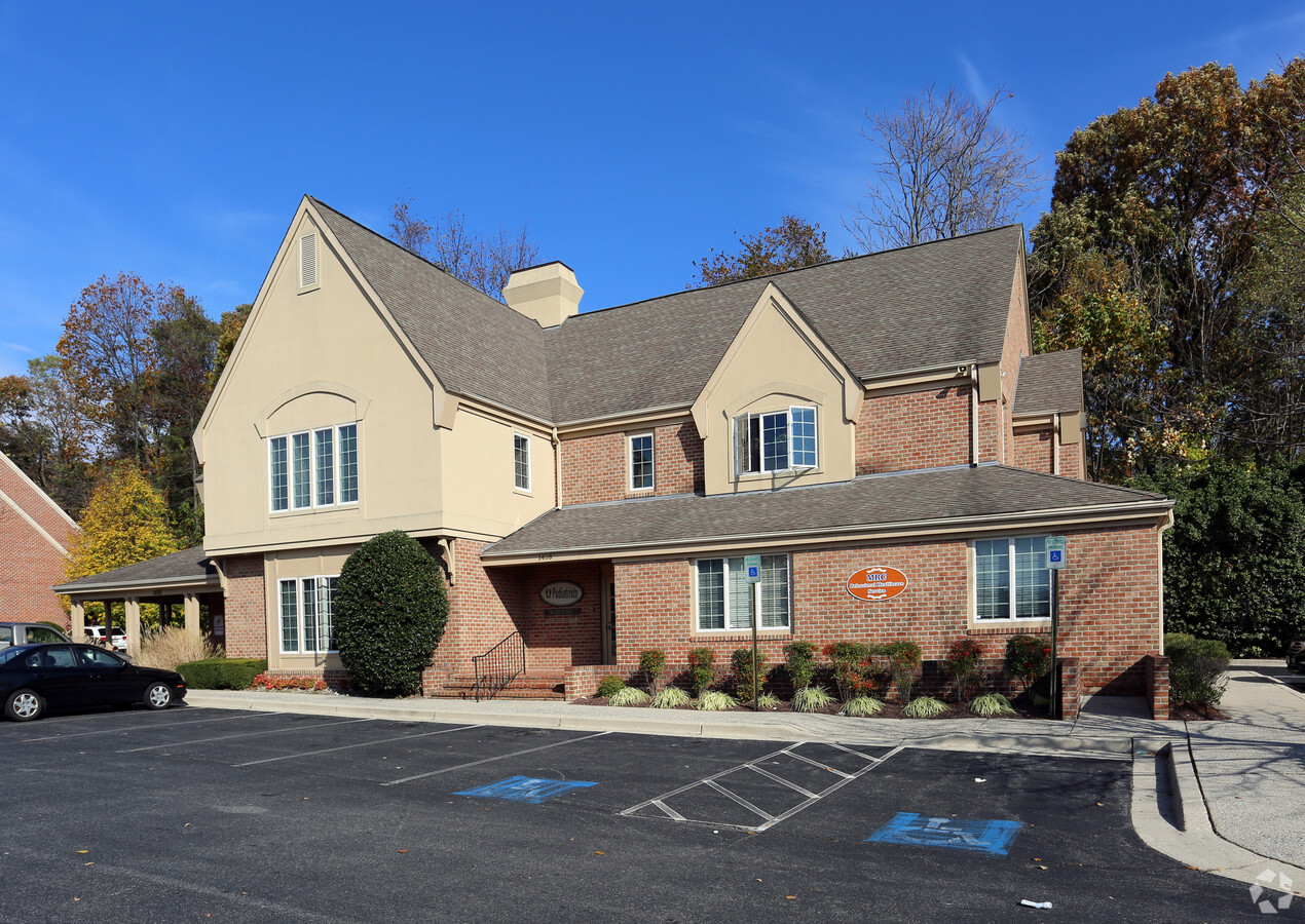
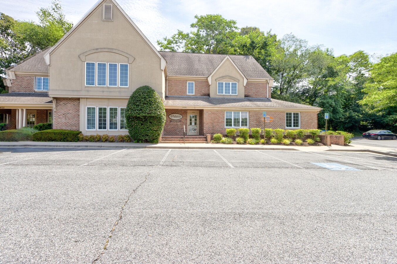
Property Record
1405 Madison Park Dr, Glen Burnie, MD 21061
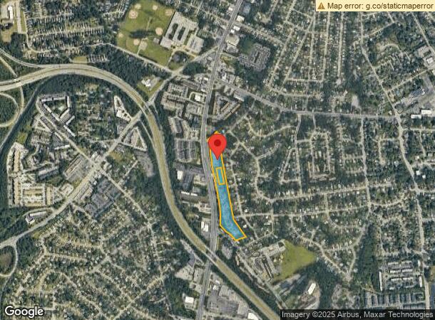

NEARBY LISTINGS FOR SALE OR LEASE
Property Detail
1405 Madison Park Dr
03-511-90098795
Madison Park
Officecondo
BLD C PH 1 MADISON PARK
X
Anne Arundel
24003C0044E
Maryland
2024
0.13 AC
2024
Route 2 Corridor North
730403
Baltimore
8,629 SF
Baltimore-Columbia-Towson, MD
DEMOGRAPHICS near 1405 Madison Park Dr
1 Mile
3 Mile
5 Mile
2024 Total Population
18,576
89,464
195,290
2029 Population
18,953
91,430
199,876
Pop Growth 2024-2029
+ 2.03%
+ 2.20%
+ 2.35%
Average Age
38
39
39
2024 Total Households
7,159
33,967
72,089
HH Growth 2024-2029
+ 2.08%
+ 2.24%
+ 2.43%
Median Household Inc
$71,641
$86,550
$97,840
Avg Household Size
2.50
2.60
2.60
2024 Avg HH Vehicles
2.00
2.00
2.00
Median Home Value
$278,208
$329,295
$358,889
Median Year Built
1968
1974
1980
Nearby Places
- Restaurants
- Banks
- Shops
- Fitness
- Groceries
PUBLIC TRANSPORTATION
COMMUTER RAIL
Bwi Airport (Penn Line - Maryland Area Regional Commuter Trains (The MARC))
DRIVE
WALK
Distance
Bwi Airport (Penn Line - Maryland Area Regional Commuter Trains (The MARC))
14 min
6.6 mi
Odenton (Penn Line - Maryland Area Regional Commuter Trains (The MARC))
DRIVE
WALK
Distance
Odenton (Penn Line - Maryland Area Regional Commuter Trains (The MARC))
15 min
7.8 mi
AIRPORT
Baltimore/Washington International Thurgood Marshall
DRIVE
WALK
Distance
Baltimore/Washington International Thurgood Marshall
13 min
6.2 mi
Ronald Reagan Washington Ntl
DRIVE
WALK
Distance
Ronald Reagan Washington Ntl
57 min
38.7 mi
Freight Ports
Port of Baltimore
DRIVE
WALK
Distance
Port of Baltimore
21 min
11.9 mi
SALE & LEASE HISTORY
LISTING DATE
SALE/LEASE

Jul 26, 2024
For Lease
Nearby Properties
Address
Land Use
TOTAL SIZE
Lot Size
Zoning
Address
Land Use
TOTAL SIZE
Lot Size
Zoning
637,060 SF
22.19 AC
C2
Address
Land Use
TOTAL SIZE
Lot Size
Zoning
851,355 SF
172.49 AC
R5
Address
Land Use
TOTAL SIZE
Lot Size
Zoning
312,489 SF
9.04 AC
C3
Address
Land Use
TOTAL SIZE
Lot Size
Zoning
176,405 SF
41.81 AC
C3
Address
Land Use
TOTAL SIZE
Lot Size
Zoning
32.18 AC
R15
Address
Land Use
TOTAL SIZE
Lot Size
Zoning
374,664 SF
22.89 AC
R15
Address
Land Use
TOTAL SIZE
Lot Size
Zoning
11.57 AC
R22
Address
Land Use
TOTAL SIZE
Lot Size
Zoning
1,555.10 AC
R1
Address
Land Use
TOTAL SIZE
Lot Size
Zoning
14.21 AC
R15
Address
Land Use
TOTAL SIZE
Lot Size
Zoning
28.02 AC
R15
Address
Land Use
TOTAL SIZE
Lot Size
Zoning
15.33 AC
R15
Address
Land Use
TOTAL SIZE
Lot Size
Zoning
21.45 AC
R15
Address
Land Use
TOTAL SIZE
Lot Size
Zoning
239 AC
R22
Address
Land Use
TOTAL SIZE
Lot Size
Zoning
14.58 AC
R22
Address
Land Use
TOTAL SIZE
Lot Size
Zoning
154,044 SF
16.89 AC
C3
Address
Land Use
TOTAL SIZE
Lot Size
Zoning
7.07 AC
R15
Address
Land Use
TOTAL SIZE
Lot Size
Zoning
16.72 AC
R15
Address
Land Use
TOTAL SIZE
Lot Size
Zoning
18.93 AC
R15
Address
Land Use
TOTAL SIZE
Lot Size
Zoning
9.45 AC
R22
Address
Land Use
TOTAL SIZE
Lot Size
Zoning
277,203 SF
15.88 AC
R15
Address
Land Use
TOTAL SIZE
Lot Size
Zoning
5.95 AC
R22
Address
Land Use
TOTAL SIZE
Lot Size
Zoning
240 AC
R15
Address
Land Use
TOTAL SIZE
Lot Size
Zoning
218,565 SF
20.87 AC
C3
Address
Land Use
TOTAL SIZE
Lot Size
Zoning
8.78 AC
R15
Address
Land Use
TOTAL SIZE
Lot Size
Zoning
10.92 AC
R15
Address
Land Use
TOTAL SIZE
Lot Size
Zoning
7.23 AC
R22
Address
Land Use
TOTAL SIZE
Lot Size
Zoning
106,760 SF
5.09 AC
C4
Address
Land Use
TOTAL SIZE
Lot Size
Zoning
13.03 AC
R15
Address
Land Use
TOTAL SIZE
Lot Size
Zoning
28,188 SF
6.51 AC
C3
Address
Land Use
TOTAL SIZE
Lot Size
Zoning
6.95 AC
R15
The World's #1 Commercial Real Estate Marketplace
Connect with us
© 2025 CoStar Group
The information above has been obtained from sources believed reliable. While we do not doubt its accuracy we have not verified it and make no guarantee, warranty or representation about it. It is your responsibility to independently confirm its accuracy and completeness. Any projections, opinions, assumptions, or estimates used are for example only and do not represent the current or future performance of the property. The value of this transaction to you depends on tax and other factors which should be evaluated by your tax, financial, and legal advisors. You and your advisors should conduct a careful, independent investigation of the property to determine to your satisfaction the suitability of the property for your needs.