Property Record
14218 E 126Th St N, Collinsville, OK 74021
NEARBY LISTINGS FOR SALE OR LEASE
-
-
View all Collinsville listings for sale on LoopNet.com
Property Detail
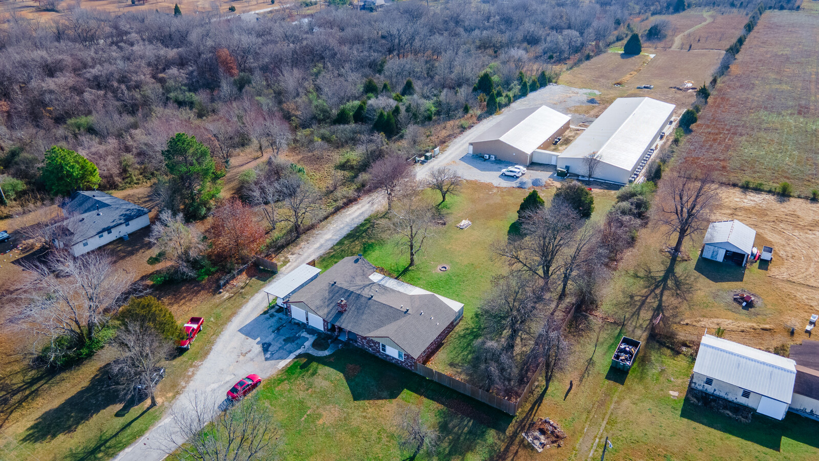
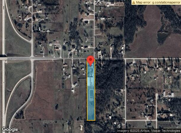
14218 E 126Th St N
91404-14-04-01910
Unplatted
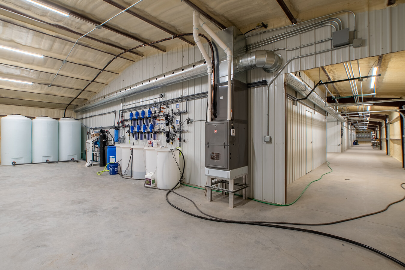
Warehouse
W/2 NE NE LESS W495 THEREOF & LESS N16.5 THEREOF FOR RD SEC 4 21 14 4.94AC
X
Tulsa
40131C0250H
Oklahoma
2023
4.94 AC
2024
Northeast Tulsa
005810
Tulsa
17,008 SF
Tulsa, OK
DEMOGRAPHICS near 14218 E 126Th St N
1 Mile
3 Mile
5 Mile
2024 Total Population
2,313
25,687
62,162
2029 Population
2,440
26,870
65,183
Pop Growth 2024-2029
+ 5.49%
+ 4.61%
+ 4.86%
Average Age
38
37
38
2024 Total Households
856
9,433
22,862
HH Growth 2024-2029
+ 5.49%
+ 4.59%
+ 4.83%
Median Household Inc
$74,650
$75,897
$78,740
Avg Household Size
2.70
2.70
2.70
2024 Avg HH Vehicles
2.00
2.00
2.00
Median Home Value
$217,976
$195,094
$215,349
Median Year Built
2005
2001
1998
Nearby Places
- Restaurants
- Banks
- Shops
- Fitness
- Groceries
PUBLIC TRANSPORTATION
AIRPORT
Tulsa International
DRIVE
WALK
Distance
Tulsa International
17 min
12.7 mi
Freight Ports
Tulsa Port Of Catoosa
DRIVE
WALK
Distance
Tulsa Port Of Catoosa
20 min
15.6 mi
SALE & LEASE HISTORY
LISTING DATE
SALE/LEASE

Dec 21, 2021
For Sale
Nearby Properties
Address
Land Use
TOTAL SIZE
Lot Size
Zoning
Address
Land Use
TOTAL SIZE
Lot Size
Zoning
299,471 SF
64.32 AC
AG
Address
Land Use
TOTAL SIZE
Lot Size
Zoning
111,792 SF
12.43 AC
OM
Address
Land Use
TOTAL SIZE
Lot Size
Zoning
47,798 SF
5.13 AC
CS
Address
Land Use
TOTAL SIZE
Lot Size
Zoning
105,098 SF
18.22 AC
RS2
Address
Land Use
TOTAL SIZE
Lot Size
Zoning
43,882 SF
10 AC
AG
Address
Land Use
TOTAL SIZE
Lot Size
Zoning
270,386 SF
14.65 AC
RM
Address
Land Use
TOTAL SIZE
Lot Size
Zoning
24,164 SF
11.81 AC
NCU
Address
Land Use
TOTAL SIZE
Lot Size
Zoning
22,679 SF
0.77 AC
CBD
Address
Land Use
TOTAL SIZE
Lot Size
Zoning
17,600 SF
15.04 AC
RE
Address
Land Use
TOTAL SIZE
Lot Size
Zoning
226,062 SF
11.78 AC
RM2
Address
Land Use
TOTAL SIZE
Lot Size
Zoning
22,874 SF
1.29 AC
CBD
Address
Land Use
TOTAL SIZE
Lot Size
Zoning
40,206 SF
3.72 AC
RS3
Address
Land Use
TOTAL SIZE
Lot Size
Zoning
40,822 SF
11.39 AC
AG
Address
Land Use
TOTAL SIZE
Lot Size
Zoning
28,400 SF
12.66 AC
AG
Address
Land Use
TOTAL SIZE
Lot Size
Zoning
42,211 SF
0.64 AC
RS3
Address
Land Use
TOTAL SIZE
Lot Size
Zoning
133,301 SF
21.09 AC
RS3
Address
Land Use
TOTAL SIZE
Lot Size
Zoning
24,435 SF
4.41 AC
RE
Address
Land Use
TOTAL SIZE
Lot Size
Zoning
3,679 SF
33.74 AC
AG
Address
Land Use
TOTAL SIZE
Lot Size
Zoning
33,157 SF
3.82 AC
AGR
Address
Land Use
TOTAL SIZE
Lot Size
Zoning
14,934 SF
9.15 AC
AG
Address
Land Use
TOTAL SIZE
Lot Size
Zoning
61,622 SF
13.96 AC
CG
Address
Land Use
TOTAL SIZE
Lot Size
Zoning
103,300 SF
13.81 AC
CS
Address
Land Use
TOTAL SIZE
Lot Size
Zoning
8,334 SF
46.11 AC
AG
Address
Land Use
TOTAL SIZE
Lot Size
Zoning
60,970 SF
3.06 AC
OM
Address
Land Use
TOTAL SIZE
Lot Size
Zoning
17,044 SF
5.28 AC
RD
Address
Land Use
TOTAL SIZE
Lot Size
Zoning
43,414 SF
5 AC
CS
Address
Land Use
TOTAL SIZE
Lot Size
Zoning
16,097 SF
6.06 AC
AG
Address
Land Use
TOTAL SIZE
Lot Size
Zoning
16,942 SF
5.80 AC
AG
Address
Land Use
TOTAL SIZE
Lot Size
Zoning
143,419 SF
29.73 AC
IM
The World's #1 Commercial Real Estate Marketplace
Connect with us
© 2025 CoStar Group
The information above has been obtained from sources believed reliable. While we do not doubt its accuracy we have not verified it and make no guarantee, warranty or representation about it. It is your responsibility to independently confirm its accuracy and completeness. Any projections, opinions, assumptions, or estimates used are for example only and do not represent the current or future performance of the property. The value of this transaction to you depends on tax and other factors which should be evaluated by your tax, financial, and legal advisors. You and your advisors should conduct a careful, independent investigation of the property to determine to your satisfaction the suitability of the property for your needs.