Property Record
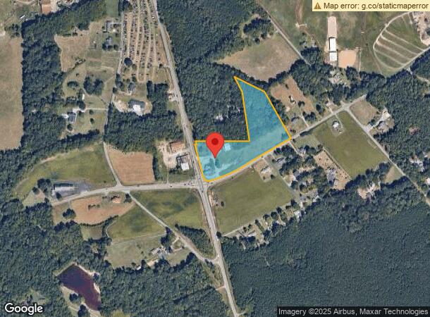
14250 Mountain Rd, Rockville, VA 23146

NEARBY LISTINGS FOR SALE OR LEASE
-
-
No Photo
-
View all Rockville listings for sale on LoopNet.com
Property Detail
14250 Mountain Rd
7749-71-9781
14200 BLK MOUNTAIN ROAD
Commercialnec
Hanover
X
Virginia
51085C0280C
5.16 AC
2024
I-95 North/Ashland
2024
Richmond VA
320300
Richmond, VA
1,383 SF
DEMOGRAPHICS near 14250 Mountain Rd
1 Mile
3 Mile
5 Mile
2024 Total Population
398
6,840
40,307
2029 Population
422
6,977
40,699
Pop Growth 2024-2029
+ 6.03%
+ 2.00%
+ 0.97%
Average Age
45
42
39
2024 Total Households
155
2,448
13,972
HH Growth 2024-2029
+ 6.45%
+ 2.25%
+ 1.16%
Median Household Inc
$94,642
$161,415
$155,250
Avg Household Size
2.50
2.80
2.80
2024 Avg HH Vehicles
3.00
3.00
2.00
Median Home Value
$457,692
$583,979
$519,234
Median Year Built
1987
1996
2000
Nearby Places
- Restaurants
- Banks
- Shops
- Fitness
- Groceries
PUBLIC TRANSPORTATION
COMMUTER RAIL
Ashland Amtrak (Northeast Regional - Amtrak)
DRIVE
WALK
Distance
Ashland Amtrak (Northeast Regional - Amtrak)
12 min
6.8 mi
Richmond Staples Mill Road Amtrak Station (Carolinian - Amtrak, Northeast Regional - Amtrak, Palmetto - Amtrak, Silver Meteor - Amtrak)
DRIVE
WALK
Distance
Richmond Staples Mill Road Amtrak Station (Carolinian - Amtrak, Northeast Regional - Amtrak, Palmetto - Amtrak, Silver Meteor - Amtrak)
15 min
9.6 mi
AIRPORT
Richmond International
DRIVE
WALK
Distance
Richmond International
37 min
27.4 mi
Freight Ports
Virginia Port Authority - Richmond
DRIVE
WALK
Distance
Virginia Port Authority - Richmond
37 min
23.8 mi
Nearby Properties
Address
Land Use
TOTAL SIZE
Lot Size
Zoning
Address
Land Use
TOTAL SIZE
Lot Size
Zoning
117,605 SF
29.24 AC
A-1
Address
Land Use
TOTAL SIZE
Lot Size
Zoning
170,850 SF
14.90 AC
M-2
Address
Land Use
TOTAL SIZE
Lot Size
Zoning
31,000 SF
205.22 AC
MIXE
Address
Land Use
TOTAL SIZE
Lot Size
Zoning
25,464 SF
67.21 AC
RC
Address
Land Use
TOTAL SIZE
Lot Size
Zoning
10,805 SF
238 AC
A-1
Address
Land Use
TOTAL SIZE
Lot Size
Zoning
10,904 SF
8.21 AC
A-1
Address
Land Use
TOTAL SIZE
Lot Size
Zoning
1,728 SF
229.50 AC
A-1
Address
Land Use
TOTAL SIZE
Lot Size
Zoning
3 AC
A-1
Address
Land Use
TOTAL SIZE
Lot Size
Zoning
9.19 AC
A-1
Address
Land Use
TOTAL SIZE
Lot Size
Zoning
6,158 SF
0.99 AC
A-1
Address
Land Use
TOTAL SIZE
Lot Size
Zoning
10,250 SF
47.28 AC
B-2
Address
Land Use
TOTAL SIZE
Lot Size
Zoning
6.04 AC
A-1
Address
Land Use
TOTAL SIZE
Lot Size
Zoning
2.36 AC
A-1
Address
Land Use
TOTAL SIZE
Lot Size
Zoning
10 AC
M-2
Address
Land Use
TOTAL SIZE
Lot Size
Zoning
105.41 AC
A-1
Address
Land Use
TOTAL SIZE
Lot Size
Zoning
4,272 SF
28.40 AC
A-1
Address
Land Use
TOTAL SIZE
Lot Size
Zoning
93.62 AC
A-1
Address
Land Use
TOTAL SIZE
Lot Size
Zoning
2,425 SF
2.07 AC
A-1
Address
Land Use
TOTAL SIZE
Lot Size
Zoning
115.70 AC
A-1
Address
Land Use
TOTAL SIZE
Lot Size
Zoning
1,650 SF
93.44 AC
A-1
Address
Land Use
TOTAL SIZE
Lot Size
Zoning
9,573 SF
1.96 AC
M-2
Address
Land Use
TOTAL SIZE
Lot Size
Zoning
6.39 AC
A-1
Address
Land Use
TOTAL SIZE
Lot Size
Zoning
3,104 SF
65.34 AC
A-1
Address
Land Use
TOTAL SIZE
Lot Size
Zoning
99.41 AC
A-1
Address
Land Use
TOTAL SIZE
Lot Size
Zoning
1,964 SF
28.96 AC
A-1
Address
Land Use
TOTAL SIZE
Lot Size
Zoning
Address
Land Use
TOTAL SIZE
Lot Size
Zoning
63 AC
A-1
Address
Land Use
TOTAL SIZE
Lot Size
Zoning
50.92 AC
A-1
The World's #1 Commercial Real Estate Marketplace
Connect with us
© 2025 CoStar Group
The information above has been obtained from sources believed reliable. While we do not doubt its accuracy we have not verified it and make no guarantee, warranty or representation about it. It is your responsibility to independently confirm its accuracy and completeness. Any projections, opinions, assumptions, or estimates used are for example only and do not represent the current or future performance of the property. The value of this transaction to you depends on tax and other factors which should be evaluated by your tax, financial, and legal advisors. You and your advisors should conduct a careful, independent investigation of the property to determine to your satisfaction the suitability of the property for your needs.