Property Record
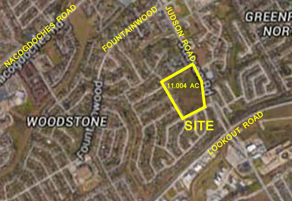
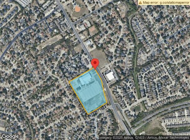
14303 Judson Rd, San Antonio, TX 78233
NEARBY LISTINGS FOR SALE OR LEASE
Property Detail
14303 Judson Rd
San Antonio-New Braunfels, TX
Ncb 16291 (Agape Christian Church)
16291-005-1080
NCB 16291 (AGAPE CHRISTIAN CHURCH), BLOCK 5 LOT 108 2018 NA FROM PA 588012 PER PLAT 9723/101 FILED 11-3-2017 SCG/GIS 11/20/2017
Religious
Bexar
X
Texas
48029C0280F
108
2023
11.10 AC
2023
Northeast
121804
San Antonio
38,978 SF
DEMOGRAPHICS near 14303 Judson Rd
1 Mile
3 Mile
5 Mile
2024 Total Population
17,322
100,058
224,567
2029 Population
18,321
105,914
238,435
Pop Growth 2024-2029
+ 5.77%
+ 5.85%
+ 6.18%
Average Age
36
38
38
2024 Total Households
6,258
37,663
85,526
HH Growth 2024-2029
+ 5.85%
+ 6.01%
+ 6.29%
Median Household Inc
$62,572
$68,338
$66,307
Avg Household Size
2.70
2.60
2.60
2024 Avg HH Vehicles
2.00
2.00
2.00
Median Home Value
$159,868
$189,067
$203,916
Median Year Built
1988
1988
1987
Nearby Places
- Restaurants
- Banks
- Shops
- Fitness
- Groceries
PUBLIC TRANSPORTATION
AIRPORT
San Antonio International
DRIVE
WALK
Distance
San Antonio International
15 min
10.2 mi
Freight Ports
Calhoun Port
DRIVE
WALK
Distance
Calhoun Port
180 min
148.9 mi
SALE & LEASE HISTORY
LISTING DATE
SALE/LEASE

Sep 24, 2016
For Sale
Nearby Properties
Address
Land Use
TOTAL SIZE
Lot Size
Zoning
Address
Land Use
TOTAL SIZE
Lot Size
Zoning
37,195 SF
1,118.06 AC
Address
Land Use
TOTAL SIZE
Lot Size
Zoning
402,370 SF
45.49 AC
Address
Land Use
TOTAL SIZE
Lot Size
Zoning
350,805 SF
20.85 AC
Address
Land Use
TOTAL SIZE
Lot Size
Zoning
240,644 SF
16.35 AC
Address
Land Use
TOTAL SIZE
Lot Size
Zoning
246,965 SF
11.73 AC
Address
Land Use
TOTAL SIZE
Lot Size
Zoning
280,516 SF
12.92 AC
Address
Land Use
TOTAL SIZE
Lot Size
Zoning
223,185 SF
16.85 AC
Address
Land Use
TOTAL SIZE
Lot Size
Zoning
266,702 SF
13.49 AC
Address
Land Use
TOTAL SIZE
Lot Size
Zoning
251,110 SF
12.26 AC
Address
Land Use
TOTAL SIZE
Lot Size
Zoning
242,267 SF
15.77 AC
Address
Land Use
TOTAL SIZE
Lot Size
Zoning
258,951 SF
15.43 AC
Address
Land Use
TOTAL SIZE
Lot Size
Zoning
218,379 SF
9.65 AC
Address
Land Use
TOTAL SIZE
Lot Size
Zoning
523,268 SF
22.57 AC
Address
Land Use
TOTAL SIZE
Lot Size
Zoning
281,145 SF
30.01 AC
Address
Land Use
TOTAL SIZE
Lot Size
Zoning
240,077 SF
16.92 AC
Address
Land Use
TOTAL SIZE
Lot Size
Zoning
200,940 SF
10.31 AC
Address
Land Use
TOTAL SIZE
Lot Size
Zoning
359,349 SF
23.59 AC
Address
Land Use
TOTAL SIZE
Lot Size
Zoning
223,980 SF
17.11 AC
Address
Land Use
TOTAL SIZE
Lot Size
Zoning
229,077 SF
10.06 AC
Address
Land Use
TOTAL SIZE
Lot Size
Zoning
180,000 SF
40.73 AC
Address
Land Use
TOTAL SIZE
Lot Size
Zoning
212,072 SF
10.66 AC
Address
Land Use
TOTAL SIZE
Lot Size
Zoning
245,993 SF
23.82 AC
Address
Land Use
TOTAL SIZE
Lot Size
Zoning
441,676 SF
19.99 AC
Address
Land Use
TOTAL SIZE
Lot Size
Zoning
172,080 SF
17 AC
Address
Land Use
TOTAL SIZE
Lot Size
Zoning
213,566 SF
10.17 AC
Address
Land Use
TOTAL SIZE
Lot Size
Zoning
263,209 SF
13.67 AC
Address
Land Use
TOTAL SIZE
Lot Size
Zoning
154,641 SF
9.06 AC
Address
Land Use
TOTAL SIZE
Lot Size
Zoning
446,278 SF
39.09 AC
Address
Land Use
TOTAL SIZE
Lot Size
Zoning
228,927 SF
16.24 AC
Address
Land Use
TOTAL SIZE
Lot Size
Zoning
153,144 SF
6.35 AC
The World's #1 Commercial Real Estate Marketplace
Connect with us
© 2025 CoStar Group
The information above has been obtained from sources believed reliable. While we do not doubt its accuracy we have not verified it and make no guarantee, warranty or representation about it. It is your responsibility to independently confirm its accuracy and completeness. Any projections, opinions, assumptions, or estimates used are for example only and do not represent the current or future performance of the property. The value of this transaction to you depends on tax and other factors which should be evaluated by your tax, financial, and legal advisors. You and your advisors should conduct a careful, independent investigation of the property to determine to your satisfaction the suitability of the property for your needs.