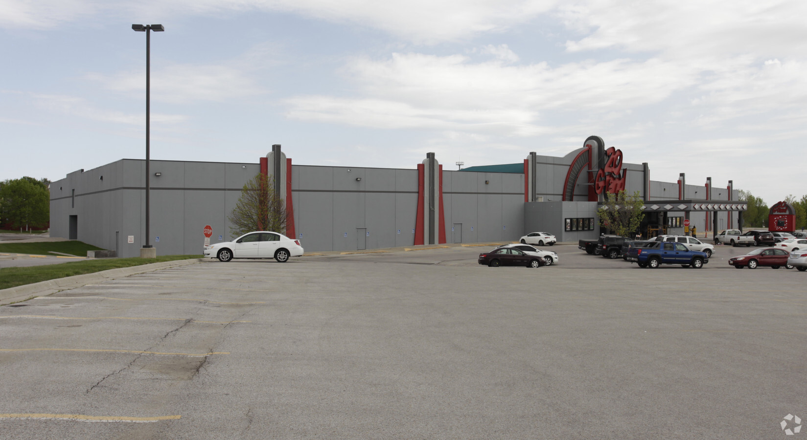
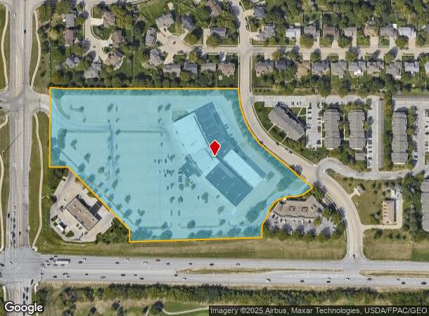
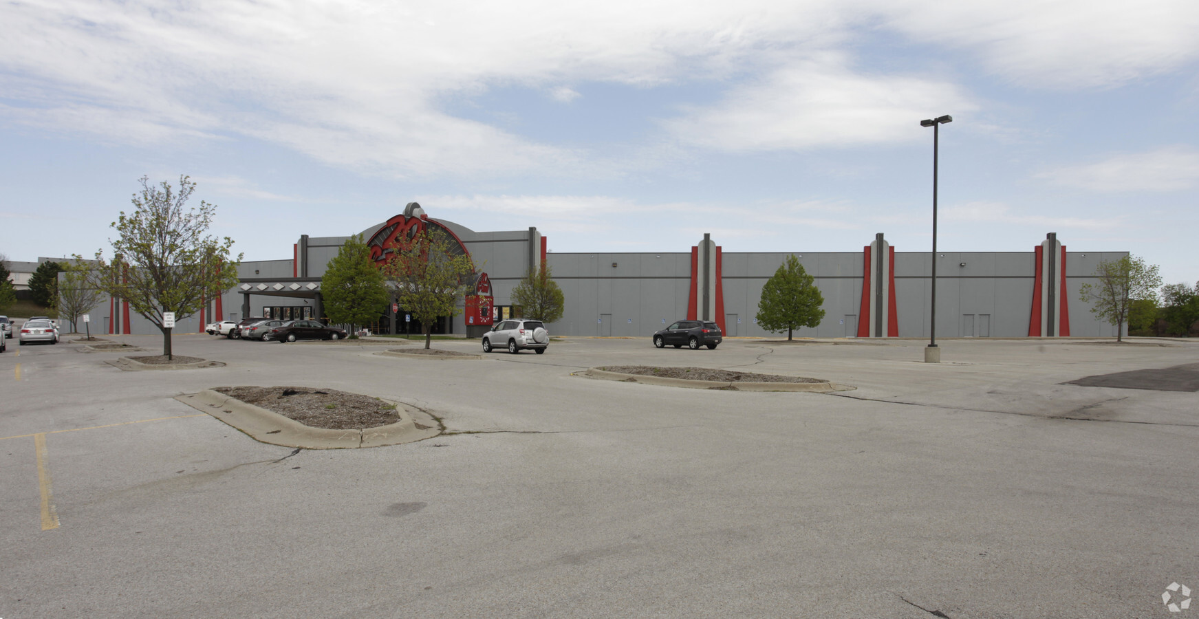
Property Record
14304 W Maple Rd, Omaha, NE 68164
NEARBY LISTINGS FOR SALE OR LEASE
Property Detail
14304 W Maple Rd
Omaha-Council Bluffs, NE-IA
Hillsborough
1295-1602-13
HILLSBOROUGH REPLAT 7* LOT 2 BLOCK 0 IRREG
Theater
Douglas
X
Nebraska
31055C0192H
2
2023
11.72 AC
2023
Northwest Omaha
007431
Omaha/Council Bluffs
71,584 SF
DEMOGRAPHICS near 14304 W Maple Rd
1 Mile
3 Mile
5 Mile
2024 Total Population
11,937
92,195
199,141
2029 Population
11,967
93,484
202,270
Pop Growth 2024-2029
+ 0.25%
+ 1.40%
+ 1.57%
Average Age
39
38
39
2024 Total Households
4,995
36,203
79,509
HH Growth 2024-2029
+ 0.30%
+ 1.34%
+ 1.51%
Median Household Inc
$86,143
$96,995
$88,922
Avg Household Size
2.40
2.50
2.50
2024 Avg HH Vehicles
2.00
2.00
2.00
Median Home Value
$253,831
$272,967
$268,754
Median Year Built
1996
1996
1990
Nearby Places
- Restaurants
- Banks
- Shops
- Fitness
- Groceries
PUBLIC TRANSPORTATION
AIRPORT
Eppley Airfield
DRIVE
WALK
Distance
Eppley Airfield
29 min
15.6 mi
Freight Ports
Tulsa Port Of Catoosa
DRIVE
WALK
Distance
Tulsa Port Of Catoosa
479 min
430.6 mi
Nearby Properties
Address
Land Use
TOTAL SIZE
Lot Size
Zoning
Address
Land Use
TOTAL SIZE
Lot Size
Zoning
856,187 SF
36.41 AC
Address
Land Use
TOTAL SIZE
Lot Size
Zoning
584,213 SF
36.38 AC
R7
Address
Land Use
TOTAL SIZE
Lot Size
Zoning
396,428 SF
14.45 AC
R6
Address
Land Use
TOTAL SIZE
Lot Size
Zoning
545,041 SF
22.69 AC
R6
Address
Land Use
TOTAL SIZE
Lot Size
Zoning
420,483 SF
18.51 AC
R6
Address
Land Use
TOTAL SIZE
Lot Size
Zoning
239,976 SF
20.12 AC
Address
Land Use
TOTAL SIZE
Lot Size
Zoning
311,856 SF
19.22 AC
Address
Land Use
TOTAL SIZE
Lot Size
Zoning
250,386 SF
17.06 AC
Address
Land Use
TOTAL SIZE
Lot Size
Zoning
428,342 SF
18.62 AC
Address
Land Use
TOTAL SIZE
Lot Size
Zoning
233,882 SF
9.48 AC
MU
Address
Land Use
TOTAL SIZE
Lot Size
Zoning
339,557 SF
12.89 AC
R7
Address
Land Use
TOTAL SIZE
Lot Size
Zoning
350,925 SF
12.71 AC
Address
Land Use
TOTAL SIZE
Lot Size
Zoning
255,483 SF
14.25 AC
Address
Land Use
TOTAL SIZE
Lot Size
Zoning
460,264 SF
20.87 AC
Address
Land Use
TOTAL SIZE
Lot Size
Zoning
184,930 SF
7.96 AC
Address
Land Use
TOTAL SIZE
Lot Size
Zoning
288,432 SF
12.98 AC
Address
Land Use
TOTAL SIZE
Lot Size
Zoning
200,114 SF
7.36 AC
Address
Land Use
TOTAL SIZE
Lot Size
Zoning
261,247 SF
13.20 AC
Address
Land Use
TOTAL SIZE
Lot Size
Zoning
314,690 SF
11.95 AC
Address
Land Use
TOTAL SIZE
Lot Size
Zoning
168,896 SF
8.79 AC
MU
Address
Land Use
TOTAL SIZE
Lot Size
Zoning
263,712 SF
9.39 AC
Address
Land Use
TOTAL SIZE
Lot Size
Zoning
108,027 SF
10.86 AC
Address
Land Use
TOTAL SIZE
Lot Size
Zoning
136,340 SF
7.50 AC
MU
Address
Land Use
TOTAL SIZE
Lot Size
Zoning
142,950 SF
5.94 AC
Address
Land Use
TOTAL SIZE
Lot Size
Zoning
230,952 SF
8.56 AC
Address
Land Use
TOTAL SIZE
Lot Size
Zoning
264,371 SF
20.18 AC
Address
Land Use
TOTAL SIZE
Lot Size
Zoning
159,506 SF
5.62 AC
GO
Address
Land Use
TOTAL SIZE
Lot Size
Zoning
99,353 SF
6.25 AC
LO
Address
Land Use
TOTAL SIZE
Lot Size
Zoning
135,576 SF
6.44 AC
R7
Address
Land Use
TOTAL SIZE
Lot Size
Zoning
219,265 SF
13.48 AC
The World's #1 Commercial Real Estate Marketplace
Connect with us
© 2025 CoStar Group
The information above has been obtained from sources believed reliable. While we do not doubt its accuracy we have not verified it and make no guarantee, warranty or representation about it. It is your responsibility to independently confirm its accuracy and completeness. Any projections, opinions, assumptions, or estimates used are for example only and do not represent the current or future performance of the property. The value of this transaction to you depends on tax and other factors which should be evaluated by your tax, financial, and legal advisors. You and your advisors should conduct a careful, independent investigation of the property to determine to your satisfaction the suitability of the property for your needs.