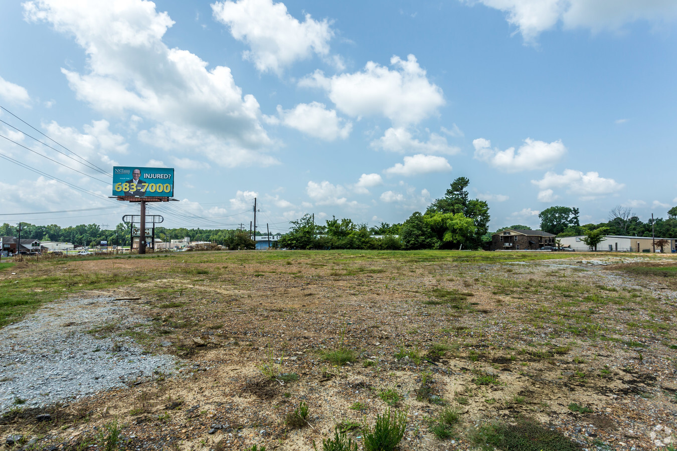
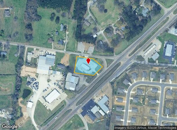
Property Record
14319 Highway 51 S, Atoka, TN 38004
NEARBY LISTINGS FOR SALE OR LEASE
Property Detail
14319 Highway 51 S
127-055.03
DISTRICT: 06 SERVICE STN & RESTAURANT, COUNTY AREA: S70
Restaurantbuilding
Tipton
X
Tennessee
47157C0065G
0.88 AC
2023
Tipton County
2024
Memphis
040303
Memphis, TN-MS-AR
4,040 SF
DEMOGRAPHICS near 14319 Highway 51 S
1 Mile
3 Mile
5 Mile
2024 Total Population
1,138
13,822
26,215
2029 Population
1,172
14,179
26,867
Pop Growth 2024-2029
+ 2.99%
+ 2.58%
+ 2.49%
Average Age
38
39
39
2024 Total Households
409
5,002
9,357
HH Growth 2024-2029
+ 2.93%
+ 2.50%
+ 2.38%
Median Household Inc
$91,346
$77,874
$76,822
Avg Household Size
2.80
2.70
2.80
2024 Avg HH Vehicles
2.00
2.00
2.00
Median Home Value
$243,129
$225,291
$229,132
Median Year Built
2000
1996
1996
Nearby Places
- Restaurants
- Banks
- Shops
- Fitness
- Groceries
PUBLIC TRANSPORTATION
AIRPORT
Memphis International
DRIVE
WALK
Distance
Memphis International
45 min
32.4 mi
Freight Ports
Port of Shreveport
DRIVE
WALK
Distance
Port of Shreveport
427 min
390.9 mi
SALE & LEASE HISTORY
LISTING DATE
SALE/LEASE

Aug 07, 2017
For Sale
Nearby Properties
Address
Land Use
TOTAL SIZE
Lot Size
Zoning
Address
Land Use
TOTAL SIZE
Lot Size
Zoning
13,080 SF
5.46 AC
Address
Land Use
TOTAL SIZE
Lot Size
Zoning
18,901 SF
3 AC
Address
Land Use
TOTAL SIZE
Lot Size
Zoning
10,964 SF
4 AC
R1
Address
Land Use
TOTAL SIZE
Lot Size
Zoning
9,164 SF
5.75 AC
Address
Land Use
TOTAL SIZE
Lot Size
Zoning
60,767 SF
8.85 AC
Address
Land Use
TOTAL SIZE
Lot Size
Zoning
16,800 SF
0.55 AC
Address
Land Use
TOTAL SIZE
Lot Size
Zoning
12,884 SF
3.61 AC
Address
Land Use
TOTAL SIZE
Lot Size
Zoning
11,269 SF
0.55 AC
Address
Land Use
TOTAL SIZE
Lot Size
Zoning
23,205 SF
3.10 AC
Address
Land Use
TOTAL SIZE
Lot Size
Zoning
14,940 SF
1.39 AC
Address
Land Use
TOTAL SIZE
Lot Size
Zoning
7,764 SF
1.46 AC
Address
Land Use
TOTAL SIZE
Lot Size
Zoning
2,908 SF
6.74 AC
Address
Land Use
TOTAL SIZE
Lot Size
Zoning
13,972 SF
2.80 AC
Address
Land Use
TOTAL SIZE
Lot Size
Zoning
15,068 SF
1.70 AC
Address
Land Use
TOTAL SIZE
Lot Size
Zoning
10,386 SF
0.38 AC
Address
Land Use
TOTAL SIZE
Lot Size
Zoning
11,292 SF
8.01 AC
CA
Address
Land Use
TOTAL SIZE
Lot Size
Zoning
14,690 SF
1.53 AC
Address
Land Use
TOTAL SIZE
Lot Size
Zoning
6,577 SF
1.12 AC
Address
Land Use
TOTAL SIZE
Lot Size
Zoning
9,377 SF
0.31 AC
Address
Land Use
TOTAL SIZE
Lot Size
Zoning
9,726 SF
0.48 AC
Address
Land Use
TOTAL SIZE
Lot Size
Zoning
11,352 SF
3.20 AC
Address
Land Use
TOTAL SIZE
Lot Size
Zoning
15,732 SF
1.80 AC
Address
Land Use
TOTAL SIZE
Lot Size
Zoning
7,816 SF
1.50 AC
R1
Address
Land Use
TOTAL SIZE
Lot Size
Zoning
12,480 SF
0.50 AC
Address
Land Use
TOTAL SIZE
Lot Size
Zoning
17,212 SF
5 AC
Address
Land Use
TOTAL SIZE
Lot Size
Zoning
28,770 SF
2.70 AC
Address
Land Use
TOTAL SIZE
Lot Size
Zoning
7,656 SF
1.70 AC
Address
Land Use
TOTAL SIZE
Lot Size
Zoning
22,905 SF
2.60 AC
Address
Land Use
TOTAL SIZE
Lot Size
Zoning
800 SF
3.46 AC
Address
Land Use
TOTAL SIZE
Lot Size
Zoning
7,656 SF
1 AC
The World's #1 Commercial Real Estate Marketplace
Connect with us
© 2025 CoStar Group
The information above has been obtained from sources believed reliable. While we do not doubt its accuracy we have not verified it and make no guarantee, warranty or representation about it. It is your responsibility to independently confirm its accuracy and completeness. Any projections, opinions, assumptions, or estimates used are for example only and do not represent the current or future performance of the property. The value of this transaction to you depends on tax and other factors which should be evaluated by your tax, financial, and legal advisors. You and your advisors should conduct a careful, independent investigation of the property to determine to your satisfaction the suitability of the property for your needs.