Property Record
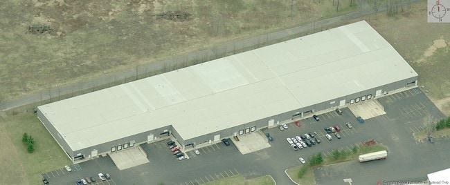
1442 S 35Th St, Galesburg, MI 49053

NEARBY LISTINGS FOR SALE OR LEASE
Property Detail
1442 S 35Th St
07-24-356-045
SEC 24-2-10 COM 14.69 FT N OF SW COR SEC 24 ALSO BEING CTR LI MILLER DR TH N ALG W LI SD SEC 419.22 FT TH NELY TO A PT THAT
Industrialgeneral
Kalamazoo
X
Michigan
26077C0218E
9.27 AC
2025
Southern Kalamazoo County
2025
West Michigan
006702
Kalamazoo-Portage, MI
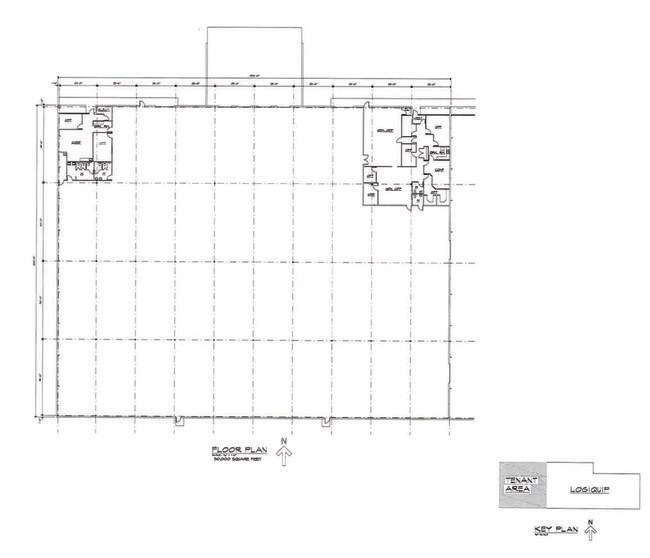
130,000 SF
DEMOGRAPHICS near 1442 S 35Th St
1 Mile
3 Mile
5 Mile
2024 Total Population
1,486
6,692
17,752
2029 Population
1,471
6,646
17,651
Pop Growth 2024-2029
(1.01%)
(0.69%)
(0.57%)
Average Age
40
40
40
2024 Total Households
611
2,614
6,847
HH Growth 2024-2029
(1.15%)
(0.69%)
(0.60%)
Median Household Inc
$68,024
$66,980
$66,767
Avg Household Size
2.40
2.50
2.50
2024 Avg HH Vehicles
2.00
2.00
2.00
Median Home Value
$170,718
$197,558
$196,907
Median Year Built
1966
1973
1973
Nearby Places
Map Layers
Map Styles
 Street
 Aerial
- Restaurants
- Banks
- Shops
- Fitness
- Groceries
PUBLIC TRANSPORTATION
COMMUTER RAIL
DRIVE
WALK
Distance
14 min
9.3 mi
AIRPORT
Kalamazoo/Battle Creek International
DRIVE
WALK
Distance
Kalamazoo/Battle Creek International
18 min
9.4 mi
SALE & LEASE HISTORY
LISTING DATE
SALE/LEASE

Nov 09, 2021
For Lease
Nearby Properties
Address
Land Use
TOTAL SIZE
Lot Size
Zoning
Address
Land Use
TOTAL SIZE
Lot Size
Zoning
1,348,074 SF
136.92 AC
R-IP
Address
Land Use
TOTAL SIZE
Lot Size
Zoning
68,520 SF
28.94 AC
LM
Address
Land Use
TOTAL SIZE
Lot Size
Zoning
268,277 SF
92.43 AC
M
Address
Land Use
TOTAL SIZE
Lot Size
Zoning
142,198 SF
10 AC
Address
Land Use
TOTAL SIZE
Lot Size
Zoning
102,937 SF
N/A
Address
Land Use
TOTAL SIZE
Lot Size
Zoning
73,710 SF
10.18 AC
LM
Address
Land Use
TOTAL SIZE
Lot Size
Zoning
52,009 SF
20 AC
LM
Address
Land Use
TOTAL SIZE
Lot Size
Zoning
2,814 SF
46.48 AC
R6
Address
Land Use
TOTAL SIZE
Lot Size
Zoning
33,300 SF
6.47 AC
B-3
Address
Land Use
TOTAL SIZE
Lot Size
Zoning
41,310 SF
1.81 AC
LM
Address
Land Use
TOTAL SIZE
Lot Size
Zoning
73,710 SF
LM
Address
Land Use
TOTAL SIZE
Lot Size
Zoning
27,556 SF
5 AC
R2
Address
Land Use
TOTAL SIZE
Lot Size
Zoning
Address
Land Use
TOTAL SIZE
Lot Size
Zoning
46,880 SF
19.50 AC
LM
Address
Land Use
TOTAL SIZE
Lot Size
Zoning
36,191 SF
4.47 AC
LM
Address
Land Use
TOTAL SIZE
Lot Size
Zoning
21,600 SF
5.46 AC
LM
Address
Land Use
TOTAL SIZE
Lot Size
Zoning
376,706 SF
20 AC
AGR
Address
Land Use
TOTAL SIZE
Lot Size
Zoning
7,653 SF
2.71 AC
B-3
Address
Land Use
TOTAL SIZE
Lot Size
Zoning
24,053 SF
N/A
Address
Land Use
TOTAL SIZE
Lot Size
Zoning
69,250 SF
5.62 AC
LM
Address
Land Use
TOTAL SIZE
Lot Size
Zoning
16,580 SF
3.45 AC
RM
Address
Land Use
TOTAL SIZE
Lot Size
Zoning
30,000 SF
N/A
Address
Land Use
TOTAL SIZE
Lot Size
Zoning
89,840 SF
4.97 AC
I2
Address
Land Use
TOTAL SIZE
Lot Size
Zoning
16,884 SF
5 AC
LM
Address
Land Use
TOTAL SIZE
Lot Size
Zoning
55,086 SF
4.56 AC
I2
Address
Land Use
TOTAL SIZE
Lot Size
Zoning
2,602 SF
120 AC
R-1A
Address
Land Use
TOTAL SIZE
Lot Size
Zoning
199.85 AC
AG-2
Address
Land Use
TOTAL SIZE
Lot Size
Zoning
13,164 SF
2.10 AC
R4
Address
Land Use
TOTAL SIZE
Lot Size
Zoning
18,263 SF
0.49 AC
C2
The World's #1 Commercial Real Estate Marketplace
Connect with us
© 2025 CoStar Group
The information above has been obtained from sources believed reliable. While we do not doubt its accuracy we have not verified it and make no guarantee, warranty or representation about it. It is your responsibility to independently confirm its accuracy and completeness. Any projections, opinions, assumptions, or estimates used are for example only and do not represent the current or future performance of the property. The value of this transaction to you depends on tax and other factors which should be evaluated by your tax, financial, and legal advisors. You and your advisors should conduct a careful, independent investigation of the property to determine to your satisfaction the suitability of the property for your needs.