Property Record
14433 Washington Hwy, Ashland, VA 23005

NEARBY LISTINGS FOR SALE OR LEASE
-
-
View all Ashland listings for sale on LoopNet.com
Property Detail
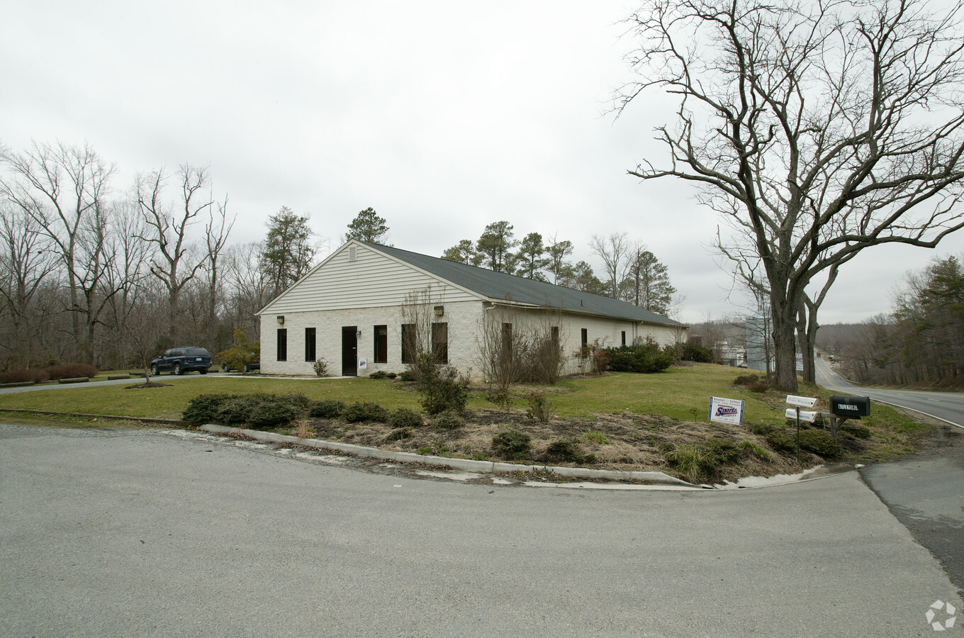
14433 Washington Hwy
7871-98-5236
Division For Ashland Roller Mills
Commercialnec
W/S RT 1 N OF RT641
X
Hanover
51085C0190C
Virginia
2024
1.54 AC
2024
I-95 North/Ashland
320500
Richmond VA
5,520 SF
Richmond, VA
DEMOGRAPHICS near 14433 Washington Hwy
1 Mile
3 Mile
5 Mile
2024 Total Population
281
6,734
15,621
2029 Population
299
7,236
16,712
Pop Growth 2024-2029
+ 6.41%
+ 7.45%
+ 6.98%
Average Age
38
39
41
2024 Total Households
92
2,373
5,835
HH Growth 2024-2029
+ 6.52%
+ 7.92%
+ 7.20%
Median Household Inc
$69,166
$68,218
$72,149
Avg Household Size
2.40
2.40
2.40
2024 Avg HH Vehicles
2.00
2.00
2.00
Median Home Value
$369,999
$331,906
$345,224
Median Year Built
1983
1985
1984
Nearby Places
- Restaurants
- Banks
- Shops
- Fitness
- Groceries
PUBLIC TRANSPORTATION
COMMUTER RAIL
Ashland Amtrak (Northeast Regional - Amtrak)
DRIVE
WALK
Distance
Ashland Amtrak (Northeast Regional - Amtrak)
7 min
3.9 mi
AIRPORT
Richmond International
DRIVE
WALK
Distance
Richmond International
39 min
28.1 mi
Freight Ports
Virginia Port Authority - Richmond
DRIVE
WALK
Distance
Virginia Port Authority - Richmond
40 min
27.7 mi
Nearby Properties
Address
Land Use
TOTAL SIZE
Lot Size
Zoning
Address
Land Use
TOTAL SIZE
Lot Size
Zoning
36.08 AC
HE
Address
Land Use
TOTAL SIZE
Lot Size
Zoning
189.83 AC
M-2
Address
Land Use
TOTAL SIZE
Lot Size
Zoning
7,538 SF
610.75 AC
B-3
Address
Land Use
TOTAL SIZE
Lot Size
Zoning
26,583 SF
9 AC
HE
Address
Land Use
TOTAL SIZE
Lot Size
Zoning
538,610 SF
545.15 AC
M-3
Address
Land Use
TOTAL SIZE
Lot Size
Zoning
311,740 SF
43.40 AC
M-1
Address
Land Use
TOTAL SIZE
Lot Size
Zoning
280,900 SF
22.69 AC
M-1
Address
Land Use
TOTAL SIZE
Lot Size
Zoning
24.20 AC
RR-1
Address
Land Use
TOTAL SIZE
Lot Size
Zoning
23.97 AC
RR-1
Address
Land Use
TOTAL SIZE
Lot Size
Zoning
244.60 AC
M-2
Address
Land Use
TOTAL SIZE
Lot Size
Zoning
70,128 SF
5.11 AC
R-5
Address
Land Use
TOTAL SIZE
Lot Size
Zoning
70,128 SF
5.32 AC
R-5
Address
Land Use
TOTAL SIZE
Lot Size
Zoning
5 AC
HE
Address
Land Use
TOTAL SIZE
Lot Size
Zoning
81,255 SF
13.48 AC
M-1
Address
Land Use
TOTAL SIZE
Lot Size
Zoning
54,460 SF
4.72 AC
B-4
Address
Land Use
TOTAL SIZE
Lot Size
Zoning
216,700 SF
11.22 AC
M-2
Address
Land Use
TOTAL SIZE
Lot Size
Zoning
9.53 AC
R-2
Address
Land Use
TOTAL SIZE
Lot Size
Zoning
125,400 SF
14.74 AC
M-1
Address
Land Use
TOTAL SIZE
Lot Size
Zoning
19,454 SF
38.31 AC
HE
Address
Land Use
TOTAL SIZE
Lot Size
Zoning
33,024 SF
3.45 AC
B-4
Address
Land Use
TOTAL SIZE
Lot Size
Zoning
48,928 SF
4 AC
R-5
Address
Land Use
TOTAL SIZE
Lot Size
Zoning
111.82 AC
M-2
Address
Land Use
TOTAL SIZE
Lot Size
Zoning
82,732 SF
12.24 AC
M-1
Address
Land Use
TOTAL SIZE
Lot Size
Zoning
89,280 SF
10.50 AC
B-3
Address
Land Use
TOTAL SIZE
Lot Size
Zoning
114,125 SF
5 AC
M-1
Address
Land Use
TOTAL SIZE
Lot Size
Zoning
698.58 AC
A-1
Address
Land Use
TOTAL SIZE
Lot Size
Zoning
216,500 SF
9.28 AC
M-2
Address
Land Use
TOTAL SIZE
Lot Size
Zoning
11,187 SF
2.43 AC
RR-1
Address
Land Use
TOTAL SIZE
Lot Size
Zoning
1,308 SF
19.37 AC
M-2
Address
Land Use
TOTAL SIZE
Lot Size
Zoning
522.02 AC
A-1
The World's #1 Commercial Real Estate Marketplace
Connect with us
© 2025 CoStar Group
The information above has been obtained from sources believed reliable. While we do not doubt its accuracy we have not verified it and make no guarantee, warranty or representation about it. It is your responsibility to independently confirm its accuracy and completeness. Any projections, opinions, assumptions, or estimates used are for example only and do not represent the current or future performance of the property. The value of this transaction to you depends on tax and other factors which should be evaluated by your tax, financial, and legal advisors. You and your advisors should conduct a careful, independent investigation of the property to determine to your satisfaction the suitability of the property for your needs.