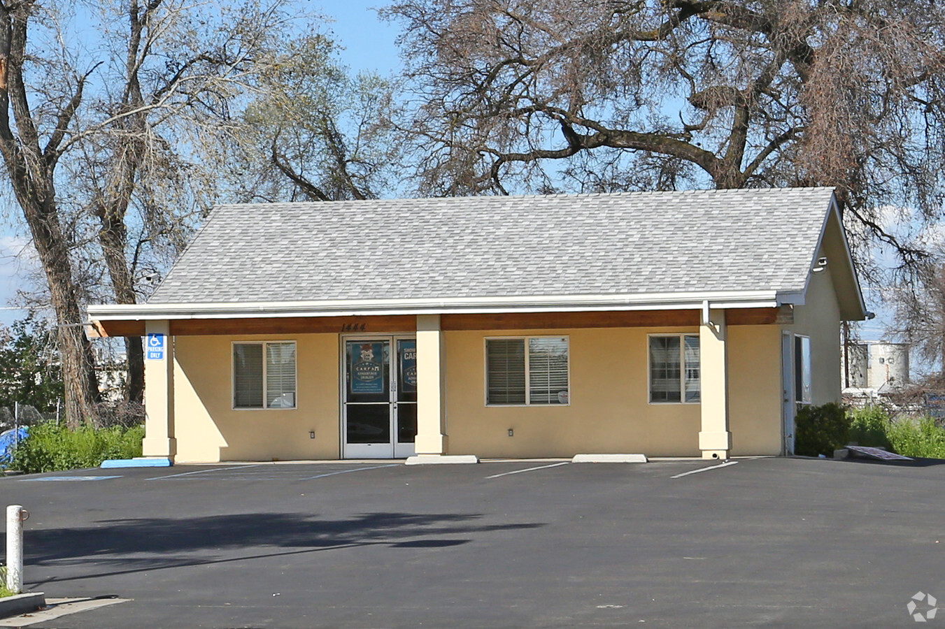
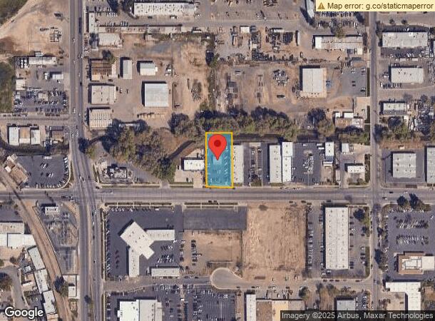
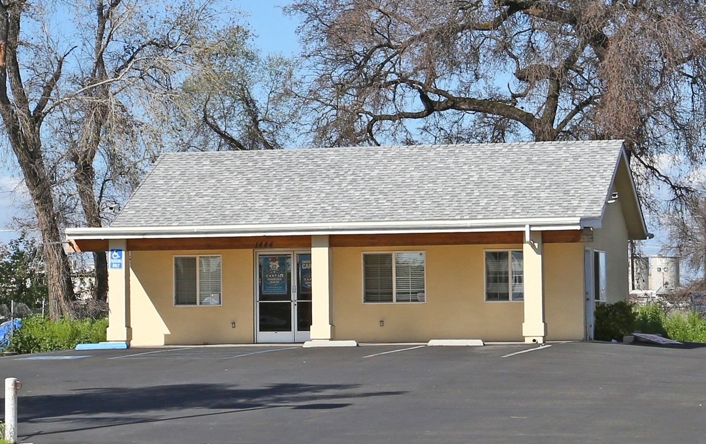
Property Record
1444 E Main St, Visalia, CA 93292
NEARBY LISTINGS FOR SALE OR LEASE
Property Detail
1444 E Main St
098-320-003-000
Parcel Map No 2257
Vehiclerentalsvehiclesales
PAR 6 PAR MAP 2257 V23 P58 PM
AE
Tulare
06107C0934E
California
2023
0.52 AC
2024
East Visalia
001305
Visalia/Porterville
840 SF
Visalia-Porterville, CA
DEMOGRAPHICS near 1444 E Main St
1 Mile
3 Mile
5 Mile
2024 Total Population
10,374
96,859
170,709
2029 Population
10,738
100,399
177,059
Pop Growth 2024-2029
+ 3.51%
+ 3.65%
+ 3.72%
Average Age
36
36
36
2024 Total Households
3,563
31,209
55,184
HH Growth 2024-2029
+ 3.51%
+ 3.62%
+ 3.71%
Median Household Inc
$54,305
$64,790
$67,870
Avg Household Size
2.80
3.00
3.00
2024 Avg HH Vehicles
2.00
2.00
2.00
Median Home Value
$248,769
$278,422
$291,713
Median Year Built
1979
1983
1986
Nearby Places
- Restaurants
- Banks
- Shops
- Fitness
- Groceries
SALE & LEASE HISTORY
LISTING DATE
SALE/LEASE

Mar 06, 2019
For Lease
Jun 05, 2019
For Lease
Nearby Properties
Address
Land Use
TOTAL SIZE
Lot Size
Zoning
Address
Land Use
TOTAL SIZE
Lot Size
Zoning
393,784 SF
17.79 AC
CR
Address
Land Use
TOTAL SIZE
Lot Size
Zoning
93,743 SF
3.16 AC
IL
Address
Land Use
TOTAL SIZE
Lot Size
Zoning
47,768 SF
6.76 AC
RM2
Address
Land Use
TOTAL SIZE
Lot Size
Zoning
146,890 SF
11.73 AC
CCM
Address
Land Use
TOTAL SIZE
Lot Size
Zoning
91,492 SF
4.80 AC
RM3
Address
Land Use
TOTAL SIZE
Lot Size
Zoning
134,055 SF
3.49 AC
CDT
Address
Land Use
TOTAL SIZE
Lot Size
Zoning
133,910 SF
14.35 AC
CSO
Address
Land Use
TOTAL SIZE
Lot Size
Zoning
185,883 SF
9.97 AC
CSO
Address
Land Use
TOTAL SIZE
Lot Size
Zoning
92,298 SF
7.32 AC
CR
Address
Land Use
TOTAL SIZE
Lot Size
Zoning
54,674 SF
1.26 AC
CDT
Address
Land Use
TOTAL SIZE
Lot Size
Zoning
56,384 SF
9.14 AC
Address
Land Use
TOTAL SIZE
Lot Size
Zoning
126,532 SF
8.63 AC
RM2
Address
Land Use
TOTAL SIZE
Lot Size
Zoning
87,160 SF
0.75 AC
PA
Address
Land Use
TOTAL SIZE
Lot Size
Zoning
5.85 AC
RM2
Address
Land Use
TOTAL SIZE
Lot Size
Zoning
69,120 SF
5.23 AC
CR
Address
Land Use
TOTAL SIZE
Lot Size
Zoning
83,011 SF
4.46 AC
QP
Address
Land Use
TOTAL SIZE
Lot Size
Zoning
88,589 SF
7.98 AC
CR
Address
Land Use
TOTAL SIZE
Lot Size
Zoning
7,311 SF
2.31 AC
Address
Land Use
TOTAL SIZE
Lot Size
Zoning
17,933 SF
3.98 AC
CR
Address
Land Use
TOTAL SIZE
Lot Size
Zoning
1.07 AC
CDT
Address
Land Use
TOTAL SIZE
Lot Size
Zoning
103,550 SF
8.63 AC
CR
Address
Land Use
TOTAL SIZE
Lot Size
Zoning
47,035 SF
3.29 AC
CCM
Address
Land Use
TOTAL SIZE
Lot Size
Zoning
6.42 AC
CN
Address
Land Use
TOTAL SIZE
Lot Size
Zoning
70,254 SF
9.08 AC
R16
Address
Land Use
TOTAL SIZE
Lot Size
Zoning
27,603 SF
2.86 AC
CCM
Address
Land Use
TOTAL SIZE
Lot Size
Zoning
29,145 SF
0.45 AC
CDT
Address
Land Use
TOTAL SIZE
Lot Size
Zoning
3,240 SF
1.08 AC
SC
Address
Land Use
TOTAL SIZE
Lot Size
Zoning
54,868 SF
4.14 AC
CR
The World's #1 Commercial Real Estate Marketplace
Connect with us
© 2025 CoStar Group
The information above has been obtained from sources believed reliable. While we do not doubt its accuracy we have not verified it and make no guarantee, warranty or representation about it. It is your responsibility to independently confirm its accuracy and completeness. Any projections, opinions, assumptions, or estimates used are for example only and do not represent the current or future performance of the property. The value of this transaction to you depends on tax and other factors which should be evaluated by your tax, financial, and legal advisors. You and your advisors should conduct a careful, independent investigation of the property to determine to your satisfaction the suitability of the property for your needs.