Property Record
1425 Trollingwood Hawflds Rd, Mebane, NC 27302


This Property Is For Sale
NEARBY LISTINGS FOR SALE OR LEASE
Property Detail
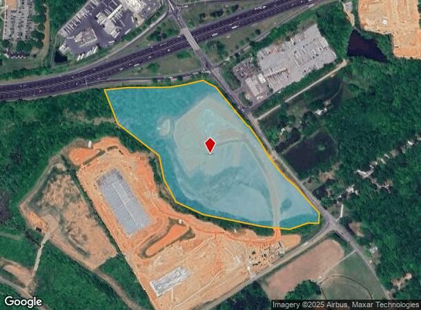
1425 Trollingwood Hawflds Rd
Burlington, NC
Robert W Gibson Jr Surv
160376
NC COMMERCE PARK LOT 1 10/17/2006
Industrialacreage
Alamance
AE
North Carolina
3710980400K
1
2025
32.09 AC
2025
SE Alamance County
021205
Greensboro/Winston-Salem
1,976 SF
DEMOGRAPHICS near 1425 Trollingwood Hawflds Rd
1 Mile
3 Mile
5 Mile
2024 Total Population
2,554
21,788
54,641
2029 Population
3,012
25,272
62,882
Pop Growth 2024-2029
+ 17.93%
+ 15.99%
+ 15.08%
Average Age
38
39
40
2024 Total Households
1,049
8,778
22,192
HH Growth 2024-2029
+ 18.40%
+ 16.46%
+ 15.56%
Median Household Inc
$73,840
$69,590
$61,411
Avg Household Size
2.40
2.40
2.40
2024 Avg HH Vehicles
2.00
2.00
2.00
Median Home Value
$253,846
$239,447
$214,898
Median Year Built
2010
2001
1994
Nearby Places
Map Layers
Map Styles
 Street
 Aerial
- Restaurants
- Banks
- Shops
- Fitness
- Groceries
PUBLIC TRANSPORTATION
COMMUTER RAIL
Burlington Station (Piedmont - North Carolina by Train (NC Train))
DRIVE
WALK
Distance
Burlington Station (Piedmont - North Carolina by Train (NC Train))
13 min
8.3 mi
Freight Ports
Virginia Port Authority - Richmond
DRIVE
WALK
Distance
Virginia Port Authority - Richmond
193 min
169.6 mi
Nearby Properties
Address
Land Use
TOTAL SIZE
Lot Size
Zoning
Address
Land Use
TOTAL SIZE
Lot Size
Zoning
18,778 SF
167.10 AC
R20
Address
Land Use
TOTAL SIZE
Lot Size
Zoning
22,500 SF
100.73 AC
Address
Land Use
TOTAL SIZE
Lot Size
Zoning
919,840 SF
85.58 AC
Address
Land Use
TOTAL SIZE
Lot Size
Zoning
9,728 SF
184.66 AC
M 2
Address
Land Use
TOTAL SIZE
Lot Size
Zoning
159,629 SF
82.81 AC
Address
Land Use
TOTAL SIZE
Lot Size
Zoning
36,234 SF
13 AC
CR
Address
Land Use
TOTAL SIZE
Lot Size
Zoning
578,100 SF
55.30 AC
Address
Land Use
TOTAL SIZE
Lot Size
Zoning
54,882 SF
52 AC
Address
Land Use
TOTAL SIZE
Lot Size
Zoning
8,024 SF
20.22 AC
R6
Address
Land Use
TOTAL SIZE
Lot Size
Zoning
27,803 SF
21.86 AC
R20
Address
Land Use
TOTAL SIZE
Lot Size
Zoning
223,391 SF
81.89 AC
R 20
Address
Land Use
TOTAL SIZE
Lot Size
Zoning
198,228 SF
25.26 AC
Address
Land Use
TOTAL SIZE
Lot Size
Zoning
367,187 SF
23.75 AC
M2
Address
Land Use
TOTAL SIZE
Lot Size
Zoning
333,775 SF
46.14 AC
Address
Land Use
TOTAL SIZE
Lot Size
Zoning
26,916 SF
14.76 AC
PUD
Address
Land Use
TOTAL SIZE
Lot Size
Zoning
476,857 SF
27.47 AC
M 2
Address
Land Use
TOTAL SIZE
Lot Size
Zoning
296,940 SF
33.78 AC
Address
Land Use
TOTAL SIZE
Lot Size
Zoning
231,346 SF
37.07 AC
M 2
Address
Land Use
TOTAL SIZE
Lot Size
Zoning
37,242 SF
10.50 AC
CR
Address
Land Use
TOTAL SIZE
Lot Size
Zoning
47,648 SF
18.48 AC
R8
Address
Land Use
TOTAL SIZE
Lot Size
Zoning
26,970 SF
13.72 AC
B 2
Address
Land Use
TOTAL SIZE
Lot Size
Zoning
248,000 SF
21.77 AC
Address
Land Use
TOTAL SIZE
Lot Size
Zoning
180,000 SF
78.86 AC
M 2
Address
Land Use
TOTAL SIZE
Lot Size
Zoning
76,224 SF
12.22 AC
Address
Land Use
TOTAL SIZE
Lot Size
Zoning
29,400 SF
9.02 AC
B2
Address
Land Use
TOTAL SIZE
Lot Size
Zoning
316,832 SF
41.84 AC
M 1
Address
Land Use
TOTAL SIZE
Lot Size
Zoning
183,630 SF
10 AC
M2
Address
Land Use
TOTAL SIZE
Lot Size
Zoning
750 SF
65.26 AC
M 2
Address
Land Use
TOTAL SIZE
Lot Size
Zoning
134,000 SF
23.33 AC
Address
Land Use
TOTAL SIZE
Lot Size
Zoning
59,564 SF
21.33 AC
R20
The World's #1 Commercial Real Estate Marketplace
Connect with us
© 2026 CoStar Group
The information above has been obtained from sources believed reliable. While we do not doubt its accuracy we have not verified it and make no guarantee, warranty or representation about it. It is your responsibility to independently confirm its accuracy and completeness. Any projections, opinions, assumptions, or estimates used are for example only and do not represent the current or future performance of the property. The value of this transaction to you depends on tax and other factors which should be evaluated by your tax, financial, and legal advisors. You and your advisors should conduct a careful, independent investigation of the property to determine to your satisfaction the suitability of the property for your needs.