Property Record
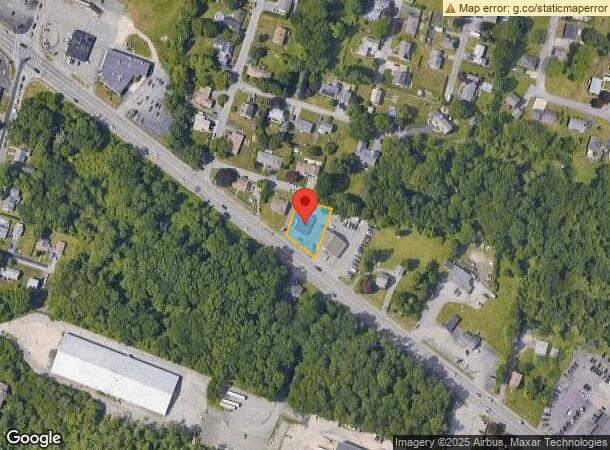
1448 Grand Army Hwy, Somerset, MA 02726


NEARBY LISTINGS FOR SALE OR LEASE
Property Detail
1448 Grand Army Hwy
SOME-000008B-000000-000182
Bristol
Storebuilding
Massachusetts
X
182
25005C0331G
0.29 AC
2024
Attleboro/New Bedford
2024
Boston
644200
Providence-Warwick, RI-MA
2,710 SF
DEMOGRAPHICS near 1448 Grand Army Hwy
1 Mile
3 Mile
5 Mile
2024 Total Population
4,791
58,301
142,741
2029 Population
4,740
58,103
141,929
Pop Growth 2024-2029
(1.06%)
(0.34%)
(0.57%)
Average Age
44
42
41
2024 Total Households
1,908
24,910
60,519
HH Growth 2024-2029
(1.10%)
(0.34%)
(0.60%)
Median Household Inc
$95,312
$65,550
$61,323
Avg Household Size
2.50
2.30
2.30
2024 Avg HH Vehicles
2.00
2.00
2.00
Median Home Value
$360,072
$368,502
$364,938
Median Year Built
1960
1953
1953
Nearby Places
- Restaurants
- Banks
- Shops
- Fitness
- Groceries
PUBLIC TRANSPORTATION
AIRPORT
Rhode Island Tf Green International
DRIVE
WALK
Distance
Rhode Island Tf Green International
33 min
21.1 mi
Freight Ports
Port of Davisville, RI
DRIVE
WALK
Distance
Port of Davisville, RI
49 min
33.4 mi
SALE & LEASE HISTORY
LISTING DATE
SALE/LEASE

Sep 25, 2016
For Lease
Sep 25, 2016
For Lease
May 29, 2022
For Sale
Apr 15, 2024
For Lease
Apr 15, 2024
For Sale
Nearby Properties
Address
Land Use
TOTAL SIZE
Lot Size
Zoning
Address
Land Use
TOTAL SIZE
Lot Size
Zoning
634,182 SF
63.86 AC
N/A
Address
Land Use
TOTAL SIZE
Lot Size
Zoning
226,473 SF
29.10 AC
R1
Address
Land Use
TOTAL SIZE
Lot Size
Zoning
203,989 SF
2.01 AC
A-2
Address
Land Use
TOTAL SIZE
Lot Size
Zoning
14.30 AC
G
Address
Land Use
TOTAL SIZE
Lot Size
Zoning
105,949 SF
25.21 AC
R1
Address
Land Use
TOTAL SIZE
Lot Size
Zoning
10 AC
B
Address
Land Use
TOTAL SIZE
Lot Size
Zoning
126,146 SF
1.18 AC
A-2
Address
Land Use
TOTAL SIZE
Lot Size
Zoning
85,692 SF
4.05 AC
S
Address
Land Use
TOTAL SIZE
Lot Size
Zoning
255,600 SF
12.46 AC
R4
Address
Land Use
TOTAL SIZE
Lot Size
Zoning
160,234 SF
2.98 AC
CBD
Address
Land Use
TOTAL SIZE
Lot Size
Zoning
172,570 SF
3.13 AC
CBD
Address
Land Use
TOTAL SIZE
Lot Size
Zoning
75,736 SF
1.39 AC
B-L
Address
Land Use
TOTAL SIZE
Lot Size
Zoning
143,084 SF
12.60 AC
R1
Address
Land Use
TOTAL SIZE
Lot Size
Zoning
155,364 SF
15.27 AC
C
Address
Land Use
TOTAL SIZE
Lot Size
Zoning
136,814 SF
4.07 AC
IND
Address
Land Use
TOTAL SIZE
Lot Size
Zoning
131,086 SF
2.29 AC
CBD
Address
Land Use
TOTAL SIZE
Lot Size
Zoning
3,150 SF
7.91 AC
S
Address
Land Use
TOTAL SIZE
Lot Size
Zoning
119,932 SF
4.79 AC
G
Address
Land Use
TOTAL SIZE
Lot Size
Zoning
152,620 SF
20.73 AC
C
Address
Land Use
TOTAL SIZE
Lot Size
Zoning
137,976 SF
10.59 AC
C
Address
Land Use
TOTAL SIZE
Lot Size
Zoning
112,515 SF
1.83 AC
CBD
Address
Land Use
TOTAL SIZE
Lot Size
Zoning
114,424 SF
12.94 AC
C
Address
Land Use
TOTAL SIZE
Lot Size
Zoning
52,475 SF
0.98 AC
IND
Address
Land Use
TOTAL SIZE
Lot Size
Zoning
6.48 AC
G
Address
Land Use
TOTAL SIZE
Lot Size
Zoning
70,741 SF
16.24 AC
Address
Land Use
TOTAL SIZE
Lot Size
Zoning
4 AC
M
Address
Land Use
TOTAL SIZE
Lot Size
Zoning
5.79 AC
S
Address
Land Use
TOTAL SIZE
Lot Size
Zoning
103,846 SF
3.60 AC
G
Address
Land Use
TOTAL SIZE
Lot Size
Zoning
106,293 SF
1.32 AC
CBD
Address
Land Use
TOTAL SIZE
Lot Size
Zoning
17.01 AC
S
The World's #1 Commercial Real Estate Marketplace
Connect with us
© 2025 CoStar Group
The information above has been obtained from sources believed reliable. While we do not doubt its accuracy we have not verified it and make no guarantee, warranty or representation about it. It is your responsibility to independently confirm its accuracy and completeness. Any projections, opinions, assumptions, or estimates used are for example only and do not represent the current or future performance of the property. The value of this transaction to you depends on tax and other factors which should be evaluated by your tax, financial, and legal advisors. You and your advisors should conduct a careful, independent investigation of the property to determine to your satisfaction the suitability of the property for your needs.