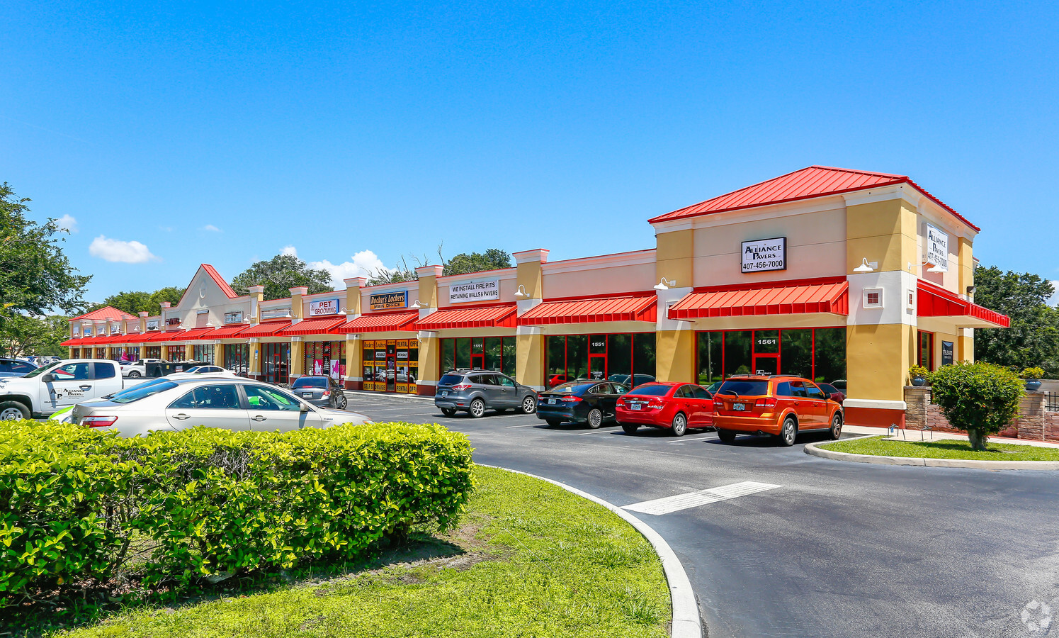
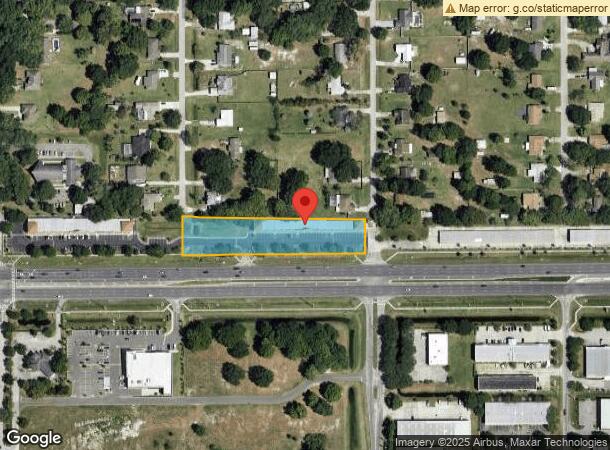
Property Record
1451 E Irlo Bronson Memorial Hwy, Saint Cloud, FL 34771
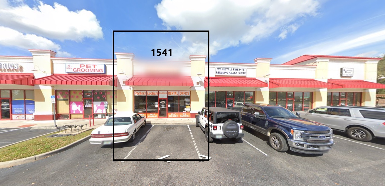
Current Lease Availabilities
General Retail LEASE
$25.00 SF/YR
900 SF
NEARBY LISTINGS FOR SALE OR LEASE
Property Detail
1451 E Irlo Bronson Memorial Hwy
Orlando-Kissimmee-Sanford, FL
Ashton Commerce Center Ph 2
07-26-31-0006-0001-00C0
ASHTON COMMERCE CENTER PH 2 PB 17 PGS 94-96 TRACTS C & D
Storebuilding
Osceola
X
Florida
12097C0257G
c
2023
1.81 AC
2024
St Cloud
043600
Orlando
14,078 SF
DEMOGRAPHICS near 1451 E Irlo Bronson Memorial Hwy
1 Mile
3 Mile
5 Mile
2024 Total Population
5,104
38,042
85,856
2029 Population
6,163
46,248
103,494
Pop Growth 2024-2029
+ 20.75%
+ 21.57%
+ 20.54%
Average Age
40
39
39
2024 Total Households
1,795
13,552
29,250
HH Growth 2024-2029
+ 20.67%
+ 21.38%
+ 20.40%
Median Household Inc
$72,951
$68,052
$69,990
Avg Household Size
2.90
2.80
2.90
2024 Avg HH Vehicles
2.00
2.00
2.00
Median Home Value
$351,336
$307,554
$314,133
Median Year Built
2004
1998
2003
Nearby Places
- Restaurants
- Banks
- Shops
- Fitness
- Groceries
PUBLIC TRANSPORTATION
AIRPORT
Orlando International
DRIVE
WALK
Distance
Orlando International
33 min
20.2 mi
Freight Ports
Port Canaveral
DRIVE
WALK
Distance
Port Canaveral
71 min
54.7 mi
Nearby Properties
Address
Land Use
TOTAL SIZE
Lot Size
Zoning
Address
Land Use
TOTAL SIZE
Lot Size
Zoning
313,120 SF
54.86 AC
SP
Address
Land Use
TOTAL SIZE
Lot Size
Zoning
185,953 SF
63.41 AC
SP
Address
Land Use
TOTAL SIZE
Lot Size
Zoning
127,960 SF
14.40 AC
SPUD
Address
Land Use
TOTAL SIZE
Lot Size
Zoning
50,025 SF
4.45 AC
SP
Address
Land Use
TOTAL SIZE
Lot Size
Zoning
55,521 SF
10.75 AC
SHB
Address
Land Use
TOTAL SIZE
Lot Size
Zoning
89,482 SF
4.82 AC
SPUD
Address
Land Use
TOTAL SIZE
Lot Size
Zoning
159.30 AC
Address
Land Use
TOTAL SIZE
Lot Size
Zoning
60,211 SF
6.46 AC
SPUD
Address
Land Use
TOTAL SIZE
Lot Size
Zoning
30,520 SF
5.94 AC
SHB
Address
Land Use
TOTAL SIZE
Lot Size
Zoning
44,380 SF
7.84 AC
SHB
Address
Land Use
TOTAL SIZE
Lot Size
Zoning
14,234 SF
1.79 AC
SHB
Address
Land Use
TOTAL SIZE
Lot Size
Zoning
50,570 SF
4.98 AC
SPUD
Address
Land Use
TOTAL SIZE
Lot Size
Zoning
24.99 AC
SHB
Address
Land Use
TOTAL SIZE
Lot Size
Zoning
99.81 AC
Address
Land Use
TOTAL SIZE
Lot Size
Zoning
1,104 SF
11.77 AC
OCG
Address
Land Use
TOTAL SIZE
Lot Size
Zoning
73.74 AC
OAC
Address
Land Use
TOTAL SIZE
Lot Size
Zoning
13,406 SF
33.31 AC
SP
Address
Land Use
TOTAL SIZE
Lot Size
Zoning
57,600 SF
4.83 AC
SHB
Address
Land Use
TOTAL SIZE
Lot Size
Zoning
50,442 SF
13.86 AC
E-1
Address
Land Use
TOTAL SIZE
Lot Size
Zoning
12,268 SF
1.68 AC
SHB
Address
Land Use
TOTAL SIZE
Lot Size
Zoning
4,308 SF
1.84 AC
RM-2
Address
Land Use
TOTAL SIZE
Lot Size
Zoning
35,838 SF
20.56 AC
SA
Address
Land Use
TOTAL SIZE
Lot Size
Zoning
44,565 SF
7 AC
AC
Address
Land Use
TOTAL SIZE
Lot Size
Zoning
13,712 SF
1.06 AC
SNB
Address
Land Use
TOTAL SIZE
Lot Size
Zoning
48,306 SF
3.13 AC
SHB
Address
Land Use
TOTAL SIZE
Lot Size
Zoning
17,136 SF
1.98 AC
SPUD
Address
Land Use
TOTAL SIZE
Lot Size
Zoning
58,272 SF
4.58 AC
ORM2
Address
Land Use
TOTAL SIZE
Lot Size
Zoning
47,514 SF
9.83 AC
SP
Address
Land Use
TOTAL SIZE
Lot Size
Zoning
22.31 AC
OAC
Address
Land Use
TOTAL SIZE
Lot Size
Zoning
5,755 SF
1.76 AC
SHB
The World's #1 Commercial Real Estate Marketplace
Connect with us
© 2025 CoStar Group
The information above has been obtained from sources believed reliable. While we do not doubt its accuracy we have not verified it and make no guarantee, warranty or representation about it. It is your responsibility to independently confirm its accuracy and completeness. Any projections, opinions, assumptions, or estimates used are for example only and do not represent the current or future performance of the property. The value of this transaction to you depends on tax and other factors which should be evaluated by your tax, financial, and legal advisors. You and your advisors should conduct a careful, independent investigation of the property to determine to your satisfaction the suitability of the property for your needs.