Property Record
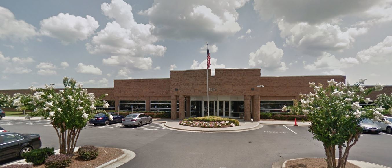
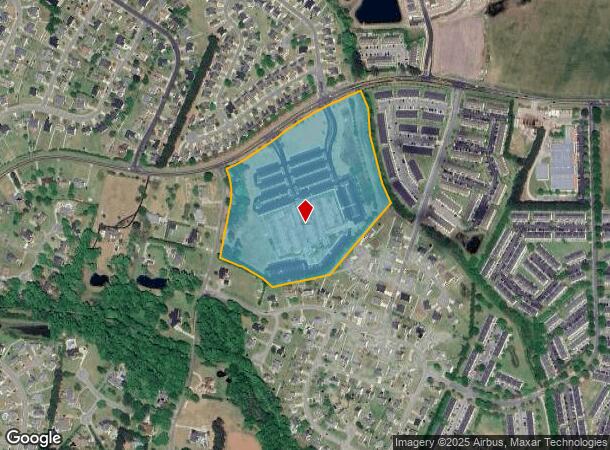
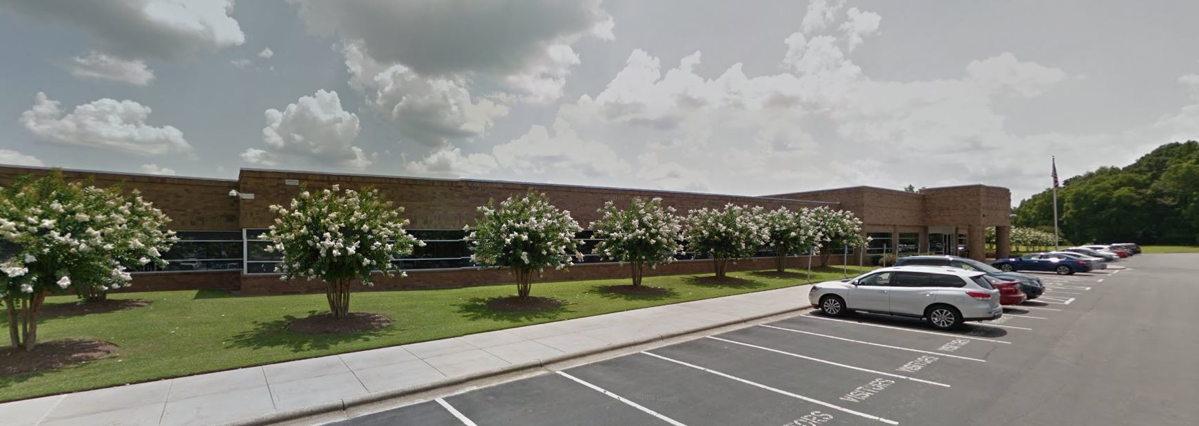
1451 Thomas Langston Rd, Winterville, NC 28590
NEARBY LISTINGS FOR SALE OR LEASE
Property Detail
1451 Thomas Langston Rd
057749
SR 1134
Commercialnec
Pitt
X
North Carolina
3720467600K
20 AC
2024
Southwest Greenville
2024
Other Market Areas
000603
Greenville, NC
111,833 SF
DEMOGRAPHICS near 1451 Thomas Langston Rd
1 Mile
3 Mile
5 Mile
2024 Total Population
7,490
49,059
102,135
2029 Population
7,756
51,244
107,256
Pop Growth 2024-2029
+ 3.55%
+ 4.45%
+ 5.01%
Average Age
35
37
36
2024 Total Households
2,915
20,704
43,433
HH Growth 2024-2029
+ 3.77%
+ 4.78%
+ 5.49%
Median Household Inc
$45,270
$54,111
$46,229
Avg Household Size
2.50
2.30
2.20
2024 Avg HH Vehicles
2.00
2.00
2.00
Median Home Value
$205,317
$183,569
$181,516
Median Year Built
1995
1997
1994
Nearby Places
- Restaurants
- Banks
- Shops
- Fitness
- Groceries
PUBLIC TRANSPORTATION
AIRPORT
Pitt-Greenville
DRIVE
WALK
Distance
Pitt-Greenville
20 min
10.2 mi
Freight Ports
Port of Morehead City
DRIVE
WALK
Distance
Port of Morehead City
130 min
85.6 mi
SALE & LEASE HISTORY
LISTING DATE
SALE/LEASE

Oct 15, 2018
For Lease
Nov 15, 2018
For Lease
May 22, 2018
For Sale
Jun 26, 2018
For Lease
Jul 10, 2018
For Sale
Jan 24, 2020
For Lease
Aug 28, 2019
For Lease
Nearby Properties
Address
Land Use
TOTAL SIZE
Lot Size
Zoning
Address
Land Use
TOTAL SIZE
Lot Size
Zoning
33,163 SF
20.14 AC
OR
Address
Land Use
TOTAL SIZE
Lot Size
Zoning
142,831 SF
13.61 AC
MO
Address
Land Use
TOTAL SIZE
Lot Size
Zoning
25,290 SF
18.26 AC
OR
Address
Land Use
TOTAL SIZE
Lot Size
Zoning
18,932 SF
11.51 AC
MR
Address
Land Use
TOTAL SIZE
Lot Size
Zoning
251,265 SF
30.17 AC
0&I
Address
Land Use
TOTAL SIZE
Lot Size
Zoning
90,108 SF
11.27 AC
OI
Address
Land Use
TOTAL SIZE
Lot Size
Zoning
162,126 SF
30 AC
OI
Address
Land Use
TOTAL SIZE
Lot Size
Zoning
23,772 SF
8.75 AC
MR
Address
Land Use
TOTAL SIZE
Lot Size
Zoning
20,292 SF
12.40 AC
OR
Address
Land Use
TOTAL SIZE
Lot Size
Zoning
152,334 SF
15.92 AC
CG
Address
Land Use
TOTAL SIZE
Lot Size
Zoning
94,176 SF
23.12 AC
R6
Address
Land Use
TOTAL SIZE
Lot Size
Zoning
19,183 SF
5.85 AC
OR
Address
Land Use
TOTAL SIZE
Lot Size
Zoning
97,638 SF
28.62 AC
R9S
Address
Land Use
TOTAL SIZE
Lot Size
Zoning
118,668 SF
9.49 AC
CH
Address
Land Use
TOTAL SIZE
Lot Size
Zoning
84,649 SF
44.78 AC
AR
Address
Land Use
TOTAL SIZE
Lot Size
Zoning
124,845 SF
13.48 AC
CG
Address
Land Use
TOTAL SIZE
Lot Size
Zoning
139,128 SF
6.57 AC
OI
Address
Land Use
TOTAL SIZE
Lot Size
Zoning
6,872 SF
8.14 AC
R6
Address
Land Use
TOTAL SIZE
Lot Size
Zoning
56,748 SF
1.72 AC
OI
Address
Land Use
TOTAL SIZE
Lot Size
Zoning
8,968 SF
17.20 AC
R6
Address
Land Use
TOTAL SIZE
Lot Size
Zoning
55,020 SF
5.07 AC
CG
Address
Land Use
TOTAL SIZE
Lot Size
Zoning
7,996 SF
3.77 AC
OR
Address
Land Use
TOTAL SIZE
Lot Size
Zoning
11,784 SF
3.98 AC
OR
Address
Land Use
TOTAL SIZE
Lot Size
Zoning
54,430 SF
39.09 AC
RA20
Address
Land Use
TOTAL SIZE
Lot Size
Zoning
45,471 SF
10.69 AC
MO
Address
Land Use
TOTAL SIZE
Lot Size
Zoning
58,705 SF
1.81 AC
CG
Address
Land Use
TOTAL SIZE
Lot Size
Zoning
8,736 SF
6.91 AC
MR
Address
Land Use
TOTAL SIZE
Lot Size
Zoning
102,792 SF
11.19 AC
CG
Address
Land Use
TOTAL SIZE
Lot Size
Zoning
38,356 SF
11.87 AC
OR
Address
Land Use
TOTAL SIZE
Lot Size
Zoning
5,370 SF
8.19 AC
R6
The World's #1 Commercial Real Estate Marketplace
Connect with us
© 2025 CoStar Group
The information above has been obtained from sources believed reliable. While we do not doubt its accuracy we have not verified it and make no guarantee, warranty or representation about it. It is your responsibility to independently confirm its accuracy and completeness. Any projections, opinions, assumptions, or estimates used are for example only and do not represent the current or future performance of the property. The value of this transaction to you depends on tax and other factors which should be evaluated by your tax, financial, and legal advisors. You and your advisors should conduct a careful, independent investigation of the property to determine to your satisfaction the suitability of the property for your needs.