Property Record
14535 Delaware St, Westminster, CO 80023
NEARBY LISTINGS FOR SALE OR LEASE
Property Detail
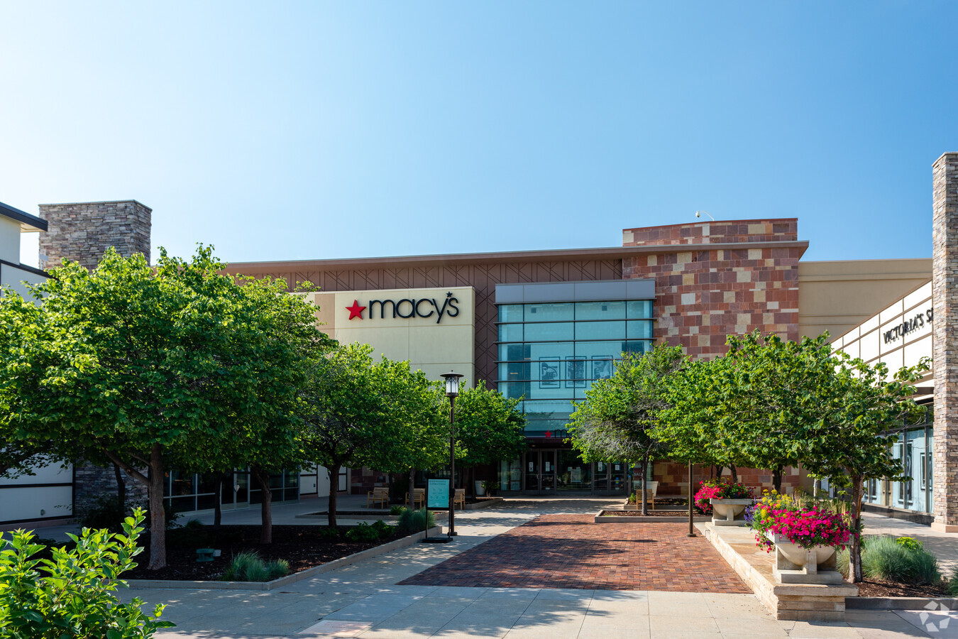
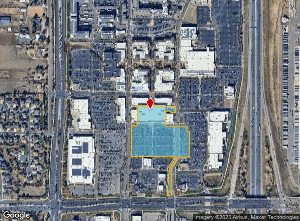
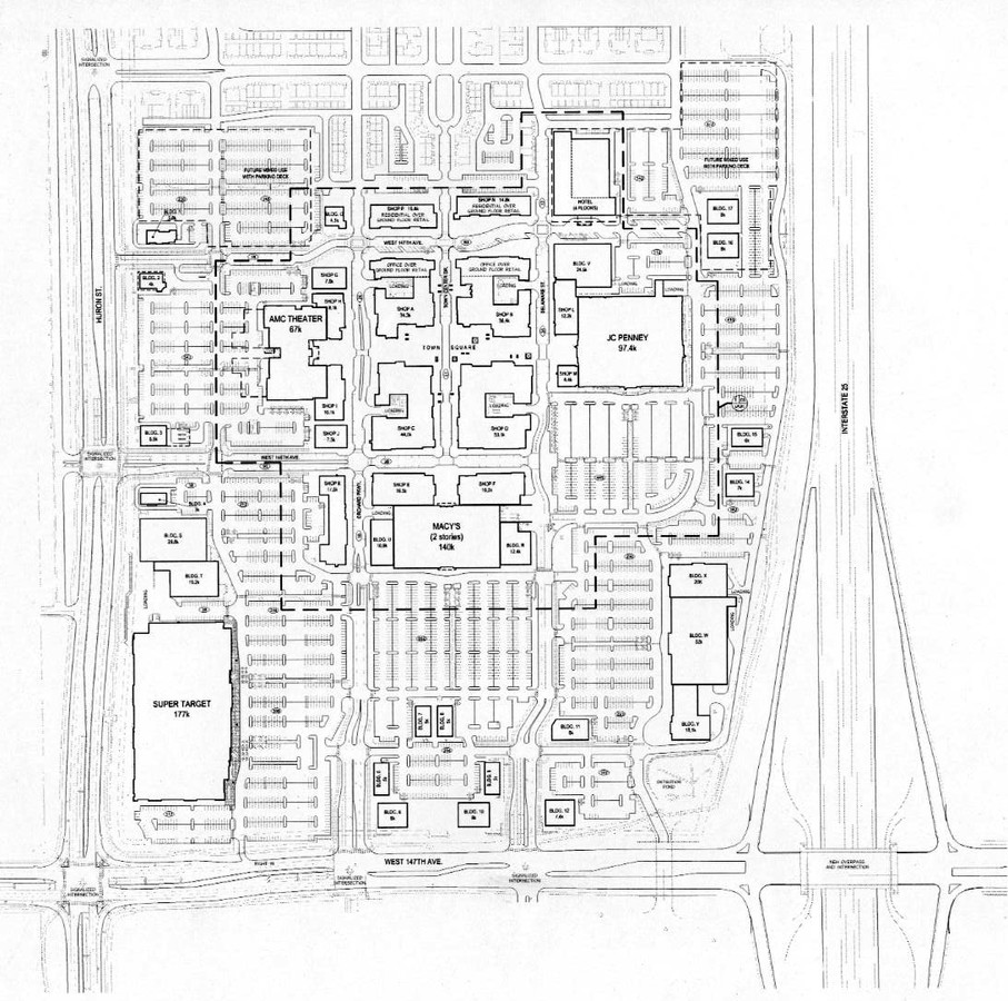
14535 Delaware St
Denver-Aurora-Lakewood, CO
The Orchard At Westminster
1573-15-3-01-006
SUB:THE ORCHARD AT WESTMINSTER FILING NO 1 FIRST REPLAT BLK:1 LOT:3A
Storebuilding
Adams
X
Colorado
08001C0303J
3a
2023
8.57 AC
2024
Northwest
060001
Denver
140,075 SF
DEMOGRAPHICS near 14535 Delaware St
1 Mile
3 Mile
5 Mile
2024 Total Population
4,848
63,489
192,894
2029 Population
5,167
66,972
203,631
Pop Growth 2024-2029
+ 6.58%
+ 5.49%
+ 5.57%
Average Age
36
37
38
2024 Total Households
2,218
22,231
70,268
HH Growth 2024-2029
+ 7.62%
+ 5.51%
+ 5.57%
Median Household Inc
$84,425
$117,954
$105,144
Avg Household Size
2.20
2.80
2.70
2024 Avg HH Vehicles
2.00
2.00
2.00
Median Home Value
$745,505
$610,052
$518,786
Median Year Built
2010
2002
1998
Nearby Places
- Restaurants
- Banks
- Shops
- Fitness
- Groceries
PUBLIC TRANSPORTATION
COMMUTER RAIL
Eastlake - 124Th Station Track 2 (Union Station to Eastlake & 124th Station - Regional Transportation District)
DRIVE
WALK
Distance
Eastlake - 124Th Station Track 2 (Union Station to Eastlake & 124th Station - Regional Transportation District)
9 min
4.4 mi
Northglenn - 112Th Station Track 2 (Union Station to Eastlake & 124th Station - Regional Transportation District)
DRIVE
WALK
Distance
Northglenn - 112Th Station Track 2 (Union Station to Eastlake & 124th Station - Regional Transportation District)
12 min
6.4 mi
AIRPORT
Denver International
DRIVE
WALK
Distance
Denver International
31 min
26.3 mi
Freight Ports
Tulsa Port Of Catoosa
DRIVE
WALK
Distance
Tulsa Port Of Catoosa
738 min
720.5 mi
Nearby Properties
Address
Land Use
TOTAL SIZE
Lot Size
Zoning
Address
Land Use
TOTAL SIZE
Lot Size
Zoning
385,623 SF
32.77 AC
Address
Land Use
TOTAL SIZE
Lot Size
Zoning
712,276 SF
72.16 AC
Address
Land Use
TOTAL SIZE
Lot Size
Zoning
177,730 SF
17.82 AC
PUD
Address
Land Use
TOTAL SIZE
Lot Size
Zoning
190,387 SF
106.32 AC
PUD
Address
Land Use
TOTAL SIZE
Lot Size
Zoning
869,000 SF
61.97 AC
Address
Land Use
TOTAL SIZE
Lot Size
Zoning
271,772 SF
21.56 AC
Address
Land Use
TOTAL SIZE
Lot Size
Zoning
424,498 SF
43.50 AC
Address
Land Use
TOTAL SIZE
Lot Size
Zoning
202,491 SF
52.56 AC
PUD
Address
Land Use
TOTAL SIZE
Lot Size
Zoning
506,255 SF
19.10 AC
Address
Land Use
TOTAL SIZE
Lot Size
Zoning
251,374 SF
20.95 AC
B-1
Address
Land Use
TOTAL SIZE
Lot Size
Zoning
244,459 SF
50.30 AC
Address
Land Use
TOTAL SIZE
Lot Size
Zoning
1 SF
13.55 AC
Address
Land Use
TOTAL SIZE
Lot Size
Zoning
136,036 SF
12.87 AC
PUD
Address
Land Use
TOTAL SIZE
Lot Size
Zoning
253,459 SF
34.63 AC
Address
Land Use
TOTAL SIZE
Lot Size
Zoning
149,769 SF
20.71 AC
Address
Land Use
TOTAL SIZE
Lot Size
Zoning
119,427 SF
12.75 AC
PUD
Address
Land Use
TOTAL SIZE
Lot Size
Zoning
284,997 SF
13.55 AC
PUD
Address
Land Use
TOTAL SIZE
Lot Size
Zoning
120,471 SF
8.39 AC
Address
Land Use
TOTAL SIZE
Lot Size
Zoning
529,836 SF
87.92 AC
Address
Land Use
TOTAL SIZE
Lot Size
Zoning
176,000 SF
8.72 AC
Address
Land Use
TOTAL SIZE
Lot Size
Zoning
146,300 SF
9 AC
Address
Land Use
TOTAL SIZE
Lot Size
Zoning
18,900 SF
60.88 AC
PUD
Address
Land Use
TOTAL SIZE
Lot Size
Zoning
74,610 SF
1.56 AC
Address
Land Use
TOTAL SIZE
Lot Size
Zoning
152,841 SF
9.30 AC
PUD
Address
Land Use
TOTAL SIZE
Lot Size
Zoning
152,841 SF
7.74 AC
PUD
Address
Land Use
TOTAL SIZE
Lot Size
Zoning
355,866 SF
16.16 AC
Address
Land Use
TOTAL SIZE
Lot Size
Zoning
150,494 SF
19.69 AC
PUDP
Address
Land Use
TOTAL SIZE
Lot Size
Zoning
235,690 SF
24.97 AC
Address
Land Use
TOTAL SIZE
Lot Size
Zoning
289,062 SF
13.74 AC
Address
Land Use
TOTAL SIZE
Lot Size
Zoning
290,841 SF
12.97 AC
The World's #1 Commercial Real Estate Marketplace
Connect with us
© 2025 CoStar Group
The information above has been obtained from sources believed reliable. While we do not doubt its accuracy we have not verified it and make no guarantee, warranty or representation about it. It is your responsibility to independently confirm its accuracy and completeness. Any projections, opinions, assumptions, or estimates used are for example only and do not represent the current or future performance of the property. The value of this transaction to you depends on tax and other factors which should be evaluated by your tax, financial, and legal advisors. You and your advisors should conduct a careful, independent investigation of the property to determine to your satisfaction the suitability of the property for your needs.