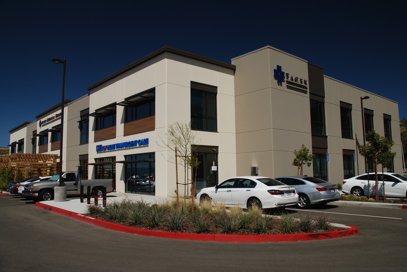
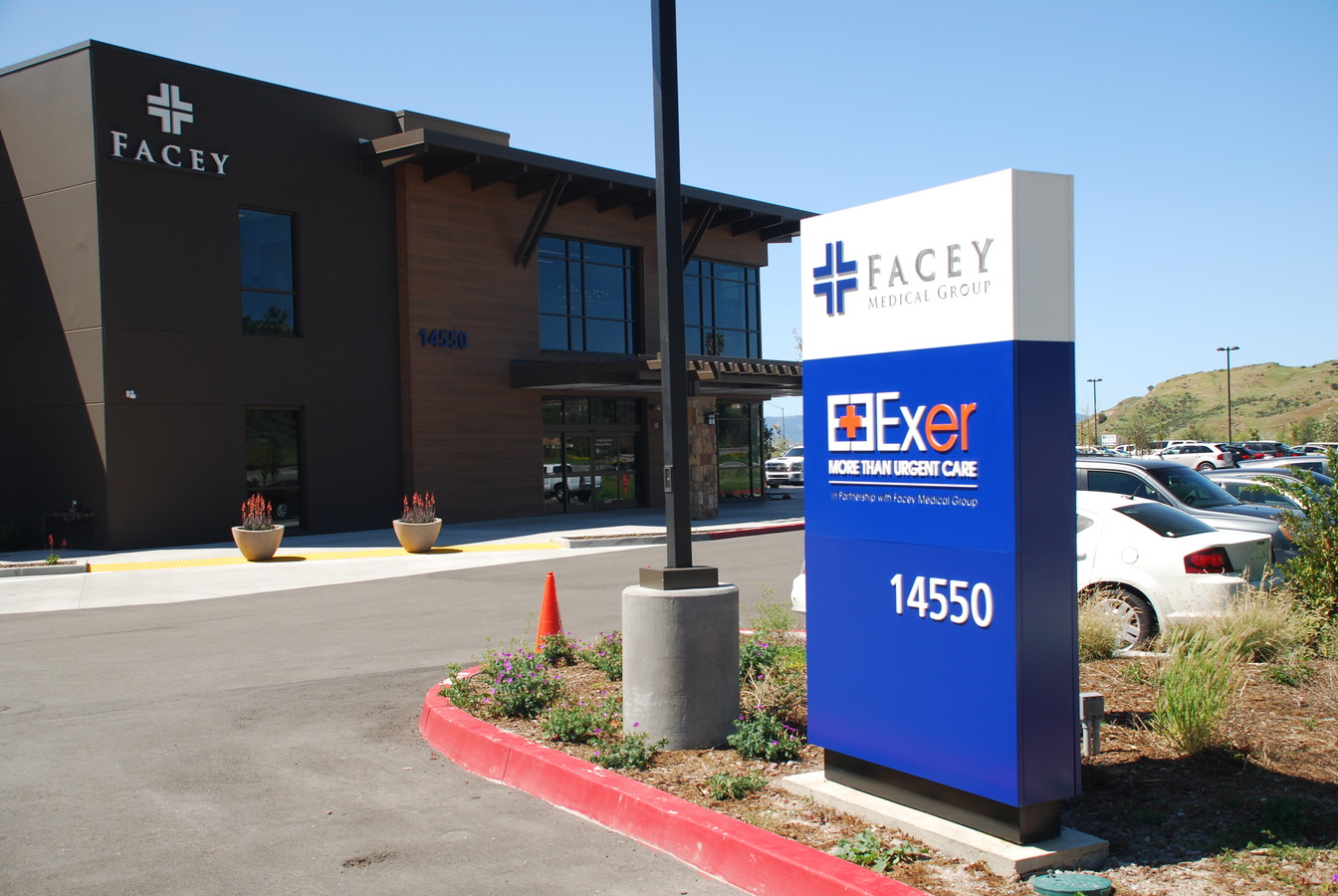
Property Record
14550 Soledad Canyon Rd, Canyon Country, CA 91387

NEARBY LISTINGS FOR SALE OR LEASE
Property Detail
14550 Soledad Canyon Rd
2854-044-050
FOR DESC SEE ASSESSORS MAPS POR OF POR N 1/2 SEC 18 T4N R14W
Medicalbuilding
Los Angeles
X
California
06037C0845G
2.04 AC
2024
Santa Clarita Valley
2024
Los Angeles
910810
Los Angeles-Long Beach-Glendale, CA
38,308 SF
DEMOGRAPHICS near 14550 Soledad Canyon Rd
1 Mile
3 Mile
5 Mile
2024 Total Population
5,119
19,748
62,252
2029 Population
4,930
18,855
59,939
Pop Growth 2024-2029
(3.69%)
(4.52%)
(3.72%)
Average Age
41
40
38
2024 Total Households
1,606
6,132
19,576
HH Growth 2024-2029
(3.99%)
(4.75%)
(4.04%)
Median Household Inc
$133,271
$120,584
$98,941
Avg Household Size
3.20
3.20
3.10
2024 Avg HH Vehicles
3.00
3.00
2.00
Median Home Value
$728,297
$742,632
$678,576
Median Year Built
1985
1985
1987
Nearby Places
- Restaurants
- Banks
- Shops
- Fitness
- Groceries
PUBLIC TRANSPORTATION
COMMUTER RAIL
Via Princessa (Antelope Valley Line - Southern California Regional Rail Authority (Metrolink))
DRIVE
WALK
Distance
Via Princessa (Antelope Valley Line - Southern California Regional Rail Authority (Metrolink))
8 min
6.0 mi
Santa Clarita (Antelope Valley Line - Southern California Regional Rail Authority (Metrolink))
DRIVE
WALK
Distance
Santa Clarita (Antelope Valley Line - Southern California Regional Rail Authority (Metrolink))
14 min
8.9 mi
AIRPORT
Bob Hope
DRIVE
WALK
Distance
Bob Hope
30 min
24.5 mi
Freight Ports
Port of Long Beach
DRIVE
WALK
Distance
Port of Long Beach
73 min
60.9 mi
Nearby Properties
Address
Land Use
TOTAL SIZE
Lot Size
Zoning
Address
Land Use
TOTAL SIZE
Lot Size
Zoning
272,382 SF
35.44 AC
SCUR5
Address
Land Use
TOTAL SIZE
Lot Size
Zoning
53,342 SF
1.37 AC
SCCC
Address
Land Use
TOTAL SIZE
Lot Size
Zoning
55,719 SF
0.61 AC
SCSP
Address
Land Use
TOTAL SIZE
Lot Size
Zoning
37,260 SF
0.97 AC
SCCC
Address
Land Use
TOTAL SIZE
Lot Size
Zoning
96,666 SF
9.19 AC
SCBP
Address
Land Use
TOTAL SIZE
Lot Size
Zoning
18,900 SF
4.67 AC
LCM1*
Address
Land Use
TOTAL SIZE
Lot Size
Zoning
10,414 SF
14.81 AC
SCCC
Address
Land Use
TOTAL SIZE
Lot Size
Zoning
50,639 SF
3.50 AC
SCUR2
Address
Land Use
TOTAL SIZE
Lot Size
Zoning
165.83 AC
LCR1
Address
Land Use
TOTAL SIZE
Lot Size
Zoning
112.98 AC
LCA1
Address
Land Use
TOTAL SIZE
Lot Size
Zoning
43,605 SF
2.36 AC
SCUR2
Address
Land Use
TOTAL SIZE
Lot Size
Zoning
45,016 SF
2.56 AC
SCCC
Address
Land Use
TOTAL SIZE
Lot Size
Zoning
10,800 SF
1.08 AC
SCUR2
Address
Land Use
TOTAL SIZE
Lot Size
Zoning
38,362 SF
2.07 AC
SCUR2
Address
Land Use
TOTAL SIZE
Lot Size
Zoning
840 SF
31.53 AC
LCC3-A11*
Address
Land Use
TOTAL SIZE
Lot Size
Zoning
148.76 AC
LCC3-A11-R
Address
Land Use
TOTAL SIZE
Lot Size
Zoning
120,523 SF
4.60 AC
SCPI
Address
Land Use
TOTAL SIZE
Lot Size
Zoning
24,966 SF
1.16 AC
SCCC
Address
Land Use
TOTAL SIZE
Lot Size
Zoning
24,700 SF
1.81 AC
SCUR3
Address
Land Use
TOTAL SIZE
Lot Size
Zoning
1.92 AC
SCCC
Address
Land Use
TOTAL SIZE
Lot Size
Zoning
24,700 SF
1.29 AC
SCUR3
Address
Land Use
TOTAL SIZE
Lot Size
Zoning
38,308 SF
0.85 AC
SCCC
Address
Land Use
TOTAL SIZE
Lot Size
Zoning
6,740 SF
0.44 AC
SCCC
Address
Land Use
TOTAL SIZE
Lot Size
Zoning
6,815 SF
1.07 AC
SCUR2
Address
Land Use
TOTAL SIZE
Lot Size
Zoning
4,609 SF
0.44 AC
SCCC
Address
Land Use
TOTAL SIZE
Lot Size
Zoning
38,308 SF
0.39 AC
SCCC
Address
Land Use
TOTAL SIZE
Lot Size
Zoning
18,525 SF
1.69 AC
SCUR3
Address
Land Use
TOTAL SIZE
Lot Size
Zoning
24,627 SF
6.33 AC
SCOS
Address
Land Use
TOTAL SIZE
Lot Size
Zoning
4,054 SF
0.98 AC
SCCC
The World's #1 Commercial Real Estate Marketplace
Connect with us
© 2025 CoStar Group
The information above has been obtained from sources believed reliable. While we do not doubt its accuracy we have not verified it and make no guarantee, warranty or representation about it. It is your responsibility to independently confirm its accuracy and completeness. Any projections, opinions, assumptions, or estimates used are for example only and do not represent the current or future performance of the property. The value of this transaction to you depends on tax and other factors which should be evaluated by your tax, financial, and legal advisors. You and your advisors should conduct a careful, independent investigation of the property to determine to your satisfaction the suitability of the property for your needs.