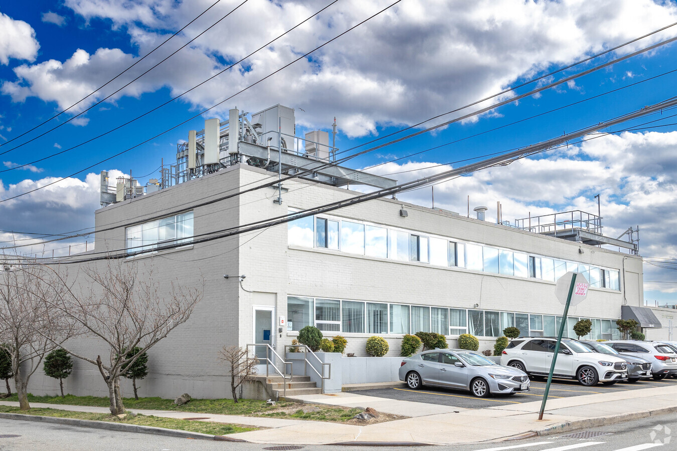
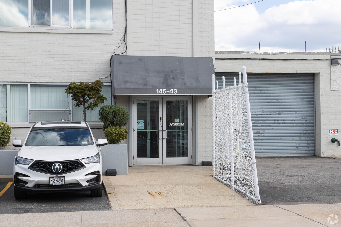
Property Record
14569 226Th St, Springfield Gardens, NY 11413

Current Lease Availabilities
NEARBY LISTINGS FOR SALE OR LEASE
Property Detail
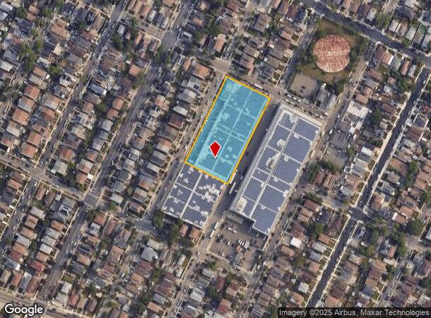
14569 226Th St
13474-0012
Pierini Park
Warehouse
Queens
X
New York
3604970242F
12
2024
1.84 AC
2024
South Queens
069000
Long Island (New York)
67,400 SF
New York-Jersey City-White Plains, NY-NJ
DEMOGRAPHICS near 14569 226Th St
1 Mile
3 Mile
5 Mile
2024 Total Population
35,392
274,842
855,304
2029 Population
32,009
256,037
800,642
Pop Growth 2024-2029
(9.56%)
(6.84%)
(6.39%)
Average Age
41
41
41
2024 Total Households
10,337
84,086
265,821
HH Growth 2024-2029
(10.26%)
(7.26%)
(6.62%)
Median Household Inc
$97,912
$91,405
$84,816
Avg Household Size
3.20
3.10
3.00
2024 Avg HH Vehicles
1.00
1.00
1.00
Median Home Value
$655,998
$627,241
$654,770
Median Year Built
1954
1953
1952
Nearby Places
- Restaurants
- Banks
- Shops
- Fitness
- Groceries
PUBLIC TRANSPORTATION
COMMUTER RAIL
Laurelton Station (Far Rockaway Branch - Long Island Rail Road)
DRIVE
WALK
Distance
Laurelton Station (Far Rockaway Branch - Long Island Rail Road)
2 min
12 min
0.7 mi
Rosedale Station (Far Rockaway Branch - Long Island Rail Road)
DRIVE
WALK
Distance
Rosedale Station (Far Rockaway Branch - Long Island Rail Road)
3 min
1.3 mi
AIRPORT
John F Kennedy International
DRIVE
WALK
Distance
John F Kennedy International
10 min
4.6 mi
Laguardia
DRIVE
WALK
Distance
Laguardia
21 min
11.6 mi
Newark Liberty International
DRIVE
WALK
Distance
Newark Liberty International
47 min
31.3 mi
Freight Ports
NY - Red Hook Container Terminal
DRIVE
WALK
Distance
NY - Red Hook Container Terminal
31 min
16.0 mi
Nearby Properties
Address
Land Use
TOTAL SIZE
Lot Size
Zoning
Address
Land Use
TOTAL SIZE
Lot Size
Zoning
14,417,607 SF
4,921.45 AC
M1-1
Address
Land Use
TOTAL SIZE
Lot Size
Zoning
111.98 AC
PARK
Address
Land Use
TOTAL SIZE
Lot Size
Zoning
182.50 AC
M1-1
Address
Land Use
TOTAL SIZE
Lot Size
Zoning
294.47 AC
PARK
Address
Land Use
TOTAL SIZE
Lot Size
Zoning
731,247 SF
56.09 AC
R3-2
Address
Land Use
TOTAL SIZE
Lot Size
Zoning
208,952 SF
9.03 AC
M1-1
Address
Land Use
TOTAL SIZE
Lot Size
Zoning
285,170 SF
12.63 AC
R3-1
Address
Land Use
TOTAL SIZE
Lot Size
Zoning
50,000 SF
52.45 AC
PARK
Address
Land Use
TOTAL SIZE
Lot Size
Zoning
175,040 SF
10.19 AC
R3X
Address
Land Use
TOTAL SIZE
Lot Size
Zoning
129,378 SF
4.86 AC
R2A
Address
Land Use
TOTAL SIZE
Lot Size
Zoning
160,551 SF
0.68 AC
C4-2
Address
Land Use
TOTAL SIZE
Lot Size
Zoning
304,128 SF
3.70 AC
R6
Address
Land Use
TOTAL SIZE
Lot Size
Zoning
41,756 SF
1.02 AC
R5D
Address
Land Use
TOTAL SIZE
Lot Size
Zoning
189,693 SF
2.11 AC
R3-2
Address
Land Use
TOTAL SIZE
Lot Size
Zoning
160,000 SF
4.02 AC
R3-2
Address
Land Use
TOTAL SIZE
Lot Size
Zoning
165,600 SF
2.11 AC
R6
Address
Land Use
TOTAL SIZE
Lot Size
Zoning
233,210 SF
1.74 AC
C4-2
Address
Land Use
TOTAL SIZE
Lot Size
Zoning
197,532 SF
1.42 AC
C4-2
Address
Land Use
TOTAL SIZE
Lot Size
Zoning
615,000 SF
3.60 AC
R3-2
Address
Land Use
TOTAL SIZE
Lot Size
Zoning
199,873 SF
1.65 AC
C4-2
Address
Land Use
TOTAL SIZE
Lot Size
Zoning
178,870 SF
7.60 AC
M1-1
Address
Land Use
TOTAL SIZE
Lot Size
Zoning
122,080 SF
2.80 AC
R2
Address
Land Use
TOTAL SIZE
Lot Size
Zoning
32,017 SF
0.38 AC
R5D
Address
Land Use
TOTAL SIZE
Lot Size
Zoning
243,100 SF
2.30 AC
R3A
Address
Land Use
TOTAL SIZE
Lot Size
Zoning
875 SF
21.59 AC
PARK
Address
Land Use
TOTAL SIZE
Lot Size
Zoning
5,296 SF
37.42 AC
PARK
Address
Land Use
TOTAL SIZE
Lot Size
Zoning
138,000 SF
7.06 AC
R3-2
Address
Land Use
TOTAL SIZE
Lot Size
Zoning
213,338 SF
2.91 AC
R3X
Address
Land Use
TOTAL SIZE
Lot Size
Zoning
104,824 SF
2.80 AC
R6
Address
Land Use
TOTAL SIZE
Lot Size
Zoning
252,665 SF
7.50 AC
R3-2
The World's #1 Commercial Real Estate Marketplace
Connect with us
© 2025 CoStar Group
The information above has been obtained from sources believed reliable. While we do not doubt its accuracy we have not verified it and make no guarantee, warranty or representation about it. It is your responsibility to independently confirm its accuracy and completeness. Any projections, opinions, assumptions, or estimates used are for example only and do not represent the current or future performance of the property. The value of this transaction to you depends on tax and other factors which should be evaluated by your tax, financial, and legal advisors. You and your advisors should conduct a careful, independent investigation of the property to determine to your satisfaction the suitability of the property for your needs.