Property Record
1462 Eatonton Rd, Madison, GA 30650
NEARBY LISTINGS FOR SALE OR LEASE
Property Detail
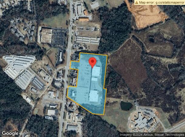
1462 Eatonton Rd
037E010000
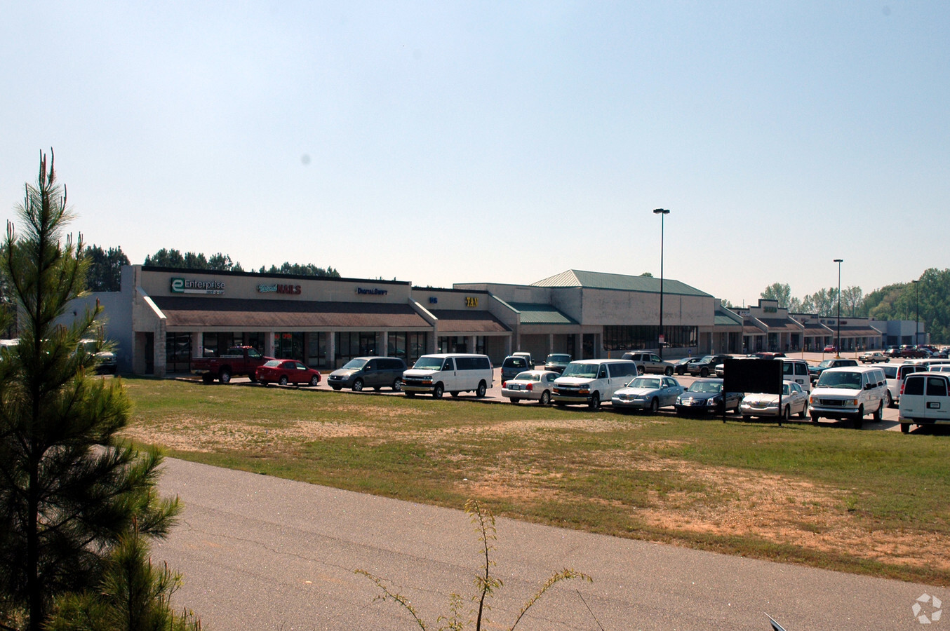
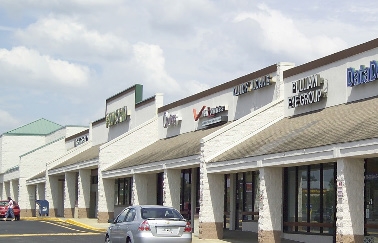
Beacon Heights
Stripcommercialcenter
BEACON HEIGHTS SHOPPING CENTER/PARCEL 1
X
Morgan
13211C0205B
Georgia
2024
17.61 AC
2024
Atlanta East
010302
Other Market Areas
110,017 SF
Atlanta-Sandy Springs-Roswell, GA
DEMOGRAPHICS near 1462 Eatonton Rd
1 Mile
3 Mile
5 Mile
2024 Total Population
994
6,534
9,043
2029 Population
1,098
7,293
10,112
Pop Growth 2024-2029
+ 10.46%
+ 11.62%
+ 11.82%
Average Age
40
41
41
2024 Total Households
356
2,486
3,416
HH Growth 2024-2029
+ 10.39%
+ 11.58%
+ 11.80%
Median Household Inc
$70,499
$73,837
$73,451
Avg Household Size
2.60
2.50
2.50
2024 Avg HH Vehicles
2.00
2.00
2.00
Median Home Value
$451,724
$357,266
$353,065
Median Year Built
1966
1982
1986
Nearby Places
- Restaurants
- Banks
- Shops
- Fitness
- Groceries
SALE & LEASE HISTORY
LISTING DATE
SALE/LEASE

Sep 25, 2016
For Lease
Mar 06, 2024
For Lease
Nearby Properties
Address
Land Use
TOTAL SIZE
Lot Size
Zoning
Address
Land Use
TOTAL SIZE
Lot Size
Zoning
115,369 SF
79.11 AC
R
Address
Land Use
TOTAL SIZE
Lot Size
Zoning
74,434 SF
22.42 AC
R
Address
Land Use
TOTAL SIZE
Lot Size
Zoning
181,127 SF
74.30 AC
I2
Address
Land Use
TOTAL SIZE
Lot Size
Zoning
39,964 SF
21.78 AC
R1
Address
Land Use
TOTAL SIZE
Lot Size
Zoning
916 SF
23 AC
R
Address
Land Use
TOTAL SIZE
Lot Size
Zoning
162,864 SF
61.61 AC
I2
Address
Land Use
TOTAL SIZE
Lot Size
Zoning
155,624 SF
23.55 AC
C3 / PCD
Address
Land Use
TOTAL SIZE
Lot Size
Zoning
17,100 SF
0.46 AC
C1
Address
Land Use
TOTAL SIZE
Lot Size
Zoning
109,854 SF
18.19 AC
C3 / PCD
Address
Land Use
TOTAL SIZE
Lot Size
Zoning
133,680 SF
I1
Address
Land Use
TOTAL SIZE
Lot Size
Zoning
17,326 SF
2.28 AC
R1
Address
Land Use
TOTAL SIZE
Lot Size
Zoning
2,426 SF
28.08 AC
PPD
Address
Land Use
TOTAL SIZE
Lot Size
Zoning
118,124 SF
26.68 AC
I1
Address
Land Use
TOTAL SIZE
Lot Size
Zoning
17,341 SF
42.81 AC
C4
Address
Land Use
TOTAL SIZE
Lot Size
Zoning
177,950 SF
7.12 AC
I1
Address
Land Use
TOTAL SIZE
Lot Size
Zoning
67,286 SF
7.47 AC
C3
Address
Land Use
TOTAL SIZE
Lot Size
Zoning
180,870 SF
16.87 AC
I2
Address
Land Use
TOTAL SIZE
Lot Size
Zoning
6,192 SF
6.24 AC
R2
Address
Land Use
TOTAL SIZE
Lot Size
Zoning
29,289 SF
5.83 AC
P1
Address
Land Use
TOTAL SIZE
Lot Size
Zoning
11,793 SF
14.63 AC
C4
Address
Land Use
TOTAL SIZE
Lot Size
Zoning
156,496 SF
5.58 AC
I1
Address
Land Use
TOTAL SIZE
Lot Size
Zoning
61,525 SF
12.12 AC
C3
Address
Land Use
TOTAL SIZE
Lot Size
Zoning
333,111 SF
27.51 AC
I1
Address
Land Use
TOTAL SIZE
Lot Size
Zoning
2,013 SF
9.93 AC
R8 / PRD
Address
Land Use
TOTAL SIZE
Lot Size
Zoning
48,642 SF
4.82 AC
I1
Address
Land Use
TOTAL SIZE
Lot Size
Zoning
36,219 SF
2 AC
C4
Address
Land Use
TOTAL SIZE
Lot Size
Zoning
21,345 SF
1.47 AC
R1
Address
Land Use
TOTAL SIZE
Lot Size
Zoning
422.06 AC
AG
Address
Land Use
TOTAL SIZE
Lot Size
Zoning
109,124 SF
16.03 AC
I2
The World's #1 Commercial Real Estate Marketplace
Connect with us
© 2025 CoStar Group
The information above has been obtained from sources believed reliable. While we do not doubt its accuracy we have not verified it and make no guarantee, warranty or representation about it. It is your responsibility to independently confirm its accuracy and completeness. Any projections, opinions, assumptions, or estimates used are for example only and do not represent the current or future performance of the property. The value of this transaction to you depends on tax and other factors which should be evaluated by your tax, financial, and legal advisors. You and your advisors should conduct a careful, independent investigation of the property to determine to your satisfaction the suitability of the property for your needs.