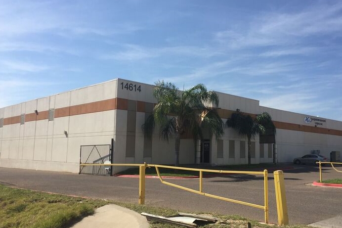
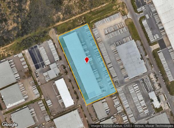
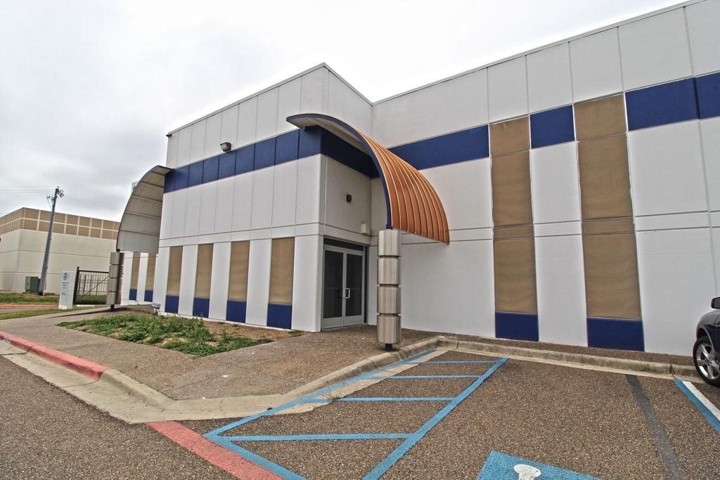
Property Record
14621 Archer Dr, Laredo, TX 78045
NEARBY LISTINGS FOR SALE OR LEASE
Property Detail
14621 Archer Dr
Laredo, TX
Killam Ind Park
256119
KILLAM IND PARK, BLOCK 12, LOTS 7 & 8, UNIT 8
Commercialnec
Webb
X
Texas
48479C1185C
7,8
2023
8.31 AC
2024
Texas South Area
0017112013
Other Market Areas
147,482 SF
DEMOGRAPHICS near 14621 Archer Dr
1 Mile
3 Mile
5 Mile
2024 Total Population
535
29,136
75,751
2029 Population
546
29,683
76,686
Pop Growth 2024-2029
+ 2.06%
+ 1.88%
+ 1.23%
Average Age
32
33
34
2024 Total Households
146
8,455
23,283
HH Growth 2024-2029
+ 2.74%
+ 2.03%
+ 1.30%
Median Household Inc
$57,999
$64,700
$79,658
Avg Household Size
3.60
3.40
3.20
2024 Avg HH Vehicles
2.00
2.00
2.00
Median Home Value
$177,048
$170,511
$211,454
Median Year Built
2007
2004
2002
Nearby Places
- Restaurants
- Banks
- Shops
- Fitness
- Groceries
PUBLIC TRANSPORTATION
AIRPORT
Laredo International
DRIVE
WALK
Distance
Laredo International
18 min
11.2 mi
Freight Ports
Port of Corpus Christi
DRIVE
WALK
Distance
Port of Corpus Christi
174 min
150.2 mi
SALE & LEASE HISTORY
LISTING DATE
SALE/LEASE

Mar 20, 2020
For Lease
Nearby Properties
Address
Land Use
TOTAL SIZE
Lot Size
Zoning
Address
Land Use
TOTAL SIZE
Lot Size
Zoning
251,512 SF
57.32 AC
B4
Address
Land Use
TOTAL SIZE
Lot Size
Zoning
649,220 SF
38.29 AC
M1
Address
Land Use
TOTAL SIZE
Lot Size
Zoning
109,695 SF
3.72 AC
M1
Address
Land Use
TOTAL SIZE
Lot Size
Zoning
562,944 SF
30 AC
M1
Address
Land Use
TOTAL SIZE
Lot Size
Zoning
411,456 SF
37.36 AC
Address
Land Use
TOTAL SIZE
Lot Size
Zoning
436,600 SF
29.51 AC
Address
Land Use
TOTAL SIZE
Lot Size
Zoning
169,188 SF
60.99 AC
Address
Land Use
TOTAL SIZE
Lot Size
Zoning
436,814 SF
27.66 AC
Address
Land Use
TOTAL SIZE
Lot Size
Zoning
521,026 SF
30 AC
M1
Address
Land Use
TOTAL SIZE
Lot Size
Zoning
192,203 SF
22.01 AC
B4
Address
Land Use
TOTAL SIZE
Lot Size
Zoning
162,013 SF
9.16 AC
B1
Address
Land Use
TOTAL SIZE
Lot Size
Zoning
118,124 SF
11.30 AC
R1A
Address
Land Use
TOTAL SIZE
Lot Size
Zoning
95,769 SF
11.81 AC
Address
Land Use
TOTAL SIZE
Lot Size
Zoning
96,665 SF
11.12 AC
R1A
Address
Land Use
TOTAL SIZE
Lot Size
Zoning
200,446 SF
25.68 AC
M1
Address
Land Use
TOTAL SIZE
Lot Size
Zoning
98,998 SF
10.31 AC
B3
Address
Land Use
TOTAL SIZE
Lot Size
Zoning
253,870 SF
16.05 AC
M1
Address
Land Use
TOTAL SIZE
Lot Size
Zoning
70,453 SF
21.12 AC
AG
Address
Land Use
TOTAL SIZE
Lot Size
Zoning
257,516 SF
21.94 AC
Address
Land Use
TOTAL SIZE
Lot Size
Zoning
246,003 SF
24.32 AC
Address
Land Use
TOTAL SIZE
Lot Size
Zoning
174,928 SF
10 AC
R2
Address
Land Use
TOTAL SIZE
Lot Size
Zoning
274,784 SF
13.52 AC
M1
Address
Land Use
TOTAL SIZE
Lot Size
Zoning
243,399 SF
15.50 AC
Address
Land Use
TOTAL SIZE
Lot Size
Zoning
243,707 SF
18.34 AC
Address
Land Use
TOTAL SIZE
Lot Size
Zoning
121,400 SF
12.92 AC
B4
Address
Land Use
TOTAL SIZE
Lot Size
Zoning
253,180 SF
16.56 AC
M1
Address
Land Use
TOTAL SIZE
Lot Size
Zoning
152,192 SF
8.97 AC
R2
Address
Land Use
TOTAL SIZE
Lot Size
Zoning
69,135 SF
9.52 AC
R1
Address
Land Use
TOTAL SIZE
Lot Size
Zoning
184,814 SF
10.47 AC
M1
Address
Land Use
TOTAL SIZE
Lot Size
Zoning
69,364 SF
8.96 AC
B3
The World's #1 Commercial Real Estate Marketplace
Connect with us
© 2025 CoStar Group
The information above has been obtained from sources believed reliable. While we do not doubt its accuracy we have not verified it and make no guarantee, warranty or representation about it. It is your responsibility to independently confirm its accuracy and completeness. Any projections, opinions, assumptions, or estimates used are for example only and do not represent the current or future performance of the property. The value of this transaction to you depends on tax and other factors which should be evaluated by your tax, financial, and legal advisors. You and your advisors should conduct a careful, independent investigation of the property to determine to your satisfaction the suitability of the property for your needs.