Property Record
14638 Apple Dr, Fruitport, MI 49415
NEARBY LISTINGS FOR SALE OR LEASE
-
-
View all Fruitport listings for sale on LoopNet.com
Property Detail
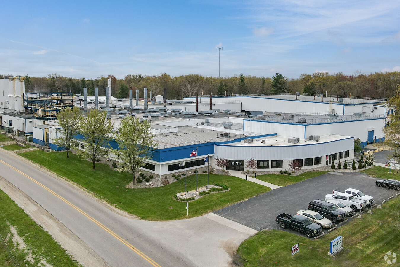
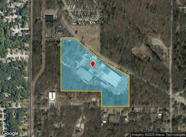
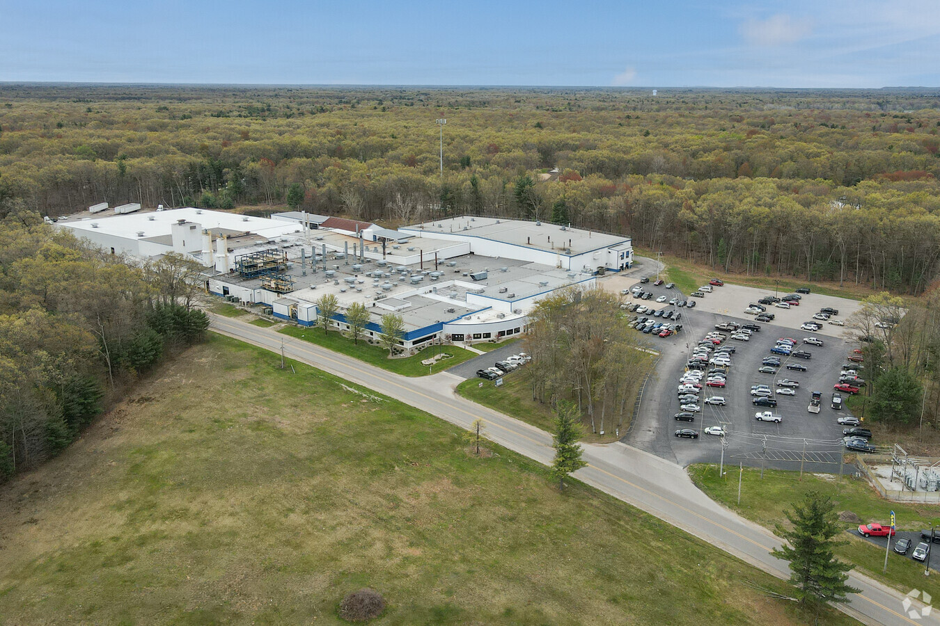
14638 Apple Dr
70-03-01-200-025
W 5206 FT OF E 796 A OF NE FRL 1/4 LYING S OF APPLE DR, EXC S 43 FT FOR RD R/W, ALSO E 750 FT OF N 3/4 OF SW 1/4 OF NE 1/4 LYING SW'LY OF APPLE DR SEC 1 T8N R16W 263 A
Lightindustrial
Ottawa
X
Michigan
26121C0407E
22 AC
2023
Grand Haven/Ferrysburg
2024
West Michigan
020503
Grand Rapids-Wyoming, MI
207,571 SF
DEMOGRAPHICS near 14638 Apple Dr
1 Mile
3 Mile
5 Mile
2024 Total Population
2,113
16,663
42,509
2029 Population
2,202
17,429
44,409
Pop Growth 2024-2029
+ 4.21%
+ 4.60%
+ 4.47%
Average Age
41
42
42
2024 Total Households
824
6,620
17,395
HH Growth 2024-2029
+ 4.37%
+ 4.76%
+ 4.63%
Median Household Inc
$81,338
$72,753
$71,570
Avg Household Size
2.60
2.50
2.40
2024 Avg HH Vehicles
2.00
2.00
2.00
Median Home Value
$293,608
$279,660
$262,396
Median Year Built
1981
1987
1982
Nearby Places
- Restaurants
- Banks
- Shops
- Fitness
- Groceries
SALE & LEASE HISTORY
LISTING DATE
SALE/LEASE

May 14, 2021
For Sale
Nearby Properties
Address
Land Use
TOTAL SIZE
Lot Size
Zoning
Address
Land Use
TOTAL SIZE
Lot Size
Zoning
169.22 AC
PR
Address
Land Use
TOTAL SIZE
Lot Size
Zoning
55,600 SF
LI
Address
Land Use
TOTAL SIZE
Lot Size
Zoning
40,251 SF
159.38 AC
PR
Address
Land Use
TOTAL SIZE
Lot Size
Zoning
2,724 SF
56.50 AC
MHP
Address
Land Use
TOTAL SIZE
Lot Size
Zoning
27,006 SF
6.12 AC
MU
Address
Land Use
TOTAL SIZE
Lot Size
Zoning
64,143 SF
11.43 AC
LI
Address
Land Use
TOTAL SIZE
Lot Size
Zoning
4,064 SF
39.10 AC
Address
Land Use
TOTAL SIZE
Lot Size
Zoning
32,368 SF
Address
Land Use
TOTAL SIZE
Lot Size
Zoning
588 SF
39.91 AC
MHP
Address
Land Use
TOTAL SIZE
Lot Size
Zoning
2,618 SF
13.25 AC
LI
Address
Land Use
TOTAL SIZE
Lot Size
Zoning
63,006 SF
3.30 AC
MFR-B
Address
Land Use
TOTAL SIZE
Lot Size
Zoning
141,122 SF
9.67 AC
I INDU
Address
Land Use
TOTAL SIZE
Lot Size
Zoning
27,768 SF
4.58 AC
GC
Address
Land Use
TOTAL SIZE
Lot Size
Zoning
94,226 SF
3.70 AC
EED-PUD
Address
Land Use
TOTAL SIZE
Lot Size
Zoning
22,500 SF
I INDU
Address
Land Use
TOTAL SIZE
Lot Size
Zoning
122,963 SF
4.23 AC
LI
Address
Land Use
TOTAL SIZE
Lot Size
Zoning
84,140 SF
4.66 AC
LI
Address
Land Use
TOTAL SIZE
Lot Size
Zoning
13 AC
MHP
Address
Land Use
TOTAL SIZE
Lot Size
Zoning
10.33 AC
R-2
Address
Land Use
TOTAL SIZE
Lot Size
Zoning
95,126 SF
5.08 AC
LI
Address
Land Use
TOTAL SIZE
Lot Size
Zoning
38,563 SF
B-3
Address
Land Use
TOTAL SIZE
Lot Size
Zoning
52,533 SF
2.75 AC
MFR-B
Address
Land Use
TOTAL SIZE
Lot Size
Zoning
67,980 SF
11.02 AC
LI
Address
Land Use
TOTAL SIZE
Lot Size
Zoning
53,100 SF
2.76 AC
LI
Address
Land Use
TOTAL SIZE
Lot Size
Zoning
187.73 AC
PR
Address
Land Use
TOTAL SIZE
Lot Size
Zoning
3,676 SF
2.27 AC
R-2
Address
Land Use
TOTAL SIZE
Lot Size
Zoning
41,832 SF
5.24 AC
LI
Address
Land Use
TOTAL SIZE
Lot Size
Zoning
32,797 SF
B-3
Address
Land Use
TOTAL SIZE
Lot Size
Zoning
1,380 SF
46.68 AC
RR
The World's #1 Commercial Real Estate Marketplace
Connect with us
© 2025 CoStar Group
The information above has been obtained from sources believed reliable. While we do not doubt its accuracy we have not verified it and make no guarantee, warranty or representation about it. It is your responsibility to independently confirm its accuracy and completeness. Any projections, opinions, assumptions, or estimates used are for example only and do not represent the current or future performance of the property. The value of this transaction to you depends on tax and other factors which should be evaluated by your tax, financial, and legal advisors. You and your advisors should conduct a careful, independent investigation of the property to determine to your satisfaction the suitability of the property for your needs.