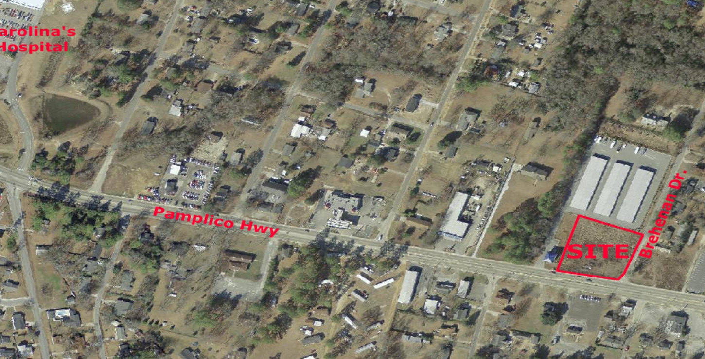
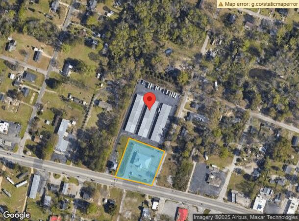
Property Record
1465 Pamplico Hwy, Florence, SC 29505
NEARBY LISTINGS FOR SALE OR LEASE
Property Detail
1465 Pamplico Hwy
90133-01-002
Rgh Associates Lp And American Storage
Medicalbuilding
PAMPLICO HWY TRACT A
X
Florence
45041C0163E
South Carolina
2023
1.45 AC
2023
Florence/Dillon
000600
Other Market Areas
6,768 SF
Florence, SC
DEMOGRAPHICS near 1465 Pamplico Hwy
1 Mile
3 Mile
5 Mile
2024 Total Population
3,624
27,960
60,322
2029 Population
3,579
27,661
59,958
Pop Growth 2024-2029
(1.24%)
(1.07%)
(0.60%)
Average Age
40
40
40
2024 Total Households
1,465
11,472
24,982
HH Growth 2024-2029
(1.23%)
(0.99%)
(0.58%)
Median Household Inc
$69,502
$55,043
$48,323
Avg Household Size
2.40
2.40
2.30
2024 Avg HH Vehicles
2.00
2.00
2.00
Median Home Value
$150,806
$162,760
$157,827
Median Year Built
1982
1988
1981
Nearby Places
- Restaurants
- Banks
- Shops
- Fitness
- Groceries
PUBLIC TRANSPORTATION
COMMUTER RAIL
Florence Amtrak Station (Palmetto - Amtrak, Silver Meteor - Amtrak)
DRIVE
WALK
Distance
Florence Amtrak Station (Palmetto - Amtrak, Silver Meteor - Amtrak)
8 min
4.0 mi
Freight Ports
North Charleston Terminal
DRIVE
WALK
Distance
North Charleston Terminal
138 min
101.4 mi
SALE & LEASE HISTORY
LISTING DATE
SALE/LEASE

Sep 28, 2017
For Sale
Sep 24, 2016
For Sale
Nearby Properties
Address
Land Use
TOTAL SIZE
Lot Size
Zoning
Address
Land Use
TOTAL SIZE
Lot Size
Zoning
125,000 SF
6.84 AC
B1
Address
Land Use
TOTAL SIZE
Lot Size
Zoning
1,347.68 AC
Address
Land Use
TOTAL SIZE
Lot Size
Zoning
86,950 SF
6.82 AC
B2
Address
Land Use
TOTAL SIZE
Lot Size
Zoning
26.36 AC
B1
Address
Land Use
TOTAL SIZE
Lot Size
Zoning
134,869 SF
20.08 AC
Address
Land Use
TOTAL SIZE
Lot Size
Zoning
14,820 SF
0.88 AC
B3
Address
Land Use
TOTAL SIZE
Lot Size
Zoning
112,056 SF
18.96 AC
Address
Land Use
TOTAL SIZE
Lot Size
Zoning
30.32 AC
Address
Land Use
TOTAL SIZE
Lot Size
Zoning
2.39 AC
B1
Address
Land Use
TOTAL SIZE
Lot Size
Zoning
18,908 SF
0.47 AC
B3
Address
Land Use
TOTAL SIZE
Lot Size
Zoning
14,950 SF
1.41 AC
B3
Address
Land Use
TOTAL SIZE
Lot Size
Zoning
59,361 SF
9.14 AC
Address
Land Use
TOTAL SIZE
Lot Size
Zoning
22,464 SF
4.46 AC
Address
Land Use
TOTAL SIZE
Lot Size
Zoning
47,905 SF
7.02 AC
Address
Land Use
TOTAL SIZE
Lot Size
Zoning
13,454 SF
3.86 AC
Address
Land Use
TOTAL SIZE
Lot Size
Zoning
10,008 SF
20.91 AC
Address
Land Use
TOTAL SIZE
Lot Size
Zoning
7,200 SF
6.65 AC
R5
Address
Land Use
TOTAL SIZE
Lot Size
Zoning
80,000 SF
11.02 AC
B3
Address
Land Use
TOTAL SIZE
Lot Size
Zoning
77,515 SF
17.19 AC
Address
Land Use
TOTAL SIZE
Lot Size
Zoning
32,800 SF
1.89 AC
B1
Address
Land Use
TOTAL SIZE
Lot Size
Zoning
46,097 SF
5.30 AC
B2
Address
Land Use
TOTAL SIZE
Lot Size
Zoning
1,130 SF
8.38 AC
Address
Land Use
TOTAL SIZE
Lot Size
Zoning
2,800 SF
0.81 AC
B3
Address
Land Use
TOTAL SIZE
Lot Size
Zoning
12,634 SF
10.27 AC
Address
Land Use
TOTAL SIZE
Lot Size
Zoning
2,008 SF
7.22 AC
The World's #1 Commercial Real Estate Marketplace
Connect with us
© 2025 CoStar Group
The information above has been obtained from sources believed reliable. While we do not doubt its accuracy we have not verified it and make no guarantee, warranty or representation about it. It is your responsibility to independently confirm its accuracy and completeness. Any projections, opinions, assumptions, or estimates used are for example only and do not represent the current or future performance of the property. The value of this transaction to you depends on tax and other factors which should be evaluated by your tax, financial, and legal advisors. You and your advisors should conduct a careful, independent investigation of the property to determine to your satisfaction the suitability of the property for your needs.