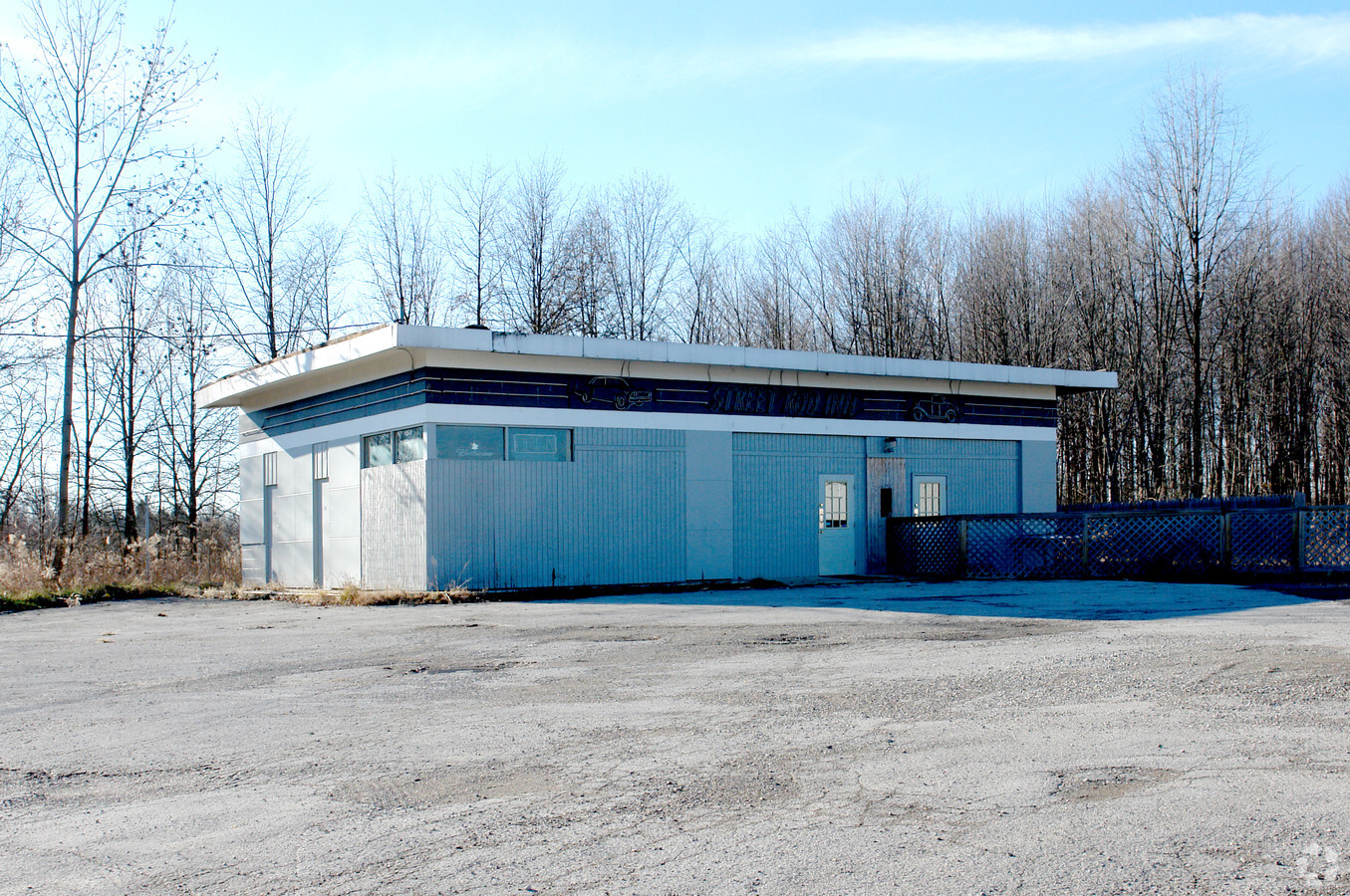
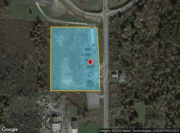
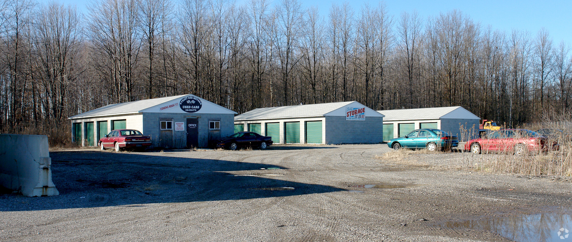
Property Record
147 N Pricetown Rd, Diamond, OH 44412
NEARBY LISTINGS FOR SALE OR LEASE
Property Detail
147 N Pricetown Rd
Youngstown/Warren/Boardman
Milton Heights Plat
Youngstown-Warren-Boardman, OH-PA
LOT 1 632.64 X 497.30 (IRR) REPLAT FOR LOT 1 MILTON HEIGHTS PLAT NO. 1
51-109-0-008.00-0
Mahoning
Publicstorage
Ohio
2023
1
2023
7.09 AC
812800
Mahoning County
5,940 SF
DEMOGRAPHICS near 147 N Pricetown Rd
1 Mile
3 Mile
5 Mile
2024 Total Population
247
4,493
9,372
2029 Population
235
4,492
9,209
Pop Growth 2024-2029
(4.86%)
(0.02%)
(1.74%)
Average Age
45
46
45
2024 Total Households
99
1,925
3,917
HH Growth 2024-2029
(5.05%)
+ 0.10%
(1.68%)
Median Household Inc
$72,691
$66,241
$68,232
Avg Household Size
2.50
2.30
2.40
2024 Avg HH Vehicles
3.00
2.00
2.00
Median Home Value
$256,521
$241,702
$220,544
Median Year Built
1976
1973
1973
Nearby Places
- Restaurants
- Banks
- Shops
- Fitness
- Groceries
PUBLIC TRANSPORTATION
AIRPORT
Akron-Canton Regional
DRIVE
WALK
Distance
Akron-Canton Regional
50 min
42.8 mi
Freight Ports
Port of Toledo
DRIVE
WALK
Distance
Port of Toledo
185 min
156.3 mi
Nearby Properties
Address
Land Use
TOTAL SIZE
Lot Size
Zoning
Address
Land Use
TOTAL SIZE
Lot Size
Zoning
598,435 SF
126.44 AC
I2
Address
Land Use
TOTAL SIZE
Lot Size
Zoning
90,602 SF
100.46 AC
AG
Address
Land Use
TOTAL SIZE
Lot Size
Zoning
5,436 SF
2,374.01 AC
AG
Address
Land Use
TOTAL SIZE
Lot Size
Zoning
65,256 SF
20 AC
AG
Address
Land Use
TOTAL SIZE
Lot Size
Zoning
12,280 SF
20.72 AC
I2
Address
Land Use
TOTAL SIZE
Lot Size
Zoning
2,908 SF
42.18 AC
AG
Address
Land Use
TOTAL SIZE
Lot Size
Zoning
24,724 SF
2.36 AC
C2
Address
Land Use
TOTAL SIZE
Lot Size
Zoning
6,733 SF
2.62 AC
Address
Land Use
TOTAL SIZE
Lot Size
Zoning
27,205 SF
2.35 AC
AG
Address
Land Use
TOTAL SIZE
Lot Size
Zoning
3,062 SF
55.53 AC
AG
Address
Land Use
TOTAL SIZE
Lot Size
Zoning
12,040 SF
2.31 AC
C2
Address
Land Use
TOTAL SIZE
Lot Size
Zoning
5,016 SF
7.94 AC
R1
Address
Land Use
TOTAL SIZE
Lot Size
Zoning
18,375 SF
8 AC
B1
Address
Land Use
TOTAL SIZE
Lot Size
Zoning
11,232 SF
26.34 AC
C2
Address
Land Use
TOTAL SIZE
Lot Size
Zoning
Address
Land Use
TOTAL SIZE
Lot Size
Zoning
9,283 SF
0.93 AC
Address
Land Use
TOTAL SIZE
Lot Size
Zoning
5,538 SF
167.51 AC
Address
Land Use
TOTAL SIZE
Lot Size
Zoning
9,170 SF
7.75 AC
C2
Address
Land Use
TOTAL SIZE
Lot Size
Zoning
7,260 SF
69.53 AC
ASER
Address
Land Use
TOTAL SIZE
Lot Size
Zoning
1,885 SF
6.63 AC
Address
Land Use
TOTAL SIZE
Lot Size
Zoning
11,089 SF
5.03 AC
R3
Address
Land Use
TOTAL SIZE
Lot Size
Zoning
8,320 SF
1.09 AC
C2
Address
Land Use
TOTAL SIZE
Lot Size
Zoning
8,695 SF
32.11 AC
AG
Address
Land Use
TOTAL SIZE
Lot Size
Zoning
0.29 AC
Address
Land Use
TOTAL SIZE
Lot Size
Zoning
12,766 SF
1.97 AC
Address
Land Use
TOTAL SIZE
Lot Size
Zoning
0.69 AC
I2
Address
Land Use
TOTAL SIZE
Lot Size
Zoning
8,352 SF
92.03 AC
AG
Address
Land Use
TOTAL SIZE
Lot Size
Zoning
0.48 AC
R1
Address
Land Use
TOTAL SIZE
Lot Size
Zoning
7,500 SF
5.68 AC
C2
The World's #1 Commercial Real Estate Marketplace
Connect with us
© 2025 CoStar Group
The information above has been obtained from sources believed reliable. While we do not doubt its accuracy we have not verified it and make no guarantee, warranty or representation about it. It is your responsibility to independently confirm its accuracy and completeness. Any projections, opinions, assumptions, or estimates used are for example only and do not represent the current or future performance of the property. The value of this transaction to you depends on tax and other factors which should be evaluated by your tax, financial, and legal advisors. You and your advisors should conduct a careful, independent investigation of the property to determine to your satisfaction the suitability of the property for your needs.