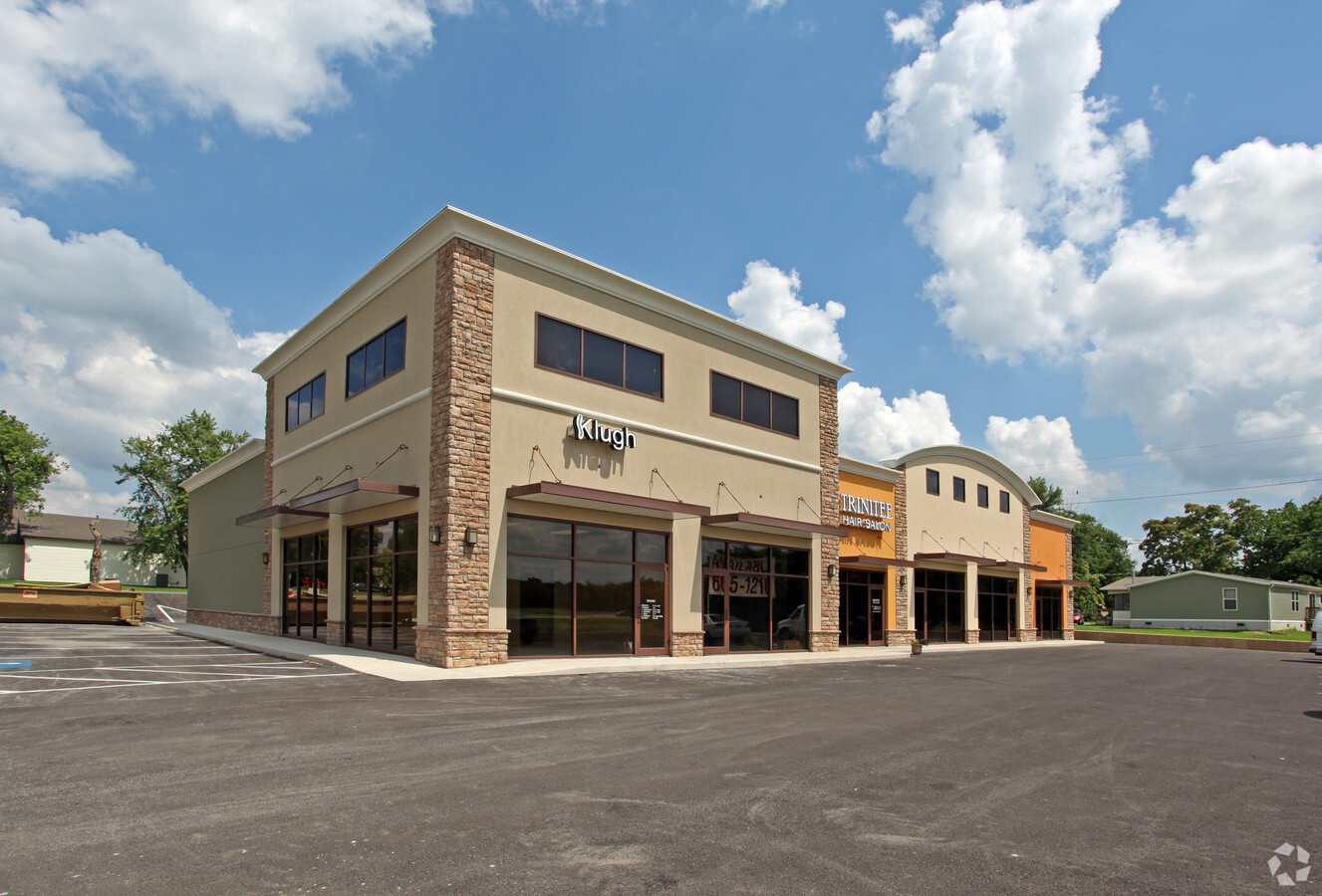
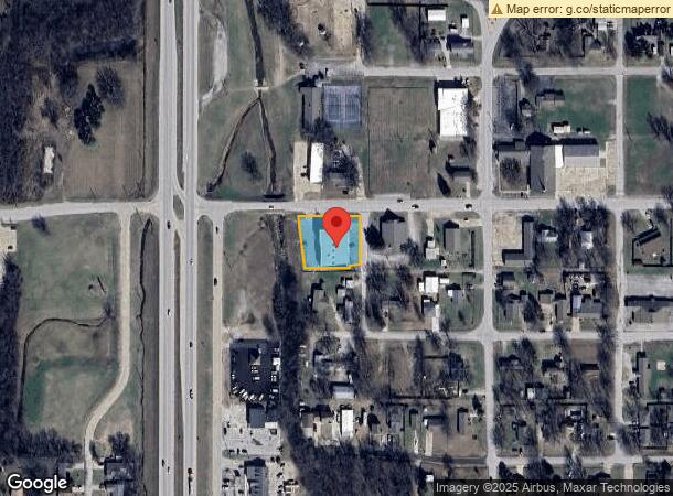
Property Record
148 W Main St S, Glenpool, OK 74033

NEARBY LISTINGS FOR SALE OR LEASE
Property Detail
148 W Main St S
97214-72-14-03190
Unplatted
Regionalshoppingcenterormallwithanchorstore
ALL BLK D OT-GLENPOOL & BEG NWC BLK D TH W154.6 SE150 E150 TO POB SEC 14 17 12 .48AC
X
Tulsa
40143C0409K
Oklahoma
2023
0.58 AC
2024
South Tulsa
007704
Tulsa
8,800 SF
Tulsa, OK
DEMOGRAPHICS near 148 W Main St S
1 Mile
3 Mile
5 Mile
2024 Total Population
5,929
20,193
45,937
2029 Population
6,079
20,798
47,479
Pop Growth 2024-2029
+ 2.53%
+ 3.00%
+ 3.36%
Average Age
35
36
36
2024 Total Households
2,063
7,010
15,693
HH Growth 2024-2029
+ 2.57%
+ 3.04%
+ 3.40%
Median Household Inc
$71,519
$77,396
$90,459
Avg Household Size
2.90
2.90
2.90
2024 Avg HH Vehicles
2.00
2.00
2.00
Median Home Value
$176,841
$205,386
$247,370
Median Year Built
1986
1999
2001
Nearby Places
- Restaurants
- Banks
- Shops
- Fitness
- Groceries
PUBLIC TRANSPORTATION
AIRPORT
Tulsa International
DRIVE
WALK
Distance
Tulsa International
32 min
23.5 mi
Freight Ports
Tulsa Port Of Catoosa
DRIVE
WALK
Distance
Tulsa Port Of Catoosa
41 min
32.3 mi
SALE & LEASE HISTORY
LISTING DATE
SALE/LEASE

Sep 23, 2016
For Sale
Nov 02, 2022
For Sale
Jan 25, 2023
For Lease
Nearby Properties
Address
Land Use
TOTAL SIZE
Lot Size
Zoning
Address
Land Use
TOTAL SIZE
Lot Size
Zoning
52,441 SF
12.79 AC
CS
Address
Land Use
TOTAL SIZE
Lot Size
Zoning
58,907 SF
5 AC
CG
Address
Land Use
TOTAL SIZE
Lot Size
Zoning
49,735 SF
14.35 AC
CG
Address
Land Use
TOTAL SIZE
Lot Size
Zoning
116,016 SF
54.80 AC
CG
Address
Land Use
TOTAL SIZE
Lot Size
Zoning
49,025 SF
10.75 AC
AG
Address
Land Use
TOTAL SIZE
Lot Size
Zoning
28,761 SF
9.71 AC
RS1
Address
Land Use
TOTAL SIZE
Lot Size
Zoning
15,636 SF
4.91 AC
AG
Address
Land Use
TOTAL SIZE
Lot Size
Zoning
331,125 SF
17.64 AC
CG
Address
Land Use
TOTAL SIZE
Lot Size
Zoning
11,436 SF
1.38 AC
CG
Address
Land Use
TOTAL SIZE
Lot Size
Zoning
25,932 SF
15 AC
RE
Address
Land Use
TOTAL SIZE
Lot Size
Zoning
6,702 SF
3.63 AC
AG
Address
Land Use
TOTAL SIZE
Lot Size
Zoning
216,308 SF
23.91 AC
CG
Address
Land Use
TOTAL SIZE
Lot Size
Zoning
23,600 SF
15.69 AC
Address
Land Use
TOTAL SIZE
Lot Size
Zoning
3,660 SF
10 AC
CG
Address
Land Use
TOTAL SIZE
Lot Size
Zoning
38,476 SF
18.68 AC
CG
Address
Land Use
TOTAL SIZE
Lot Size
Zoning
68,298 SF
28.60 AC
CG
Address
Land Use
TOTAL SIZE
Lot Size
Zoning
16,310 SF
10.28 AC
AG
Address
Land Use
TOTAL SIZE
Lot Size
Zoning
19,857 SF
3.44 AC
AG
Address
Land Use
TOTAL SIZE
Lot Size
Zoning
16,068 SF
0.80 AC
CG
Address
Land Use
TOTAL SIZE
Lot Size
Zoning
27.87 AC
IM
Address
Land Use
TOTAL SIZE
Lot Size
Zoning
32,408 SF
6.25 AC
AG
Address
Land Use
TOTAL SIZE
Lot Size
Zoning
15,097 SF
4.43 AC
RE
Address
Land Use
TOTAL SIZE
Lot Size
Zoning
27,910 SF
2.54 AC
CG
Address
Land Use
TOTAL SIZE
Lot Size
Zoning
33,128 SF
1.83 AC
RM2
Address
Land Use
TOTAL SIZE
Lot Size
Zoning
5,971 SF
2.66 AC
AG
Address
Land Use
TOTAL SIZE
Lot Size
Zoning
57,534 SF
1.73 AC
CG
Address
Land Use
TOTAL SIZE
Lot Size
Zoning
107,943 SF
8.49 AC
PUD
Address
Land Use
TOTAL SIZE
Lot Size
Zoning
5,075 SF
1.45 AC
CS
Address
Land Use
TOTAL SIZE
Lot Size
Zoning
9,950 SF
4.76 AC
RS2
Address
Land Use
TOTAL SIZE
Lot Size
Zoning
197,644 SF
32.39 AC
IL
The World's #1 Commercial Real Estate Marketplace
Connect with us
© 2025 CoStar Group
The information above has been obtained from sources believed reliable. While we do not doubt its accuracy we have not verified it and make no guarantee, warranty or representation about it. It is your responsibility to independently confirm its accuracy and completeness. Any projections, opinions, assumptions, or estimates used are for example only and do not represent the current or future performance of the property. The value of this transaction to you depends on tax and other factors which should be evaluated by your tax, financial, and legal advisors. You and your advisors should conduct a careful, independent investigation of the property to determine to your satisfaction the suitability of the property for your needs.