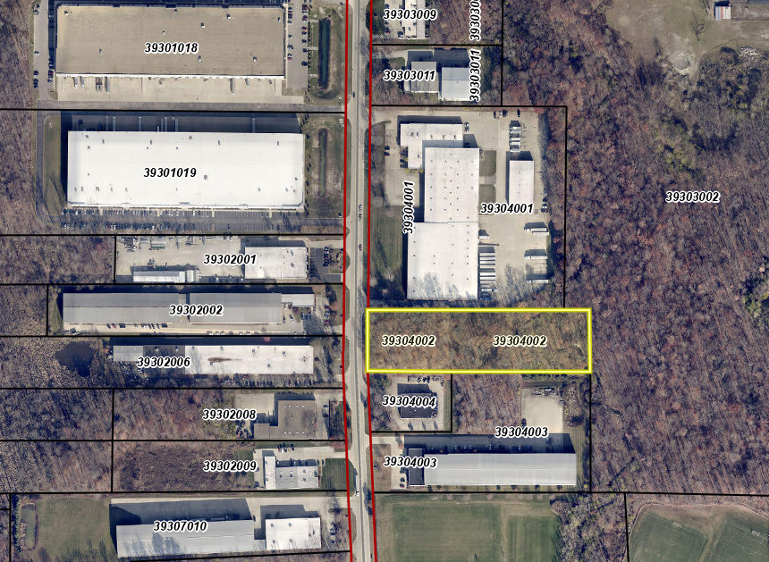
Property Record
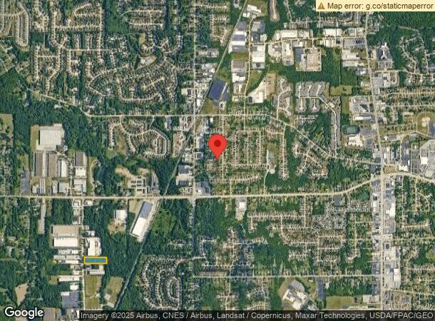
14845 Foltz Ind Pkwy, Strongsville, OH 44149
NEARBY LISTINGS FOR SALE OR LEASE
Property Detail
14845 Foltz Ind Pkwy
Cleveland-Elyria, OH
Strongsville
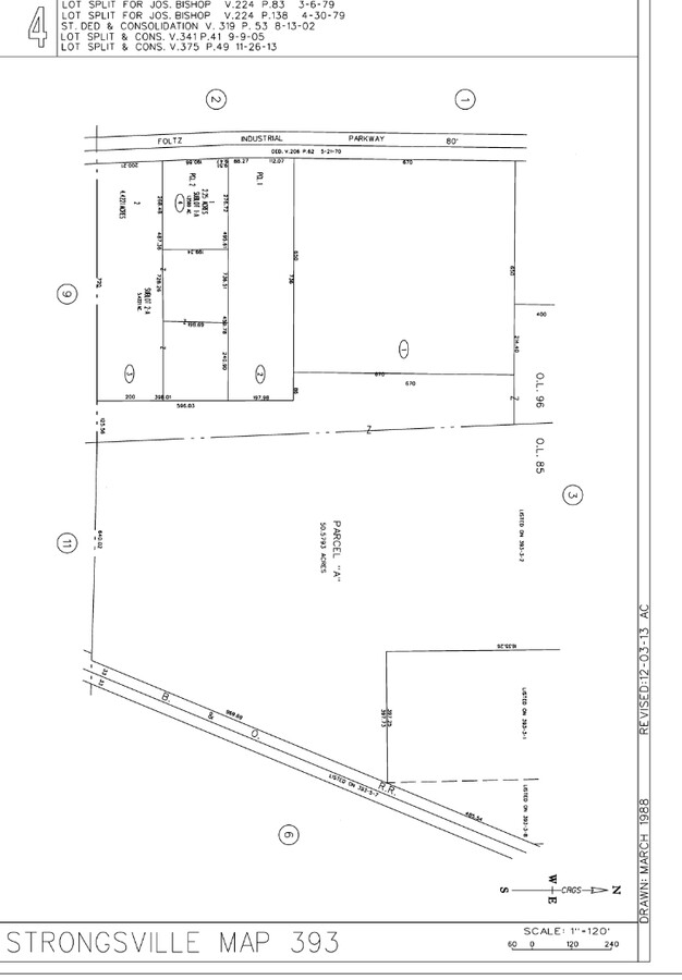
393-04-002
96
Industrialacreage
Cuyahoga
X
Ohio
39035C0286E
96
2024
4.76 AC
2024
Southwest
186206
Cleveland
DEMOGRAPHICS near 14845 Foltz Ind Pkwy
1 Mile
3 Mile
5 Mile
2024 Total Population
2,136
32,865
109,181
2029 Population
2,098
32,250
107,902
Pop Growth 2024-2029
(1.78%)
(1.87%)
(1.17%)
Average Age
45
45
43
2024 Total Households
832
12,915
44,199
HH Growth 2024-2029
(1.92%)
(2.04%)
(1.42%)
Median Household Inc
$99,230
$101,257
$86,269
Avg Household Size
2.50
2.50
2.40
2024 Avg HH Vehicles
2.00
2.00
2.00
Median Home Value
$273,981
$264,625
$234,229
Median Year Built
1975
1980
1978
Nearby Places
- Restaurants
- Banks
- Shops
- Fitness
- Groceries
PUBLIC TRANSPORTATION
AIRPORT
Cleveland-Hopkins International
DRIVE
WALK
Distance
Cleveland-Hopkins International
21 min
9.9 mi
Freight Ports
Port of Toledo
DRIVE
WALK
Distance
Port of Toledo
125 min
103.8 mi
SALE & LEASE HISTORY
LISTING DATE
SALE/LEASE

Sep 28, 2021
For Sale
Oct 08, 2024
For Sale
Nov 14, 2024
For Sale
Nearby Properties
Address
Land Use
TOTAL SIZE
Lot Size
Zoning
Address
Land Use
TOTAL SIZE
Lot Size
Zoning
127,666 SF
2.79 AC
Address
Land Use
TOTAL SIZE
Lot Size
Zoning
830,541 SF
51.19 AC
SC
Address
Land Use
TOTAL SIZE
Lot Size
Zoning
184,998 SF
20.43 AC
PF
Address
Land Use
TOTAL SIZE
Lot Size
Zoning
345,524 SF
107.02 AC
PF
Address
Land Use
TOTAL SIZE
Lot Size
Zoning
244,717 SF
23.97 AC
RMF-1
Address
Land Use
TOTAL SIZE
Lot Size
Zoning
62,681 SF
5.48 AC
OB
Address
Land Use
TOTAL SIZE
Lot Size
Zoning
127,666 SF
9.53 AC
Address
Land Use
TOTAL SIZE
Lot Size
Zoning
143,074 SF
25.34 AC
PDA-2
Address
Land Use
TOTAL SIZE
Lot Size
Zoning
288,114 SF
27.52 AC
GB
Address
Land Use
TOTAL SIZE
Lot Size
Zoning
309,231 SF
34.28 AC
Address
Land Use
TOTAL SIZE
Lot Size
Zoning
53,653 SF
30.83 AC
Address
Land Use
TOTAL SIZE
Lot Size
Zoning
230,291 SF
17.35 AC
Address
Land Use
TOTAL SIZE
Lot Size
Zoning
437,700 SF
36.08 AC
GI
Address
Land Use
TOTAL SIZE
Lot Size
Zoning
139,914 SF
17.98 AC
MS
Address
Land Use
TOTAL SIZE
Lot Size
Zoning
426.60 AC
PF
Address
Land Use
TOTAL SIZE
Lot Size
Zoning
124,195 SF
54.96 AC
PF
Address
Land Use
TOTAL SIZE
Lot Size
Zoning
310,080 SF
28.30 AC
GI
Address
Land Use
TOTAL SIZE
Lot Size
Zoning
381,528 SF
42.50 AC
GI
Address
Land Use
TOTAL SIZE
Lot Size
Zoning
34,005 SF
514.86 AC
PF
Address
Land Use
TOTAL SIZE
Lot Size
Zoning
120,478 SF
17.45 AC
Address
Land Use
TOTAL SIZE
Lot Size
Zoning
180,606 SF
10.99 AC
Address
Land Use
TOTAL SIZE
Lot Size
Zoning
89.31 AC
PF
Address
Land Use
TOTAL SIZE
Lot Size
Zoning
149,184 SF
14.09 AC
PDA-2
Address
Land Use
TOTAL SIZE
Lot Size
Zoning
185,284 SF
10.84 AC
Address
Land Use
TOTAL SIZE
Lot Size
Zoning
147,287 SF
15.58 AC
MS
Address
Land Use
TOTAL SIZE
Lot Size
Zoning
83,961 SF
6.58 AC
GB
Address
Land Use
TOTAL SIZE
Lot Size
Zoning
128,979 SF
3.87 AC
R1-75
Address
Land Use
TOTAL SIZE
Lot Size
Zoning
187,761 SF
19.98 AC
GB
Address
Land Use
TOTAL SIZE
Lot Size
Zoning
96,685 SF
16.21 AC
R-RS
Address
Land Use
TOTAL SIZE
Lot Size
Zoning
354,820 SF
10.01 AC
RMF-1
The World's #1 Commercial Real Estate Marketplace
Connect with us
© 2025 CoStar Group
The information above has been obtained from sources believed reliable. While we do not doubt its accuracy we have not verified it and make no guarantee, warranty or representation about it. It is your responsibility to independently confirm its accuracy and completeness. Any projections, opinions, assumptions, or estimates used are for example only and do not represent the current or future performance of the property. The value of this transaction to you depends on tax and other factors which should be evaluated by your tax, financial, and legal advisors. You and your advisors should conduct a careful, independent investigation of the property to determine to your satisfaction the suitability of the property for your needs.